Home
Browse
Ask Us
Chat
Harmful Language Statement
Log in
Advanced Search
Year
1864
1865
1866
1867
1868
1869
1870
1871
1872
1873
1874
1875
1876
1877
1878
1879
1880
1881
1882
1883
1884
1885
1886
1887
1888
1889
1890
1891
1892
1893
1894
1895
1896
1897
1898
1899
1900
1901
1902
1903
1904
1905
1906
1907
1908
1909
1910
1911
1912
1913
1914
1915
1916
1917
1918
1919
1920
1921
1922
1923
1924
1925
1926
1927
1928
1929
1930
1931
1932
1933
1934
1935
1936
1937
1938
1939
1940
1941
1942
1943
1944
1945
1946
1947
1948
1949
1950
1951
1952
1953
1954
1955
1956
1957
1958
1959
1960
1961
1962
1963
1964
1965
1966
1967
1968
1969
1970
1971
1972
1973
1974
1975
1976
1977
1978
1979
1980
1981
1982
1983
1984
1985
1986
1987
1988
1989
1990
1991
1992
1993
1994
1995
1996
1997
1998
1999
2000
2001
2002
2003
2004
2005
TO
1864
1865
1866
1867
1868
1869
1870
1871
1872
1873
1874
1875
1876
1877
1878
1879
1880
1881
1882
1883
1884
1885
1886
1887
1888
1889
1890
1891
1892
1893
1894
1895
1896
1897
1898
1899
1900
1901
1902
1903
1904
1905
1906
1907
1908
1909
1910
1911
1912
1913
1914
1915
1916
1917
1918
1919
1920
1921
1922
1923
1924
1925
1926
1927
1928
1929
1930
1931
1932
1933
1934
1935
1936
1937
1938
1939
1940
1941
1942
1943
1944
1945
1946
1947
1948
1949
1950
1951
1952
1953
1954
1955
1956
1957
1958
1959
1960
1961
1962
1963
1964
1965
1966
1967
1968
1969
1970
1971
1972
1973
1974
1975
1976
1977
1978
1979
1980
1981
1982
1983
1984
1985
1986
1987
1988
1989
1990
1991
1992
1993
1994
1995
1996
1997
1998
1999
2000
2001
2002
2003
2004
2005
Type
Image
2,504
Text
2
Format
image/jpeg
2,384
application/pdf
118
Collection
American Westward Migration
1
Beckwith Photograph Collection
6
Classified Photographs
285
Photo Archives
1,767
Shipler Commercial Photographers
2
Utah River Running Photo Archives
440
Vernal Express Photographs
1
Western Waters Electronic Resources
2
More
Filters:
Spatial Coverage:
"Arizona"
Type:
"Image"
2276
-
2300
of
2,504
<
87
88
89
90
91
92
93
94
95
96
>
Gallery view
Number of results to display per page
10
25
50
100
200
Sort by Relevance
Sort by Title A-Z
Sort by Title Z-A
Sort by Date Ascending
Sort by Date Descending
Sort by Last Modified Ascending
Sort by Last Modified Descending
Title
Date
Type
Setname
2276
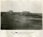
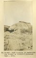
Tse-na-kahn (Round Rock), from southeast. New Mexico. Heald, photo. 1911 (Photo N-M128)
1911
Image
uum_map
2277
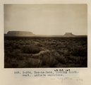
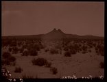
Tse-na-kahn from north side. La Plata on Dolores.
1913
Image
uum_map
2278
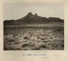
Tse-na-kahn, looking northwest. LaPlata sandstone (Photo G-284)
1911
Image
uum_map
2279
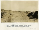
Tuba Desert, 1914. Note pebble-covered floor
1914
Image
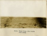
uum_map
2280
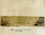
Tuba from the south
1914
Image
uum_map
2281
Tuba from the south
1914
Image
uum_map
2282
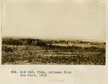
Tuba, Arizona from the west, 1914
1914
Image
uum_map
2283
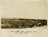
Tuba, Arizona, from the north, 1914
1914
Image
uum_map
2284
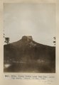
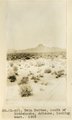
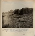
Tubby Butte near Tsa-lee. Looking east. Heald, photo, 1911 (Photo G296)
1911
Image
uum_map
2285
Tuff (Tertiary) resting on red sandstone (La Plata? or McElmo?) between Sunrise Spgs. and Biddehoche (Indian Wells), Ariz., 1909 (photo G-50)
1909
Image
uum_map
2286
Tuff on unevenly eroded sandstone (La Plata? or McElmo?), Lucasaca Springs, Ariz., 1909 (photo G-56)
1909
Image
uum_map
2287
Tuff resting on sandstone (La Plata? or McElmo?), Lucasaca Spgs., Ariz. (photo G-55)
1909
Image
uum_map
2288
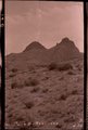
Twin Buttes (negative for photo G-62)
1909
Image
uum_map
2289
Twin Buttes (Photo G248)
1911
Image
uum_map
2290
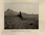
Twin Buttes south of Biddehoche, Arizona, looking west, 1909 (photo G-60)
1909
Image
uum_map
2291
Twin Buttes south of Biddehoche, Arizona, looking west, 1909 (photo G-60)
1909
Image
uum_map
2292
Twin Buttes, 1909 (negative for photo G-61)
1909
Image
uum_map
2293
Twin Buttes, and dike (Photo G249)
1911
Image
uum_map
2294
Twin Buttes, Ariz. (Negative for photo G-60)
1909
Image
uum_map
2295
Twin Buttes, near view from southeast, 1909 (photo G-61)
1909
Image
uum_map
2296
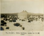
Twin Buttes, same as G-60, 1909 (photo G-62)
1909
Image
uum_map
2297
Twin Buttes, volcanic neck with ash mesa, 6± mi. south of Biddehoche, Ariz. 1911 (Photo G251)
1911
Image
uum_map
2298
Twin Buttes, volcanic neck, 6± mi. south of Biddehoche, Ariz. 1911 (Photo G247)
1911
Image
uum_map
2299
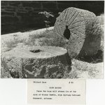
Two mill stones located in Pipe Spring National Monument, Arizona
1930; 1931; 1932; 1933; 1934; 1935; 1936; 1937; 1938; 1939; 1940; 1941; 1942; 1943; 1944; 1945; 1946; 1947; 1948; 1949; 1950; 1951; 1952; 1953; 1954; 1955; 1956; 1957; 1958; 1959; 1960; 1961; 1962; 1963; 1964; 1965; 1966; 1967; 1968; 1969
Image
uum_map
2300
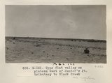
Type flat valley on plateau west of Hunter's Pt. tributary to Black Creek (Photo G321)
1913
Image
uum_map
2276
-
2300
of
2,504
<
87
88
89
90
91
92
93
94
95
96
>