Home
Browse
Ask Us
Chat
Harmful Language Statement
Log in
Advanced Search
Year
1864
1865
1866
1867
1868
1869
1870
1871
1872
1873
1874
1875
1876
1877
1878
1879
1880
1881
1882
1883
1884
1885
1886
1887
1888
1889
1890
1891
1892
1893
1894
1895
1896
1897
1898
1899
1900
1901
1902
1903
1904
1905
1906
1907
1908
1909
1910
1911
1912
1913
1914
1915
1916
1917
1918
1919
1920
1921
1922
1923
1924
1925
1926
1927
1928
1929
1930
1931
1932
1933
1934
1935
1936
1937
1938
1939
1940
1941
1942
1943
1944
1945
1946
1947
1948
1949
1950
1951
1952
1953
1954
1955
1956
1957
1958
1959
1960
1961
1962
1963
1964
1965
1966
1967
1968
1969
1970
1971
1972
1973
1974
1975
1976
1977
1978
1979
1980
1981
1982
1983
1984
1985
1986
1987
1988
1989
1990
1991
1992
1993
1994
1995
1996
1997
1998
1999
2000
2001
2002
2003
2004
2005
TO
1864
1865
1866
1867
1868
1869
1870
1871
1872
1873
1874
1875
1876
1877
1878
1879
1880
1881
1882
1883
1884
1885
1886
1887
1888
1889
1890
1891
1892
1893
1894
1895
1896
1897
1898
1899
1900
1901
1902
1903
1904
1905
1906
1907
1908
1909
1910
1911
1912
1913
1914
1915
1916
1917
1918
1919
1920
1921
1922
1923
1924
1925
1926
1927
1928
1929
1930
1931
1932
1933
1934
1935
1936
1937
1938
1939
1940
1941
1942
1943
1944
1945
1946
1947
1948
1949
1950
1951
1952
1953
1954
1955
1956
1957
1958
1959
1960
1961
1962
1963
1964
1965
1966
1967
1968
1969
1970
1971
1972
1973
1974
1975
1976
1977
1978
1979
1980
1981
1982
1983
1984
1985
1986
1987
1988
1989
1990
1991
1992
1993
1994
1995
1996
1997
1998
1999
2000
2001
2002
2003
2004
2005
Type
Image
2,504
Text
2
Format
image/jpeg
2,384
application/pdf
118
Collection
American Westward Migration
1
Beckwith Photograph Collection
6
Classified Photographs
285
Photo Archives
1,767
Shipler Commercial Photographers
2
Utah River Running Photo Archives
440
Vernal Express Photographs
1
Western Waters Electronic Resources
2
More
Filters:
Spatial Coverage:
"Arizona"
Type:
"Image"
2126
-
2150
of
2,504
<
81
82
83
84
85
86
87
88
89
90
>
Gallery view
Number of results to display per page
10
25
50
100
200
Sort by Relevance
Sort by Title A-Z
Sort by Title Z-A
Sort by Date Ascending
Sort by Date Descending
Sort by Last Modified Ascending
Sort by Last Modified Descending
Title
Date
Type
Setname
2126
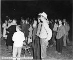
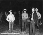
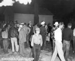
Short Creek, Polygamy
1953
Image
dha_cp
2127
Short Creek, Polygamy
1953
Image
dha_cp
2128
Short Creek, Polygamy
1953
Image
dha_cp
2129
Short Creek, Polygamy
1953
Image
dha_cp
2130
Short Creek, Polygamy
1953
Image
dha_cp
2131
Short Creek, Polygamy
1953
Image
dha_cp
2132
Short Creek, Polygamy
1953
Image
dha_cp
2133
Short Creek, Polygamy
1953
Image
dha_cp
2134
Short Creek, Polygamy
1953
Image
dha_cp
2135
Short Creek, Polygamy
1953
Image
dha_cp
2136
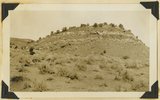
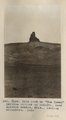
Showing the peneplain levels north of old store, Blue Canon
1913
Image
uum_map
2137
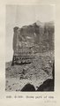
Shows part of 624 (La Plata sandstone, junction of Chinlee and Carrizo Washes, Photo G329)
1913
Image
uum_map
2138
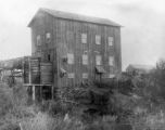
Shumway Grist Mill P.1
Image
dha_cp
2139
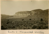
Side of Toroweap Valley
1900
Image
uum_map
2140
Site of Lee's Ferry crossing on the Colorado River.
1941
Image
uum_map
2141
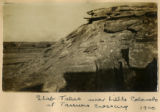
Slab talus near Little Colorado at Tanners Crossing 1900
1900
Image
uum_map
2142
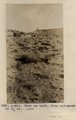
Slice of Chinle on Sevier fault, Pipe Springs-Moccasin road, 1936.
1936
Image
uum_map
2143
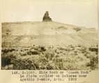
Slim Rock or "Queen Rock," La Plata outlier on Dolores near Agathla Needle, Ariz., 1909 (photo G-108)
1909
Image
uum_map
2144
Slim Rock or "The Queen" from the east (Photo G153)
1910
Image
uum_map
2145
Slim Rock or "The Queen" from the east (Photo G153)
1910
Image
uum_map
2146
Slim Rock or "the Queen," LaPlata outlier on Dolores, near Agathla Needle, Ariz., looking southwest, 1910 (Photo G152)
1910
Image
uum_map
2147
Slim Rock or "the Queen," LaPlata outlier on Dolores, near Agathla Needle, Ariz., looking southwest, 1910 (Photo G152)
1910
Image
uum_map
2148
Slim Rock or "the Queen," LaPlata outlier on Dolores, near Agathla Needle, Ariz., looking southwest, 1910 (Photo N-M91)
1910
Image
uum_map
2149
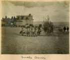
Snake dance
1900
Image
uum_map
2150
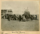
Snake dance
1900
Image
uum_map
2126
-
2150
of
2,504
<
81
82
83
84
85
86
87
88
89
90
>