Home
Browse
Ask Us
Chat
Harmful Language Statement
Log in
Advanced Search
Year
1864
1865
1866
1867
1868
1869
1870
1871
1872
1873
1874
1875
1876
1877
1878
1879
1880
1881
1882
1883
1884
1885
1886
1887
1888
1889
1890
1891
1892
1893
1894
1895
1896
1897
1898
1899
1900
1901
1902
1903
1904
1905
1906
1907
1908
1909
1910
1911
1912
1913
1914
1915
1916
1917
1918
1919
1920
1921
1922
1923
1924
1925
1926
1927
1928
1929
1930
1931
1932
1933
1934
1935
1936
1937
1938
1939
1940
1941
1942
1943
1944
1945
1946
1947
1948
1949
1950
1951
1952
1953
1954
1955
1956
1957
1958
1959
1960
1961
1962
1963
1964
1965
1966
1967
1968
1969
1970
1971
1972
1973
1974
1975
1976
1977
1978
1979
1980
1981
1982
1983
1984
1985
1986
1987
1988
1989
1990
1991
1992
1993
1994
1995
1996
1997
1998
1999
2000
2001
2002
2003
2004
2005
TO
1864
1865
1866
1867
1868
1869
1870
1871
1872
1873
1874
1875
1876
1877
1878
1879
1880
1881
1882
1883
1884
1885
1886
1887
1888
1889
1890
1891
1892
1893
1894
1895
1896
1897
1898
1899
1900
1901
1902
1903
1904
1905
1906
1907
1908
1909
1910
1911
1912
1913
1914
1915
1916
1917
1918
1919
1920
1921
1922
1923
1924
1925
1926
1927
1928
1929
1930
1931
1932
1933
1934
1935
1936
1937
1938
1939
1940
1941
1942
1943
1944
1945
1946
1947
1948
1949
1950
1951
1952
1953
1954
1955
1956
1957
1958
1959
1960
1961
1962
1963
1964
1965
1966
1967
1968
1969
1970
1971
1972
1973
1974
1975
1976
1977
1978
1979
1980
1981
1982
1983
1984
1985
1986
1987
1988
1989
1990
1991
1992
1993
1994
1995
1996
1997
1998
1999
2000
2001
2002
2003
2004
2005
Type
Image
2,504
Text
2
Format
image/jpeg
2,384
application/pdf
118
Collection
American Westward Migration
1
Beckwith Photograph Collection
6
Classified Photographs
285
Photo Archives
1,767
Shipler Commercial Photographers
2
Utah River Running Photo Archives
440
Vernal Express Photographs
1
Western Waters Electronic Resources
2
More
Filters:
Spatial Coverage:
"Arizona"
Type:
"Image"
1951
-
1975
of
2,504
<
74
75
76
77
78
79
80
81
82
83
>
Gallery view
Number of results to display per page
10
25
50
100
200
Sort by Relevance
Sort by Title A-Z
Sort by Title Z-A
Sort by Date Ascending
Sort by Date Descending
Sort by Last Modified Ascending
Sort by Last Modified Descending
Title
Date
Type
Setname
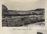
1951
Same as 735 (Grand Falls, Photo G417)
1913
Image
uum_map
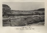
1952
Same as 735 (Grand Falls, Photo G418)
1913
Image
uum_map
1953
Same as 754 (Painted Desert, Tuba, Photo G433)
1913
Image
uum_map
1954
Same as 754 (Painted Desert, Tuba, Photo G434)
1913
Image
uum_map
1955
Same as 757 (La Plata, Tuba, Photo G436)
1913
Image
uum_map
1956
Same as 757 (La Plata, Tuba, Photo G437)
1913
Image
uum_map
1957
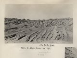
Same as 760 (Wind etching, Tuba, Photo G439)
1913
Image
uum_map
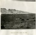
1958
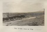
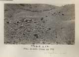
Same as 767 (Bridge, Little Colorado, Photo G443)
1913
Image
uum_map
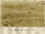
1959
Same as 770 (Dolores Fossil Forest, Photo G444)
1913
Image
uum_map
1960
Same as 772 (North Forest, Carrizo Creek, Photo G446)
1913
Image
uum_map
1961
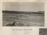
Same as 774 (North Forest, Carrizo Creek, Photo G449)
1913
Image
uum_map
1962
Same as 774 (North Forest, Carrizo Creek, Photo N-M186)
1913
Image
uum_map
1963
Same as 775 (North Forest, Carrizo Creek, Photo G448)
1913
Image
uum_map
1964
Same as 790 & 791 [Desert pavement between Red Lake and Tuba]
1913
Image
uum_map
1965
Same as 799 (Short Creek near village of Short Creek. Cutting of its channel 20-30 feet done since about 1885. Mohave County, Arizona, 1937). Point of Vermillion Cliff in upper left.
1937
Image
uum_map
1966
Same as 826 ["Painted Desert", four miles west of Tuba]
1913
Image
uum_map
1967
Same as 827 ["Painted Desert", 2 mi. west of Tuba]
1913
Image
uum_map
1968
Same as 835 [La Plata in Marsh Pass]
1913
Image
uum_map
1969
Same as 835 [La Plata in Marsh Pass]
1913
Image
uum_map
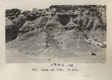
1970
The same as G-45: Tertiary clay shales interbedded with tuff. "Black Rock" between Sunrise Springs and Biddehoche (Indian wells), Ariz., 1909 (photo G-46)
1909
Image
uum_map
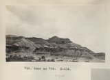
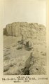
1971
Same as G-52 (Tertiary clay shales interbeddied with tuff south of Biddehoche, Ariz., 1909 (photo G-53)
1909
Image
uum_map
1972
Same as G-52 (Tertiary clay shales interbeddied with tuff, 2± mi. south of Biddehoche, Ariz., 1909, negative for photo G-53)
1909
Image
uum_map
1973
Same as G-63 (Dike of peridotite or diabase at Twin Buttes, south of Beddehoche), 1909 (photo G-64)
1909
Image
uum_map
1974
Same as G-63, looking east (Dike of peridotite or diabase at Twin Buttes, south of Beddehoche), 1909 (photo G-65)
1909
Image
uum_map
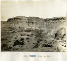
1975
Same as G-72 (Montezuma's Chair, negative for photo G-73)
1909
Image
uum_map
1951
-
1975
of
2,504
<
74
75
76
77
78
79
80
81
82
83
>