Home
Browse
Ask Us
Chat
Harmful Language Statement
Log in
Advanced Search
Year
1864
1865
1866
1867
1868
1869
1870
1871
1872
1873
1874
1875
1876
1877
1878
1879
1880
1881
1882
1883
1884
1885
1886
1887
1888
1889
1890
1891
1892
1893
1894
1895
1896
1897
1898
1899
1900
1901
1902
1903
1904
1905
1906
1907
1908
1909
1910
1911
1912
1913
1914
1915
1916
1917
1918
1919
1920
1921
1922
1923
1924
1925
1926
1927
1928
1929
1930
1931
1932
1933
1934
1935
1936
1937
1938
1939
1940
1941
1942
1943
1944
1945
1946
1947
1948
1949
1950
1951
1952
1953
1954
1955
1956
1957
1958
1959
1960
1961
1962
1963
1964
1965
1966
1967
1968
1969
1970
1971
1972
1973
1974
1975
1976
1977
1978
1979
1980
1981
1982
1983
1984
1985
1986
1987
1988
1989
1990
1991
1992
1993
1994
1995
1996
1997
1998
1999
2000
2001
2002
2003
2004
2005
TO
1864
1865
1866
1867
1868
1869
1870
1871
1872
1873
1874
1875
1876
1877
1878
1879
1880
1881
1882
1883
1884
1885
1886
1887
1888
1889
1890
1891
1892
1893
1894
1895
1896
1897
1898
1899
1900
1901
1902
1903
1904
1905
1906
1907
1908
1909
1910
1911
1912
1913
1914
1915
1916
1917
1918
1919
1920
1921
1922
1923
1924
1925
1926
1927
1928
1929
1930
1931
1932
1933
1934
1935
1936
1937
1938
1939
1940
1941
1942
1943
1944
1945
1946
1947
1948
1949
1950
1951
1952
1953
1954
1955
1956
1957
1958
1959
1960
1961
1962
1963
1964
1965
1966
1967
1968
1969
1970
1971
1972
1973
1974
1975
1976
1977
1978
1979
1980
1981
1982
1983
1984
1985
1986
1987
1988
1989
1990
1991
1992
1993
1994
1995
1996
1997
1998
1999
2000
2001
2002
2003
2004
2005
Type
Image
2,504
Text
2
Format
image/jpeg
2,384
application/pdf
118
Collection
American Westward Migration
1
Beckwith Photograph Collection
6
Classified Photographs
285
Photo Archives
1,767
Shipler Commercial Photographers
2
Utah River Running Photo Archives
440
Vernal Express Photographs
1
Western Waters Electronic Resources
2
More
Filters:
Spatial Coverage:
"Arizona"
Type:
"Image"
1726
-
1750
of
2,504
<
65
66
67
68
69
70
71
72
73
74
>
Gallery view
Number of results to display per page
10
25
50
100
200
Sort by Relevance
Sort by Title A-Z
Sort by Title Z-A
Sort by Date Ascending
Sort by Date Descending
Sort by Last Modified Ascending
Sort by Last Modified Descending
Title
Date
Type
Setname
1726
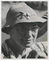
Norman D. Nevills' 1938 Green and Colorado Rivers expedition. Dr. Elzada U. Clover.
1938-08
Image
uum_map_rr
1727
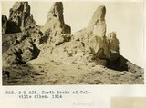
North Peaks of Colville dikes, 1914
1914
Image
uum_map
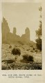
1728
North Peaks of Colville dikes, 1914
1914
Image
uum_map
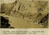
1729
North wall Glen Canyon 2 miles above Lees Ferry, Coconino County, Arizona. June, 1915.
1915
Image
uum_map
1730
Northern edge Kanab Plateau. Village of Fredonia on surface eroded from lower Moenkopi beds and crossed by Kanab Creek. Buttes of Moenkopi capped by Shinarump (right), Coconino County, August, 1939
1939
Image
uum_map
1731
Nutter, Preston Corporation P.3
Image
dha_cp
1732
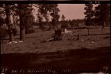
NW Ft. Defiance Ariz., 1909 (negative for photo G-22)
1909
Image
uum_map
1733
NW Ft. Defiance, Ariz., 1909 (negative for photo G-20)
1909
Image
uum_map
1734
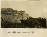
Oasis, Moenave, 1914
1914
Image
uum_map
1735
Office at Short Creek
1953
Image
dha_cp
1736
Old crier of Walpi. Firewood stored above his doorway
1915
Image
uum_map
1737
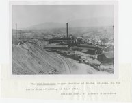
Old Dominion copper smelter, early Globe, Arizona
1900; 1901; 1902; 1903; 1904; 1905; 1906; 1907; 1908; 1909; 1910; 1911; 1912; 1913; 1914; 1915; 1916; 1917; 1918; 1919; 1920; 1921; 1922; 1923; 1924; 1925; 1926; 1927; 1928; 1929; 1930; 1931; 1932; 1933; 1934; 1935; 1936; 1937; 1938; 1939; 1940
Image
uum_map
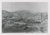
1738
Old Dominion smelter, Globe, Arizona
1900; 1901; 1902; 1903; 1904; 1905; 1906; 1907; 1908; 1909; 1910; 1911; 1912; 1913; 1914; 1915; 1916; 1917; 1918; 1919; 1920; 1921; 1922; 1923; 1924; 1925; 1926; 1927; 1928; 1929; 1930; 1931; 1932; 1933; 1934; 1935; 1936; 1937; 1938; 1939; 1940
Image
uum_map
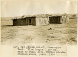
1739
Old Indian school, Moencopie Wash, "Blue Canyon," 18± mi. east of Tuba, Ariz., McElmo strata (Stephen Janus photo, 1909)
1909
Image
uum_map
1740
Old store, Nazlini canyon, VII, 23 (Photo N-M126)
1911
Image
uum_map
1741
Oljito, Arizona, 1929
1929
Image
uum_map_rr
1742
On Saw Mill road. 1913. Dr. Elliott, photo.
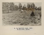
1909
Image
uum_map
1743
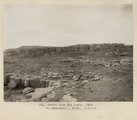
Oraibi from the south, 1909. W. C. Mendenhall, photo. U.S.G.S.
1909
Image
uum_map
1744
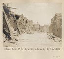
Oraibi street, Ariz. 1909
1909
Image
uum_map
1745
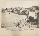
Oraibi, Ariz. "Center Street". 1909
1909
Image
uum_map
1746
Oraibi, Ariz. pueblo. 1909
1909
Image
uum_map
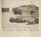
1747
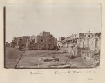
Oraibi, Ariz. Townsend photo. 1910
1910
Image
uum_map
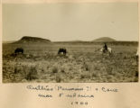
1748
Outlier (Permian?) & cone near Fredonia 1900
1900
Image
uum_map
1749
Overlooking the Colorado River.
1973-09
Image
uum_map_rr
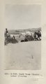
1750
Pack team (Heald)., Lower Chinlee (Photo G333)
1913
Image
uum_map
1726
-
1750
of
2,504
<
65
66
67
68
69
70
71
72
73
74
>