Home
Browse
Ask Us
Chat
Harmful Language Statement
Log in
Advanced Search
Year
1864
1865
1866
1867
1868
1869
1870
1871
1872
1873
1874
1875
1876
1877
1878
1879
1880
1881
1882
1883
1884
1885
1886
1887
1888
1889
1890
1891
1892
1893
1894
1895
1896
1897
1898
1899
1900
1901
1902
1903
1904
1905
1906
1907
1908
1909
1910
1911
1912
1913
1914
1915
1916
1917
1918
1919
1920
1921
1922
1923
1924
1925
1926
1927
1928
1929
1930
1931
1932
1933
1934
1935
1936
1937
1938
1939
1940
1941
1942
1943
1944
1945
1946
1947
1948
1949
1950
1951
1952
1953
1954
1955
1956
1957
1958
1959
1960
1961
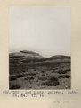
1962
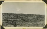
1963
1964
1965
1966
1967
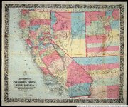
1968
1969
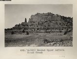
1970
1971
1972
1973
1974
1975
1976
1977
1978
1979
1980
1981
1982
1983
1984
1985
1986
1987
1988
1989
1990
1991
1992
1993
1994
1995
1996
1997
1998
1999
2000
2001
2002
2003
2004
2005
TO
1864
1865
1866
1867
1868
1869
1870
1871
1872
1873
1874
1875
1876
1877
1878
1879
1880
1881
1882
1883
1884
1885
1886
1887
1888
1889
1890
1891
1892
1893
1894
1895
1896
1897
1898
1899
1900
1901
1902
1903
1904
1905
1906
1907
1908
1909
1910
1911
1912
1913
1914
1915
1916
1917
1918
1919
1920
1921
1922
1923
1924
1925
1926
1927
1928
1929
1930
1931
1932
1933
1934
1935
1936
1937
1938
1939
1940
1941
1942
1943
1944
1945
1946
1947
1948
1949
1950
1951
1952
1953
1954
1955
1956
1957
1958
1959
1960
1961
1962
1963
1964
1965
1966
1967
1968
1969
1970
1971
1972
1973
1974
1975
1976
1977
1978
1979
1980
1981
1982
1983
1984
1985
1986
1987
1988
1989
1990
1991
1992
1993
1994
1995
1996
1997
1998
1999
2000
2001
2002
2003
2004
2005
Type
Image
2,504
Text
2
Format
image/jpeg
2,384
application/pdf
118
Institution
University of Utah Marriott Library
2,207
Department of Cultural and Community ...
287
Delta City Library
6
Western Waters Digital Library
2
Uintah County Library
1
University of Utah Partnerships
1
More
Collection
American Westward Migration
1
Beckwith Photograph Collection
6
Classified Photographs
285
Photo Archives
1,767
Shipler Commercial Photographers
2
Utah River Running Photo Archives
440
Vernal Express Photographs
1
Western Waters Electronic Resources
2
More
Filters:
Spatial Coverage:
"Arizona"
Type:
"Image"
101
-
125
of
2,504
<
1
2
3
4
5
6
7
8
9
10
>
Gallery view
Number of results to display per page
10
25
50
100
200
Sort by Relevance
Sort by Title A-Z
Sort by Title Z-A
Sort by Date Ascending
Sort by Date Descending
Sort by Last Modified Ascending
Sort by Last Modified Descending
Title
Date
Type
Setname
101
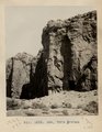
Ash, Twin Buttes (Photo G252)
1911
Image
uum_map
102
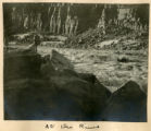
At Grand View
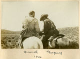
1900
Image
uum_map
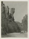
103
At the River
1900
Image
uum_map
104
B. P. road in Bonita Canyon
1940; 1941; 1942; 1943; 1944; 1945; 1946; 1947; 1948; 1949; 1950; 1951; 1952; 1953; 1954; 1955; 1956; 1957; 1958; 1959; 1960
Image
uum_map
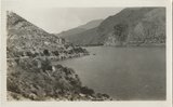
105
Back of Roosevelt Dam
1932-05
Image
uum_map_rr
106
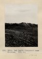
Bad Lands (Dolores) near Chinlee. VII, 26 (Photo G271)
1911
Image
uum_map
107
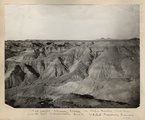
Bad lands, Chinle strata in Hopi Buttes region, north east of Holbrook, Ariz. USGS, probably Darton
1911
Image
uum_map
108
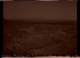
Bad Lands, Cottonwood Wash. 1909
1911
Image
uum_map
109
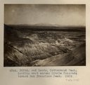
Bad Lands, Cottonwood Wash. 1909 (photograph from Herbert E. Gregory Book 5: Navajo, 1911)
1911
Image
uum_map
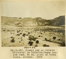
110
Bad Lands, Dolores. Lower Pueblo Colorado Wash. Section VI, 79-80. 1911 (Photo G226)
1911
Image
uum_map
111
Bad Lands. Dolores. Butte No. 24. VI, 76 (Photo G227)
1911
Image
uum_map
112
Bancroft's map of California, Nevada, Utah and Arizona
1864
Image
uu_awm
113
Banded Navajo sandstone near place where Wingate and Kayenta first lose their identity. Chinle immediately below. Two miles northwest of Pipe Springs, Mohave County, Arizona, 1936.
1936
Image
uum_map
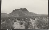
114
Banded Upper LaPlata Black Creek (Photo G390)
1913
Image
uum_map
115
Barrett, Gregory
1900
Image
uum_map
116
Barrett, Gregory, 1900
1900
Image
uum_map
117
Basalt cap on Dolores (Triassic) on Holbrook-Keams Canyon road, 9± mi. south of Biddehoche, Arizona, 1909 (photo G-69)
1909
Image
uum_map
118
Basalt, Cedar Springs, AZ. 35± mi. north of Winslow. 1911 (Photo G242)
1911
Image
uum_map
119
Basalt-capped mesa on Dolores (Triassic), 6± miles south of Beddehoche (Indian Wells), Ariz., 1909 (photo G-67)
1909
Image
uum_map
120
Basalt-capped mesa on Dolores (Triassic), 6± miles south of Beddehoche (Indian Wells), Ariz., 1909 (photo G-67)
1909
Image
uum_map
121
Basalt-capped mesa on Dolores (Triassic), 8± miles south of Beddehoche, Ariz., 1909 (photo G-68)
1909
Image
uum_map
122
Basalt-capped mesa on Dolores (Triassic), 8± miles south of Beddehoche, Ariz., 1909 (photo G-68)
1909
Image
uum_map
123
Basalt-capped mesa with dike on Dolores (Triassic), 8± miles south-southwest of Beddehoche (Indian Wells), Ariz., 1909 (photo G-66)
1909
Image
uum_map
124
Basalt-capped mesa, Biddehoche, Ariz. (negative for photo G-68)
1909
Image
uum_map
125
Battleship, Grand Canyon National Park, Arizona
1930; 1931; 1932; 1933; 1934; 1935; 1936; 1937; 1938; 1939; 1940; 1941; 1942; 1943; 1944; 1945
Image
uum_map
101
-
125
of
2,504
<
1
2
3
4
5
6
7
8
9
10
>