| | Title | Date | Type | Setname |
|---|
| 401 |  | Desert pavement between Red Lake and Tuba | 1913 | Image | uum_map |
| 402 | 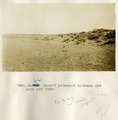 | Desert pavement between Red Lake and Tuba | 1913 | Image | uum_map |
| 403 | 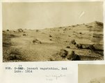 | Desert vegetation, Red Lake, 1914 | 1914 | Image | uum_map |
| 404 | 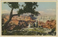 | Desert View looking north, Grand Canyon National Park, Arizona | 1930; 1931; 1932; 1933; 1934; 1935; 1936; 1937; 1938; 1939; 1940; 1941; 1942; 1943; 1944; 1945 | Image | uum_map |
| 405 |  | Desert wildflowers and Joshua tree [1] | 1937; 1938; 1939; 1940; 1941; 1942; 1943; 1944; 1945; 1946; 1947; 1948; 1949; 1950; 1951; 1952; 1953; 1954; 1955; 1956; 1957; 1958; 1959; 1960; 1961; 1962; 1963; 1964; 1965; 1966; 1967; 1968; 1969; 1970 | Image | uum_map_rr |
| 406 |  | Desert wildflowers and Joshua tree [2] | 1937; 1938; 1939; 1940; 1941; 1942; 1943; 1944; 1945; 1946; 1947; 1948; 1949; 1950; 1951; 1952; 1953; 1954; 1955; 1956; 1957; 1958; 1959; 1960; 1961; 1962; 1963; 1964; 1965; 1966; 1967; 1968; 1969; 1970 | Image | uum_map_rr |
| 407 |  | Desert wildflowers and Joshua tree [3] | 1937; 1938; 1939; 1940; 1941; 1942; 1943; 1944; 1945; 1946; 1947; 1948; 1949; 1950; 1951; 1952; 1953; 1954; 1955; 1956; 1957; 1958; 1959; 1960; 1961; 1962; 1963; 1964; 1965; 1966; 1967; 1968; 1969; 1970; 1971; 1972; 1973; 1974; 1975; 1976; 1977; 1978; 1979; 1980 | Image | uum_map_rr |
| 408 | 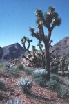 | Desert wildflowers and Joshua tree [4] | 1937; 1938; 1939; 1940; 1941; 1942; 1943; 1944; 1945; 1946; 1947; 1948; 1949; 1950; 1951; 1952; 1953; 1954; 1955; 1956; 1957; 1958; 1959; 1960; 1961; 1962; 1963; 1964; 1965; 1966; 1967; 1968; 1969; 1970; 1971; 1972; 1973; 1974; 1975; 1976; 1977; 1978; 1979; 1980 | Image | uum_map_rr |
| 409 |  | Desert wildflowers and Joshua tree [5] | 1937; 1938; 1939; 1940; 1941; 1942; 1943; 1944; 1945; 1946; 1947; 1948; 1949; 1950; 1951; 1952; 1953; 1954; 1955; 1956; 1957; 1958; 1959; 1960; 1961; 1962; 1963; 1964; 1965; 1966; 1967; 1968; 1969; 1970 | Image | uum_map_rr |
| 410 |  | Desert wildflowers: Ocotillo | 1937; 1938; 1939; 1940; 1941; 1942; 1943; 1944; 1945; 1946; 1947; 1948; 1949; 1950; 1951; 1952; 1953; 1954; 1955; 1956; 1957; 1958; 1959; 1960; 1961; 1962; 1963; 1964; 1965; 1966; 1967; 1968; 1969; 1970 | Image | uum_map_rr |
| 411 |  | Detail of dike 6 mi. SE of Agathla Needle, Laguna Creek valley, 1910 (Photo G149) | 1910 | Image | uum_map |
| 412 |  | Detail of dike 6 mi. SE of Agathla Needle, Laguna Creek valley, 1910 (Photo G150) | 1910 | Image | uum_map |
| 413 |  | Detail of dike 6 mi. SE of Agathla Needle, Laguna Creek valley, 1910 (Photo G151) | 1910 | Image | uum_map |
| 414 |  | Detail, ash, Twin Buttes (Photo G250) | 1911 | Image | uum_map |
| 415 | 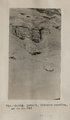 | Detail, Dolores section, as in No. 742 (Photo G425) | 1913 | Image | uum_map |
| 416 |  | Detail, McElmo, Blue Canyon, 1914 | 1914 | Image | uum_map |
| 417 | 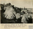 | Details, McElmo or La Plata (?), Blue Canyon, 18± mi. east of Tuba, Ariz. (M. R. Campbell photo, 1909, U.S.G.S.) | 1909 | Image | uum_map |
| 418 | 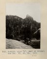 | Dike "B", east of Baigaiche Mt. VI, 45, 55. 1911 (Photo N-M114) | 1911 | Image | uum_map |
| 419 | 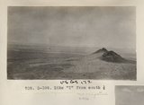 | Dike "T" from south 1/2 (Photo G399) | 1913 | Image | uum_map |
| 420 | 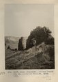 | Dike (diabase), Stiles Ranche 30± mi. north of Winslow, AZ. 1911 (Photo G237) | 1911 | Image | uum_map |
| 421 | 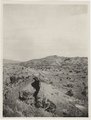 | Dike (diabase), Stiles Ranche, 30± mi. north of Winslow, AZ. 1911 (Photo G236) | 1911 | Image | uum_map |
| 422 | 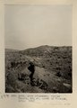 | Dike (diabase), Stiles Ranche, 30± mi. north of Winslow, AZ. 1911 (Photo G236) | 1911 | Image | uum_map |
| 423 | 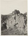 | Dike (diabase?), Stiles Ranche, Moqui Buttes region, AZ. 1911 (Photo G235) | 1911 | Image | uum_map |
| 424 |  | Dike (diabase?), Stiles Ranche, Moqui Buttes region, AZ. 1911 (Photo G235) | 1911 | Image | uum_map |
| 425 |  | Dike along Moencopie near Tuba, 1900 | 1900 | Image | uum_map |