Home
Browse
Ask Us
Chat
Harmful Language Statement
Log in
Theses & Dissertations
Advanced Search
Year
1910
1911
1912
1913
1914
1915
1916
1917
1918
1919
1920
1921
1922
1923
1924
1925
1926
1927
1928
1929
1930
1931
1932
1933
1934
1935
1936
1937
1938
1939
1940
1941
1942
1943
1944
1945
1946
1947
1948
1949
1950
1951
1952
1953
1954
1955
1956
1957
1958
1959
1960
1961
1962
1963
1964
1965
1966
1967
1968
1969
1970
1971
1972
1973
1974
1975
1976
1977
1978
1979
1980
1981
1982
1983
1984
1985
1986
1987
1988
1989
1990
1991
1992
1993
1994
1995
1996
1997
1998
1999
2000
2001
2002
2003
2004
2005
2006
2007
2008
2009
2010
2011
2012
2013
2014
2015
2016
TO
1910
1911
1912
1913
1914
1915
1916
1917
1918
1919
1920
1921
1922
1923
1924
1925
1926
1927
1928
1929
1930
1931
1932
1933
1934
1935
1936
1937
1938
1939
1940
1941
1942
1943
1944
1945
1946
1947
1948
1949
1950
1951
1952
1953
1954
1955
1956
1957
1958
1959
1960
1961
1962
1963
1964
1965
1966
1967
1968
1969
1970
1971
1972
1973
1974
1975
1976
1977
1978
1979
1980
1981
1982
1983
1984
1985
1986
1987
1988
1989
1990
1991
1992
1993
1994
1995
1996
1997
1998
1999
2000
2001
2002
2003
2004
2005
2006
2007
2008
2009
2010
2011
2012
2013
2014
2015
2016
School Or College
College of Mines & Earth Sciences
80
College of Nursing
56
School of Medicine
27
College of Science
8
College of Education
6
College of Humanities
6
College of Social & Behavioral Science
6
College of Pharmacy
4
College of Engineering
3
College of Fine Arts
3
College of Mines and Earth Sciences
2
College of Health
1
More
Department
Geology & Geophysics
73
Nursing
56
Biomedical Informatics
13
Family & Preventive Medicine
11
Biological Sciences
8
Education, Culture & Society
4
Geography
4
Materials Science & Engineering
4
History
3
Art & Art History
2
Atmospheric Sciences
2
Chemical Engineering
2
Human Genetics
2
Mining Engineering
2
Pharmaceutics & Pharmaceutical Chemistry
2
Pharmacology & Toxicology
2
Biochemistry
1
Civil & Environmental Engineering
1
Economics
1
Educational Leadership & Policy
1
Educational Psychology
1
English
1
Health & Kinesiology
1
Linguistics
1
Metallurgical Engineering
1
Political Science
1
Theatre
1
World Languages & Cultures
1
More
Publication Type
thesis
166
dissertation
29
map
8
Subject
Utah
203
Geology
57
Thesis and dissertation georeferencing project
26
Stratigraphic
14
Thesis and dissertation georeferencing project
10
Salt Lake City
8
Grand County
7
Petrology
7
Summit County
6
Wasatch County
6
Salt Lake County
5
Coalville region
4
Family Planning
4
Juab County
4
Tertiary
4
Beaver County
3
Bonneville
3
Box Elder County
3
Carbon County
3
Crystalline
3
Economics
3
Education
3
Geochemistry
3
Granite
3
Great Salt Lake Basin
3
LDS Hospital
3
Mesozoic
3
Metamorphic
3
Moenkopi group
3
Mount Ogden
3
Newfoundland Mountains
3
Nurses
3
Ore deposits
3
Precambrian
3
Psychology
3
Rocks
3
Sediments (Geology)
3
Silver Island Mountains
3
Stansbury Island
3
Thaynes Formation
3
Utah County
3
Wasatch Hinterland
3
Childbirth
2
Cretaceous
2
Gerontology
2
Great Salt Lake
2
Green River Formation
2
History
2
Idaho
2
Lake
2
Long-Term Care Facilities
2
Mineralogy
2
Mines and mineral resources
2
Mining
2
Nursing
2
Remote sensing
2
Salt Lake Valley
2
Sandstone
2
Socialization
2
Tar sands
2
Uinta Mountains
2
University of Utah
2
modeling
2
1932-1950
1
20th century
1
Adverse Effects
1
Algae
1
Algea
1
Alluvial Architecture
1
America
1
American
1
American history
1
Analysis
1
Animal ethics
1
Arches
1
Arden Syntax Medical Logic
1
Asian American
1
Atlas
1
Attitude to Health
1
Attituds
1
Bakhtin
1
Behavior modification
1
Biological sciences
1
Blood Sugar Monitoring
1
Breast cancer
1
Bromus tectorum
1
Bryce Canyon National Park
1
Bryce Canyon National Park Erosion
1
Cambrian
1
Cancer
1
Canyon
1
Case Studies
1
Cedar Mountains
1
Cheatgrass
1
Church Hills region
1
Church of Jesus Christ of Later-day Saints
1
Circle cliffs
1
Classroom management
1
Clinical Microbiology
1
Clustering
1
Coked sands
1
Colonization
1
Colorado
1
Colt Mesa Mine
1
Computerizab;e Protocol
1
Computerized Laboratory Alerting System
1
Computerized Reminder System
1
Conflict Management
1
Cove Creek area
1
Cultural anthropology
1
Data Collection
1
Death
1
Demographics
1
Demography
1
Depression in Adolescence
1
Designs and plans Latter Day Saint temples
1
Diabetes Mellitus, Insulin-Dependent
1
Diagenesis
1
Diatomaceae
1
Distant Education
1
Drug Effects
1
Drugs
1
Earthquake effects
1
East Canyon Reservoir
1
Ecology
1
Educational psychology
1
Elbert D Thomas
1
Electrical Fetal Monitoring
1
Energy
1
Environmental justice
1
Epidemiology
1
Equation
1
Ethics
1
Ethnography
1
Exit
1
FHP Providers
1
Family
1
Family Behavior
1
Family Health Program
1
Family Size
1
Father and Child
1
Female poverty
1
Flood
1
Fluvial
1
Fossil
1
Frequency
1
GIS
1
Gender
1
Genetic Distances
1
Geological
1
Geothermal
1
Gilson Mountains
1
Glacial epoch
1
Gold
1
Gold mines and mining
1
Graduate Srudents
1
Grassland
1
Green River Fomartion
1
Groundwater
1
HELP System
1
Hazardous Substances
1
Head Start
1
Health
1
Health Care Delivery
1
Health Servies
1
Heber
1
Hospital Administrators
1
Housing
1
Hybridized geothermal-solar
1
Hydrocarbons
1
Incidence
1
Ingestion of Non-Food Substances
1
Involuntary sterilization
1
Ion deposition
1
Ions
1
Iron Oxide
1
Islam
1
Islamic Studies
1
Jets
1
Job Corps
1
Job Description
1
John Henry Member
1
John henry member
1
Kaiparowits
1
Kaiparowits Plateau
1
Kangroo rats
1
Lakeside mountains
1
Landslides
1
Latter Day Saints: Orson Spencer
1
Latter-day Saints
1
Leadership
1
Life course
1
Manpower
1
Marysvale
1
Maternity Nursing
1
Mayflower Mine (Park City, Utah)
1
McCarthyism
1
Medicaid
1
Medical Genetics
1
Mentoring
1
Mica
1
Microbiology
1
Midwife
1
Moenkopi formation
1
Moran Eye Center
1
Morgan County
1
Mormon
1
Mothers
1
Murray
1
Muslim
1
NDVI time-series
1
Narrative
1
National Park
1
Natural gas
1
Navajo Indians
1
Needles Range Formation
1
New deal
1
Newcastle
1
Nitrate
1
Normal Training School
1
Norwood Tuff
1
Nurse Administratoars
1
Nurse Practioners
1
Nurse-Physician Joint Practice
1
Obstetrical Nursing
1
Odgen
1
Older People
1
Older people
1
Organization and Administration
1
Outdoor theatre
1
Paleoecology
1
Paleolimnology
1
Paleomagnetism
1
Paleontology
1
Park City District
1
Pastoralism
1
Pharmacy
1
Pipe, Asbestos-Cement
1
Pleistocene
1
Pneumococcal Pneumonia
1
Pneumonia Risk Assessment
1
Police
1
Politics and government
1
Postnatal Care
1
Power (Social Sciences)
1
Power plant
1
Precambrian
1
Predicition Models
1
Prenatal Care
1
Prescriptions, Drugs
1
Primary Care
1
Professional
1
Property
1
Protocols
1
Public Health Surveillance
1
Pyrolysis
1
Queer
1
Questionnaire
1
Radiology, Medical
1
Rational
1
Religion
1
Reservoir
1
Resonance
1
Rocks, Igneous
1
Rural Health Services
1
Salt
1
Salt Lake Couty
1
Salt Lake Temple Church architecture
1
School improvement programs
1
Sediments
1
Sequence stratigraphy
1
Sex education
1
Sheep
1
Shepherds
1
Sibilants
1
Sick Role
1
Side Effects
1
Single Person
1
Snow
1
Social Class
1
Social Conditions
1
Social Environment
1
Social Values
1
Societies, Nursing
1
Socioeconomic
1
Solar thermal
1
Spatial-temporal modeling
1
Speech
1
St. Mark's Hospital
1
Stansbury Mountains
1
Stansbury Range
1
Straight Cliffs Formation
1
Straight cliffs formation
1
Structural Health Monitoring
1
Subjects Sculpture
1
Sulfate
1
Superintendent
1
Teachers colleges
1
Teen motherhood
1
Teen pregnancy
1
Temperature Inversions
1
Theatre design
1
Thermally driven winds
1
Thesis and dissertation dereferencing project
1
Tooele County
1
Tooele Valley Hospital
1
Transpiration
1
Treatment
1
Trees
1
Tuff
1
Uinta Basin
1
United States of America
1
United States senator
1
Universtiy of Utah
1
Upper Cretaceous
1
Urban forest
1
Utah Genetic Reference Project
1
Utah Lake
1
Utah Shrubs
1
Utilization Control Methods
1
Utilization Review
1
Volcanic ash
1
Wanship region
1
Wasatch Mountain
1
Water resources
1
Weber Canyon
1
Wind
1
Women
1
Women's Hospital
1
Working fluid
1
Youth
1
children
1
cold-air pool
1
community action
1
cross-correlation
1
detection
1
earthquake
1
federalism
1
geography
1
intelligence testing
1
land use
1
poverty
1
public lands
1
seismic
1
study
1
swarm
1
wilderness
1
More
Filters:
Collection:
ir_etd
Subject:
"Utah"
76
-
100
of
203
<
1
2
3
4
5
6
7
8
9
>
Gallery view
Number of results to display per page
10
25
50
100
200
Sort by Relevance
Sort by Title A-Z
Sort by Title Z-A
Sort by Date Ascending
Sort by Date Descending
Sort by Last Modified Ascending
Sort by Last Modified Descending
Title
Setname
Type
76
Fracture analysis, hydrodynamic properties and mineral abundance in altered igneous wall rocks of the Mayflower Mine, Park City District, Utah
ir_etd
Text
77
Fractures and surface lineaments in northeastern Utah
ir_etd
Text
78
Genetic analysis of quantitative traits in the Utah CEPH pedigrees
ir_etd
Text
79
Genetic and biochemical basis of familial advanced sleep phase syndrome in a Utah kindre
ir_etd
Text
80
Geological and geophysical studies of the Gilson Mountains and vicinity, Juab County, Utah
ir_etd
Text
81
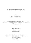
The geology and erosional development Northern Bryce Canyon National Park
ir_etd
Text
82
Geology and geochemistry of the colt mesa copper deposit, Circle Cliffs Area, Utah
ir_etd
Text
83
Geology and mineral deposits of the western portion church hills, Millard County, Utah
ir_etd
Text
84
Geology and mineralogy of the Milford Flat Quadrangle and the Old Moscow Mine Star District, Beaver County, Utah
ir_etd
Text
85
Geology and structure of Stansbury Island (Thesis and maps)
ir_etd
Text; Image
86
Geology and structure of Stansbury Island: Georeferenced map files
ir_etd
Image
87
Geology of the Cedar Mountains,Tooele County, Utah (Thesis and maps)
ir_etd
Text; Image
88
Geology of the Cove Creek area Millard County and Beaver County, Utah
ir_etd
Text; Image
89
Geology of the Keetley-Kamas volcanic area
ir_etd
Text; Image
90
Geology of the Keetley-Kamas volcanic area (Google Earth map overlay KMZ file)
ir_etd
Image
91
Geology of the Keetley-Kamas volcanic area: Georeferenced map files
ir_etd
Image
92
Geology of the Mercur Gold Camp, Utah
ir_etd
Text
93
Geology of the Morgan-Henefer area Morgan and Summit Counties, Utah
ir_etd
Text
94
Geology of the Newfoundland Mountains, Box Elder County, Utah
ir_etd
Text; Image
95
Geology of the Newfoundland Mountains, Box Elder County, Utah: Georeferenced map files
ir_etd
Image
96
Geology of the Northern Silver Island Mountains, Box Elder and Tooele Counties, Utah
ir_etd
Text; Image
97
Geology of the Northern Silver Island Mountains, Box Elder and Tooele Counties, Utah (Google Earth map overlay KMZ file)
ir_etd
Image
98
Geology of the northern Silver Island Mountains, Box Elder and Tooele Counties, Utah: Georeferenced maps
ir_etd
Image
99
Geology of the Picture Rock Hills quadrangle, Southwestern Keg Mountains, Juab County, Utah (Google Earth map overlay KMZ file)
ir_etd
Image
100
Geology of the Picture Rock Hills quadrangle, Southwestern Keg Mountains, Juab County, Utah (Thesis and maps)
ir_etd
Text; Image
76
-
100
of
203
<
1
2
3
4
5
6
7
8
9
>