351 - 375 of 752
Number of results to display per page
TitleDateType
351 Mable Wall1935-08Image/StillImage
352 Mable Wall with baby in cradleboard; Cedar City, Iron County, UtahImage/StillImage
353 Mable, Grace, and Annie; Cedar City, Iron County, Utah1925Image/StillImage
354 Mamie and John Mericats; Moccasin, Arizona1936Image/StillImage
355 Mamie Merricats and Stella Rogers1930Image/StillImage
356 Mamie Merricats; Cedar City, Iron County, Utah1936Image/StillImage
357 Man seated outside loge house, Bannock Tribe, 18721872Image/StillImage
358 Man sitting at a deskImage/StillImage
359 Man with petroglyphs; Deseret, Millard County, Utah1926Image/StillImage
360 Mancos George; Allen Canyon, San Juan County, Utah1936Image/StillImage
361 Mancos Jim1890; 1891; 1892; 1893; 1894; 1895; 1896; 1897; 1899; 1900Image/StillImage
362 Map of Indian Land Cessions in the United StatesImage/StillImage
363 Map of Indian Reservation. 1884Image/StillImage
364 Map of Indian Reservations in the Western United StatesImage/StillImage
365 Map of Indian Territory in the Western United StatesImage/StillImage
366 Map of Indian Tribes of North AmericaImage/StillImage
367 Map of Major Historical Trails of Southern Utah
368 Map of North America and Original Inhabitants' Territory.Image/StillImage
369 Map of Reservations of the Western United States and the Religions that Worked on the Reservations 1870's1873Image/StillImage
370 Map of Shoshone Indian Territory, and the Division of Shoshone Boundaries in NevadaImage/StillImage
371 Map of Southern Paiute Bands
372 Map of Southern Paiute Territory
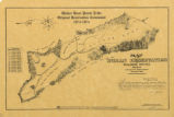
373 Map of Walker River Paiute Tribe Original Reservation Centennial 1874-19741874Image/StillImage
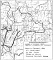
374 Map showing boundaries of Northern Paiute, Southern Paiute, Shoshone Bannock and UteImage/StillImage
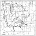
375 Map showing the boundary of the Shoshone Indian territory1941Image/StillImage
351 - 375 of 752