|
|
Title | Collection Number And Name | Photo Number |
| 76 |
 |
"Barbara photographing petroglyphs in Twilight Canyon mile 71." | P0867 Marjorie G. Paul Photograph Collection | P0867n063 |
| 77 |
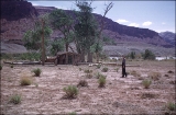 |
"Bert Loper's Cabin, Mile 150." | P0867 Marjorie G. Paul Photograph Collection | P0867n026 |
| 78 |
 |
"Boat barge created as we pulled in together for a short interval. Olive, Joe, Don, Jack, Verona, Wyman." | P0867 Marjorie G. Paul Photograph Collection | P0867n102 |
| 79 |
 |
"Breakfast Tues am above Aztec Creek miles above Lee's Ferry 68.5" | P0867 Marjorie G. Paul Photograph Collection | P0867n095 |
| 80 |
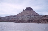 |
"Castle Butte on our way to plane which landed on sand bar." | P0867 Marjorie G. Paul Photograph Collection | P0867n022 |
| 81 |
 |
"Don Smith, Frank Wright and Jack Rigg. Mexican Hat Expeditions. 5-17-51." | P0867 Marjorie G. Paul Photograph Collection | P0867n109 |
| 82 |
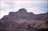 |
"Eastward from Mile 61 to Wild Horse Mesa." | P0867 Marjorie G. Paul Photograph Collection | P0867n097 |
| 83 |
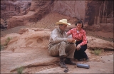 |
"Frank and Marjorie at register on top of Rainbow Bridge, 5-15-51." | P0867 Marjorie G. Paul Photograph Collection | P0867n086 |
| 84 |
 |
"Goodbye to Rainbow Bridge as we turn for a final view and clouds close in on Navajo Mt." | P0867 Marjorie G. Paul Photograph Collection | P0867n091 |
| 85 |
 |
"House where John D Lee lived and operated the ferry." | P0867 Marjorie G. Paul Photograph Collection | P0867n115 |
| 86 |
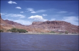 |
"Knowles Canyon mile 134. East side of river." | P0867 Marjorie G. Paul Photograph Collection | P0867n029 |
| 87 |
 |
"Landing at Lee's Ferry end of our 162 mile boat trip through Glen Canyon of Colorado." | P0867 Marjorie G. Paul Photograph Collection | P0867n117 |
| 88 |
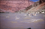 |
"Last Rapid Paria Creek." | P0867 Marjorie G. Paul Photograph Collection | P0867n116 |
| 89 |
 |
"Looking back NE over 4 mile straight stretch. Mile 51" | P0867 Marjorie G. Paul Photograph Collection | P0867n104 |
| 90 |
 |
"Looking down from cliffs to boats at edge of San Juan River. Mile 78" | P0867 Marjorie G. Paul Photograph Collection | P0867n058 |
| 91 |
 |
"Looking down N. W. from top of Rainbow Bridge our companions 300 ft below." | P0867 Marjorie G. Paul Photograph Collection | P0867n084 |
| 92 |
 |
"Looking down onto the boats at mouth of Kane Creek. Wyman, Verona, M." | P0867 Marjorie G. Paul Photograph Collection | P0867n101 |
| 93 |
 |
"Looking East out of Outlaw Cave 160x40x30. Over last night camp site. Mile 17" | P0867 Marjorie G. Paul Photograph Collection | P0867n107 |
| 94 |
 |
"Lunch at Kane Creek. 5-16-51." | P0867 Marjorie G. Paul Photograph Collection | P0867n099 |
| 95 |
 |
"Lunch stop on SW bank of Colorado River at mile 9.5" | P0867 Marjorie G. Paul Photograph Collection | P0867n111 |
| 96 |
 |
"M. by tamarisk looking East from Kane Creek above crossing of the Fathers." | P0867 Marjorie G. Paul Photograph Collection | P0867n100 |
| 97 |
 |
"Marjorie and Barbara at end of trail after 7 days of river life. 5-17-51." | P0867 Marjorie G. Paul Photograph Collection | P0867n119 |
| 98 |
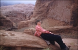 |
"Marjorie in a relaxed pose on top of rainbow Bridge- Navajo Mt and clouds to East. 5-15-51." | P0867 Marjorie G. Paul Photograph Collection | P0867n087 |
| 99 |
 |
"Marjorie looking over river map and making a final note. Art Greene's Power boat moored nearby." | P0867 Marjorie G. Paul Photograph Collection | P0867n118 |
| 100 |
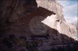 |
"Mite camp x 2 Aztec Creek old Native American Site." | P0867 Marjorie G. Paul Photograph Collection | P0867n069 |


