|
|
Title | Collection Number And Name | Photo Number |
| 101 |
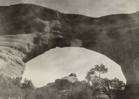 | Men standing on top of Sipapu Natural Bridge, Natural Bridges National Monument. | P0068 Dick Beck Photograph Collection | P0068n059 |
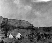
| 102 |
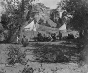 | Men and women sitting in the shade drinking water near their tents. | P0068 Dick Beck Photograph Collection | P0068n06 |
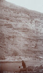
| 103 |
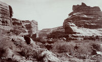 | "Victoria Camp, Grand Gulch, San Juan County, Utah. Queen Vic's profiled is seen on top of cliff, right side." | P0068 Dick Beck Photograph Collection | P0068n060 |
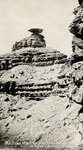
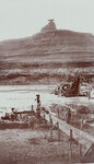
| 104 |
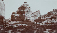 | "Mokee Castle, Grand Gulch, San Juan County, Utah. Around its base and under its sheltering cliffs were found many relics of the old cliff-dwellers." | P0068 Dick Beck Photograph Collection | P0068n061 |
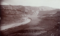
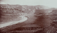
| 105 |
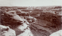 | "Grand Gulch near junction with San Juan River. 600 feet deep." | P0068 Dick Beck Photograph Collection | P0068n062 |
| 106 |
 | "Looking southwest from Bluff, Utah." | P0068 Dick Beck Photograph Collection | P0068n063 |
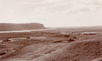
| 107 |
 | "Looking southwest from Bluff, Utah." | P0068 Dick Beck Photograph Collection | P0068n064 |
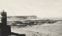
| 108 |
 | "Mexican Hat on the San Juan River at Wilson's Camp." | P0068 Dick Beck Photograph Collection | P0068n065 |
| 109 |
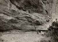 | Men and women climbing a long ladder up a cliff to examine the ruins of a cliff-dweller settlement. | P0068 Dick Beck Photograph Collection | P0068n066 |
| 110 |
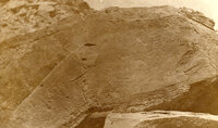 | Petroglyphs in San Juan County, Utah. | P0068 Dick Beck Photograph Collection | P0068n067 |
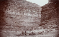
| 111 |
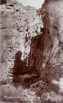 | "Trails to Honaker's Camp, San Juan Canyon, Utah." | P0068 Dick Beck Photograph Collection | P0068n068 |
| 112 |
 | Men and women standing near their horses outside of camp. | P0068 Dick Beck Photograph Collection | P0068n07 |
| 113 |
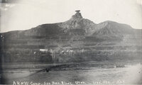 | View of the AR&W camp on the San Juan River, Utah. | P0068 Dick Beck Photograph Collection | P0068n070 |
| 114 |
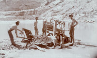 | "Placer mining on San Juan River near Bluff, Utah." | P0068 Dick Beck Photograph Collection | P0068n071 |
| 115 |
 | "Mexican Hat or Blanced Rock in the background of placer miners. View in Oil Basin, 25 miles west of Bluff, Utah." | P0068 Dick Beck Photograph Collection | P0068n072 |
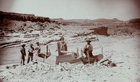
| 116 |
 | "Placer mining at foot of Honaker Trail in San Juan Canyon, Utah." | P0068 Dick Beck Photograph Collection | P0068n073 |
| 117 |
 | "Crasy Smith mining in San Juan River Canyon, Utah." | P0068 Dick Beck Photograph Collection | P0068n074 |
| 118 |
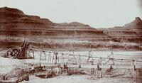 | "Raplee's placer mining works in Oil Basin, 25 miles west of Bluff, Utah." | P0068 Dick Beck Photograph Collection | P0068n075 |
| 119 |
 | "First discovery of oil in quantity on San Juan River, Utah. Oil is being poured from the bucket." | P0068 Dick Beck Photograph Collection | P0068n076 |
| 120 |
 | "San Juan Oil Basin at Raplee's Camp. Lime Ridge Dome in background." | P0068 Dick Beck Photograph Collection | P0068n077 |
| 121 |
 | "San Juan Oil Basin at Raplee's Camp. Lime Ridge Dome in background." | P0068 Dick Beck Photograph Collection | P0068n078 |
| 122 |
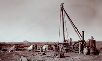 | "The first Goodridge Oil Well. Oil struck March 4, 1908." | P0068 Dick Beck Photograph Collection | P0068n079 |
| 123 |
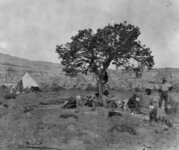 | Women and men sitting under a tree near their camp. | P0068 Dick Beck Photograph Collection | P0068n08 |
| 124 |
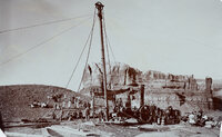 | "Bluff City artesian well number one. Struck water on November 3rd, 1908." | P0068 Dick Beck Photograph Collection | P0068n080 |
| 125 |
 | "Artesian well flowing 120 gallons of water per minute on B.D. Harshberger's farm, Bluff, Utah." | P0068 Dick Beck Photograph Collection | P0068n081 |