|
|
Title | Collection Number And Name | Photo Number |
| 876 |
 |
Stouffer Creek, Idaho [5] | P2162 Bear River Portfolio by Craig Denton | P2162n06_07_005 |
| 877 |
 |
Stouffer Creek, Idaho [6] | P2162 Bear River Portfolio by Craig Denton | P2162n06_07_006 |
| 878 |
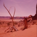 |
Unidentified landscape. | P0618 S.J. Quinney Photograph Collection | P0618n5_01_18 |
| 879 |
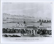 |
"Camp scene in the Mojave Valley of Rio Colorado" | P0046 The Institute of the American West photograph collection, 1886-1985 | P0046n01_07_197 |
| 880 |
 |
Davis Gulch, Utah [21] | P0796 Bill Wolverton Photograph Collection | P0796n01_14_21 |
| 881 |
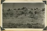 |
Entrada sandstone (bottom) in contact with shales and gypsum of Curtis formation, Paria Valley 4 miles south of Cannonville, Kane County, UT. 1939 | P0013 Herbert E. Gregory Photograph Collection | P0013n11_040_2589 |
| 882 |
 |
Erosion in Dolores, Beautiful Valley, north of Ganado. 1911 (Photo G267) | P0013 Herbert E. Gregory Photograph Collection | P0013n05_63_0773 |
| 883 |
 |
Fiftymile Gulch, Utah [01] | P0796 Bill Wolverton Photograph Collection | P0796n01_13_01 |
| 884 |
 |
Fiftymile Gulch, Utah [06] | P0796 Bill Wolverton Photograph Collection | P0796n01_13_06 |
| 885 |
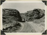 |
Gap cut in Navajo sandstone by Kaibab Creek where it leaves its structural valley to cross East Kaibab monocline. Northward through the gap House Rock Valley and Kaibab Plateau are visible. Kane County, UT. 1944 | P0013 Herbert E. Gregory Photograph Collection | P0013n12_044_2895 |
| 886 |
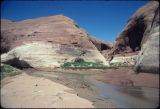 |
Glen Canyon Reservoir, Willow Gulch, Utah [1] | P0796 Bill Wolverton Photograph Collection | P0796n01_09_01 |
| 887 |
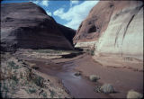 |
Glen Canyon Reservoir, Willow Gulch, Utah [2] | P0796 Bill Wolverton Photograph Collection | P0796n01_09_02 |
| 888 |
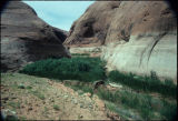 |
Glen Canyon Reservoir, Willow Gulch, Utah [3] | P0796 Bill Wolverton Photograph Collection | P0796n01_09_03 |
| 889 |
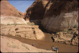 |
Glen Canyon Reservoir, Willow Gulch, Utah [4] | P0796 Bill Wolverton Photograph Collection | P0796n01_09_04 |
| 890 |
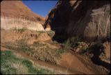 |
Glen Canyon Reservoir, Willow Gulch, Utah [5] | P0796 Bill Wolverton Photograph Collection | P0796n01_09_05 |
| 891 |
 |
Gunsight Pass from Last Chance Valley to Kane Springs Valley. Strata massive sandstone of 'Sentinel'. Kane County, UT. 1922 | P0013 Herbert E. Gregory Photograph Collection | P0013n08_128_1558 |
| 892 |
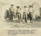 |
Longwell 7, 1924. Shoshone, Amoragosa Valley. Professor Gregory, Rocky Mountain George, Dr. Noble, Dr. Hewett | P0013 Herbert E. Gregory Photograph Collection | P0013n08_187_1709 |
| 893 |
 |
McElmo strata, Holly's ranche, McElmo valley, Colo., 33+ mi. west of Cortez, Colo., 1910 (Photo G-125) | P0013 Herbert E. Gregory Photograph Collection | P0013n04_03_0515 |
| 894 |
 |
McElmo strata, Holly's ranche, McElmo valley, Colo., 33+ mi. west of Cortez, Colo., 1910 (Photo G-126) | P0013 Herbert E. Gregory Photograph Collection | P0013n04_03_0516 |
| 895 |
 |
McElmo strata, Holly's ranche, McElmo valley, Colo., 33+ mi. west of Cortez, Colo., 1910 (Photo N-M76) | P0013 Herbert E. Gregory Photograph Collection | P0013n04_04_0517 |
| 896 |
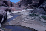 |
Mudflat at Willow Gulch, Utah [5] | P0796 Bill Wolverton Photograph Collection | P0796n01_10_05 |
| 897 |
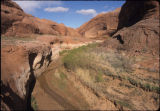 |
Mudflat at Willow Gulch, Utah [6] | P0796 Bill Wolverton Photograph Collection | P0796n01_10_06 |
| 898 |
 |
Paria River valley above "the box" 3± miles below Cannonville. At the left the lowest bed is massive sandstone separated from Navajo sandstone by shales and limestone. Kane County, Utah, 1931. | P0013 Herbert E. Gregory Photograph Collection | P0013n10_081_2222 |
| 899 |
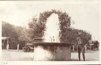 |
Artesian Park, Huntsville, 1920 [04] | P0268 Frederick J. Pack photograph collection | P0268n01_13_011 |
| 900 |
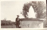 |
Artesian Park, Huntsville, 1920 [06] | P0268 Frederick J. Pack photograph collection | P0268n01_13_013 |