|
|
Title | Collection Number And Name | Photo Number |
| 326 |
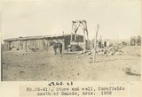 |
Store and well, Cornfields south of Ganado, Ariz., 1909 (sheet G-61) | P0013 Herbert E. Gregory Photograph Collection | P0013n02_027_247 |
| 327 |
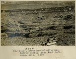 |
Structure of alluvium, Canyon Bonito, near Fort Defiance, Ariz., 1909 (photo G-10) | P0013 Herbert E. Gregory Photograph Collection | P0013n02_006_206 |
| 328 |
 |
SW Sunrise Springs, Arizona (Negative for photo G-43) | P0013 Herbert E. Gregory Photograph Collection | P0013n02_028_249_neg |
| 329 |
 |
Tertiary clay shales near Sunrise Springs and Indian Wells (Negative for photo G-46) | P0013 Herbert E. Gregory Photograph Collection | P0013n02_030_252_neg |
| 330 |
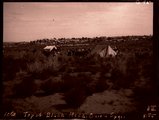 |
Top of Black Mesa, Onion Spgs. (Negative for photo G-95) | P0013 Herbert E. Gregory Photograph Collection | P0013n02_055_306_neg |
| 331 |
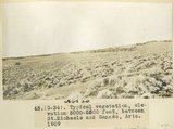 |
Typical vegetation, elevation 5000-5500 feet, between St. Michaels and Ganado, Ariz., 1909 (photo G-34) | P0013 Herbert E. Gregory Photograph Collection | P0013n02_025_240 |
| 332 |
 |
Vegetation, Black Creek Valley, Arizona, 1909 (photo G-11) | P0013 Herbert E. Gregory Photograph Collection | P0013n02_006_207 |
| 333 |
 |
View, Fort Defiance-Tolhatchie road (negative for photo G-104) | P0013 Herbert E. Gregory Photograph Collection | P0013n02_078_339_neg |
| 334 |
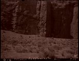 |
Volcanic conglomerate, Ariz. (negative for photo G-16) | P0013 Herbert E. Gregory Photograph Collection | P0013n02_014_218_neg |
| 335 |
 |
Webo Spgs., water from Mesa Verde sandstones (negative for photo G-97) | P0013 Herbert E. Gregory Photograph Collection | P0013n02_056_308_neg |
| 336 |
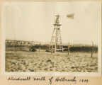 |
Windmill north of Holbrook, 1909 | P0013 Herbert E. Gregory Photograph Collection | P0013n01_70_190 |
| 337 |
 |
Windmills with points driven into alluvial sand, 10± miles north of Holbrook, Ariz., 1909 (photo G-79) | P0013 Herbert E. Gregory Photograph Collection | P0013n02_044_286 |
| 338 |
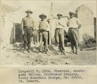 |
Longwell 7, 1924. Shoshone, Amoragosa Valley. Professor Gregory, Rocky Mountain George, Dr. Noble, Dr. Hewett | P0013 Herbert E. Gregory Photograph Collection | P0013n08_187_1709 |
| 339 |
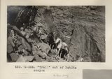 |
"Trail" out of PahUte canyon (Photo G354) | P0013 Herbert E. Gregory Photograph Collection | P0013n06_038_0900 |
| 340 |
 |
Camp and Indian pasture, Da-dat-soe. East terrace of Choiskai Mt., NM. 1911 | P0013 Herbert E. Gregory Photograph Collection | P0013n05_10_0684 |
| 341 |
 |
Camp south edge of Elk Ridge at head of Grand Gulch, San Juan County, Utah. June, 1915. | P0013 Herbert E. Gregory Photograph Collection | P0013n08_033_1374 |
| 342 |
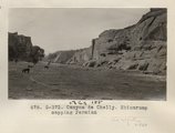 |
Canyon de Chelly. Shinarump capping Permian (Photo G373) | P0013 Herbert E. Gregory Photograph Collection | P0013n06_048_0924 |
| 343 |
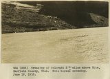 |
Crossing of Colorado River 3+ miles above Hite, Garfield County, Utah. Note horses swimming. June 19, 1915. | P0013 Herbert E. Gregory Photograph Collection | P0013n08_033_1373 |
| 344 |
 |
Dike east of Dike no. 2, Laguna Creek valley, Ariz., 1910 (Photo N-M87) | P0013 Herbert E. Gregory Photograph Collection | P0013n04_26_0558 |
| 345 |
 |
Looking east from base of Choiskai Mt., Tohatchie valley in distance. H.E.G. and Grover Cleveland. Heald, photo. 1911 (Photo N-M110) | P0013 Herbert E. Gregory Photograph Collection | P0013n05_10_0685 |
| 346 |
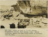 |
Outfit at head of "Cliff" Canyon, Kaiparowitz Plateau, Kane County, Utah. Dakota sandstone, Mancos and Mesa Verde strata in distance. June 10, 1915. | P0013 Herbert E. Gregory Photograph Collection | P0013n08_022_1352 |
| 347 |
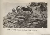 |
Pack train, Sagy canyon (Photo G348) | P0013 Herbert E. Gregory Photograph Collection | P0013n06_035_0894 |
| 348 |
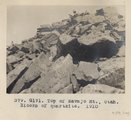 |
Top of Navajo Mt., Utah. Blocks of quartzite, 1910 (Photo G171) | P0013 Herbert E. Gregory Photograph Collection | P0013n04_50_0591 |
| 349 |
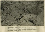 |
Trail from Lees Ferry to top of plateau east of Paria River, Coconino County, Arizona. June, 1915. | P0013 Herbert E. Gregory Photograph Collection | P0013n08_012_1330 |
| 350 |
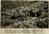 |
Vegetation south slope of Bears Ears, Elk Ridge, San Juan County, Utah. June, 1915. | P0013 Herbert E. Gregory Photograph Collection | P0013n08_034_1375 |