Over 70,000 photos covering a variety of topics from Marriott Library Special Collections
TO
Filters: Collection: "uum_map"
| Title | Collection Number And Name | Photo Number | ||
|---|---|---|---|---|
| 276 |
 |
Hyrum State Park, Cache County, Utah (negative) [06] | P2162 Bear River Portfolio by Craig Denton | P2162n02_05_006 |
| 277 |
 |
Hyrum State Park, Cache County, Utah (negative) [07] | P2162 Bear River Portfolio by Craig Denton | P2162n02_05_007 |
| 278 |
 |
Hyrum State Park, Cache County, Utah (negative) [08] | P2162 Bear River Portfolio by Craig Denton | P2162n02_05_008 |
| 279 |
 |
Hyrum State Park, Cache County, Utah (negative) [10] | P2162 Bear River Portfolio by Craig Denton | P2162n02_05_010 |
| 280 |
 |
Hyrum State Park, Cache County, Utah (negative) [11] | P2162 Bear River Portfolio by Craig Denton | P2162n02_05_011 |
| 281 |
 |
Hyrum State Park, Cache County, Utah (negative) [12] | P2162 Bear River Portfolio by Craig Denton | P2162n02_05_012 |
| 282 |
 |
Hyrum State Park, Cache County, Utah (negative) [13] | P2162 Bear River Portfolio by Craig Denton | P2162n02_05_013 |
| 283 |
 |
Hyrum State Park, Cache County, Utah (negative) [14] | P2162 Bear River Portfolio by Craig Denton | P2162n02_05_014 |
| 284 |
 |
Hyrum State Park, Cache County, Utah (negative) [16] | P2162 Bear River Portfolio by Craig Denton | P2162n02_05_016 |
| 285 |
 |
Hyrum State Park, Cache County, Utah (negative) [18] | P2162 Bear River Portfolio by Craig Denton | P2162n02_05_018 |
| 286 |
 |
Hyrum State Park, Cache County, Utah (negative) [19] | P2162 Bear River Portfolio by Craig Denton | P2162n02_05_019 |
| 287 |
 |
Hyrum State Park, Cache County, Utah (negative) [20] | P2162 Bear River Portfolio by Craig Denton | P2162n02_05_020 |
| 288 |
 |
Hyrum State Park, Cache County, Utah (negative) [22] | P2162 Bear River Portfolio by Craig Denton | P2162n02_05_022 |
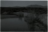
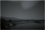
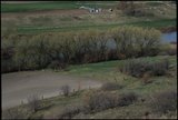
| 289 |
 |
Last Chance Reservoir (forebay) forming after rapids (negative) | P2162 Bear River Portfolio by Craig Denton | P2162n01_15_010 |
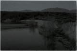
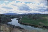
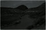
| 290 |
 |
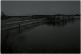
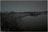
Views from dugway downstream from Cutler Reservoir [02] | P2162 Bear River Portfolio by Craig Denton | P2162n05_25_002 |
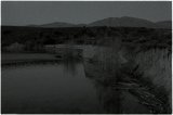
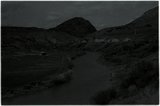
| 291 |
 |
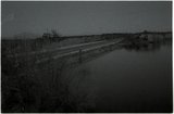
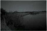
Views from dugway downstream from Cutler Reservoir [03] | P2162 Bear River Portfolio by Craig Denton | P2162n05_25_003 |
| 292 |
 |
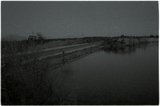
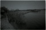
Views from dugway downstream from Cutler Reservoir [05] | P2162 Bear River Portfolio by Craig Denton | P2162n05_25_005 |
| 293 |
 |
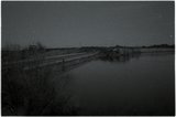
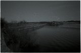
Views from dugway downstream from Cutler Reservoir [11] | P2162 Bear River Portfolio by Craig Denton | P2162n05_25_011 |
| 294 |
 |
Views from dugway downstream from Cutler Reservoir [12] | P2162 Bear River Portfolio by Craig Denton | P2162n05_25_012 |
| 295 |
 |
Views from dugway downstream from Cutler Reservoir [13] | P2162 Bear River Portfolio by Craig Denton | P2162n05_25_013 |
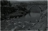
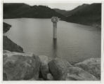
| 296 |
 |
Woodruff spillway : Woodruff equalizing reservoir, showing first construction camp, 1926, and beginning of the new dam [and] Woodruff spillway at the height of 24 ft., which was the first level reached | P0208 Utah Flood Survey photograph collection | P0208n01_01_082-083 |
| 297 |
 |
Electric Lake, Emery County, Utah [021] | P0206 Rocky Mountain Power Company Photograph Collection | P0206add2n09_08_021 |
| 298 |
 |
Electric Lake, Emery County, Utah [022] | P0206 Rocky Mountain Power Company Photograph Collection | P0206add2n09_08_022 |
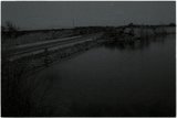
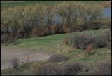
| 299 |
 |
Bear River downstream from Cutler Reservoir (negative) [08] | P2162 Bear River Portfolio by Craig Denton | P2162n01_27_009 |
| 300 |
 |
Bear River downstream from Cutler Reservoir (negative) [09] | P2162 Bear River Portfolio by Craig Denton | P2162n01_27_010 |