|
|
Title | Collection Number And Name | Photo Number |
| 101 |
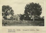 |
Mangum's hotel, Cannonville | P0013 Herbert E. Gregory Photograph Collection | P0013n08_167_1655 |
| 102 |
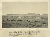 |
Camp in Escalante Desert. Kaiparowitz Plateau in background | P0013 Herbert E. Gregory Photograph Collection | P0013n08_173_1679 |
| 103 |
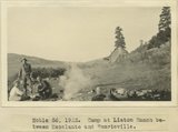 |
Camp at Liston Ranch between Escalante and Henrieville | P0013 Herbert E. Gregory Photograph Collection | P0013n08_173_1680 |
| 104 |
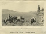 |
Liston Ranch | P0013 Herbert E. Gregory Photograph Collection | P0013n08_174_1681 |
| 105 |
 |
Liston Ranch, Marion | P0013 Herbert E. Gregory Photograph Collection | P0013n08_174_1682 |
| 106 |
 |
Liston Ranch, Dewey | P0013 Herbert E. Gregory Photograph Collection | P0013n08_174_1683 |
| 107 |
 |
Liston Ranch, Sam | P0013 Herbert E. Gregory Photograph Collection | P0013n08_174_1684 |
| 108 |
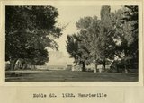 |
Henrieville | P0013 Herbert E. Gregory Photograph Collection | P0013n08_175_1685 |
| 109 |
 |
Banded red and white sands. 'Marine Jurassic', immediately west of Cannonville | P0013 Herbert E. Gregory Photograph Collection | P0013n09_002_1725 |
| 110 |
 |
Banded red and white sands. 'Marine Jurassic', immediately west of Cannonville | P0013 Herbert E. Gregory Photograph Collection | P0013n09_003_1726 |
| 111 |
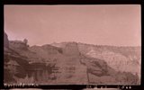 |
Banded red and white sands. 'Marine Jurassic', immediately west of Cannonville, Garfield County, Utah | P0013 Herbert E. Gregory Photograph Collection | P0013n09_003_1726 |
| 112 |
 |
Banded red and white sands. 'Marine Jurassic', immediately west of Cannonville | P0013 Herbert E. Gregory Photograph Collection | P0013n09_004_1727 |
| 113 |
 |
Banded red and white sands. 'Marine Jurassic', immediately west of Cannonville | P0013 Herbert E. Gregory Photograph Collection | P0013n09_005_1728 |
| 114 |
 |
Sandstone and shale, 'Marine Jurassic'. Wall of Paria River, 3 miles below Cannonville | P0013 Herbert E. Gregory Photograph Collection | P0013n09_005_1729 |
| 115 |
 |
Ripple-marked sandstone, Marine Jurassic, from bed 40 feet above top of Navajo sandstone, Rock Spring Gulch, 6 miles below Cannonville. S.S. Johnson, packer, in foreground | P0013 Herbert E. Gregory Photograph Collection | P0013n09_005_1730 |
| 116 |
 |
Contact McElmo and Dakota, Henrieville Wash. Garfield County, UT, 1924 | P0013 Herbert E. Gregory Photograph Collection | P0013n09_007_1733 |
| 117 |
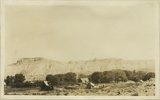 |
Cannonville, UT, looking east. September, 1924 | P0013 Herbert E. Gregory Photograph Collection | P0013n09_007_1734 |
| 118 |
 |
General view upper two thirds Waweap beds 1 mile southwest of Cannonville, Garfield County, UT 1924 | P0013 Herbert E. Gregory Photograph Collection | P0013n09_008_1736 |
| 119 |
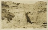 |
Detail view showing change in massiveness of beds of Waweap formation. along strike. Cannonville, Garfield County, UT, 1924 | P0013 Herbert E. Gregory Photograph Collection | P0013n09_009_1737 |
| 120 |
 |
Yellow-red sandstone above gypsiferous shales, Waweap formation 3 miles SE of Cannonville. Equivalent of beds shown in photograph 1728. Garfield County, UT 1924 | P0013 Herbert E. Gregory Photograph Collection | P0013n09_009_1738 |
| 121 |
 |
Red House in Red Canyon, U. S. G. S., Miser, 448 | P0013 Herbert E. Gregory Photograph Collection | P0013n09_153_2010 |
| 122 |
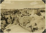 |
View southwest toward the rim of Bryce Canyon from the north side of lower canyon near the Fairy Temple trail. | P0013 Herbert E. Gregory Photograph Collection | P0013n10_074_2209 |
| 123 |
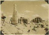 |
View east toward Seal Castle and Fairy Temple. "Lot's wife" in the foreground. | P0013 Herbert E. Gregory Photograph Collection | P0013n10_075_2210 |
| 124 |
 |
Contact Morrison (?) and Dakota (?) 2 miles north of Henrieville, Garfield County, Utah, 1932. | P0013 Herbert E. Gregory Photograph Collection | P0013n10_111_2275 |
| 125 |
 |
Coal beds just above Morrison Dakota contact (in shadow) 2± miles north of Cannonville, Utah, 1932. | P0013 Herbert E. Gregory Photograph Collection | P0013n10_113_2278 |