Over 70,000 photos covering a variety of topics from Marriott Library Special Collections
TO
| Title | Collection Number And Name | Photo Number | ||
|---|---|---|---|---|
| 226 |
 |
Sevier River formation overlaid by basalt near mouth of Corral Creek on Highway 89, 2 miles east of Panguitch. Garfield County, UT. 1944 | P0013 Herbert E. Gregory Photograph Collection | P0013n12_075_2940A |
| 227 |
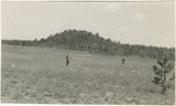 |
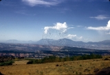
Bowers Knoll; Volcano viewed from northwest. Garfield County, UT. 1944 | P0013 Herbert E. Gregory Photograph Collection | P0013n12_076_2940B |
| 228 |
 |
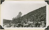
Basalt, head of Rock Creek. Old lava (foreground) and end of newer flow (center). Garfield County, UT, 1944 | P0013 Herbert E. Gregory Photograph Collection | P0013n12_077_2941 |
| 229 |
 |
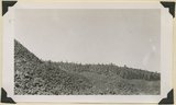
End of basalt flow in Black Rock Valley. White rocks (foreground) and left sky line (Haycock Mountain) of Brian Head formation. Garfield County, UT, 1944 | P0013 Herbert E. Gregory Photograph Collection | P0013n12_077_2942 |
| 230 |
 |
End of basalt flow in Black Rock Valley. White rocks (foreground) and left sky line (Haycock Mountain) of Brian Head formation. Garfield County, UT, 1944 | P0013 Herbert E. Gregory Photograph Collection | P0013n12_078_2943 |
| 231 |
 |
Wagon Wheel Gap, Rock Creek Canyon. Walls of basalt, 120 feet high. Garfield County, UT, 1944 | P0013 Herbert E. Gregory Photograph Collection | P0013n12_078_2944 |
| 232 |
 |
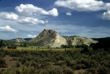
Ridge of uptilted strata | P0013 Herbert E. Gregory Photograph Collection | P0013n16_09_01 |
| 233 |
 |
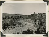
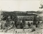
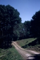
Road and lava field, Rock Creek Valley, Utah | P0013 Herbert E. Gregory Photograph Collection | P0013n16_12_02 |
| 234 |
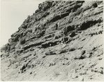 |
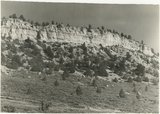
Rocky cliff near Hillsdale | P0013 Herbert E. Gregory Photograph Collection | P0013n16_12_03 |
| 235 |
 |
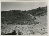
Lava, Black Rock Valley | P0013 Herbert E. Gregory Photograph Collection | P0013n16_12_04 |
| 236 |
 |
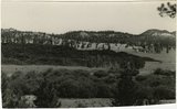
White rocks on road to Panquitch, Utah | P0013 Herbert E. Gregory Photograph Collection | P0013n16_12_09 |
| 237 |
 |
End of lava flow 6 miles long in Black Creek Valley | P0013 Herbert E. Gregory Photograph Collection | P0013n16_12_12 |
| 238 |
 |
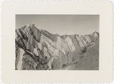
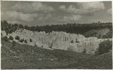
White cliffs along highway south of Asay Creek, Brian Head formation | P0013 Herbert E. Gregory Photograph Collection | P0013n16_12_13 |
| 239 |
 |
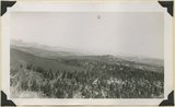
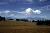
Boulder Mountain, Garfield County, Utah [7] | P0100 Charles Kelly Photograph Collection | P0100n1_17_04 |
| 240 |
 |
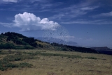
Boulder Mountain, Garfield County, Utah [2] | P0100 Charles Kelly Photograph Collection | P0100n1_17_05 |
| 241 |
 |
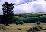
Boulder Mountain, Garfield County, Utah [5] | P0100 Charles Kelly Photograph Collection | P0100n1_17_06 |
| 242 |
 |
Boulder Mountain, Garfield County, Utah [1] | P0100 Charles Kelly Photograph Collection | P0100n1_17_07 |
| 243 |
 |
Boulder Mountain, Garfield County, Utah [4] | P0100 Charles Kelly Photograph Collection | P0100n1_17_08 |
| 244 |
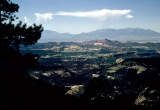 |
Boulder Mountain, Garfield County, Utah [6] | P0100 Charles Kelly Photograph Collection | P0100n1_17_09 |
| 245 |
 |
Boulder Mountain, Garfield County, Utah [3] | P0100 Charles Kelly Photograph Collection | P0100n1_17_10 |
| 246 |
 |
Diversion dam above Orderville [and] Diversion dam above Escalante in Potato Valley | P0208 Utah Flood Survey photograph collection | P0208n01_01_070-071 |
| 247 |
 |
Intelligence Tours - Red Canyon approaching Bryce | P0268 Frederick J. Pack photograph collection | P0268n01_12_469 |
| 248 |
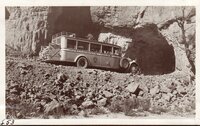 |
Intelligence Tours - Red Canyon approaching Bryce | P0268 Frederick J. Pack photograph collection | P0268n01_12_470 |
| 249 |
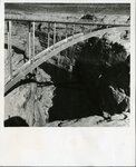 |
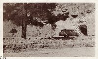
Bridge over Dirty Devil River | P0481 Bridges photograph collection | P0481n01_01_002 |
| 250 |
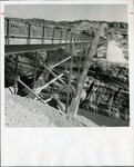 |
Bridge over Colorado River | P0481 Bridges photograph collection | P0481n01_01_003 |