Home
Browse
Ask Us
Chat
Harmful Language Statement
Log in
Art and Art History
Advanced Search
Subject
Brazil
401
Brazilian Art
177
Latin American Art
174
Latin America
71
Brazilian Architecture
48
1970s
27
Architecture
25
Brasilia
25
Colonial Latin America
20
Landscapes
20
Portraiture
20
Amazon
14
Maps
13
Slavery
11
Currency
10
International Style
10
Modernist Architecture
10
Money
10
Purity
10
Religious Buildings
10
Utopia
10
Neo-Concrete
9
Political Art
9
Dutch Brazil
7
Religious Art
6
Transamazon Highway
6
Colonialism
5
Plantation
5
Animals
4
Printmaking
4
Historical Painting
3
Self Portraits
2
Afro-Brazil
1
Baroque
1
Brasília
1
Cityscapes
1
Costumes and Textiles
1
Documentary Photography
1
Ethnography
1
Kinetic Art
1
Portrait of the Artist
1
Residential Block
1
Superquadra
1
More
Filters:
Collection:
"uu_aah_art"
Subject:
"Brazil"
126
-
150
of
401
<
1
2
3
4
5
6
7
8
9
10
>
Gallery view
Number of results to display per page
10
25
50
100
200
Sort by Relevance
Sort by Title A-Z
Sort by Title Z-A
Sort by Date Ascending
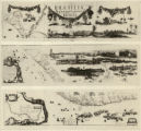
Sort by Date Descending
Sort by Last Modified Ascending
Sort by Last Modified Descending
Sort by Module Order
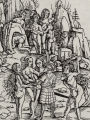
Title
Setname
Type
126
Brasilia, Congress Complex
uu_aah_art
Image
127
Brasilia, Congress Complex
uu_aah_art
Image
128
Juscelino Kubitschek with Lucio Costa, in 1957, at the center of the Pilot Plan to be built, Brasilia
uu_aah_art
Image
129
New Hydrographic and Geographic Map of Brazil, containing the Provinces of Ciriji, with Itapuama in Paranambuca, Itamaraca, Paraiba, and Potigi to the Rio Grande
uu_aah_art
Image
130
Map of America
uu_aah_art
Image
131
The Island of Brazil (2)
uu_aah_art
Image
132
The Island of Brazil (1)
uu_aah_art
Image
133
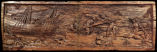
Sugar Mill (detail)
uu_aah_art
Image
134
Sugar Mill
uu_aah_art
Image
135
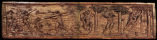
Ruins of the Jesuit Church in Olinda
uu_aah_art
Image
136
Ruins of Olinda (detail)
uu_aah_art
Image
137
Ruins of Olinda
uu_aah_art
Image
138
Map: Areas in northeast Brazil occupied by the Dutch, showing the main regions under Johan Maurits van Nassau's rule, 1637 - 1644
uu_aah_art
Image
139
Portrait of Johan Maurits van Nassau-Siegen
uu_aah_art
Image
140
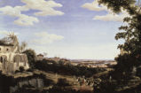
View of the Church of Glória
uu_aah_art
Image
141
View of the Sugar Loaf
uu_aah_art
Image
142
Tapuias Indians, Manaus
uu_aah_art
Image
143
King João VI and Queen Carlota Joaquina on Quinta da Boa Vista
uu_aah_art
Image
144
Indians of Amazonas
uu_aah_art
Image
145
Slaves of the Naturalist
uu_aah_art
Image
146
Inhabitant of Minas Crossing a River
uu_aah_art
Image
147
Maritime View of Rio de Janeiro
uu_aah_art
Image
148
Amazons
uu_aah_art
Image
149
Amazons
uu_aah_art
Image
150
Serro Frio: Two Overseers Search a Slave (or Whipping an Enslaved Male)
uu_aah_art
Image
126
-
150
of
401
<
1
2
3
4
5
6
7
8
9
10
>