Home
Browse
Ask Us
Chat
Harmful Language Statement
Log in
Uintah County Regional History Center Maps
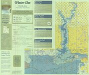
Advanced Search
Year
1825
1826
1827
1828
1829
1830
1831
1832
1833
1834
1835
1836
1837
1838
1839
1840
1841
1842
1843
1844
1845
1846
1847
1848
1849
1850
1851
1852
1853
1854
1855
1856
1857
1858
1859
1860
1861
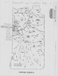
1862
1863
1864
1865
1866
1867
1868
1869
1870
1871
1872
1873
1874
1875
1876
1877
1878
1879
1880
1881
1882
1883
1884
1885
1886
1887
1888
1889
1890
1891
1892
1893
1894
1895
1896
1897
1898
1899
1900
1901
1902
1903
1904
1905
1906
1907
1908
1909
1910
1911
1912
1913
1914
1915
1916
1917
1918
1919
1920
1921
1922
1923
1924
1925
1926
1927
1928
1929
1930
1931
1932
1933
1934
1935
1936
1937
1938
1939
1940
1941
1942
1943
1944
1945
1946
1947
1948
1949
1950
1951
1952
1953
1954
1955
1956
1957
1958
1959
1960
1961
1962
1963
1964
1965
1966
1967
1968
1969
1970
1971
1972
1973
1974
1975
1976
1977
1978
1979
1980
1981
1982
1983
1984
1985
1986
1987
1988
1989
1990
1991
1992
1993
1994
1995
1996
1997
1998
1999
2000
2001
2002
2003
2004
2005
2006
2007
2008
2009
2010
2011
2012
2013
2014
TO
1825
1826
1827
1828
1829
1830
1831
1832
1833
1834
1835
1836
1837
1838
1839
1840
1841
1842
1843
1844
1845
1846
1847
1848
1849
1850
1851
1852
1853
1854
1855
1856
1857
1858
1859
1860
1861
1862
1863
1864
1865
1866
1867
1868
1869
1870
1871
1872
1873
1874
1875
1876
1877
1878
1879
1880
1881
1882
1883
1884
1885
1886
1887
1888
1889
1890
1891
1892
1893
1894
1895
1896
1897
1898
1899
1900
1901
1902
1903
1904
1905
1906
1907
1908
1909
1910
1911
1912
1913
1914
1915
1916
1917
1918
1919
1920
1921
1922
1923
1924
1925
1926
1927
1928
1929
1930
1931
1932
1933
1934
1935
1936
1937
1938
1939
1940
1941
1942
1943
1944
1945
1946
1947
1948
1949
1950
1951
1952
1953
1954
1955
1956
1957
1958
1959
1960
1961
1962
1963
1964
1965
1966
1967
1968
1969
1970
1971
1972
1973
1974
1975
1976
1977
1978
1979
1980
1981
1982
1983
1984
1985
1986
1987
1988
1989
1990
1991
1992
1993
1994
1995
1996
1997
1998
1999
2000
2001
2002
2003
2004
2005
2006
2007
2008
2009
2010
2011
2012
2013
2014
Type
Image/StillImage
474
Format
image/jpeg
329
application/pdf
145
Collection
Uintah County Regional History Center...
474
Filters:
Collection:
"ucl_maps"
1
-
50
of
474
<
1
2
3
4
5
6
7
8
9
10
>
Gallery view
Number of results to display per page
10
25
50
100
200
Sort by Relevance
Sort by Title A-Z
Sort by Title Z-A
Sort by Date Ascending
Sort by Date Descending
Sort by Last Modified Ascending
Sort by Last Modified Descending
Title
Date
Type
1
A Guide To Temple Square
Image/StillImage
2
Alma Taylor Plateau Vegetation Management Project
2005
Image/StillImage
3
American Gilsonite Co Property Survey Located In Section 15 & 16, T9S R24E, Uintah County, Utah
1974
Image/StillImage
4
Arches US DOI 1978
1978
Image/StillImage
5
Ashley and Brush Creeks Dye Tests
1978
Image/StillImage
6
Ashley National Forest - Analysis Units - High Uintas Roadless Area Study
Image/StillImage
7
Ashley National Forest - Forest Visitor Map 1998
1998
Image/StillImage
8
Ashley National Forest - Roosevelt and Duchesne Ranger Districts, Utah - Salt Lake and Uintah Meridians 1971
1971
Image/StillImage
9
Ashley National Forest - Uinta National Forest - Wasatch National Forest - Manti La Sal National Forest
Image/StillImage
10
Ashley National Forest - Utah, Wyoming - Uintah, Salt Lake and Sixth Principal Meridians 1971
1971
Image/StillImage
11
Ashley National Forest - Vernal Ranger District - September 2009 - ROD Selected Alternative
2009
Image/StillImage
12
Ashley National Forest - Vernal Ranger District Travel Map 1999 - Revised 2003
1999; 2003
Image/StillImage
13
Ashley National Forest Map
1945
Image/StillImage
14
Ashley National Forest Map
1909
Image/StillImage
15
Ashley National Forest Proposed Travel Alts (Alt. C) Vernal Ranger District April 2009
2009
Image/StillImage
16
Ashley National Forest Travel Map - Flaming Gorge Ranger District 2005
2005
Image/StillImage
17
Ashley National Forest Travel Map - Flaming Gorge, Vernal, Roosevelt, and Duchesne Ranger Districts 1971
1971
Image/StillImage
18
Ashley National Forest Utah - Salt Lake and Uinta Special Meridians 1955
1955
Image/StillImage
19
Ashley National Forest Utah and Wyoming - Roosevelt, Flaming Gorge, and Vernal Ranger Districts 1971
1971
Image/StillImage
20
Ashley National Forest Utah and Wyoming - Salt Lake, Uinta Special, and Sixth Principal Meridians 1928
1928
Image/StillImage
21
Ashley National Forest Utah and Wyoming - Salt Lake, Uinta Special, and Sixth Principal Meridians 1945
1945
Image/StillImage
22
Ashley National Forest Wilderness Proposal 1967 - South Slope Plan
1967
Image/StillImage
23
Ashley National Forest Wilderness Proposal 1967 - South Slope Plan - Roadless Areas - Alternative 1
1967
Image/StillImage
24
Ashley National Forest Wilderness Proposal 1967 - South Slope Plan - Roadless Areas - Alternative 2
1967
Image/StillImage
25
Ashley National Forest Wilderness Proposal 1967 - South Slope Plan - Roadless Areas - Alternative 3
1967
Image/StillImage
26
Ashley National Forest Wilderness Proposal 1967 - South Slope Plan - Roadless Areas - Alternative 4
1967
Image/StillImage
27
Ashley National Forest, Duchesne, Flaming Gorge, Roosevelt and Vernal Ranger Districts 1982
1982
Image/StillImage
28
Ashley National Forest, Roosevelt and Duchesne Ranger Districts 1971
1971
Image/StillImage
29
Ashley National Forest, Roosevelt, Flaming Gorge & Vernal Ranger Distrs. 1971. UT & WY
1971
Image/StillImage
30
Ashley National Forest, Utah - Salt Lake and Uinta Special Meridians
1962
Image/StillImage
31
Ashley National Forest, Utah - Salt Lake and Uinta Special Meridians 1962
1962
Image/StillImage
32
Ashley National Forest, Utah and Wyoming - Salt Lake, Uinta Special, and Sixth Principal Meridians 1928
1928
Image/StillImage
33
Ashley National Forest, Utah and Wyoming - Salt Lake, Uinta Special, and Sixth Principal Meridians 1933
1933
Image/StillImage
34
Ashley National Forest, Utah, Salt Lake and Uinta Special Meridians. 1955 - reprint of 1945 edition
1955
Image/StillImage
35
Ashley Survey Positive Sanborn 1880
1880
Image/StillImage
36
Ashley Valley
1977; 1978; 1979
Image/StillImage
37
Ashley Valley 1907 Reconnaissance Map
1907
Image/StillImage
38
Ashley Valley Survey T5S R20 East SLM, 1880s
1879; 1880; 1881; 1882; 1883; 1884; 1885; 1886; 1887; 1888; 1889
Image/StillImage
39
Ashley Valley Survey T5S R21E SLM 1880s
1880; 1881; 1882; 1883; 1884; 1885; 1886; 1887; 1888; 1889
Image/StillImage
40
Ashley Valley Survey, T5S R20E SLM, 1880s
1880
Image/StillImage
41
Ashley, Utah reprint edition of Dec. 1885 map
1885
Image/StillImage
42
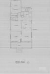
Ashton Home Floor Plan
1989
Image/StillImage
43
Basin US DOI BLM 1977
1977
Image/StillImage
44
Bear Lake US DOI BLM 1974
1974
Image/StillImage
45
Beaver US DOI BLM 1977
1977
Image/StillImage
46
Bennett and Leeton Map, Uintah County, Utah
Image/StillImage
47
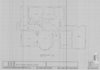
Bennion - Feltch Home Floor Plans
1989
Image/StillImage
48
Bennion - Valora Home Floor Plans
1989
Image/StillImage
49
Bitter Creek, NE-18, (US DOI BLM) 1975 (revised)
1975
Image/StillImage
50
Black Ridge Gilsonite Mine - Profile View, Plot Plan, Topographical Profile View - February 1971
1971
Image/StillImage
1
-
50
of
474
<
1
2
3
4
5
6
7
8
9
10
>