Filters: Collection: "ucl_maps"
1 - 25 of 10
| Title | Date | Type | ||
|---|---|---|---|---|
| 1 |
 |
Duchesne, Duchesne County, Utah, Sanborn Map Company, April 1917 | 1917 | Image/StillImage |
| 2 |
 |
Myton, Duchesne County, Utah; Sanborn Map Company, April 1917 | 1917 | Image/StillImage |
| 3 |
 |
Plat of the Townsite of Randlett, Utah 1905 | 1905 | Image/StillImage |
| 4 |
 |
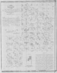
Roosevelt, Duchesne County, Utah - Sanborn Map Company - May 1917 Corrected July 1931 Plate 1 | 1931 | Image/StillImage |
| 5 |
 |
Roosevelt, Duchesne County, Utah - Sanborn Map Company - May 1917 plate 1 | 1917 | Image/StillImage |
| 6 |
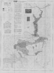 |
Ashley National Forest Travel Map - Flaming Gorge, Vernal, Roosevelt, and Duchesne Ranger Districts 1971 | 1971 | Image/StillImage |
| 7 |
 |
Dutch John, Utah 1997 | 1997 | Image/StillImage |
| 8 |
 |
Uintah County Building Blue Prints 1984 | 1984 | Image/StillImage |
| 9 |
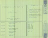 |
Western Park Museum Blue Prints 1990 | 1990 | Image/StillImage |
| 10 |
 |
Uintah County Transportation Travel Atlas 2008 | 2008 | Image/StillImage |
1 - 25 of 10