Home
Browse
Ask Us
Chat
Harmful Language Statement
Log in
Uintah County Regional History Center Maps
Advanced Search
Year
1825
1826
1827
1828
1829
1830
1831
1832
1833
1834
1835
1836
1837
1838
1839
1840
1841
1842
1843
1844
1845
1846
1847
1848
1849
1850
1851
1852
1853
1854
1855
1856
1857
1858
1859
1860
1861
1862
1863
1864
1865
1866
1867
1868
1869
1870
1871
1872
1873
1874
1875
1876
1877
1878
1879
1880
1881
1882
1883
1884
1885
1886
1887
1888
1889
1890
1891
1892
1893
1894
1895
1896
1897
1898
1899
1900
1901
1902
1903
1904
1905
1906
1907
1908
1909
1910
1911
1912
1913
1914
1915
1916
1917
1918
1919
1920
1921
1922
1923
1924
1925
1926
1927
1928
1929
1930
1931
1932
1933
1934
1935
1936
1937
1938
1939
1940
1941
1942
1943
1944
1945
1946
1947
1948
1949
1950
1951
1952
1953
1954
1955
1956
1957
1958
1959
1960
1961
1962
1963
1964
1965
1966
1967
1968
1969
1970
1971
1972
1973
1974
1975
1976
1977
1978
1979
1980
1981
1982
1983
1984
1985
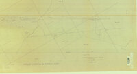
1986
1987
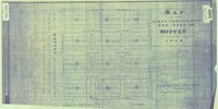
1988
1989
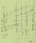
1990
1991
1992
1993
1994
1995
1996
1997
1998
1999
2000
2001
2002
2003
2004
2005
2006
2007
2008
2009
2010
2011
2012
2013
2014
TO
1825
1826
1827
1828
1829
1830
1831
1832
1833
1834
1835
1836
1837
1838
1839
1840
1841
1842
1843
1844
1845
1846
1847
1848
1849
1850
1851
1852
1853
1854
1855
1856
1857
1858
1859
1860
1861
1862
1863
1864
1865
1866
1867
1868
1869
1870
1871
1872
1873
1874
1875
1876
1877
1878
1879
1880
1881
1882
1883
1884
1885
1886
1887
1888
1889
1890
1891
1892
1893
1894
1895
1896
1897
1898
1899
1900
1901
1902
1903
1904
1905
1906
1907
1908
1909
1910
1911
1912
1913
1914
1915
1916
1917
1918
1919
1920
1921
1922
1923
1924
1925
1926
1927
1928
1929
1930
1931
1932
1933
1934
1935
1936
1937
1938
1939
1940
1941
1942
1943
1944
1945
1946
1947
1948
1949
1950
1951
1952
1953
1954
1955
1956
1957
1958
1959
1960
1961
1962
1963
1964
1965
1966
1967
1968
1969
1970
1971
1972
1973
1974
1975
1976
1977
1978
1979
1980
1981
1982
1983
1984
1985
1986
1987
1988
1989
1990
1991
1992
1993
1994
1995
1996
1997
1998
1999
2000
2001
2002
2003
2004
2005
2006
2007
2008
2009
2010
2011
2012
2013
2014
Type
Image/StillImage
474
Format
image/jpeg
329
application/pdf
145
Collection
Uintah County Regional History Center...
474
Filters:
Collection:
"ucl_maps"
151
-
175
of
474
<
2
3
4
5
6
7
8
9
10
11
>
Gallery view
Number of results to display per page
10
25
50
100
200
Sort by Relevance
Sort by Title A-Z
Sort by Title Z-A
Sort by Date Ascending
Sort by Date Descending
Sort by Last Modified Ascending
Sort by Last Modified Descending
Title
Date
Type
151
Vernal City - no date
Image/StillImage
152
Vernal City Office Blue Prints - Sheet 6
Image/StillImage
153
Vernal City Roads - Vernal Ave East to County Landfill & Diamond Mountain Road 2012
2012
Image/StillImage
154
Wah Wah US DOI BLM 1978
1978
Image/StillImage
155
Wasatch US DOI BLM 1973
1973
Image/StillImage
156
Workman Ratliff Home
1989
Image/StillImage
157
A Guide To Temple Square
Image/StillImage
158
Arches US DOI 1978
1978
Image/StillImage
159
Ashley National Forest - Analysis Units - High Uintas Roadless Area Study
Image/StillImage
160
Ashley National Forest Utah - Salt Lake and Uinta Special Meridians 1955
1955
Image/StillImage
161
Ashley National Forest Wilderness Proposal 1967 - South Slope Plan
1967
Image/StillImage
162
Bonanza Tap - Aerial Photo 3-A Drawing No 10317
Image/StillImage
163
Bonanza Tap - Aerial Photo 4-A Drawing No 10318
Image/StillImage
164
Carbon US DOI BLM 1967
1967
Image/StillImage
165
Craig, Colorado 1979
1979
Image/StillImage
166
Dixie US DOI BLM 1977
1977
Image/StillImage
167
Douglas Pass, Colorado 1981
1981
Image/StillImage
168
Duchesne US DOI BLM 1977
1977
Image/StillImage
169
Geologic Map of the Blue Mountain Area 1963
1963
Image/StillImage
170
Gusher, Lapoint, Tridell, Utah - Reconnaissance Survey Maps C, D, & E
1964
Image/StillImage
171
Independent Gilsonite Vein 1978
1978
Image/StillImage
172
Map of the First Addition to the Town of Moffat 1905
1905
Image/StillImage
173
Myton, Utah - 1964
1964
Image/StillImage
174
NW-SE Electric Log Cross Profile A-A Bluebell to Gusher, Upper Green River Sand Development 1958
1958
Image/StillImage
175
Ouray Wildlife Refuge Exhibit 7 - 1995 - Improvement of Existing Main Canal Inlet
1995
Image/StillImage
151
-
175
of
474
<
2
3
4
5
6
7
8
9
10
11
>