|
|
Title | Date | Type |
| 301 |
 |
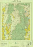
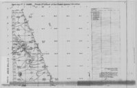
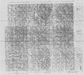
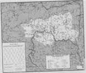
Roan Plateau (Planimetric) SE-3 (US DOI BLM) 1975 | 1975 | Image/StillImage |
| 302 |
 |
Roosevelt, Duchesne County, Utah - Sanborn Map Company - May 1917 Corrected July 1931 Plate 1 | 1931 | Image/StillImage |
| 303 |
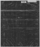 |
Roosevelt, Duchesne County, Utah - Sanborn Map Company - May 1917 Corrected July 1931 Plate 2 | 1931 | Image/StillImage |
| 304 |
 |
Roosevelt, Duchesne County, Utah - Sanborn Map Company - May 1917 plate 1 | 1917 | Image/StillImage |
| 305 |
 |
Roosevelt, Duchesne County, Utah - Sanborn Map Company - May 1917 plate 2 | 1917 | Image/StillImage |
| 306 |
 |
Route of Highway 40, 1920s | 1920; 1921; 1922; 1923; 1924; 1925; 1926; 1927; 1928; 1929 | Image/StillImage |
| 307 |
 |
Route of the Mormon Pioneers from Nauvoo to the Great Salt Lake, July 1847 | 1847 | Image/StillImage |
| 308 |
 |
Salt Flats US DOI BLM 1977 | 1977 | Image/StillImage |
| 309 |
 |
Salt Lake City, Utah-Wyoming 1980 | 1980 | Image/StillImage |
| 310 |
 |
Sanpete US DOI BLM 1978 | 1978 | Image/StillImage |
| 311 |
 |
Seep Ridge, Utah 1999 | 1999 | Image/StillImage |
| 312 |
 |
Seep Ridge, Utah-Colorado 1981 | 1981 | Image/StillImage |
| 313 |
 |
Seep Ridge, Utah-Colorado 1982 | 1981; 1982 | Image/StillImage |
| 314 |
 |
Sketch of Camp Douglas | 1864 | Image/StillImage |
| 315 |
 |
Snow Canyon State Park (Brochure and Map) | | Image/StillImage |
| 316 |
 |
Southeastern Utah, Sectional and Multipurpose Map #5 of 5 | 1975 | Image/StillImage |
| 317 |
 |
Southwestern Utah, Sectional and Multipurpose Map #4 of 5 | 1975 | Image/StillImage |
| 318 |
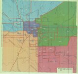 |
Stake Boundaries for the Glines, Maeser, Vernal, Uintah, and Ashley Stakes 2005? | 2005 | Image/StillImage |
| 319 |
 |
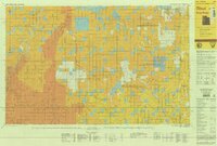
State of Utah - Minerals Status 1983 | 1983 | Image/StillImage |
| 320 |
 |
State of Utah, Land Ownership and Public Management - 1973 | 1973 | Image/StillImage |
| 321 |
 |
State of Utah, Land Ownership and Public Management - 1974 | 1974 | Image/StillImage |
| 322 |
 |
State Open Ride for Mountain Bikes Map of Trails 2001 | 2001 | Image/StillImage |
| 323 |
 |
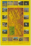
State Parks of Utah (Brochure and Map) | | Image/StillImage |
| 324 |
 |
The Strip - no date | | Image/StillImage |
| 325 |
 |
The Strip - no date (2) | | Image/StillImage |
| 326 |
 |
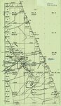
Sunnyside (Planimetric) NE-16 (US DOI BLM) 1974 | 1974 | Image/StillImage |
| 327 |
 |
Sunnyside (Planimetric) NE-16 (US DOI BLM) 1975 (revised) | 1975 | Image/StillImage |
| 328 |
 |
Surficial Deposits and Ingenious Rocks 1980 | 1980 | Image/StillImage |
| 329 |
 |
Swain Hatch Home 1989 | 1989 | Image/StillImage |
| 330 |
 |
Taylor Mountain Formations | | Image/StillImage |
| 331 |
 |
Tintic US DOI BLM 1976 | 1976 | Image/StillImage |
| 332 |
 |
Tom Taylor Mines Mining Plan Proposal (Bulk Head & Floor Map) - Ziegler Chemical & Mineral Corp | 1997; 1999; 2000 | Image/StillImage |
| 333 |
 |
Topographic Map of the Dinosaur National Monument, Colorado - Utah, 1951 | 1945; 1951 | Image/StillImage |
| 334 |
 |
Township 10 South Range 23 - 24 - 25 East Survey | 1904; 1922 | Image/StillImage |
| 335 |
 |
Township 10 South, Range 25 East, of the Salt Lake Meridian, Utah - Dependent ReSurvey | 1980 | Image/StillImage |
| 336 |
 |
Township No 2 South Range No 1 East of the Uintah Special Base & Meridian, Utah | 1903; 1904; 1905 | Image/StillImage |
| 337 |
 |
Township No 2 South Range No 1 East of the Uintah Special Meridian 1875 | 1875 | Image/StillImage |
| 338 |
 |
Township No 2 South Range No 1 East of Uinta Special Meridian, Utah - Supplemental Plat | 1913; 1914 | Image/StillImage |
| 339 |
 |
Township No 2 South Range No 1 West of the Uintah Special Meridian - 1875 | 1875 | Image/StillImage |
| 340 |
 |
Township No 2 South Range No 2 East of the Uintah Special Meridian - 1875 | 1875 | Image/StillImage |
| 341 |
 |
Township No 2 South Range No 2 East of the Uintah Special Meridian - The Strip 1890 | 1890; 1891 | Image/StillImage |
| 342 |
 |
Townsite of Independence - Uintah County, Utah, January 1906 | 1906 | Image/StillImage |
| 343 |
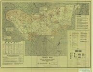 |
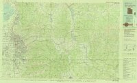
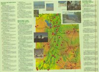
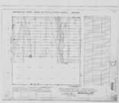
Travel Map Ashley National Forest - Vernal Ranger District, Utah | 1991 | Image/StillImage |
| 344 |
 |
Trout Slope Landscape Assessment - Vernal Ranger District | | Image/StillImage |
| 345 |
 |
U.S. Indian Irrigation Service, Uintah Irrigation Project, Uintah Mountains | 1919 | Image/StillImage |
| 346 |
 |
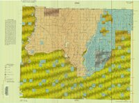
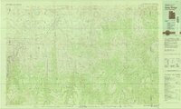
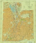
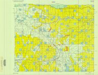
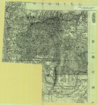
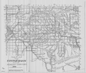
Uinta Basin and Adjacent Areas - 1986 | 1986 | Image/StillImage |
| 347 |
 |
Uinta Mountains Ashley Sheet Utah Colorado 1885-1901 | 1885; 1886; 1887; 1888; 1889; 1890; 1991 | Image/StillImage |
| 348 |
 |
Uinta National Forest, Utah - Salt Lake Meridian & Uinta Special Meridian 1937 | 1937 | Image/StillImage |
| 349 |
 |
Uinta, Utah 1885 | 1885 | Image/StillImage |
| 350 |
 |
Uintah And Grand Counties 1901 | 1901 | Image/StillImage |
| 351 |
 |
Uintah and Uncompahgre Ute Indian Reservation | | Image/StillImage |
| 352 |
 |
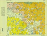
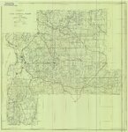
Uintah Basin and Adjacent Territory 1914 | 1914 | Image/StillImage |
| 353 |
 |
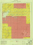
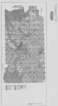
Uintah County - Early 1980s | 1980; 1981; 1982; 1983; 1984 | Image/StillImage |
| 354 |
 |
Uintah County Building Blue Prints 1984 | 1984 | Image/StillImage |
| 355 |
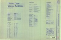 |
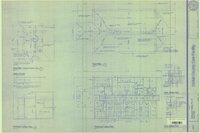
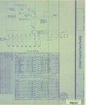
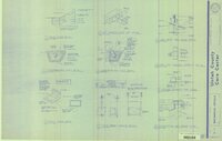
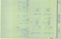
Uintah County Care Center Addition 1991 (Sheet A1.0) | 1991 | Image/StillImage |
| 356 |
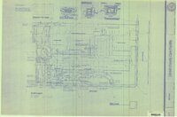 |
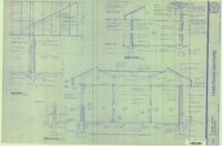
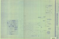
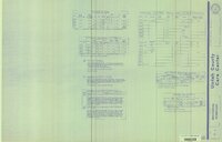
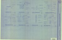
Uintah County Care Center Addition 1991 (Sheet A1.1) | 1991 | Image/StillImage |
| 357 |
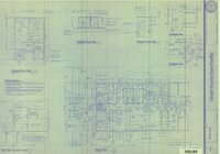 |
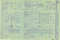
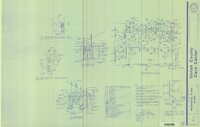
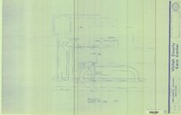
Uintah County Care Center Addition 1991 (Sheet A2.1) | 1991 | Image/StillImage |
| 358 |
 |
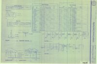
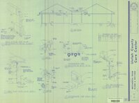
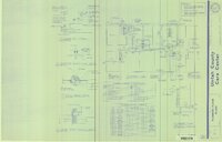
Uintah County Care Center Addition 1991 (Sheet A2.2) | 1991 | Image/StillImage |
| 359 |
 |
Uintah County Care Center Addition 1991 (Sheet A4.1) | 1991 | Image/StillImage |
| 360 |
 |
Uintah County Care Center Addition 1991 (Sheet A4.2) | 1991 | Image/StillImage |
| 361 |
 |
Uintah County Care Center Addition 1991 (Sheet A5.1) | 1991 | Image/StillImage |
| 362 |
 |
Uintah County Care Center Addition 1991 (Sheet A7.1) | 1991 | Image/StillImage |
| 363 |
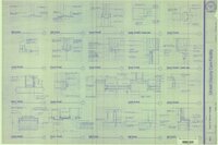 |
Uintah County Care Center Addition 1991 (Sheet A8.1) | 1991 | Image/StillImage |
| 364 |
 |
Uintah County Care Center Addition 1991 (Sheet A8.2) | 1991 | Image/StillImage |
| 365 |
 |
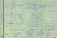
Uintah County Care Center Addition 1991 (Sheet E-1) | 1991 | Image/StillImage |
| 366 |
 |
Uintah County Care Center Addition 1991 (Sheet E-2) | 1991 | Image/StillImage |
| 367 |
 |
Uintah County Care Center Addition 1991 (Sheet E-3) | 1991 | Image/StillImage |
| 368 |
 |
Uintah County Care Center Addition 1991 (Sheet E-4) | 1991 | Image/StillImage |
| 369 |
 |
Uintah County Care Center Addition 1991 (Sheet M-1) | 1991 | Image/StillImage |
| 370 |
 |
Uintah County Care Center Addition 1991 (Sheet M-2) | 1991 | Image/StillImage |
| 371 |
 |
Uintah County Care Center Addition 1991 (Sheet M-3) | 1991 | Image/StillImage |
| 372 |
 |
Uintah County Care Center Addition 1991 (Sheet M-4) | 1991 | Image/StillImage |
| 373 |
 |
Uintah County Care Center Addition 1991 (Sheet P-0) | 1991 | Image/StillImage |
| 374 |
 |
Uintah County Care Center Addition 1991 (Sheet P-1) | 1991 | Image/StillImage |
| 375 |
 |
Uintah County Care Center Addition 1991 (Sheet P-2) | 1991 | Image/StillImage |
| 376 |
 |
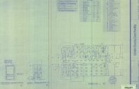
Uintah County Care Center Addition 1991 (Sheet S1) | 1991 | Image/StillImage |
| 377 |
 |
Uintah County Care Center Addition 1991 (Sheet S2) | 1991 | Image/StillImage |
| 378 |
 |
Uintah County Care Center Addition 1991 (Sheet S3) | 1991 | Image/StillImage |
| 379 |
 |
Uintah County Care Center Addition 1991 (Sheet S4) | 1991 | Image/StillImage |
| 380 |
 |
Uintah County Care Center Addition 1991 (Sheet S5) | 1991 | Image/StillImage |
| 381 |
 |
Uintah County Fairgrounds | 1987 | Image/StillImage |
| 382 |
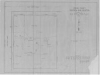 |
Uintah County Golden Age Center Property Plat | 1975 | Image/StillImage |
| 383 |
 |
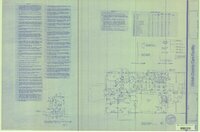
Uintah County Jail 1984 (Sheet No E14) | 1983; 1984 | Image/StillImage |
| 384 |
 |
Uintah County Jail 1984 (Sheet No E16) | 1983; 1984 | Image/StillImage |
| 385 |
 |
Uintah County Jail 1984 (Sheet No E4) | 1983; 1984 | Image/StillImage |
| 386 |
 |
Uintah County Jail 1984 (Sheet No E5) | 1983; 1984 | Image/StillImage |
| 387 |
 |
Uintah County Jail 1984 (Sheet No E6) | 1983; 1984 | Image/StillImage |
| 388 |
 |
Uintah County Jail 1984 (Sheet No E7) | 1983; 1984 | Image/StillImage |
| 389 |
 |
Uintah County Jail 1984 (Sheet No E8) | 1983; 1984 | Image/StillImage |
| 390 |
 |
Uintah County Jail 1984 (Sheet No E9) | 1983; 1984 | Image/StillImage |
| 391 |
 |
Uintah County Library Alterations 1984 | 1984 | Image/StillImage |
| 392 |
 |
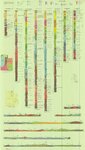
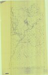
Uintah County R.S. 2477 Road Map | 1880; 1881; 1882; 1883; 1884; 1885; 1886; 1887; 1888; 1889; 1890; 1891; 1892; 1893; 1894; 1895; 1896; 1897; 1898; 1899; 1900; 1901; 1902; 1903; 1904; 1905; 1906; 1907; 1908; 1909; 1910; 1911; 1912; 1913; 1914; 1915; 1916; 1917; 1918; 1919; 1920; 1921; 1922; 1923; 1924; 1925; 1926; 1927; 1928; 1929; ... | Image/StillImage |
| 393 |
 |
Uintah County Recorder's Office Road Maintenance 1989 | 1989 | Image/StillImage |
| 394 |
 |
Uintah County Road 1997 RS2477 | 1997 | Image/StillImage |
| 395 |
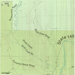 |
Uintah County Roads - Bean Draw, Brush Creek, Sunshine Bench Roads 2012 | 2012 | Image/StillImage |
| 396 |
 |
Uintah County Roads - Collier Pass, Dog Valley Roads 2012 | 2012 | Image/StillImage |
| 397 |
 |
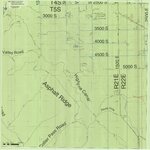
Uintah County Roads - Dry Fork, Deep Creek, Shindy Ridge Roads 2012 | 2012 | Image/StillImage |
| 398 |
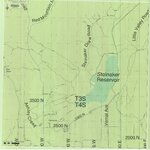 |
Uintah County Roads - Steinaker Draw, Little Valley, Red Mountain, Taylor Mountain, Carter Military Roads 2012 | 2012 | Image/StillImage |
| 399 |
 |
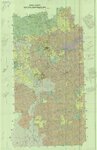
Uintah County School Districts 1900 | 1906; 1907; 1908; 1909; 1910; 1911; 1912; 1913; 1914; 1915; 1916; 1917; 1918; 1919; 1920; 1921; 1922; 1923; 1924; 1925; 1926; 1927; 1928; 1929; 1930; 1931; 1932; 1933; 1934; 1935; 1936; 1937; 1938; 1939; 1940 | Image/StillImage |
| 400 |
 |
Uintah County School, Section 36 | 1898 | Image/StillImage |