Home
Browse
Ask Us
Chat
Harmful Language Statement
Log in
Uintah County Regional History Center Maps
Advanced Search
Year
1825
1826
1827
1828
1829
1830
1831
1832
1833
1834
1835
1836
1837
1838
1839
1840
1841
1842
1843
1844
1845
1846
1847
1848
1849
1850
1851
1852
1853
1854
1855
1856
1857
1858
1859
1860
1861
1862
1863
1864
1865
1866
1867
1868
1869
1870
1871
1872
1873
1874
1875
1876
1877
1878
1879
1880
1881
1882
1883
1884
1885
1886
1887
1888
1889
1890
1891
1892
1893
1894
1895
1896
1897
1898
1899
1900
1901
1902
1903
1904
1905
1906
1907
1908
1909
1910
1911
1912
1913
1914
1915
1916
1917
1918
1919
1920
1921
1922
1923
1924
1925
1926
1927
1928
1929
1930
1931
1932
1933
1934
1935
1936
1937
1938
1939
1940
1941
1942
1943
1944
1945
1946
1947
1948
1949
1950
1951
1952
1953
1954
1955
1956
1957
1958
1959
1960
1961
1962
1963
1964
1965
1966
1967
1968
1969
1970
1971
1972
1973
1974
1975
1976
1977
1978
1979
1980
1981
1982
1983
1984
1985
1986
1987
1988
1989
1990
1991
1992
1993
1994
1995
1996
1997
1998
1999
2000
2001
2002
2003
2004
2005
2006
2007
2008
2009
2010
2011
2012
2013
2014
TO
1825
1826
1827
1828
1829
1830
1831
1832
1833
1834
1835
1836
1837
1838
1839
1840
1841
1842
1843
1844
1845
1846
1847
1848
1849
1850
1851
1852
1853
1854
1855
1856
1857
1858
1859
1860
1861
1862
1863
1864
1865
1866
1867
1868
1869
1870
1871
1872
1873
1874
1875
1876
1877
1878
1879
1880
1881
1882
1883
1884
1885
1886
1887
1888
1889
1890
1891
1892
1893
1894
1895
1896
1897
1898
1899
1900
1901
1902
1903
1904
1905
1906
1907
1908
1909
1910
1911
1912
1913
1914
1915
1916
1917
1918
1919
1920
1921
1922
1923
1924
1925
1926
1927
1928
1929
1930
1931
1932
1933
1934
1935
1936
1937
1938
1939
1940
1941
1942
1943
1944
1945
1946
1947
1948
1949
1950
1951
1952
1953
1954
1955
1956
1957
1958
1959
1960
1961
1962
1963
1964
1965
1966
1967
1968
1969
1970
1971
1972
1973
1974
1975
1976
1977
1978
1979
1980
1981
1982
1983
1984
1985
1986
1987
1988
1989
1990
1991
1992
1993
1994
1995
1996
1997
1998
1999
2000
2001
2002
2003
2004
2005
2006
2007
2008
2009
2010
2011
2012
2013
2014
Type
Image/StillImage
474
Format
image/jpeg
329
application/pdf
145
Collection
Uintah County Regional History Center...
474
Filters:
Collection:
"ucl_maps"
51
-
75
of
474
<
1
2
3
4
5
6
7
8
9
10
>
Gallery view
Number of results to display per page
10
25
50
100
200
Sort by Relevance
Sort by Title A-Z
Sort by Title Z-A
Sort by Date Ascending
Sort by Date Descending
Sort by Last Modified Ascending
Sort by Last Modified Descending
Title
Date
Type
51
Roosevelt, Duchesne County, Utah - Sanborn Map Company - May 1917 plate 2
1917
Image/StillImage
52
Sketch of Camp Douglas
1864
Image/StillImage
53
Swain Hatch Home 1989
1989
Image/StillImage
54
Townsite of Independence - Uintah County, Utah, January 1906
1906
Image/StillImage
55
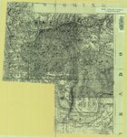
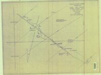
Uintah and Uncompahgre Ute Indian Reservation
Image/StillImage
56
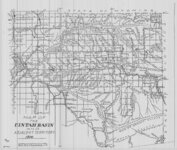
Uintah Basin and Adjacent Territory 1914
1914
Image/StillImage
57
Uintah County Fairgrounds
1987
Image/StillImage
58
Uintah County Jail 1984 (Sheet No E4)
1983; 1984
Image/StillImage
59
Uintah County Jail 1984 (Sheet No E8)
1983; 1984
Image/StillImage
60
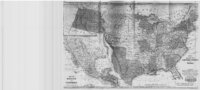
United States and Texas, Mexico, and Guatemala - 1839
1839
Image/StillImage
61
Whiterocks Townsite 1967
1967
Image/StillImage
62
Workman Colton Home
1989
Image/StillImage
63
Uintah Railway Stagecoach and Toll Road
2003
Image/StillImage
64
Bonanza - Rainbow Area Mine
1973; 1980
Image/StillImage
65
Bonanza To Little Bonanza 1-A Drawing No. 10315
Image/StillImage
66
Camp Floyd, Utah 1859
1859
Image/StillImage
67
Dragon Area, R25E, Property Map
Image/StillImage
68
Green - Hardy - Freestone Home Floor Plan
1989
Image/StillImage
69
Harris Lode - Mineral Survey #5689 - 1907
1907
Image/StillImage
70
Hyrum and Pontha Calder Home Floor Plan
1989
Image/StillImage
71
Independence Vein (Plat of Claim of Arthur W. Sweail; known as the Triumph & Cumberland Land)
Image/StillImage
72
Indian Reservation 1856
1856
Image/StillImage
73
King Home Floor Plan 1989
1989
Image/StillImage
74
Little Emma Vein - Tom Taylor Mines Exhibit 2 of 2
Image/StillImage
75
Map of a Portion of Plat "A" of Hayden, Utah, Townsite 1908
1908
Image/StillImage
51
-
75
of
474
<
1
2
3
4
5
6
7
8
9
10
>