|
|
Title | Date | Type |
| 101 |
 |
Dinosaurland One-Day Self-Guided Tour #1 Jones Hole National Fish Hatchery | | Image/StillImage |
| 102 |
 |
Dinosaurland One-Day Self-Guided Tour #10 North Fork of the Duchesne River | | Image/StillImage |
| 103 |
 |
Dinosaurland One-Day Self-Guided Tour #11 Rock Creek and Upper Stillwater Dam | | Image/StillImage |
| 104 |
 |
Dinosaurland One-Day Self-Guided Tour #2 Indian Petroglyphs Dry Fork Canyon | | Image/StillImage |
| 105 |
 |
Dinosaurland One-Day Self-Guided Tour #3 Red Cloud Loop Scenic Byway | | Image/StillImage |
| 106 |
 |
Dinosaurland One-Day Self-Guided Tour #4 Red Fleet & Steinaker Lake State Parks | | Image/StillImage |
| 107 |
 |
Dinosaurland One-Day Self-Guided Tour #5 Dinosaur National Monument, Quarry and Harper's Corner | | Image/StillImage |
| 108 |
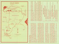 |
Dinosaurland One-Day Self-Guided Tour #6 Outlaw Country - Crouse Canyon, Brown's Park, Javie's Ranch, Jessie Ewing Canyon | | Image/StillImage |
| 109 |
 |
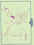
Dinosaurland One-Day Self-Guided Tour #7 Vernal Walking Tour | | Image/StillImage |
| 110 |
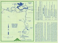 |
Dinosaurland One-Day Self-Guided Tour #8 Sheep Creek Canyon and Spirit Lake | | Image/StillImage |
| 111 |
 |
Dinosaurland One-Day Self-Guided Tour #9 Indian Canyon | | Image/StillImage |
| 112 |
 |
Dixie US DOI BLM 1977 | 1977 | Image/StillImage |
| 113 |
 |
Dominguez - Escalante Expedition 1776 (Brochure and Map) | | Image/StillImage |
| 114 |
 |
Douglas Pass, Colorado 1981 | 1981 | Image/StillImage |
| 115 |
 |
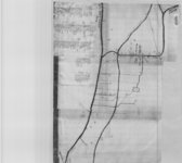
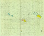
Dragon Area, R25E, Property Map | | Image/StillImage |
| 116 |
 |
Dry Fork (aka Mountain Dell or Hallsville) prepared by Oral Merkley & Liz Weist | | Image/StillImage |
| 117 |
 |
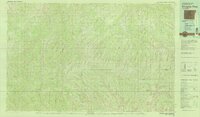
Duchesne County Road Map | 2004 | Image/StillImage |
| 118 |
 |
Duchesne County Tourism Map | | Image/StillImage |
| 119 |
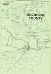 |
Duchesne County, Utah | | Image/StillImage |
| 120 |
 |
Duchesne US DOI BLM 1977 | 1977 | Image/StillImage |
| 121 |
 |
Duchesne, Duchesne County, Utah, Sanborn Map Company, April 1917 | 1917 | Image/StillImage |
| 122 |
 |
Duchesne, Duchesne County, Utah. Sanborn Map Co. April 1917. Corrected July 1931. | 1914; 1931 | Image/StillImage |
| 123 |
 |
Dutch John, Utah 1997 | 1997 | Image/StillImage |
| 124 |
 |
Dutch John, Utah-Colorado-Wyoming 1981 | 1981 | Image/StillImage |
| 125 |
 |
Dutch John, Utah-Colorado-Wyoming 1982 | 1981; 1982 | Image/StillImage |
| 126 |
 |
East Tavaputs, Utah - Colorado. Reprint edition of Dec. 1885 Map | 1885 | Image/StillImage |
| 127 |
 |
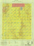
Energy Project Sites, Uintah County 1980s | 1980; 1981; 1982; 1983; 1984; 1985; 1986; 1987; 1988; 1989 | Image/StillImage |
| 128 |
 |
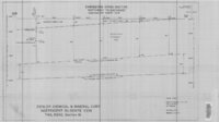
Engineering Cross Section on the Rainbow & Pride-of-the-West Gilsonite Vein | 1978 | Image/StillImage |
| 129 |
 |
Fish Lake US DOI BLM 1978 | 1978 | Image/StillImage |
| 130 |
 |
Fish Springs US DOI BLM 1977 | 1977 | Image/StillImage |
| 131 |
 |
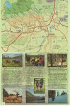
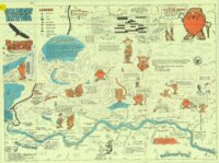
Flaming Gorge Country (Brochure and Map) | 1987 | Image/StillImage |
| 132 |
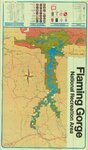 |
Flaming Gorge National Recreation Area | 1987 | Image/StillImage |
| 133 |
 |
Flaming Gorge National Recreation Area - Ashley National Forest | | Image/StillImage |
| 134 |
 |
Flaming Gorge National Recreation Area - Ashley National Forest 1962 | 1962 | Image/StillImage |
| 135 |
 |
Flaming Gorge Recreation Map - Ashley National Forest | 1965 | Image/StillImage |
| 136 |
 |
Fort Bridger, Original Survey | | Image/StillImage |
| 137 |
 |
Fort Thornburgh, Map of the road from Park City to Ft. Thornburgh. Sept. 1881 | 1881 | Image/StillImage |
| 138 |
 |
Fort Thornburgh, Proposed Reservation for Post | | Image/StillImage |
| 139 |
 |
Froiseth's New Sectional and Mineral Map of Utah 1878 | 1878 | Image/StillImage |
| 140 |
 |
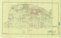
General Highway Map - Uintah County, Utah No. 24 | | Image/StillImage |
| 141 |
 |
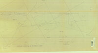
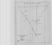
Geologic Cross Section of the Cowboy Gilsonite Vein (Hand Drawn) | 1960 | Image/StillImage |
| 142 |
 |
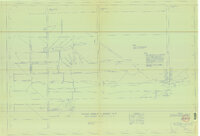
Geologic Map and Structure Sections of the Uinta River-Brush Creek Area, Duchesne and Uintah Counties, Utah | 1947 | Image/StillImage |
| 143 |
 |
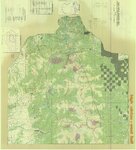
Geologic Map of Bonanza Area, Uintah County, Utah 1976 | 1976 | Image/StillImage |
| 144 |
 |
Geologic Map of the Blue Mountain Area 1963 | 1963 | Image/StillImage |
| 145 |
 |
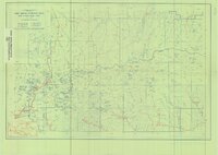
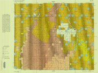
Geologic Map of Uintah County, Utah - North Half - 1950s | 1950; 1951; 1952; 1953; 1954; 1955; 1956; 1957; 1958; 1959 | Image/StillImage |
| 146 |
 |
Geologic Map of Uintah County, Utah - South Half - 1950s | 1950; 1951; 1952; 1953; 1954; 1955; 1956; 1957; 1958; 1959 | Image/StillImage |
| 147 |
 |
Geologic North-South Cross Profile Whiterocks Area 1957 | 1957 | Image/StillImage |
| 148 |
 |
Geological Map DNM Quarry | 1979 | Image/StillImage |
| 149 |
 |
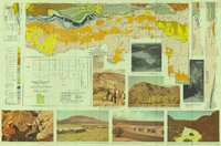
Geological Map of the Dinosaur National Monument | 1965 | Image/StillImage |
| 150 |
 |
Geological Map of Uintah County, Utah - North Half - 1950s | 1950; 1951; 1952; 1953; 1954; 1955; 1956; 1957; 1958; 1959 | Image/StillImage |
| 151 |
 |
Geological Map of Uintah County, Utah - South Half - 1950s | 1950; 1951; 1952; 1953; 1954; 1955; 1956; 1957; 1958; 1959 | Image/StillImage |
| 152 |
 |
Gilsonite Map - Gusher Vein 1988 | 1988 | Image/StillImage |
| 153 |
 |
Gilsonite Properties - Bonanza Area 1979 | 1979 | Image/StillImage |
| 154 |
 |
Gilsonite Vein System - Geologic Map of the Ute Area | 1977 | Image/StillImage |
| 155 |
 |
Grazing Service C.C.C. Range Surveys, 1927 | 1927 | Image/StillImage |
| 156 |
 |
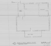
Green - Hardy - Freestone Home Floor Plan | 1989 | Image/StillImage |
| 157 |
 |
Green River - Flaming Gorge National Recreation Area, Ashley National Forest | | Image/StillImage |
| 158 |
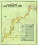 |
Green River Land Ownership Data - Generated From FWS Maps | | Image/StillImage |
| 159 |
 |
Grouse Creek US DOI BLM 1974 | 1974 | Image/StillImage |
| 160 |
 |
Gulf Standard Exploratory Plan 1974 | 1974 | Image/StillImage |
| 161 |
 |
Gusher Home Sites | | Image/StillImage |
| 162 |
 |
Gusher, Lapoint, Tridell, Utah - Reconnaissance Survey Map A | 1964 | Image/StillImage |
| 163 |
 |
Gusher, Lapoint, Tridell, Utah - Reconnaissance Survey Map B | 1964 | Image/StillImage |
| 164 |
 |
Gusher, Lapoint, Tridell, Utah - Reconnaissance Survey Maps C, D, & E | 1964 | Image/StillImage |
| 165 |
 |
Gusher, Utah - The Strip | 1927 | Image/StillImage |
| 166 |
 |
H. Bert and Diana Jensen Home Directions | | Image/StillImage |
| 167 |
 |
Hardaway Load - Mineral Survey #5688 - 1907 | 1907 | Image/StillImage |
| 168 |
 |
Harris Lode - Mineral Survey #5689 - 1907 | 1907 | Image/StillImage |
| 169 |
 |
The Hastings Cutoff in Wyoming | | Image/StillImage |
| 170 |
 |
Hatch Freeman House Floor Plan | 1989 | Image/StillImage |
| 171 |
 |
Henry and Mary Harris Home - Gusher | 1994 | Image/StillImage |
| 172 |
 |
High Uintas Primitive Area - Ashley and Wasatch National Forests, Utah 1958 | 1958 | Image/StillImage |
| 173 |
 |
High Uintas Primitive Area, Wasatch and Ashley National Forests, Utah, Salt Lake and Uinta Special Meridians | 1980 | Image/StillImage |
| 174 |
 |
Hill Creek (Planimetric) NE-17 (US DOI BLM) 1975 (revised) | 1975 | Image/StillImage |
| 175 |
 |
Holy Episcopal Church Randlett Floor Plan 1989 | 1989 | Image/StillImage |
| 176 |
 |
Hyrum and Pontha Calder Home Floor Plan | 1989 | Image/StillImage |
| 177 |
 |
Independence Vein (Plat of Claim of Arthur W. Sweail; known as the Triumph & Cumberland Land) | | Image/StillImage |
| 178 |
 |
Independence Vein Drilling | 1976 | Image/StillImage |
| 179 |
 |
Independent & Bonanza Gilsonite Veins and the Cowboy Vein - Ziegler Chemical & Mineral Corp | 1996 | Image/StillImage |
| 180 |
 |
Independent Gilsonite Vein 1978 | 1978 | Image/StillImage |
| 181 |
 |
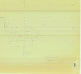
Independent Gilsonite Vein 1978-1979 - Engineering Cross Profile Northwest of West Boundary of Ziegler Property | 1979 | Image/StillImage |
| 182 |
 |
Independent Gilsonite Vein 1978-1979 - Engineering Cross Section Northwest to Southeast Independent North Vein | 1979 | Image/StillImage |
| 183 |
 |
Independent Vein 1981 | 1981 | Image/StillImage |
| 184 |
 |
Independent Vein Location | 1995 | Image/StillImage |
| 185 |
 |
Independent Veins 3, 4, 5 | 1987 | Image/StillImage |
| 186 |
 |
Index To Geologic Atlas of Utah - Daggett County - 1950s | 1950; 1951; 1952; 1953; 1954; 1955; 1956; 1957; 1958; 1959 | Image/StillImage |
| 187 |
 |
Indian Reservation 1856 | 1856 | Image/StillImage |
| 188 |
 |
Indian Reservation, Uintah - Part of the Uncompahgre Indian Reservation | | Image/StillImage |
| 189 |
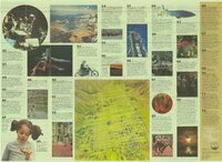 |
It All Adds Up To Salt Lake (Tourist Attractions) | | Image/StillImage |
| 190 |
 |
Jensen Quadrangle 1907 | 1907 | Image/StillImage |
| 191 |
 |
Jensen, Utah - Colorado Edition of June 1910 | 1910 | Image/StillImage |
| 192 |
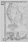 |
Johnson's New Military Map of the US (Western-half) Showing Forts, Military Posts and All Military Division, 1861 | 1861 | Image/StillImage |
| 193 |
 |
Kaiparowits US DOI BLM 1980 | 1980 | Image/StillImage |
| 194 |
 |
Kanab US DOI BLM 1978 | 1978 | Image/StillImage |
| 195 |
 |
King Home Floor Plan 1989 | 1989 | Image/StillImage |
| 196 |
 |
Kings Peak, Utah-Wyoming 1982 | 1982 | Image/StillImage |
| 197 |
 |
Ladore (Planimetric) NW-1 (US DOI BLM) 1975 | 1975 | Image/StillImage |
| 198 |
 |
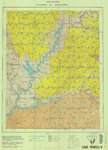
Lake Powell and Glen Canyon National Recreation Area | 1969 | Image/StillImage |
| 199 |
 |
Lake Powell US DOI BLM 1976 | 1976 | Image/StillImage |
| 200 |
 |
Land Map for Pleasant Valley | 1981 | Image/StillImage |