Home
Browse
Ask Us
Chat
Harmful Language Statement
Log in
Uintah County Regional History Center Maps
Advanced Search
Year
1885
1886
1887
1888
1889
1890
1891
1892
1893
1894
1895
1896
1897
1898
1899
1900
1901
1902
1903
1904
1905
1906
1907
1908
1909
1910
1911
1912
1913
1914
1915
1916
1917
1918
1919
1920
1921
1922
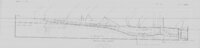
1923
1924
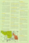
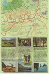
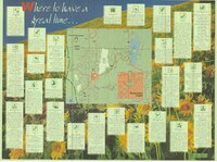
1925
1926
1927
1928
1929
1930
1931
1932
1933
1934
1935
1936
1937
1938
1939
1940
1941
1942
1943
1944
1945
1946
1947
1948
1949
1950
1951
1952
1953
1954
1955
1956
1957
1958
1959
1960
1961
1962
1963
1964
1965
1966
1967
1968
1969
1970
1971
1972
1973
1974
1975
1976
1977
1978
1979
1980
1981
1982
1983
1984
1985
1986
1987
1988
1989
1990
1991
1992
1993
1994
1995
1996
1997
1998
1999
2000
2001
2002
2003
2004
2005
2006
2007
2008
2009
TO
1885
1886
1887
1888
1889
1890
1891
1892
1893
1894
1895
1896
1897
1898
1899
1900
1901
1902
1903
1904
1905
1906
1907
1908
1909
1910
1911
1912
1913
1914
1915
1916
1917
1918
1919
1920
1921
1922
1923
1924
1925
1926
1927
1928
1929
1930
1931
1932
1933
1934
1935
1936
1937
1938
1939
1940
1941
1942
1943
1944
1945
1946
1947
1948
1949
1950
1951
1952
1953
1954
1955
1956
1957
1958
1959
1960
1961
1962
1963
1964
1965
1966
1967
1968
1969
1970
1971
1972
1973
1974
1975
1976
1977
1978
1979
1980
1981
1982
1983
1984
1985
1986
1987
1988
1989
1990
1991
1992
1993
1994
1995
1996
1997
1998
1999
2000
2001
2002
2003
2004
2005
2006
2007
2008
2009
Type
Image/StillImage
95
Format
image/jpeg
73
application/pdf
22
Collection
Uintah County Regional History Center...
95
Filters:
Collection:
"ucl_maps"
26
-
50
of
95
<
1
2
3
4
>
Gallery view
Number of results to display per page
10
25
50
100
200
Sort by Relevance
Sort by Title A-Z
Sort by Title Z-A
Sort by Date Ascending
Sort by Date Descending
Sort by Last Modified Ascending
Sort by Last Modified Descending
Title
Date
Type
26
Ziegler Chemical Inventory Unit Mining Claims - May 24, 1999
1999
Image/StillImage
27
Ashley National Forest, Utah - Salt Lake and Uinta Special Meridians
1962
Image/StillImage
28
Dinosaurland One-Day Self-Guided Tour #7 Vernal Walking Tour
Image/StillImage
29
Critical Habitat Polygons for Penstemon Grahamii
Image/StillImage
30
Flaming Gorge National Recreation Area - Ashley National Forest 1962
1962
Image/StillImage
31
Bountiful (Planimetric) NW-12 (US DOI BLM) 1975
1975
Image/StillImage
32
Geological Map of the Dinosaur National Monument
1965
Image/StillImage
33
Alma Taylor Plateau Vegetation Management Project
2005
Image/StillImage
34
Dutch John, Utah-Colorado-Wyoming 1982
1981; 1982
Image/StillImage
35
Price, Utah 1980
1980
Image/StillImage
36
Dutch John, Utah 1997
1997
Image/StillImage
37
Dinosaurland Eastern Uintas Cross-Country Ski Trails
Image/StillImage
38
Kanab US DOI BLM 1978
1978
Image/StillImage
39
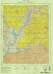
Lake Powell US DOI BLM 1976
1976
Image/StillImage
40
Utah! National Park State
Image/StillImage
41
Vernal, Utah 1993
1993
Image/StillImage
42
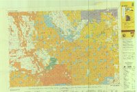
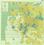
BLM Vernal Field Office Grazing Allotments 2004
2004
Image/StillImage
43
Recreation Map - Ashley National Forest - Utah and Wyoming 1955
1955
Image/StillImage
44
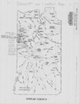
Bennett and Leeton Map, Uintah County, Utah
Image/StillImage
45
Flaming Gorge National Recreation Area - Ashley National Forest
Image/StillImage
46
Taylor Mountain Formations
Image/StillImage
47
Township 10 South, Range 25 East, of the Salt Lake Meridian, Utah - Dependent ReSurvey
1980
Image/StillImage
48
Zion National Park, Washington County (Brochure and Map)
Image/StillImage
49
Duchesne County Tourism Map
Image/StillImage
50
Bridgerland, Cache County, Brochure
Image/StillImage
26
-
50
of
95
<
1
2
3
4
>