Home
Browse
Ask Us
Chat
Harmful Language Statement
Log in
Uintah County Regional History Center Maps
Advanced Search
Year
1825
1826
1827
1828
1829
1830
1831
1832
1833
1834
1835
1836
1837
1838
1839
1840
1841
1842
1843
1844
1845
1846
1847
1848
1849
1850
1851
1852
1853
1854
1855
1856
1857
1858
1859
1860
1861
1862
1863
1864
1865
1866
1867
1868
1869
1870
1871
1872
1873
1874
1875
1876
1877
1878
1879
1880
1881
1882
1883
1884
1885
1886
1887
1888
1889
1890
1891
1892
1893
1894
1895
1896
1897
1898
1899
1900
1901
1902
1903
1904
1905
1906
1907
1908
1909
1910
1911
1912
1913
1914
1915
1916
1917
1918
1919
1920
1921
1922
1923
1924
1925
1926
1927
1928
1929
1930
1931
1932
1933
1934
1935
1936
1937
1938
1939
1940
1941
1942
1943
1944
1945
1946
1947
1948
1949
1950
1951
1952
1953
1954
1955
1956
1957
1958
1959
1960
1961
1962
1963
1964
1965
1966
1967
1968
1969
1970
1971
1972
1973
1974
1975
1976
1977
1978
1979
1980
1981
1982
1983
1984
1985
1986
1987
1988
1989
1990
1991
1992
1993
1994
1995
1996
1997
1998
1999
2000
2001
2002
2003
2004
2005
2006
2007
2008
2009
2010
2011
2012
2013
2014
TO
1825
1826
1827
1828
1829
1830
1831
1832
1833
1834
1835
1836
1837
1838
1839
1840
1841
1842
1843
1844
1845
1846
1847
1848
1849
1850
1851
1852
1853
1854
1855
1856
1857
1858
1859
1860
1861
1862
1863
1864
1865
1866
1867
1868
1869
1870
1871
1872
1873
1874
1875
1876
1877
1878
1879
1880
1881
1882
1883
1884
1885
1886
1887
1888
1889
1890
1891
1892
1893
1894
1895
1896
1897
1898
1899
1900
1901
1902
1903
1904
1905
1906
1907
1908
1909
1910
1911
1912
1913
1914
1915
1916
1917
1918
1919
1920
1921
1922
1923
1924
1925
1926
1927
1928
1929
1930
1931
1932
1933
1934
1935
1936
1937
1938
1939
1940
1941
1942
1943
1944
1945
1946
1947
1948
1949
1950
1951
1952
1953
1954
1955
1956
1957
1958
1959
1960
1961
1962
1963
1964
1965
1966
1967
1968
1969
1970
1971
1972
1973
1974
1975
1976
1977
1978
1979
1980
1981
1982
1983
1984
1985
1986
1987
1988
1989
1990
1991
1992
1993
1994
1995
1996
1997
1998
1999
2000
2001
2002
2003
2004
2005
2006
2007
2008
2009
2010
2011
2012
2013
2014
Type
Image/StillImage
474
Format
image/jpeg
329
application/pdf
145
Collection
Uintah County Regional History Center...
474
Filters:
Collection:
"ucl_maps"
26
-
50
of
474
<
1
2
3
4
5
6
7
8
9
10
>
Gallery view
Number of results to display per page
10
25
50
100
200
Sort by Relevance
Sort by Title A-Z
Sort by Title Z-A
Sort by Date Ascending
Sort by Date Descending
Sort by Last Modified Ascending
Sort by Last Modified Descending
Title
Date
Type
26
Little Emma Vein - Plane Table Sheet (American Gilsonite, Uintah, Utah)
Image/StillImage
27
Moffat School House - Outside Front View 1994
1994
Image/StillImage
28
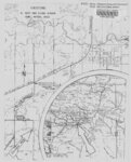
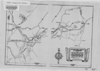
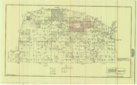
Township 10 South Range 23 - 24 - 25 East Survey
1904; 1922
Image/StillImage
29
Ashley National Forest Map
1945
Image/StillImage
30
Duchesne County Tourism Map
Image/StillImage
31
Ashley Valley
1977; 1978; 1979
Image/StillImage
32
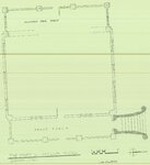
Caldwell Home Floor Plan
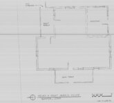
1989
Image/StillImage
33
Diamond Mountain Landowners 1935-1940
1935; 1936; 1937; 1938; 1939; 1940
Image/StillImage
34
H. Bert and Diana Jensen Home Directions
Image/StillImage
35
Hatch Freeman House Floor Plan
1989
Image/StillImage
36
The Mary L. Naylor Hotel Gusher 1994
1994
Image/StillImage
37
Muse K Harris Cabin, Gusher - Floor Plan
1994
Image/StillImage
38
Ashton Home Floor Plan
1989
Image/StillImage
39
Duchesne, Duchesne County, Utah. Sanborn Map Co. April 1917. Corrected July 1931.
1914; 1931
Image/StillImage
40
Hardaway Load - Mineral Survey #5688 - 1907
1907
Image/StillImage
41
The Hastings Cutoff in Wyoming
Image/StillImage
42
Henry and Mary Harris Home - Gusher
1994
Image/StillImage
43
Holy Episcopal Church Randlett Floor Plan 1989
1989
Image/StillImage
44
Land Map for Pleasant Valley
1981
Image/StillImage
45
Map of White River Gilsonite District
1930
Image/StillImage
46
Merkley Home Floor Plan 1994
1994
Image/StillImage
47
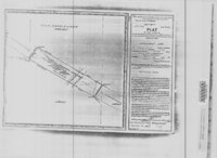
Plat of the Town of Moffat, in Uintah County, Utah 1906
1906
Image/StillImage
48
Plat of the Townsite of Leota 1911
1911
Image/StillImage
49
Pony Express Stations Deep Creek
Image/StillImage
50
Roosevelt, Duchesne County, Utah - Sanborn Map Company - May 1917 Corrected July 1931 Plate 2
1931
Image/StillImage
26
-
50
of
474
<
1
2
3
4
5
6
7
8
9
10
>