Home
Browse
Ask Us
Chat
Harmful Language Statement
Log in
Uintah County Regional History Center Maps
Advanced Search
Year
1825
1826
1827
1828
1829
1830
1831
1832
1833
1834
1835
1836
1837
1838
1839
1840
1841
1842
1843
1844
1845
1846
1847
1848
1849
1850
1851
1852
1853
1854
1855
1856
1857
1858
1859
1860
1861
1862
1863
1864
1865
1866
1867
1868
1869
1870
1871
1872
1873
1874
1875
1876
1877
1878
1879
1880
1881
1882
1883
1884
1885
1886
1887
1888
1889
1890
1891
1892
1893
1894
1895
1896
1897
1898
1899
1900
1901
1902
1903
1904
1905
1906
1907
1908
1909
1910
1911
1912
1913
1914
1915
1916
1917
1918
1919
1920
1921
1922
1923
1924
1925
1926
1927
1928
1929
1930
1931
1932
1933
1934
1935
1936
1937
1938
1939
1940
1941
1942
1943
1944
1945
1946
1947
1948
1949
1950
1951
1952
1953
1954
1955
1956
1957
1958
1959
1960
1961
1962
1963
1964
1965
1966
1967
1968
1969
1970
1971
1972
1973
1974
1975
1976
1977
1978
1979
1980
1981
1982
1983
1984
1985
1986
1987
1988
1989
1990
1991
1992
1993
1994
1995
1996
1997
1998
1999
2000
2001
2002
2003
2004
2005
2006
2007
2008
2009
2010
2011
2012
2013
2014
TO
1825
1826
1827
1828
1829
1830
1831
1832
1833
1834
1835
1836
1837
1838
1839
1840
1841
1842
1843
1844
1845
1846
1847
1848
1849
1850
1851
1852
1853
1854
1855
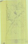
1856
1857
1858
1859
1860
1861
1862
1863
1864
1865
1866
1867
1868
1869
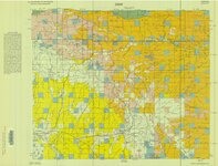
1870
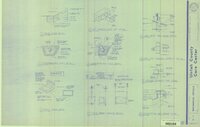
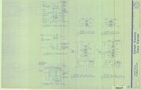
1871
1872
1873
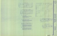
1874
1875
1876
1877
1878
1879
1880
1881
1882
1883
1884
1885
1886
1887
1888
1889
1890
1891
1892
1893
1894
1895
1896
1897
1898
1899
1900
1901
1902
1903
1904
1905
1906
1907
1908
1909
1910
1911
1912
1913
1914
1915
1916
1917
1918
1919
1920
1921
1922
1923
1924
1925
1926
1927
1928
1929
1930
1931
1932
1933
1934
1935
1936
1937
1938
1939
1940
1941
1942
1943
1944
1945
1946
1947
1948
1949
1950
1951
1952
1953
1954
1955
1956
1957
1958
1959
1960
1961
1962
1963
1964
1965
1966
1967
1968
1969
1970
1971
1972
1973
1974
1975
1976
1977
1978
1979
1980
1981
1982
1983
1984
1985
1986
1987
1988
1989
1990
1991
1992
1993
1994
1995
1996
1997
1998
1999
2000
2001
2002
2003
2004
2005
2006
2007
2008
2009
2010
2011
2012
2013
2014
Type
Image/StillImage
474
Format
image/jpeg
329
application/pdf
145
Collection
Uintah County Regional History Center...
474
Filters:
Collection:
"ucl_maps"
226
-
250
of
474
<
5
6
7
8
9
10
11
12
13
14
>
Gallery view
Number of results to display per page
10
25
50
100
200
Sort by Relevance
Sort by Title A-Z
Sort by Title Z-A
Sort by Date Ascending
Sort by Date Descending
Sort by Last Modified Ascending
Sort by Last Modified Descending
Title
Date
Type
226
Moon Lake Project Deserado Mine Sheet 1
1981
Image/StillImage
227
Moon Lake Project Deserado Mine Sheet 2
1981
Image/StillImage
228
Oquirrh US DOI BLM 1977
1977
Image/StillImage
229
Ouray Wildlife Refuge Scheme 5 - 1995 - Semi-Control of Flood Inflow to Pond L-7, Two Low Head Weirs
1995
Image/StillImage
230
Ouray Wildlife Refuge Scheme 6 - 1995 - Control of Flood Inflow to the Nursery Habitat
1995
Image/StillImage
231
Ouray, Utah - 1964
1964
Image/StillImage
232
Outlaw ATV Trail
Image/StillImage
233
Part of Moffat Town (Gusher) First Addition (Sometimes Referred to as "Plat A")
Image/StillImage
234
Partial Map of Gusher, Utah
1963; 1964
Image/StillImage
235
Pelican Lake, Utah - 1964
1964
Image/StillImage
236
Pony Express Needles Station Camp Floyd
Image/StillImage
237
Pony Express Stations in Utah - April 3, 1860 - October 24, 1861
1860; 1861
Image/StillImage
238
Promontory US DOI BLM 1973
1973
Image/StillImage
239
Property Survey - Ziegler Chemical & Mineral Corp
2000
Image/StillImage
240
Randlett, Utah - 1964
1964
Image/StillImage
241
Roan Plateau (Pianimetric) SE-3 (US DOI BLM) 1977 (revised)
1977
Image/StillImage
242
Roan Plateau (Planimetric) SE-3 (US DOI BLM) 1975
1975
Image/StillImage
243
State of Utah - Minerals Status 1983
1983
Image/StillImage
244
Sunnyside (Planimetric) NE-16 (US DOI BLM) 1975 (revised)
1975
Image/StillImage
245
Uintah County - Early 1980s
1980; 1981; 1982; 1983; 1984
Image/StillImage
246
Uintah County Care Center Addition 1991 (Sheet M-3)
1991
Image/StillImage
247
Uintah County Care Center Addition 1991 (Sheet M-4)
1991
Image/StillImage
248
Uintah County Care Center Addition 1991 (Sheet P-2)
1991
Image/StillImage
249
Uintah County Care Center Addition 1991 (Sheet S4)
1991
Image/StillImage
250
Uintah County Jail 1984 (Sheet No E16)
1983; 1984
Image/StillImage
226
-
250
of
474
<
5
6
7
8
9
10
11
12
13
14
>