|
|
Title | Date | Type |
| 1 |
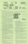 |
A Guide To Temple Square | | Image/StillImage |
| 2 |
 |
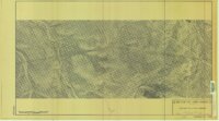
Alma Taylor Plateau Vegetation Management Project | 2005 | Image/StillImage |
| 3 |
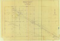 |
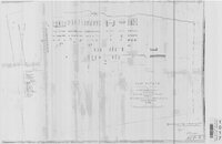
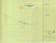
American Gilsonite Co Property Survey Located In Section 15 & 16, T9S R24E, Uintah County, Utah | 1974 | Image/StillImage |
| 4 |
 |
Arches US DOI 1978 | 1978 | Image/StillImage |
| 5 |
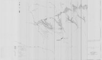 |
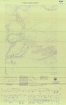
Ashley and Brush Creeks Dye Tests | 1978 | Image/StillImage |
| 6 |
 |
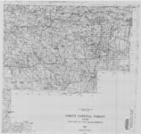
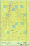
Ashley National Forest - Analysis Units - High Uintas Roadless Area Study | | Image/StillImage |
| 7 |
 |
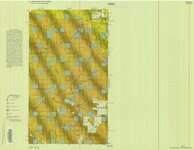
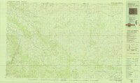
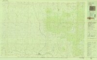
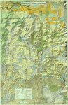
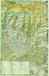
Ashley National Forest - Forest Visitor Map 1998 | 1998 | Image/StillImage |
| 8 |
 |
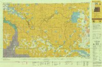
Ashley National Forest - Roosevelt and Duchesne Ranger Districts, Utah - Salt Lake and Uintah Meridians 1971 | 1971 | Image/StillImage |
| 9 |
 |
Ashley National Forest - Uinta National Forest - Wasatch National Forest - Manti La Sal National Forest | | Image/StillImage |
| 10 |
 |
Ashley National Forest - Utah, Wyoming - Uintah, Salt Lake and Sixth Principal Meridians 1971 | 1971 | Image/StillImage |
| 11 |
 |
Ashley National Forest - Vernal Ranger District - September 2009 - ROD Selected Alternative | 2009 | Image/StillImage |
| 12 |
 |
Ashley National Forest - Vernal Ranger District Travel Map 1999 - Revised 2003 | 1999; 2003 | Image/StillImage |
| 13 |
 |
Ashley National Forest Map | 1945 | Image/StillImage |
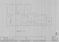
| 14 |
|
Ashley National Forest Map | 1909 | Image/StillImage |
| 15 |
 |
Ashley National Forest Proposed Travel Alts (Alt. C) Vernal Ranger District April 2009 | 2009 | Image/StillImage |
| 16 |
 |
Ashley National Forest Travel Map - Flaming Gorge Ranger District 2005 | 2005 | Image/StillImage |
| 17 |
 |
Ashley National Forest Travel Map - Flaming Gorge, Vernal, Roosevelt, and Duchesne Ranger Districts 1971 | 1971 | Image/StillImage |
| 18 |
 |
Ashley National Forest Utah - Salt Lake and Uinta Special Meridians 1955 | 1955 | Image/StillImage |
| 19 |
 |
Ashley National Forest Utah and Wyoming - Roosevelt, Flaming Gorge, and Vernal Ranger Districts 1971 | 1971 | Image/StillImage |
| 20 |
 |
Ashley National Forest Utah and Wyoming - Salt Lake, Uinta Special, and Sixth Principal Meridians 1928 | 1928 | Image/StillImage |
| 21 |
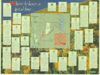
 |
Ashley National Forest Utah and Wyoming - Salt Lake, Uinta Special, and Sixth Principal Meridians 1945 | 1945 | Image/StillImage |
| 22 |
 |
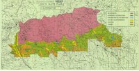
Ashley National Forest Wilderness Proposal 1967 - South Slope Plan | 1967 | Image/StillImage |
| 23 |
 |
Ashley National Forest Wilderness Proposal 1967 - South Slope Plan - Roadless Areas - Alternative 1 | 1967 | Image/StillImage |
| 24 |
 |
Ashley National Forest Wilderness Proposal 1967 - South Slope Plan - Roadless Areas - Alternative 2 | 1967 | Image/StillImage |
| 25 |
 |
Ashley National Forest Wilderness Proposal 1967 - South Slope Plan - Roadless Areas - Alternative 3 | 1967 | Image/StillImage |
| 26 |
 |
Ashley National Forest Wilderness Proposal 1967 - South Slope Plan - Roadless Areas - Alternative 4 | 1967 | Image/StillImage |
| 27 |
 |
Ashley National Forest, Duchesne, Flaming Gorge, Roosevelt and Vernal Ranger Districts 1982 | 1982 | Image/StillImage |
| 28 |
 |
Ashley National Forest, Roosevelt and Duchesne Ranger Districts 1971 | 1971 | Image/StillImage |
| 29 |
 |
Ashley National Forest, Roosevelt, Flaming Gorge & Vernal Ranger Distrs. 1971. UT & WY | 1971 | Image/StillImage |
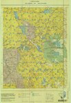
| 30 |
 |
Ashley National Forest, Utah - Salt Lake and Uinta Special Meridians | 1962 | Image/StillImage |
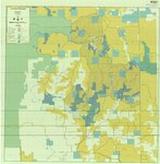
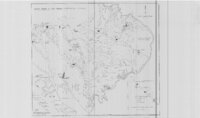
| 31 |
 |
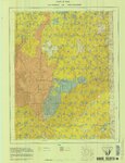
Ashley National Forest, Utah - Salt Lake and Uinta Special Meridians 1962 | 1962 | Image/StillImage |
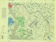
| 32 |
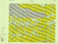
 |
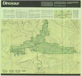
Ashley National Forest, Utah and Wyoming - Salt Lake, Uinta Special, and Sixth Principal Meridians 1928 | 1928 | Image/StillImage |
| 33 |
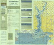
 |
Ashley National Forest, Utah and Wyoming - Salt Lake, Uinta Special, and Sixth Principal Meridians 1933 | 1933 | Image/StillImage |
| 34 |
 |
Ashley National Forest, Utah, Salt Lake and Uinta Special Meridians. 1955 - reprint of 1945 edition | 1955 | Image/StillImage |
| 35 |
 |
Ashley Survey Positive Sanborn 1880 | 1880 | Image/StillImage |
| 36 |
 |
Ashley Valley | 1977; 1978; 1979 | Image/StillImage |
| 37 |
 |
Ashley Valley 1907 Reconnaissance Map | 1907 | Image/StillImage |
| 38 |
 |
Ashley Valley Survey T5S R20 East SLM, 1880s | 1879; 1880; 1881; 1882; 1883; 1884; 1885; 1886; 1887; 1888; 1889 | Image/StillImage |
| 39 |
 |
Ashley Valley Survey T5S R21E SLM 1880s | 1880; 1881; 1882; 1883; 1884; 1885; 1886; 1887; 1888; 1889 | Image/StillImage |
| 40 |
 |
Ashley Valley Survey, T5S R20E SLM, 1880s | 1880 | Image/StillImage |
| 41 |
 |
Ashley, Utah reprint edition of Dec. 1885 map | 1885 | Image/StillImage |
| 42 |
 |
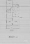
Ashton Home Floor Plan | 1989 | Image/StillImage |
| 43 |
 |
Basin US DOI BLM 1977 | 1977 | Image/StillImage |
| 44 |
 |
Bear Lake US DOI BLM 1974 | 1974 | Image/StillImage |
| 45 |
 |
Beaver US DOI BLM 1977 | 1977 | Image/StillImage |
| 46 |
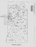 |
Bennett and Leeton Map, Uintah County, Utah | | Image/StillImage |
| 47 |
 |
Bennion - Feltch Home Floor Plans | 1989 | Image/StillImage |
| 48 |
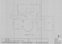 |
Bennion - Valora Home Floor Plans | 1989 | Image/StillImage |
| 49 |
 |
Bitter Creek, NE-18, (US DOI BLM) 1975 (revised) | 1975 | Image/StillImage |
| 50 |
 |
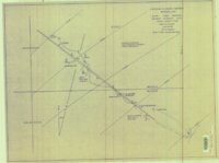
Black Ridge Gilsonite Mine - Profile View, Plot Plan, Topographical Profile View - February 1971 | 1971 | Image/StillImage |
| 51 |
 |
BLM Vernal Field Office Grazing Allotments 2004 | 2004 | Image/StillImage |
| 52 |
 |
Bonanza (Planimetric) NE-14 (US DOI BLM) 1975 (revised) | 1975 | Image/StillImage |
| 53 |
 |
Bonanza - Rainbow Area Mine | 1973; 1980 | Image/StillImage |
| 54 |
 |
Bonanza Tap - Aerial Photo 2 Drawing No 10314 | | Image/StillImage |
| 55 |
 |
Bonanza Tap - Aerial Photo 2-A Drawing No 10316 | | Image/StillImage |
| 56 |
 |
Bonanza Tap - Aerial Photo 3-A Drawing No 10317 | | Image/StillImage |
| 57 |
 |
Bonanza Tap - Aerial Photo 4-A Drawing No 10318 | | Image/StillImage |
| 58 |
 |
Bonanza Tap - Aerial Photo Drawing No. 10313 | 1968 | Image/StillImage |
| 59 |
 |
Bonanza To Little Bonanza 1-A Drawing No. 10315 | | Image/StillImage |
| 60 |
 |
Bonneville Fuels Corp - Wolf Point Pipeline Project - Uintah County, Utah - Project Site Map | | Image/StillImage |
| 61 |
 |
Book Cliffs US DOI BLM 1979 | 1979 | Image/StillImage |
| 62 |
 |
Bountiful (Planimetric) NW-12 (US DOI BLM) 1975 | 1975 | Image/StillImage |
| 63 |
 |
Brennan Basin Quad 1999 - National Wetlands Inventory | 1999 | Image/StillImage |
| 64 |
 |
Bridgerland, Cache County, Brochure | | Image/StillImage |
| 65 |
 |
Brush Creek and Pot Creek Distribution Systems | | Image/StillImage |
| 66 |
 |
Caldwell Home Floor Plan | 1989 | Image/StillImage |
| 67 |
 |
Camp Floyd, Utah 1859 | 1859 | Image/StillImage |
| 68 |
 |
Canyon of Lodore, Colorado 1979 | 1979 | Image/StillImage |
| 69 |
 |
Canyon of Lodore, Colorado 1993 | 1993 | Image/StillImage |
| 70 |
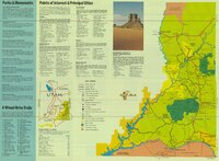 |
Canyonlands, USA Southeastern Utah's Family Vacation Land Brochure | | Image/StillImage |
| 71 |
 |
Carbon US DOI BLM 1967 | 1967 | Image/StillImage |
| 72 |
 |
Carbon US DOI BLM 1978 | 1978 | Image/StillImage |
| 73 |
 |
Carter Military Road, Map & Brochure | | Image/StillImage |
| 74 |
 |
Cat Creek & Pebble Puppy Placer Gold Claims, Uintah County, Utah 1994 | 1994 | Image/StillImage |
| 75 |
 |
Central Business District Vernal, Utah - 1970s | 1970; 1971; 1972; 1973; 1974; 1975; 1976; 1977; 1978; 1979 | Image/StillImage |
| 76 |
 |
Collett Francke Home Floor Plan | 1989 | Image/StillImage |
| 77 |
 |
Coltharp Home 1989 | 1989 | Image/StillImage |
| 78 |
 |
County And Township Map Of Utah And Nevada | 1884 | Image/StillImage |
| 79 |
 |
Cowboy #1 Detail of Shaft and Cross Section, 1994 | 1994 | Image/StillImage |
| 80 |
 |
Cowboy - Bandana Gilsonite Vein Plan View and Profile View, 1993 | 1993 | Image/StillImage |
| 81 |
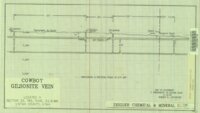 |
Cowboy Gilsonite Vein Section 33, T8S, R24E, S.L.B.&M. 1994 | 1994 | Image/StillImage |
| 82 |
 |
Cowboy Vein Shaft No 1 Horizontal & Vertical Deviation Plat, 1995 | 1995 | Image/StillImage |
| 83 |
 |
Cowboy Vein Vertical Hole 71-3 Geologic Section | 1975 | Image/StillImage |
| 84 |
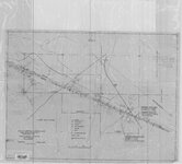 |
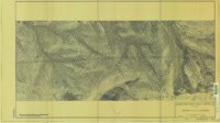
Cowboy-Eureka Gilsonite Vein Plane Table Survey, 1980 | 1980 | Image/StillImage |
| 85 |
 |
Craig, Colorado 1979 | 1979 | Image/StillImage |
| 86 |
 |
Critical Habitat Polygons for Penstemon Grahamii | | Image/StillImage |
| 87 |
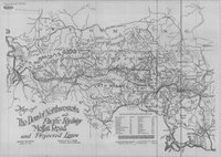 |
The Denver Northwestern and Pacific Railway, Moffat Road and Projected Lines 1911 | 1911 | Image/StillImage |
| 88 |
 |
Diagram of Township Exteriors - Uintah Indian Reserve | 1875 | Image/StillImage |
| 89 |
 |
Diamond Mountain (Planimetric) NE-10 (US DOI BLM) 1975 | 1975 | Image/StillImage |
| 90 |
 |
Diamond Mountain 2001 | 2001 | Image/StillImage |
| 91 |
 |
Diamond Mountain 2012 | 2012 | Image/StillImage |
| 92 |
 |
Diamond Mountain 2012 | 2012 | Image/StillImage |
| 93 |
 |
Diamond Mountain Landowners | | Image/StillImage |
| 94 |
 |
Diamond Mountain Landowners 1935-1940 | 1935; 1936; 1937; 1938; 1939; 1940 | Image/StillImage |
| 95 |
 |
Diamond Mountain Landowners 1991 | 1991 | Image/StillImage |
| 96 |
 |
Diamond Mountain Landowners 1993 | 1993 | Image/StillImage |
| 97 |
 |
Dinosaur (Planimetric) NW-7 (US DOI BLM) 1975 | 1975 | Image/StillImage |
| 98 |
 |
Dinosaur National Monument, 1986 | 1986 | Image/StillImage |
| 99 |
 |
Dinosaurland Bike Routes | | Image/StillImage |
| 100 |
 |
Dinosaurland Eastern Uintas Cross-Country Ski Trails | | Image/StillImage |