Home
Browse
Ask Us
Chat
Harmful Language Statement
Log in
Uintah County Regional History Center Maps
Advanced Search
Year
1880
1881
1882
1883
1884
1885
1886
1887
1888
1889
1890
1891
1892
1893
1894
1895
1896
1897
1898
1899
1900
1901
1902
1903
1904
1905
1906
1907
1908
1909
1910
1911
1912
1913
1914
1915
1916
1917
1918
1919
1920
1921
1922
1923
1924
1925
1926
1927
1928
1929
1930
1931
1932
1933
1934
1935
1936
1937
1938
1939
1940
1941
1942
1943
1944
1945
1946
1947
1948
1949
1950
1951
1952
1953
1954
1955
1956
1957
1958
1959
1960
1961
1962
1963
1964
1965
1966
1967
1968
1969
1970
1971
1972
1973
1974
1975
1976
1977
1978
1979
1980
1981
1982
1983
1984
1985
1986
1987
1988
1989
1990
1991
1992
1993
1994
1995
1996
1997
1998
1999
2000
2001
2002
2003
2004
2005
2006
2007
2008
2009
2010
2011
2012
2013
2014
TO
1880
1881
1882
1883
1884
1885
1886
1887
1888
1889
1890
1891
1892
1893
1894
1895
1896
1897
1898
1899
1900
1901
1902
1903
1904
1905
1906
1907
1908
1909
1910
1911
1912
1913
1914
1915
1916
1917
1918
1919
1920
1921
1922
1923
1924
1925
1926
1927
1928
1929
1930
1931
1932
1933
1934
1935
1936
1937
1938
1939
1940
1941
1942
1943
1944
1945
1946
1947
1948
1949
1950
1951
1952
1953
1954
1955
1956
1957
1958
1959
1960
1961
1962
1963
1964
1965
1966
1967
1968
1969
1970
1971
1972
1973
1974
1975
1976
1977
1978
1979
1980
1981
1982
1983
1984
1985
1986
1987
1988
1989
1990
1991
1992
1993
1994
1995
1996
1997
1998
1999
2000
2001
2002
2003
2004
2005
2006
2007
2008
2009
2010
2011
2012
2013
2014
Type
Image/StillImage
68
Format
image/jpeg
57
application/pdf
11
Collection
Uintah County Regional History Center...
68
Filters:
Collection:
"ucl_maps"
Type:
"Image/StillImage"
1
-
25
of
68
<
1
2
3
>
Gallery view
Number of results to display per page
10
25
50
100
200
Sort by Relevance
Sort by Title A-Z
Sort by Title Z-A
Sort by Date Ascending
Sort by Date Descending
Sort by Last Modified Ascending
Sort by Last Modified Descending
Title
Date
Type
1
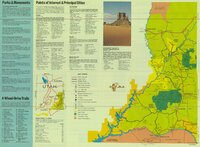
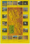
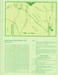
Dinosaurland One-Day Self-Guided Tour #5 Dinosaur National Monument, Quarry and Harper's Corner
Image/StillImage
2
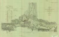
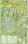
Topographic Map of the Dinosaur National Monument, Colorado - Utah, 1951
1945; 1951
Image/StillImage
3
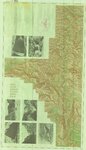
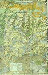
United States Department of the Interior Geological Survey, Dinosaur National Monument, Colorado - Utah, 1966
1966
Image/StillImage
4
Canyonlands, USA Southeastern Utah's Family Vacation Land Brochure
Image/StillImage
5
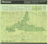
Dinosaur National Monument, 1986
1986
Image/StillImage
6
Geological Map of the Dinosaur National Monument
1965
Image/StillImage
7
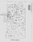
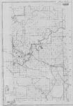
Bennett and Leeton Map, Uintah County, Utah
Image/StillImage
8
Dinosaurland Bike Routes
Image/StillImage
9
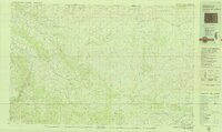
Geologic Map and Structure Sections of the Uinta River-Brush Creek Area, Duchesne and Uintah Counties, Utah
1947
Image/StillImage
10
United States Department of the Interior Geological Survey, Dinosaur National Monument, Colorado - Utah, 1971
1971
Image/StillImage
11
A Guide To Temple Square
Image/StillImage
12
Dinosaur (Planimetric) NW-7 (US DOI BLM) 1975
1975
Image/StillImage
13
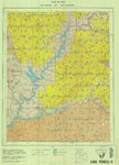
Lake Powell US DOI BLM 1976
1976
Image/StillImage
14
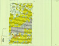
Diamond Mountain (Planimetric) NE-10 (US DOI BLM) 1975
1975
Image/StillImage
15
Energy Project Sites, Uintah County 1980s
1980; 1981; 1982; 1983; 1984; 1985; 1986; 1987; 1988; 1989
Image/StillImage
16
Snow Canyon State Park (Brochure and Map)
Image/StillImage
17
Dinosaurland One-Day Self-Guided Tour #9 Indian Canyon
Image/StillImage
18
Lake Powell and Glen Canyon National Recreation Area
1969
Image/StillImage
19
Rangely, Colorado 1979
1979; 1987
Image/StillImage
20
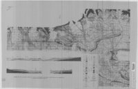
Geologic Map of Uintah County, Utah - North Half - 1950s
1950; 1951; 1952; 1953; 1954; 1955; 1956; 1957; 1958; 1959
Image/StillImage
21
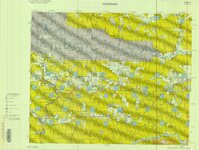
Diamond Mountain 2012
2012
Image/StillImage
22
Canyon of Lodore, Colorado 1979
1979
Image/StillImage
23
Diamond Mountain 2012
2012
Image/StillImage
24
General Highway Map - Uintah County, Utah No. 24
Image/StillImage
25
Monticello US DOI BLM 1978
1978
Image/StillImage
1
-
25
of
68
<
1
2
3
>