Home
Browse
Ask Us
Chat
Harmful Language Statement
Log in
Uintah County Regional History Center Maps
Advanced Search
Year
1878
1879
1880
1881
1882
1883
1884
1885
1886
1887
1888
1889
1890
1891
1892
1893
1894
1895
1896
1897
1898
1899
1900
1901
1902
1903
1904
1905
1906
1907
1908
1909
1910
1911
1912
1913
1914
1915
1916
1917
1918
1919
1920
1921
1922
1923
1924
1925
1926
1927
1928
1929
1930
1931
1932
1933
1934
1935
1936
1937
1938
1939
1940
1941
1942
1943
1944
1945
1946
1947
1948
1949
1950
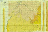
1951
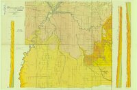
1952
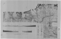
1953
1954
1955
1956
1957
1958
1959
1960
1961
1962
1963
1964
1965
1966
1967
1968
1969
1970
1971
1972
1973
1974
1975
1976
1977
1978
1979
1980
1981
1982
1983
1984
1985
1986
1987
1988
1989
1990
1991
1992
1993
1994
1995
1996
1997
1998
1999
2000
2001
2002
2003
2004
2005
2006
2007
2008
2009
2010
2011
2012
2013
2014
TO
1878
1879
1880
1881
1882
1883
1884
1885
1886
1887
1888
1889
1890
1891
1892
1893
1894
1895
1896
1897
1898
1899
1900
1901
1902
1903
1904
1905
1906
1907
1908
1909
1910
1911
1912
1913
1914
1915
1916
1917
1918
1919
1920
1921
1922
1923
1924
1925
1926
1927
1928
1929
1930
1931
1932
1933
1934
1935
1936
1937
1938
1939
1940
1941
1942
1943
1944
1945
1946
1947
1948
1949
1950
1951
1952
1953
1954
1955
1956
1957
1958
1959
1960
1961
1962
1963
1964
1965
1966
1967
1968
1969
1970
1971
1972
1973
1974
1975
1976
1977
1978
1979
1980
1981
1982
1983
1984
1985
1986
1987
1988
1989
1990
1991
1992
1993
1994
1995
1996
1997
1998
1999
2000
2001
2002
2003
2004
2005
2006
2007
2008
2009
2010
2011
2012
2013
2014
Type
Image/StillImage
300
Format
image/jpeg
300
Collection
Uintah County Regional History Center...
300
Filters:
Collection:
"ucl_maps"
Subject:
"Utah"
Type:
"Image/StillImage"
Format:
image
76
-
100
of
300
<
1
2
3
4
5
6
7
8
9
10
>
Gallery view
Number of results to display per page
10
25
50
100
200
Sort by Relevance
Sort by Title A-Z
Sort by Title Z-A
Sort by Date Ascending
Sort by Date Descending
Sort by Last Modified Ascending
Sort by Last Modified Descending
Title
Date
Type
76
Flaming Gorge National Recreation Area - Ashley National Forest 1962
1962
Image/StillImage
77
Flaming Gorge Recreation Map - Ashley National Forest
1965
Image/StillImage
78
Froiseth's New Sectional and Mineral Map of Utah 1878
1878
Image/StillImage
79
Geologic Map and Structure Sections of the Uinta River-Brush Creek Area, Duchesne and Uintah Counties, Utah
1947
Image/StillImage
80
Geologic Map of Bonanza Area, Uintah County, Utah 1976
1976
Image/StillImage
81
Geologic Map of the Blue Mountain Area 1963
1963
Image/StillImage
82
Geologic Map of Uintah County, Utah - North Half - 1950s
1950; 1951; 1952; 1953; 1954; 1955; 1956; 1957; 1958; 1959
Image/StillImage
83
Geologic Map of Uintah County, Utah - South Half - 1950s
1950; 1951; 1952; 1953; 1954; 1955; 1956; 1957; 1958; 1959
Image/StillImage
84
Geologic North-South Cross Profile Whiterocks Area 1957
1957
Image/StillImage
85
Geological Map DNM Quarry
1979
Image/StillImage
86
Geological Map of the Dinosaur National Monument
1965
Image/StillImage
87
Geological Map of Uintah County, Utah - North Half - 1950s
1950; 1951; 1952; 1953; 1954; 1955; 1956; 1957; 1958; 1959
Image/StillImage
88
Geological Map of Uintah County, Utah - South Half - 1950s
1950; 1951; 1952; 1953; 1954; 1955; 1956; 1957; 1958; 1959
Image/StillImage
89
Grazing Service C.C.C. Range Surveys, 1927
1927
Image/StillImage
90
Green - Hardy - Freestone Home Floor Plan
1989
Image/StillImage
91
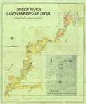
Green River Land Ownership Data - Generated From FWS Maps
Image/StillImage
92
Grouse Creek US DOI BLM 1974
1974
Image/StillImage
93
Gusher Home Sites
Image/StillImage
94
Gusher, Lapoint, Tridell, Utah - Reconnaissance Survey Map A
1964
Image/StillImage
95
Gusher, Lapoint, Tridell, Utah - Reconnaissance Survey Map B
1964
Image/StillImage
96
Gusher, Lapoint, Tridell, Utah - Reconnaissance Survey Maps C, D, & E
1964
Image/StillImage
97
Gusher, Utah - The Strip
1927
Image/StillImage
98
Hatch Freeman House Floor Plan
1989
Image/StillImage
99
Henry and Mary Harris Home - Gusher
1994
Image/StillImage
100
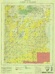
High Uintas Primitive Area - Ashley and Wasatch National Forests, Utah 1958
1958
Image/StillImage
76
-
100
of
300
<
1
2
3
4
5
6
7
8
9
10
>