| | Title | Date | Type |
|---|
| 1 | 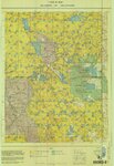 | Arches US DOI 1978 | 1978 | Image/StillImage |
| 2 |  | Ashley National Forest - Forest Visitor Map 1998 | 1998 | Image/StillImage |
| 3 |  | Ashley National Forest - Roosevelt and Duchesne Ranger Districts, Utah - Salt Lake and Uintah Meridians 1971 | 1971 | Image/StillImage |
| 4 |  | Ashley National Forest - Uinta National Forest - Wasatch National Forest - Manti La Sal National Forest | | Image/StillImage |
| 5 |  | Ashley National Forest - Utah, Wyoming - Uintah, Salt Lake and Sixth Principal Meridians 1971 | 1971 | Image/StillImage |
| 6 |  | Ashley National Forest - Vernal Ranger District - September 2009 - ROD Selected Alternative | 2009 | Image/StillImage |
| 7 |  | Ashley National Forest Travel Map - Flaming Gorge, Vernal, Roosevelt, and Duchesne Ranger Districts 1971 | 1971 | Image/StillImage |
| 8 |  | Ashley National Forest Utah and Wyoming - Roosevelt, Flaming Gorge, and Vernal Ranger Districts 1971 | 1971 | Image/StillImage |
| 9 | 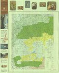 | Ashley National Forest, Duchesne, Flaming Gorge, Roosevelt and Vernal Ranger Districts 1982 | 1982 | Image/StillImage |
| 10 | 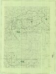 | Ashley National Forest, Roosevelt and Duchesne Ranger Districts 1971 | 1971 | Image/StillImage |
| 11 |  | Ashley National Forest, Utah - Salt Lake and Uinta Special Meridians | 1962 | Image/StillImage |
| 12 |  | Ashley National Forest, Utah - Salt Lake and Uinta Special Meridians 1962 | 1962 | Image/StillImage |
| 13 |  | Bear Lake US DOI BLM 1974 | 1974 | Image/StillImage |
| 14 |  | Beaver US DOI BLM 1977 | 1977 | Image/StillImage |
| 15 | 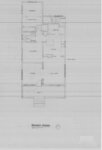 | Bennion - Feltch Home Floor Plans | 1989 | Image/StillImage |
| 16 | 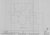 | Bennion - Valora Home Floor Plans | 1989 | Image/StillImage |
| 17 |  | BLM Vernal Field Office Grazing Allotments 2004 | 2004 | Image/StillImage |
| 18 |  | Bonanza (Planimetric) NE-14 (US DOI BLM) 1975 (revised) | 1975 | Image/StillImage |
| 19 |  | Book Cliffs US DOI BLM 1979 | 1979 | Image/StillImage |
| 20 |  | Bountiful (Planimetric) NW-12 (US DOI BLM) 1975 | 1975 | Image/StillImage |
| 21 | 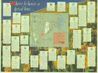 | Bridgerland, Cache County, Brochure | | Image/StillImage |
| 22 | 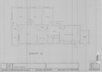 | Caldwell Home Floor Plan | 1989 | Image/StillImage |
| 23 |  | Camp Floyd, Utah 1859 | 1859 | Image/StillImage |
| 24 | 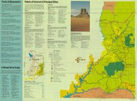 | Canyonlands, USA Southeastern Utah's Family Vacation Land Brochure | | Image/StillImage |
| 25 | 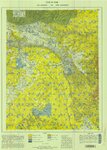 | Carbon US DOI BLM 1967 | 1967 | Image/StillImage |
| 26 | 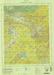 | Carbon US DOI BLM 1978 | 1978 | Image/StillImage |
| 27 | 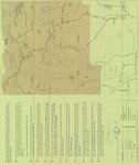 | Carter Military Road, Map & Brochure | | Image/StillImage |
| 28 |  | Collett Francke Home Floor Plan | 1989 | Image/StillImage |
| 29 |  | Coltharp Home 1989 | 1989 | Image/StillImage |
| 30 | 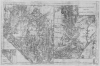 | County And Township Map Of Utah And Nevada | 1884 | Image/StillImage |
| 31 |  | Critical Habitat Polygons for Penstemon Grahamii | | Image/StillImage |
| 32 |  | Diamond Mountain (Planimetric) NE-10 (US DOI BLM) 1975 | 1975 | Image/StillImage |
| 33 |  | Diamond Mountain 2001 | 2001 | Image/StillImage |
| 34 |  | Diamond Mountain Landowners | | Image/StillImage |
| 35 |  | Diamond Mountain Landowners 1935-1940 | 1935; 1936; 1937; 1938; 1939; 1940 | Image/StillImage |
| 36 |  | Diamond Mountain Landowners 1991 | 1991 | Image/StillImage |
| 37 |  | Diamond Mountain Landowners 1993 | 1993 | Image/StillImage |
| 38 | 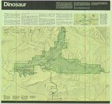 | Dinosaur National Monument, 1986 | 1986 | Image/StillImage |
| 39 |  | Dinosaurland Bike Routes | | Image/StillImage |
| 40 |  | Dinosaurland Eastern Uintas Cross-Country Ski Trails | | Image/StillImage |
| 41 |  | Dinosaurland One-Day Self-Guided Tour #1 Jones Hole National Fish Hatchery | | Image/StillImage |
| 42 |  | Dinosaurland One-Day Self-Guided Tour #10 North Fork of the Duchesne River | | Image/StillImage |
| 43 |  | Dinosaurland One-Day Self-Guided Tour #11 Rock Creek and Upper Stillwater Dam | | Image/StillImage |
| 44 |  | Dinosaurland One-Day Self-Guided Tour #2 Indian Petroglyphs Dry Fork Canyon | | Image/StillImage |
| 45 |  | Dinosaurland One-Day Self-Guided Tour #3 Red Cloud Loop Scenic Byway | | Image/StillImage |
| 46 |  | Dinosaurland One-Day Self-Guided Tour #4 Red Fleet & Steinaker Lake State Parks | | Image/StillImage |
| 47 |  | Dinosaurland One-Day Self-Guided Tour #5 Dinosaur National Monument, Quarry and Harper's Corner | | Image/StillImage |
| 48 | 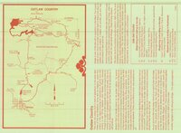 | Dinosaurland One-Day Self-Guided Tour #6 Outlaw Country - Crouse Canyon, Brown's Park, Javie's Ranch, Jessie Ewing Canyon | | Image/StillImage |
| 49 |  | Dinosaurland One-Day Self-Guided Tour #7 Vernal Walking Tour | | Image/StillImage |
| 50 | 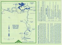 | Dinosaurland One-Day Self-Guided Tour #8 Sheep Creek Canyon and Spirit Lake | | Image/StillImage |
| 51 |  | Dinosaurland One-Day Self-Guided Tour #9 Indian Canyon | | Image/StillImage |
| 52 |  | Dixie US DOI BLM 1977 | 1977 | Image/StillImage |
| 53 |  | Dominguez - Escalante Expedition 1776 (Brochure and Map) | | Image/StillImage |
| 54 |  | Dutch John, Utah 1997 | 1997 | Image/StillImage |
| 55 |  | Dutch John, Utah-Colorado-Wyoming 1981 | 1981 | Image/StillImage |
| 56 |  | Dutch John, Utah-Colorado-Wyoming 1982 | 1981; 1982 | Image/StillImage |
| 57 |  | Fish Lake US DOI BLM 1978 | 1978 | Image/StillImage |
| 58 | 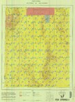 | Fish Springs US DOI BLM 1977 | 1977 | Image/StillImage |
| 59 |  | Flaming Gorge Country (Brochure and Map) | 1987 | Image/StillImage |
| 60 | 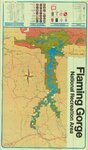 | Flaming Gorge National Recreation Area | 1987 | Image/StillImage |
| 61 |  | Flaming Gorge National Recreation Area - Ashley National Forest | | Image/StillImage |
| 62 |  | Flaming Gorge National Recreation Area - Ashley National Forest 1962 | 1962 | Image/StillImage |
| 63 |  | Flaming Gorge Recreation Map - Ashley National Forest | 1965 | Image/StillImage |
| 64 |  | Froiseth's New Sectional and Mineral Map of Utah 1878 | 1878 | Image/StillImage |
| 65 | 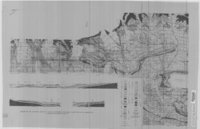 | Geologic Map and Structure Sections of the Uinta River-Brush Creek Area, Duchesne and Uintah Counties, Utah | 1947 | Image/StillImage |
| 66 |  | Geological Map of the Dinosaur National Monument | 1965 | Image/StillImage |
| 67 |  | Grazing Service C.C.C. Range Surveys, 1927 | 1927 | Image/StillImage |
| 68 | 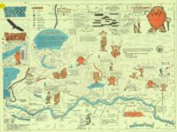 | Green River - Flaming Gorge National Recreation Area, Ashley National Forest | | Image/StillImage |
| 69 | 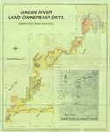 | Green River Land Ownership Data - Generated From FWS Maps | | Image/StillImage |
| 70 |  | Grouse Creek US DOI BLM 1974 | 1974 | Image/StillImage |
| 71 |  | Gusher Home Sites | | Image/StillImage |
| 72 |  | Hatch Freeman House Floor Plan | 1989 | Image/StillImage |
| 73 |  | High Uintas Primitive Area - Ashley and Wasatch National Forests, Utah 1958 | 1958 | Image/StillImage |
| 74 |  | High Uintas Primitive Area, Wasatch and Ashley National Forests, Utah, Salt Lake and Uinta Special Meridians | 1980 | Image/StillImage |
| 75 |  | Hill Creek (Planimetric) NE-17 (US DOI BLM) 1975 (revised) | 1975 | Image/StillImage |
| 76 |  | Indian Reservation 1856 | 1856 | Image/StillImage |
| 77 |  | Kaiparowits US DOI BLM 1980 | 1980 | Image/StillImage |
| 78 |  | Kanab US DOI BLM 1978 | 1978 | Image/StillImage |
| 79 |  | Kings Peak, Utah-Wyoming 1982 | 1982 | Image/StillImage |
| 80 |  | Lake Powell and Glen Canyon National Recreation Area | 1969 | Image/StillImage |
| 81 | 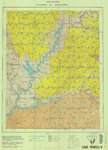 | Lake Powell US DOI BLM 1976 | 1976 | Image/StillImage |
| 82 |  | Land Map for Pleasant Valley | 1981 | Image/StillImage |
| 83 |  | Map 37 - Simple Bouguer Gravity Anomaly Map of Utah | 1975 | Image/StillImage |
| 84 | 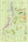 | Map 68 Energy Resources Map of Utah 1983 | 1983 | Image/StillImage |
| 85 | 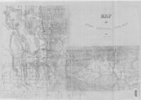 | Map of Utah Central Railway - 1890 | 1890 | Image/StillImage |
| 86 | 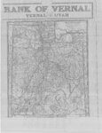 | Map of Utah with the 1920 Census Index | 1920 | Image/StillImage |
| 87 |  | Map Pages of the White River | | Image/StillImage |
| 88 |  | Monticello US DOI BLM 1978 | 1978 | Image/StillImage |
| 89 |  | Moon Lake Project Deserado Mine Sheet 2 | 1981 | Image/StillImage |
| 90 |  | Mormon Pioneer Trail | | Image/StillImage |
| 91 |  | Myton-Duchesne (Planimetric) NE-12 (US DOI BLM) 1977 (revised) | 1977 | Image/StillImage |
| 92 |  | Oil & Gas Fields and Pipelines of Utah - Revised 1976 | 1976 | Image/StillImage |
| 93 |  | Oil and Gas Wells of Utah 1891-1948 | 1891; 1892; 1893; 1894; 1895; 1896; 1897; 1898; 1899; 1900; 1901; 1902; 1903; 1904; 1905; 1906; 1907; 1908; 1909; 1910; 1911; 1912; 1913; 1914; 1915; 1916; 1917; 1918; 1919; 1920; 1921; 1922; 1923; 1924; 1925; 1926; 1927; 1928; 1929; 1930; 1931; 1932; 1933; 1934; 1935; 1936; 1937; 1938; 1939; 1940; ... | Image/StillImage |
| 94 |  | Oquirrh US DOI BLM 1977 | 1977 | Image/StillImage |
| 95 |  | Outlaw ATV Trail | | Image/StillImage |
| 96 |  | Partial Map of Gusher, Utah | 1963; 1964 | Image/StillImage |
| 97 |  | Partial Map of Gusher, Utah | | Image/StillImage |
| 98 |  | Phase 1 Inventory of Undeveloped Areas - State of Utah | 1927 | Image/StillImage |
| 99 |  | Pioneer Trails 1825-1849 | 1825; 1826; 1827; 1828; 1829; 1830; 1931; 1832; 1833; 1834; 1835; 1836; 1837; 1838; 1839; 1840; 1841; 1842; 1843; 1844; 1845; 1846; 1847; 1848; 1849 | Image/StillImage |
| 100 |  | Pony Express Needles Station Camp Floyd | | Image/StillImage |
| 101 |  | Pony Express Route - April 3, 1860 to October 24, 1861 | 1860; 1861; 1960 | Image/StillImage |
| 102 |  | Pony Express Stations Deep Creek | | Image/StillImage |
| 103 |  | Pony Express Stations in Utah - April 3, 1860 - October 24, 1861 | 1860; 1861 | Image/StillImage |
| 104 |  | Price River, Utah 1886 | 1886 | Image/StillImage |
| 105 |  | Price, Utah 1980 | 1980 | Image/StillImage |
| 106 |  | Promontory US DOI BLM 1973 | 1973 | Image/StillImage |
| 107 |  | Railroads in Utah 1896 | 1896 | Image/StillImage |
| 108 |  | Recreation Map - Ashley National Forest - Utah and Wyoming 1955 | 1955 | Image/StillImage |
| 109 | 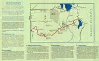 | Ride the Pony Express Trail National Back Country Byway | | Image/StillImage |
| 110 | 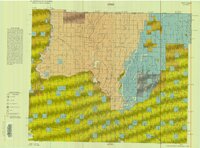 | Roan Plateau (Planimetric) SE-3 (US DOI BLM) 1975 | 1975 | Image/StillImage |
| 111 |  | Route of the Mormon Pioneers from Nauvoo to the Great Salt Lake, July 1847 | 1847 | Image/StillImage |
| 112 | 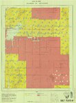 | Salt Flats US DOI BLM 1977 | 1977 | Image/StillImage |
| 113 | 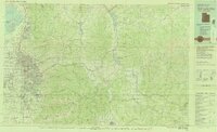 | Salt Lake City, Utah-Wyoming 1980 | 1980 | Image/StillImage |
| 114 | 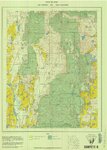 | Sanpete US DOI BLM 1978 | 1978 | Image/StillImage |
| 115 | 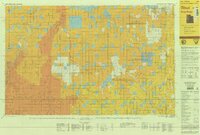 | Seep Ridge, Utah 1999 | 1999 | Image/StillImage |
| 116 | 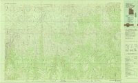 | Seep Ridge, Utah-Colorado 1981 | 1981 | Image/StillImage |
| 117 |  | Seep Ridge, Utah-Colorado 1982 | 1981; 1982 | Image/StillImage |
| 118 |  | Sketch of Camp Douglas | 1864 | Image/StillImage |
| 119 |  | Snow Canyon State Park (Brochure and Map) | | Image/StillImage |
| 120 |  | State of Utah - Minerals Status 1983 | 1983 | Image/StillImage |
| 121 |  | State Open Ride for Mountain Bikes Map of Trails 2001 | 2001 | Image/StillImage |
| 122 |  | State Parks of Utah (Brochure and Map) | | Image/StillImage |
| 123 |  | The Strip - no date | | Image/StillImage |
| 124 |  | The Strip - no date (2) | | Image/StillImage |
| 125 |  | Surficial Deposits and Ingenious Rocks 1980 | 1980 | Image/StillImage |
| 126 |  | Taylor Mountain Formations | | Image/StillImage |
| 127 |  | Tintic US DOI BLM 1976 | 1976 | Image/StillImage |
| 128 |  | Topographic Map of the Dinosaur National Monument, Colorado - Utah, 1951 | 1945; 1951 | Image/StillImage |
| 129 |  | Township No 2 South Range No 1 East of the Uintah Special Meridian 1875 | 1875 | Image/StillImage |
| 130 |  | Township No 2 South Range No 2 East of the Uintah Special Meridian - The Strip 1890 | 1890; 1891 | Image/StillImage |
| 131 |  | Travel Map Ashley National Forest - Vernal Ranger District, Utah | 1991 | Image/StillImage |
| 132 |  | U.S. Indian Irrigation Service, Uintah Irrigation Project, Uintah Mountains | 1919 | Image/StillImage |
| 133 |  | Uinta National Forest, Utah - Salt Lake Meridian & Uinta Special Meridian 1937 | 1937 | Image/StillImage |
| 134 |  | Uinta, Utah 1885 | 1885 | Image/StillImage |
| 135 |  | Uintah and Uncompahgre Ute Indian Reservation | | Image/StillImage |
| 136 |  | Uintah Railway Elevation Map 1930 | 1930 | Image/StillImage |
| 137 | 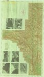 | United States Department of the Interior Geological Survey, Dinosaur National Monument, Colorado - Utah, 1966 | 1966 | Image/StillImage |
| 138 |  | United States Department of the Interior Geological Survey, Dinosaur National Monument, Colorado - Utah, 1971 | 1971 | Image/StillImage |
| 139 | 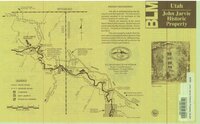 | Utah - John Jarvie Historic Property - BLM | 1949 | Image/StillImage |
| 140 |  | Utah Aeronautical Chart 1970 | 1970 | Image/StillImage |
| 141 |  | Utah Map | 1861; 1862 | Image/StillImage |
| 142 |  | Utah Map of State Roads - State Road Commission 1915 - 1916 | 1915; 1916 | Image/StillImage |
| 143 |  | Utah Story Travel Council | | Image/StillImage |
| 144 |  | Utah! National Park State | | Image/StillImage |
| 145 |  | Veritus Seismec Surveying and Positioning | | Image/StillImage |
| 146 |  | Vernal District Recreation Map, 1969 | 1969 | Image/StillImage |
| 147 |  | Vernal, Utah 1993 | 1993 | Image/StillImage |
| 148 |  | Vernal, Utah-Colorado 1980 | 1980 | Image/StillImage |
| 149 |  | Vernal, Utah-Colorado 1982 | 1980; 1982 | Image/StillImage |
| 150 |  | Wah Wah US DOI BLM 1978 | 1978 | Image/StillImage |
| 151 |  | Wasatch US DOI BLM 1973 | 1973 | Image/StillImage |
| 152 |  | West from Fort Bridger, Pioneer Trails Across Utah 1846-1850 | 1846; 1947; 1948; 1849; 1850 | Image/StillImage |
| 153 |  | Westwater, Utah-Colorado 1981 | 1980; 1981 | Image/StillImage |
| 154 |  | Wildlife Through the Ages, Flaming Gorge - Uintas National Scenic Byway | | Image/StillImage |