| Title | Date | Type | ||
|---|---|---|---|---|
| 76 |  | Indian Reservation 1856 | 1856 | Image/StillImage |
| 77 |  | Kaiparowits US DOI BLM 1980 | 1980 | Image/StillImage |
| 78 | 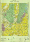 | Kanab US DOI BLM 1978 | 1978 | Image/StillImage |
| 79 |  | Kings Peak, Utah-Wyoming 1982 | 1982 | Image/StillImage |
| 80 |  | Lake Powell and Glen Canyon National Recreation Area | 1969 | Image/StillImage |
| 81 | 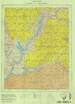 | Lake Powell US DOI BLM 1976 | 1976 | Image/StillImage |
| 82 | 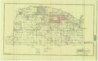 | Land Map for Pleasant Valley | 1981 | Image/StillImage |
| 83 |  | Map 37 - Simple Bouguer Gravity Anomaly Map of Utah | 1975 | Image/StillImage |
| 84 | 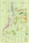 | Map 68 Energy Resources Map of Utah 1983 | 1983 | Image/StillImage |
| 85 |  | Map of Utah Central Railway - 1890 | 1890 | Image/StillImage |
| 86 |  | Map of Utah with the 1920 Census Index | 1920 | Image/StillImage |
| 87 |  | Map Pages of the White River | Image/StillImage | |
| 88 |  | Monticello US DOI BLM 1978 | 1978 | Image/StillImage |
| 89 |  | Moon Lake Project Deserado Mine Sheet 2 | 1981 | Image/StillImage |
| 90 | 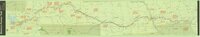 | Mormon Pioneer Trail | Image/StillImage | |
| 91 | 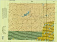 | Myton-Duchesne (Planimetric) NE-12 (US DOI BLM) 1977 (revised) | 1977 | Image/StillImage |
| 92 |  | Oil & Gas Fields and Pipelines of Utah - Revised 1976 | 1976 | Image/StillImage |
| 93 |  | Oil and Gas Wells of Utah 1891-1948 | 1891; 1892; 1893; 1894; 1895; 1896; 1897; 1898; 1899; 1900; 1901; 1902; 1903; 1904; 1905; 1906; 1907; 1908; 1909; 1910; 1911; 1912; 1913; 1914; 1915; 1916; 1917; 1918; 1919; 1920; 1921; 1922; 1923; 1924; 1925; 1926; 1927; 1928; 1929; 1930; 1931; 1932; 1933; 1934; 1935; 1936; 1937; 1938; 1939; 1940; ... | Image/StillImage |
| 94 |  | Oquirrh US DOI BLM 1977 | 1977 | Image/StillImage |
| 95 |  | Outlaw ATV Trail | Image/StillImage | |
| 96 |  | Partial Map of Gusher, Utah | 1963; 1964 | Image/StillImage |
| 97 |  | Partial Map of Gusher, Utah | Image/StillImage | |
| 98 |  | Phase 1 Inventory of Undeveloped Areas - State of Utah | 1927 | Image/StillImage |
| 99 |  | Pioneer Trails 1825-1849 | 1825; 1826; 1827; 1828; 1829; 1830; 1931; 1832; 1833; 1834; 1835; 1836; 1837; 1838; 1839; 1840; 1841; 1842; 1843; 1844; 1845; 1846; 1847; 1848; 1849 | Image/StillImage |
| 100 |  | Pony Express Needles Station Camp Floyd | Image/StillImage |