1 - 25 of 16
Number of results to display per page
TitleDateType
1 Map of Uintah Irrigation Project June 1926 Myton, UtahImage/StillImage
2 Map of the Northern Part of the Former Uintah Indian Reservation Showing the Irrigation SystemImage/StillImage
3 Map of the Southern Part of the Former Uintah Indian Reservation Showing the Irrigation System of Indian AllotmentsImage/StillImage
4 Map of Dry Gulch Irrigation District, Uintah Indian Reservation, UtahImage/StillImage
5 Uinta Indian Reservation Utah Showing Irrigation Systems.Image/StillImage
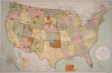
6 Map titled, "Northern Ute Lands, 1905"Image/StillImage
7 Negotiation with Ute Indians; Letter from the Acting Secretary of the Interior, 18721873-01-06Image/StillImage
8 Annual Report of the Commissioner of Indian Affairs - 18981898Image/StillImage
9 Uintah Unit Alernative No. 4 Coyote Basin AlternativeImage/StillImage
10 Upalco Unit Alternative No. 8 Twin Pots AlternativeImage/StillImage
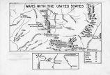
11 Map titled Wars with the United StatesImage/StillImage
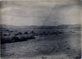
12 View near White Rocks - Summer 19091909Image/StillImage
13 Expedition to the valley of the Great Salt Lake: Including a Description of its Geography, Natural History, and Minerals, and an Analysis of Its WatersImage/StillImage
14 Annual Report of the Commissioner of Indian Affairs - 18701870Image/StillImage
15 Annual Report of the Commissioner of Indian Affairs - 18741874Image/StillImage
16 Letter from John L. Blythe to Brigham Young, April 8, 18741874-04-08Image/StillImage
1 - 25 of 16