|
|
Title | Date | Type |
| 1 |
 |
1849-1850 Annual Report of the Commissioner of Indian Affairs. | 1849 | Text |
| 2 |
 |
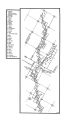
2010 Boundary Validation Program_001 | | Image/StillImage |
| 3 |
 |
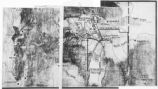
2010 Boundary Validation Program_002 | | Image/StillImage |
| 4 |
 |
2010 Boundary Validation Program_003 | | Image/StillImage |
| 5 |
 |
2010 Boundary Validation Program_004 | | Image/StillImage |
| 6 |
 |
2010 Boundary Validation Program_005 | | Image/StillImage |
| 7 |
 |
2010 Boundary Validation Program_006 | | Image/StillImage |
| 8 |
 |
A History of the Uintah-Ouray Ute Lands | 1979 | Text |
| 9 |
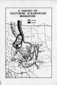 |
A Theory of Southern Athabascan Migration | | Image/StillImage |
| 10 |
 |
Agreement of 1880 | | Text |
| 11 |
 |
Annual Report of the Commissioner of Indian Affairs - 1874 | 1874 | Image/StillImage |
| 12 |
 |
Annual Report of the Commissioner of Indian Affairs - 1875 | | Text |
| 13 |
 |
Annual Report of the Commissioner of Indian Affairs - 1876 | 1876 | Text |
| 14 |
 |
Annual Report of the Commissioner of Indian Affairs - 1877 | 1877 | Text |
| 15 |
 |
Annual Report of the Commissioner of Indian Affairs - 1878 | 1878 | Image/StillImage |
| 16 |
 |
Annual Report of the Commissioner of Indian Affairs - 1880 | 1880 | Text |
| 17 |
 |
Annual Report of the Commissioner of Indian Affairs - 1881 | 1881 | Text |
| 18 |
 |
Annual Report of the Commissioner of Indian Affairs - 1882 | 1882 | Image/StillImage |
| 19 |
 |
Annual Report of the Commissioner of Indian Affairs - 1883 | 1883 | Text |
| 20 |
 |
Annual Report of the Commissioner of Indian Affairs - 1884 | 1884 | Text |
| 21 |
 |
Annual Report of the Commissioner of Indian Affairs - 1885 | 1885 | Text |
| 22 |
 |
Annual Report of the Commissioner of Indian Affairs - 1898 | 1898 | Image/StillImage |
| 23 |
 |
Annual Report of the Commissioner of Indian Affairs - 1902 (Pt II) | 1902 | Text |
| 24 |
 |
Annual Report of the Commissioner of Indian Affairs - 1903 (Pt I) | 1903 | Text |
| 25 |
 |
Annual Report of the Commissioner of Indian Affairs - 1903 (Pt II) | 1903 | Text |
| 26 |
 |
Annual Report of the Commissioner of Indian Affairs - 1904 (Pt I) | 1904 | Text |
| 27 |
 |
Annual Report of the Commissioner of Indian Affairs - 1905 (Pt II) | 1905 | Text |
| 28 |
 |
Annual Report of the Commissioner of Indian Affairs - 1906 | 1906 | Text |
| 29 |
 |
Annual Report of the Commissioner of Indian Affairs - 1907 | 1907 | Text |
| 30 |
 |
Annual Report of the Commissioner of Indian Affairs - 1908 | 1908 | Text |
| 31 |
 |
Annual Report of the Commissioner of Indian Affairs - 1909 | 1909 | Text |
| 32 |
 |
Annual Report of the Commissioner of Indian Affairs - 1910 | 1910 | Text |
| 33 |
 |
Annual Report of the Commissioner of Indian Affairs - 1911 | 1911 | Text |
| 34 |
 |
Annual Report of the Commissioner of Indian Affairs - 1912 | 1912 | Text |
| 35 |
 |
Annual Report of the Commissioner of Indian Affairs - 1913 | 1913 | Text |
| 36 |
 |
Annual Report of the Commissioner of Indian Affairs - 1914 | 1914 | Text |
| 37 |
 |
Annual Report of the Commissioner of Indian Affairs - 1915 | 1915 | Text |
| 38 |
 |
Annual Report of the Commissioner of Indian Affairs - 1916 | 1916 | Text |
| 39 |
 |
Annual Report of the Commissioner of Indian Affairs - 1917 | 1917 | Text |
| 40 |
 |
Annual Report of the Commissioner of Indian Affairs - 1921 | 1921 | Text |
| 41 |
 |
Annual Report of the Commissioner of Indian Affairs - 1924 | 1924 | Text |
| 42 |
 |
Annual Report of the Commissioner of Indian Affairs - 1925 | 1925 | Text |
| 43 |
 |
Annual Report of the Commissioner of Indian Affairs - 1926 | 1926 | Text |
| 44 |
 |
Annual Report of the Commissioner of Indian Affairs - 1927 | 1927 | Text |
| 45 |
 |
Annual Report of the Commissioner of Indian Affairs - 1928 | 1928 | Text |
| 46 |
 |
Annual Report of the Commissioner of Indian Affairs - 1929 | 1929 | Text |
| 47 |
 |
Annual Report of the Commissioner of Indian Affairs -1923 | 1923 | Text |
| 48 |
 |
Annual Report of the Commissioner of Indian Affairs to the Secretary of the Interior for the Fiscal Year Ending June 30, 1922 | 1922 | Text |
| 49 |
 |
Annual Reports of the Department of the Interior for the Fiscal Year Ending June 30, 1905 (Pt I) | 1905 | Text |
| 50 |
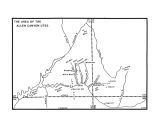 |
Area of the Allen Canyon Utes | | Image/StillImage |
| 51 |
 |
Black Hawk War 1865-72 | | Image/StillImage |
| 52 |
 |
Boundary of Shoshone Indian Territory | 1957 | Image/StillImage |
| 53 |
 |
Boundary of Shoshone Indian Territory according to Swanton, 1952 | 1952 | Image/StillImage |
| 54 |
 |
Boundary of Shoshone Indian Territory and Neighboring Tribes | 1957 | Image/StillImage |
| 55 |
 |
Boundary of Shoshone Indian Territory, Linguistic Boundaries of Shoshone and Bannock. | 1941 | Image/StillImage |
| 56 |
 |
Boundary of Shoshone Indian Territory, showing the locations of the Bannock | 1957 | Image/StillImage |
| 57 |
 |
Boundary of Shoshone Indian Territory, showing the locations of the Bannock from 1819 to 1951 | 1957 | Image/StillImage |
| 58 |
 |
Boundary of Shoshone Indian Territory, showing the locations where the Bannock and Shoshone reported together 1819-1956 | 1957 | Image/StillImage |
| 59 |
 |
Boundary of Shoshone Indian Territory; Doty Map of 1863 Indian Claims Commission | 1957 | Image/StillImage |
| 60 |
 |
Bureau of Indian Affairs | | Image/StillImage |
| 61 |
 |
Changes of Ute Territory 1868-1972 | | Text |
| 62 |
 |
Early Roads and Railroads circa 1895 | | Image/StillImage |
| 63 |
 |
Father Escalante's Map | 1941 | Text |
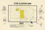
| 64 |
 |
Field Notes from Survey of Uintah Reservation | 1875-09-25 | Text |
| 65 |
 |
The Ghost dance Religion and the Sioux | | Text |
| 66 |
 |
Goshute Indian Reservation Nevada and Utah | | Image/StillImage |
| 67 |
 |
Goshute Skull Valley Reservation Geothermal Resources Map | 2004-01-14 | Image/StillImage |
| 68 |
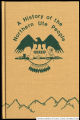 |
History of the Northern Ute People, A | 1982 | Text |
| 69 |
 |
Indian Names in Utah Geography | 1928; 1929; 1930; 1931; 1932; 1933 | Text |
| 70 |
 |
Journal of Two Campaigns by the Utah Territorial Militia Against the Navajo Indians, 1869 | 1961 | Text |
| 71 |
 |
Land Added to Confederated Ute Indian Reservation 1875-76 | | Text |
| 72 |
 |
Land Allotments, White Mesa | | Image/StillImage |
| 73 |
 |
Letter from Agent Byrnes to Commissioner of Indian Affairs John D.C. Atkins dated November 28, 1887 | 1887-11-28 | Text |
| 74 |
 |
Letter from Agent Robert Waugh to Commissioner of Indian Affairs T.J. Morgan dated July 30, 1892 | 1892-07-30 | Text |
| 75 |
 |
Letter from Brigham Young to the Commissioner of Indian Affairs dated June 28, 1853 | 1853-06-28 | Text |
| 76 |
 |
Letter to Commissioner of Indian Affairs J.T. Morgan from Agent Robert Waugh dated March 28, 1892 | 1892-03-28 | Text |
| 77 |
 |
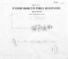
Map of a portion of the Uncompahgre Ute Indian Reservation | 1908 | Image/StillImage |
| 78 |
 |
Map of a portion of the Uncompahgre Ute Indian Reservation, surveyed and subdivided for allotments to the Uncompahgre Ute Indians in accordance with the Act approved June 1880 by authority of Honorable N. C. McFarland, Commissioner General Land Office Daniel G. Major U.S. Surveyor 1882-1883 | 1882; 1883 | Image/StillImage |
| 79 |
 |
Map of Chief Washakie's Hunting and Fighting Territory, prepare by Oscar Mosserly, 1930 | | Image/StillImage |
| 80 |
 |
Map of Dry Gulch Irrigation District, Uintah Indian Reservation, Utah | | Image/StillImage |
| 81 |
 |
Map of East Central Utah, Uintah Ouray Reservation, Utah Valley | | Image/StillImage |
| 82 |
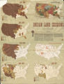 |
Map of Indian Land Cessions in the United States | | Image/StillImage |
| 83 |
 |
Map of Indian Reservation in the West, 1929 | | Image/StillImage |
| 84 |
 |
Map of Indian Reservation. 1884 | | Image/StillImage |
| 85 |
 |
Map of Indian Reservations in the Western United States | | Image/StillImage |
| 86 |
 |
Map of Indian Territory in the Western United States | | Image/StillImage |
| 87 |
 |
Map of Indian Tribes of North America | | Image/StillImage |
| 88 |
 |
Map of Navajo, Ute, and Jicarilla Apache Indian Reserves | | Image/StillImage |
| 89 |
 |
Map of North America and Original Inhabitants' Territory. | | Image/StillImage |
| 90 |
 |
Map of Northern Utah, Early Settlements | | Image/StillImage |
| 91 |
 |
Map of Part of the West Boundary of the Uncompahgre Ute Indian Reservation as Surveyed by William B. Dougall | | Image/StillImage |
| 92 |
 |
Map of Reservations of the Western United States and the Religions that Worked on the Reservations 1870's | 1873 | Image/StillImage |
| 93 |
 |
Map of Shoshone Indian Territory, and the Division of Shoshone Boundaries in Nevada | | Image/StillImage |
| 94 |
 |
Map of Shoshone Territory; Prepared by Doty, 1859 | | Image/StillImage |
| 95 |
 |
Map of Southern Colorado and the Ute Mountain Ute Reservation | | Image/StillImage |
| 96 |
 |
Map of Southern Ute Agencies | | Image/StillImage |
| 97 |
 |
Map of Stock Mining Claims in the Uintah Basin | | Image/StillImage |
| 98 |
 |
Map of the Four Corners Region and the Reservation of the Ute Mountain Ute Tribe | | Image/StillImage |
| 99 |
 |
Map of the Homelands of Northern Shoshone, 1863 | | Image/StillImage |
| 100 |
 |
Map of the Northern Part of the Former Uintah Indian Reservation Showing the Irrigation System | | Image/StillImage |
| 101 |
 |
Map of the original range of the Bannock Indians according to Bureau of Indian Affairs, 1952. | | Image/StillImage |
| 102 |
 |
Map of the Shoshone Tribes | | Image/StillImage |
| 103 |
 |
Map of the South West Boundary of the Uintah Indian Reserve Utah Territory. | | Image/StillImage |
| 104 |
 |
Map of the Southern Part of the Former Uintah Indian Reservation Showing the Irrigation System of Indian Allotments | | Image/StillImage |
| 105 |
 |
Map of the Uintah Basin and the Uintah Ouray Reservation | | Image/StillImage |
| 106 |
 |
Map of Uintah Basin and Fort Duchesne | | Image/StillImage |
| 107 |
 |
Map of Uintah Reservation. Green River Area | | Image/StillImage |
| 108 |
 |
Map of Uintah Valley Reserve, formed by order of President Abraham Lincoln, 1861. | | Image/StillImage |
| 109 |
 |
Map of Uncompahgre Ute Indian Reservation Boundaries, Sheet Number 1, 1889 | | Image/StillImage |
| 110 |
 |
Map of Uncompahgre Ute Indian Reservation Boundaries, Sheet Number 2, 1889 | | Image/StillImage |
| 111 |
 |
Map of Uncompahgre Ute Indian Reservation Boundaries, Sheet Number 3, 1889 | | Image/StillImage |
| 112 |
 |
Map of Uncompahgre Ute Indian Reservation Boundaries, Sheet Number 4, 1889 | | Image/StillImage |
| 113 |
 |
Map of Uncompahgre Ute Indian Reservation Boundaries, Sheet Number 5, 1889 | | Image/StillImage |
| 114 |
 |
Map of Uncompahgre Ute Indian Reservation Boundaries, Sheet Number 6, 1889 | | Image/StillImage |
| 115 |
 |
Map of Uncompahgre Ute Indian Reservation Boundaries, Sheet Number 7, 1889 | | Image/StillImage |
| 116 |
 |
Map of Uncompahgre Ute Indian Reservation Boundaries, Sheet Number 8, 1889 | | Image/StillImage |
| 117 |
 |
Map of Uncompahgre Ute reservation, Includes parcel divisions | | Image/StillImage |
| 118 |
 |
Map of Ute Reservation in Western Colorado, and Lands Ceded Over Time | 1882 | Image/StillImage |
| 119 |
 |
Map of Ute Territory by Band | | Image/StillImage |
| 120 |
 |
Map of Ute Territory in Utah and Colorado by Band Name and Location | | Image/StillImage |
| 121 |
 |
Map of Walker River Paiute Tribe Original Reservation Centennial 1874-1974 | 1874 | Image/StillImage |
| 122 |
 |
Map of Western Indian Territory Before 1850 | | Image/StillImage |
| 123 |
 |
Map of Western Shoshone and Northern Paiute Territory | | Image/StillImage |
| 124 |
 |
Map showing boundaries of Northern Paiute, Southern Paiute, Shoshone Bannock and Ute | | Image/StillImage |
| 125 |
 |
Map showing the boundary of the Shoshone Indian territory | 1941 | Image/StillImage |
| 126 |
 |
Map titled "Ute Bands Map" | | Image/StillImage |
| 127 |
 |
Map titled "Ute Lands, 1876" | | Image/StillImage |
| 128 |
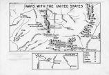 |
Map titled Wars with the United States | | Image/StillImage |
| 129 |
 |
Map titled, "Northern Ute Lands, 1905" | | Image/StillImage |
| 130 |
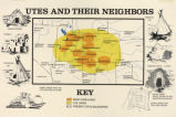 |
Map titled, "Utes and Their Neighbors" | | Image/StillImage |
| 131 |
 |
Map, [ca. 1953] | 1953 | Text |
| 132 |
 |
Meeker Incident | | Image/StillImage |
| 133 |
 |
Northern New Mexico Before 1846 | | Image/StillImage |
| 134 |
 |
Notes from St. Christopher's Mission, 1940's | 1940; 1941; 1942; 1942; 1943; 1944; 1945; 1946; 1947; 1948; 1949 | Text |
| 135 |
|
Notes on the History of the Southern Paiutes and Western Shoshonis | 1971 | Text |
| 136 |
 |
Opening of the Uncompahgre Reservation | | Image/StillImage |
| 137 |
 |
Pahute Indian Home Lands in 1850 | 1850 | Image/StillImage |
| 138 |
 |
Paiute Reservation Geothermal Resources Map | 2004-01-14 | Image/StillImage |
| 139 |
 |
Paiute Reservation Goethermal Resources Map | 2004-01-14 | Image/StillImage |
| 140 |
 |
The Paiute Strip | | Image/StillImage |
| 141 |
 |
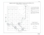
Partially Survayed Township 12th South, Range 19th West, Salt Lake Meridian_005 | | Image/StillImage |
| 142 |
 |
Pauite Reservation Wind Resource Map | 2004-01-14 | Image/StillImage |
| 143 |
 |
Pauite Reservation Wind Resource Map | 2004-01-14 | Image/StillImage |
| 144 |
|
Problems of Navajo Male Graduates of Intermountain School During Their First Year of Employment | 1959 | Text |
| 145 |
 |
Proposed Southern Ute Reservation Reservation 1879, 1889 | | Image/StillImage |
| 146 |
 |
Removal of the Colorado Utes to Utah | | Image/StillImage |
| 147 |
|
Report of a reconnaissance in the Ute country made in the year 1873, by Lieut. E. H. Ruffner, corps of engineers | 1873 | Image/StillImage |
| 148 |
 |
Reservation Boundary and General Land Status | | Image/StillImage |
| 149 |
 |
The Seasonal Movements of the Shoshone-Bannock Peoples | | Image/StillImage |
| 150 |
 |
Shoshone Bannock/ Northwestern Soshone Reservations Geothermal Resource Map | 2004-01-14 | Image/StillImage |
| 151 |
 |
Sketch of Uintah Ouray Agencies. | | Image/StillImage |
| 152 |
 |
Southern Paiute Bands | | Image/StillImage |
| 153 |
 |
St. Christopher's Newsletter dated June 1973 | 1973 | Text |
| 154 |
 |
State Maps | | Image/StillImage |
| 155 |
 |
Surface Management Responsibility_001 | | Image/StillImage |
| 156 |
 |
Surface Management Responsibility_002 | | Image/StillImage |
| 157 |
 |
Telegraph from Nevada Territorial Governor J.W. Nye to Superintendent Doty dtd January 24, 1862 | 1862-01-24 | Text |
| 158 |
 |
Third Annual Report of the Board of Indian Commissioners | 1872 | Image/StillImage |
| 159 |
 |
Tintic War 1856 | | Image/StillImage |
| 160 |
 |
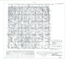
Township 12th South, Range 19th West, Salt Lake Meridian_001 | | Image/StillImage |
| 161 |
 |
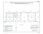
Township 12th South, Range 19th West, Salt Lake Meridian_002 | | Image/StillImage |
| 162 |
 |
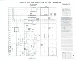
Township 12th South, Range 19th West, Salt Lake Meridian_003 | | Image/StillImage |
| 163 |
 |
Township 12th South, Range 19th West, Salt Lake Meridian_004 | | Image/StillImage |
| 164 |
 |
Township 13th South, Range 19th West, Salt Lake Meridian_001 | | Image/StillImage |
| 165 |
 |
Township 13th South, Range 19th West, Salt Lake Meridian_002 | | Image/StillImage |
| 166 |
 |
Township 13th South, Range 19th West, Salt Lake Meridian_003 | | Image/StillImage |
| 167 |
 |
Township 9th South, Range 19th West, Salt Lake Meridian_001 | | Image/StillImage |
| 168 |
 |
Township 9th South, Range 19th West, Salt Lake Meridian_002 | | Image/StillImage |
| 169 |
 |
Township 9th South, Range 19th West, Salt Lake Meridian_003 | | Image/StillImage |
| 170 |
 |
Transportation Routes in the Uintah Basin to 1910 | | Text |
| 171 |
 |
Trappers and Traders in Ute Lands 1820-1844 | | Image/StillImage |
| 172 |
 |
Uinta Indian Reservation Utah, under act of March 3, 1905 and President's Proclamation dated July 14, 1905 | | Image/StillImage |
| 173 |
 |
Uintah & Ouray Reservation Geothermal Map | 2004-01-13 | Image/StillImage |
| 174 |
 |
Uintah & Ouray Reservation Geothermal Map | 2004-01-13 | Image/StillImage |
| 175 |
 |
Uintah & Ouray Reservation Report from the U.S. Dept. of Energy | 2007-08-01 | Text |
| 176 |
 |
Uintah & Ouray Wind Resources Map | 2004-01-13 | Image/StillImage |
| 177 |
|
Uintah & Ouray Wind Resources Map | 2004-01-09 | Image/StillImage |
| 178 |
 |
Uintah Basin Replacement Project March 1995 | 1995-03-10 | Image/StillImage |
| 179 |
 |
Uintah Indian Reservation and the Three Band Divisions 1903. | 1903 | Image/StillImage |
| 180 |
 |
Uintah Indian Reservation Boundaries Sheet Number 4 | | Image/StillImage |
| 181 |
 |
Uintah Indian Reservation Boundaries; Sheet Number 1 | | Image/StillImage |
| 182 |
 |
Uintah Indian Reservation Boundaries; Sheet Number 2 | | Image/StillImage |
| 183 |
 |
Uintah Indian Reservation Boundaries; Sheet Number 3 | | Image/StillImage |
| 184 |
 |
Uintah Indian Reservation Boundaries; Sheet Number 5 | | Image/StillImage |
| 185 |
 |
Uintah Unit Alernative No. 4 Coyote Basin Alternative | | Image/StillImage |
| 186 |
|
Uintah Unit Alernative No. 4 Coyote Basin Alternative | | Text |
| 187 |
 |
Uintah Unit Alternative No. 1 Lower Uinta Alternative | | Text |
| 188 |
 |
Upalco Unit Alternative No. 8 Twin Pots Alternative | | Image/StillImage |
| 189 |
|
Upalco Unit Alternative No. 8 Twin Pots Alternative | 1995-01 | Text |
| 190 |
 |
Ute Indian Reservations in Utah Territory | | Image/StillImage |
| 191 |
|
Ute Indians: Before and after White Contact | 1966 | Text |
| 192 |
 |
Ute Lands, 1868 | | Image/StillImage |
| 193 |
 |
Ute-White Relations in Colorado and New Mexico 1848-1855 | | Image/StillImage |
| 194 |
 |
Ute-White Relations in Utah 1847-1850 | | Image/StillImage |
| 195 |
 |
The Utes Journey to South Dakota 1906-1908 | | Image/StillImage |
| 196 |
 |
Walker War Map 1853-1854 | | Image/StillImage |
| 197 |
 |
We Shall Remain: Utah Indian Elementary Curriculum Guide - Fourth Grade Assessment | 2009 | Text |
| 198 |
 |
We Shall Remain: Utah Indian Elementary Curriculum Guide; 4th Grade | 2009 | Text |
| 199 |
|
We Shall Remain: Utah Indian High School Curriculum Guide | 2009 | Text |
| 200 |
|
We Shall Remain: Utah Indian Junior High Curriculum Guide | 2009 | Text |