TO
Filters: Collection: "ir_etd" Type: "Image"
1 - 200 of 169
| Author | Title | Subject | Date | Publication Type | ||
|---|---|---|---|---|---|---|
| 1 |
 | Parr, Clayton Joseph | A study of primary sedimentary structures around the Moab anticline, Grand County, Utah (Google Earth map overlay KMZ file) | Geology; Utah; Grand County | 1965-08 | map |
| 2 |
 | Parr, Clayton Joseph | A study of primary sedimentary structures around the Moab anticline, Grand County, Utah (Thesis and maps) | Geology; Utah; Grand County | 1965-08 | thesis |
| 3 |
 | Parr, Clayton Joseph | A study of primary sedimentary structures around the Moab anticline, Grand County, Utah: Georeferenced map files | Geology; Utah; Grand County | 1965-08 | thesis |
| 4 |
 | Brooke, John Percival | Alteration and trace elements of volcanics in the San Francisco Mountains | Mineralogy; Utah; Beaver County; Geochemistry; Ore deposits; Thesis and dissertation georeferencing project | 1964-06 | thesis |
| 5 |
 | Brooke, John Percival | Alteration and trace elements of volcanics in the San Francisco Mountains (Google Earth map overlay KMZ file) | Mineralogy; Utah; Beaver County; Geochemistry; Ore deposits; Thesis and dissertation georeferencing project | 1964-06 | map |
| 6 |
 | Brooke, John Percival | Alteration and trace elements of volcanics in the San Francisco Mountains: Georeferenced map files | Thesis and dissertation georeferencing project | 1964-06 | thesis |
| 7 |
 | Wood, William James | Areal geology of the Coalville vicinity, Summit County, Utah | Geology; Utah; Coalville region | 1953-06 | thesis |
| 8 |
 | Wood, William James | Areal geology of the Coalville vicinity, Summit County, Utah (Google Earth map overlay KMZ file) | Geology; Utah; Coalville region; Thesis and dissertation georeferencing project | 1953-06 | map |
| 9 |
 | Wood, William James | Areal geology of the Coalville vicinity, Summit County, Utah: Georeferenced map files | Geology; Utah; Coalville region | 1953-06 | thesis |
| 10 |
 | Stark, Norman Paul | Areal geology of the Upton region, Summit County, Utah-Maps | Geology; Utah; upton area | 1953-06 | thesis |
| 11 |
 | Stark, Norman Paul | Areal geology of the Upton Region, Summit County, Utah: Georeferenced map files | Geology -- Utah -- Upton area; Summit County; Coalville region | 1953-06 | thesis |
| 12 |
 | O'Neill, Kelly | Bifurcate: Intersections and Photography | Fine arts; photography | 2015-04 | honors thesis |
| 13 |
 | Metcalf, Matt | Campus planning: axes, vistas and organizational views | 2011 | thesis | |
| 14 |
 | Mann, Daven Craig | Clastic laramide sediments of the Wasatch Hinterland, Northeastern Utah (Thesis and maps) | Sediments (Geology); Utah; Wasatch Hinterland | 1974 | thesis |
| 15 |
 | Mann, Daven Craig | Clastic laramide sediments of the Wasatch Hinterland, Northeastern Utah: Georeferenced map files | Sediments (Geology); Utah; Wasatch Hinterland | 1974 | thesis |
| 16 |
 | Rodriguez, Enrique Levy | Economic geology of the sulphur deposits at Sulphurdale, Utah-Maps | 1960-08 | thesis | |
| 17 |
 | Rodriguez, Enrique Levy | Economic geology of the sulphur deposits at Sulphurdale, Utah: Georeferenced map files | Geology, Economic -- Utah -- Sulphurdale; Mines and mineral resources -- Utah -- Sulphurdale; Sulphur mines and mining -- Utah -- Sulphurdale | 1960-08 | thesis |
| 18 |
 | Gates, Joseph S. | Figure 4: Longitudinal profile of Middle Canyon showing locations of the profiles across the canyon, the nickpoint, and the hypothetical profile before rejuvenation | Thesis and dissertation georeferencing project | 1960-08 | thesis |
| 19 |
 | Carter, Eric Jeffery | Final graduate design studio | 2011 | thesis | |
| 20 |
 | Arrington, Josh | Final Studio: Princeton University | 2011 | thesis | |
| 21 |
 | Baker, Walker Holcombe | Geologic setting and origin of the Grouse Creek pluton, Box Elder County, Utah-Maps | Geology--Utah | 1959-06 | thesis |
| 22 |
 | Baker, Walker Holcombe | Geologic setting and origin of the Grouse Creek pluton, Box Elder County, Utah: Georeferenced map files | Geology--Utah | 1959-06 | thesis |
| 23 |
 | Doyuran, Vedat | Geology and ground-water resources of Ogden Valley, Utah | Geology -- Utah -- Ogden Valley; Groundwater -- Utah -- Ogden Valley; Thesis and dissertation georeferencing project | 1972-06 | thesis |
| 24 |
 | Blue, Donald McCoy | Geology and ore deposits of the Lucin Mining District, Box Elder County, Utah and Elko County, Nevada: Georeferenced map files | 1960-08 | thesis | |
| 25 |
 | Blue, Donald McCoy | Geology and ore deposits of the lucin mining district, Box Elder County, Utah, and Elko County, Nevada-Maps | 1960-08 | thesis | |
| 26 |
 | Chapusa, Frank W. P. | Geology and structure of Stansbury Island (Thesis and maps) | Geology; Utah; Stansbury Island | 1969-06 | thesis |
| 27 |
 | Chapusa, Frank W. P. | Geology and structure of Stansbury Island: Georeferenced map files | Geology; Utah; Stansbury Island | 1969-06 | thesis |
| 28 |
 | Morris, Elliot Cobia | Geology of the Big Piney area, Summit County, Utah | Geology -- Utah -- Summit County | 1953-06 | thesis |
| 29 |
 | Morris, Elliot Cobia | Geology of the Big Piney area, Summit County, Utah: Georeferenced map files | Geology -- Utah -- Summit County | 1953-06 | thesis |
| 30 |
 | Maurer, Robert Eugene | Geology of the Cedar Mountains,Tooele County, Utah (Thesis and maps) | Geology; Utah; Tooele County; Geology; Utah; Cedar Mountains; Thesis and dissertation dereferencing project | 1970-06 | thesis |
| 31 |
 | Schaeffer, Frederick Ernst Jr. | Geology of the Central and Southern silver Island Mountains Tooele County, Utah and Elko County, Nevada-Maps | Geology -- Utah -- Silver Island Mountains | 1961-06 | thesis |
| 32 |
 | Schaeffer, Jr. Frederick Ernst | Geology of the Central and Southern Silver Island Mountains Tooele County, Utah and Elko County, Nevada: Georeferenced map files | 1961-06 | thesis | |
| 33 |
 | Earll, Fred Nelson | Geology of the Central Mineral Range, Beaver County, Utah | Geology -- Utah -- Mineral Mountains; Beaver County | 1957-08 | thesis |
| 34 |
 | Earll, Fred Nelson | Geology of the Central Mineral Range, Beaver County, Utah (Google Earth map overlay KMZ file) | Geology -- Utah -- Mineral Mountains; Beaver County; Thesis and dissertation georeferencing project | 1957-08 | map |
| 35 |
 | Earll, Fred Nelson | Geology of the Central Mineral Range, Beaver County, Utah: Georeferenced map files | Geology -- Utah -- Mineral Mountains; Beaver County | 1957-08 | thesis |
| 36 |
 | Zimmerman, James T. | Geology of the Cove Creek area Millard County and Beaver County, Utah | Geology; Utah; Cove Creek area; Thesis and dissertation georeferencing project | 1961-06 | thesis |
| 37 |
 | Harrill, James Reece | Geology of the Davis Knolls and northern Big Davis Mountain area, Tooele County, Utah | Geology -- Utah -- Tooele County; Thesis and dissertation georeferencing project | 1962-08 | thesis |
| 38 |
 | Harrill, James Reece | Geology of the Davis Knolls and northern Big Davis Mountain area, Tooele County, Utah (Google Earth map overlay KMZ file) | Geology -- Utah -- Tooele County; Thesis and dissertation georeferencing project | 1962-08 | map |
| 39 |
 | Harrill, James Reece | Geology of the Davis Knolls and northern Big Davis Mountain area, Tooele County, Utah: Georeferenced map files | Geology -- Utah -- Tooele County | 1962-08 | thesis |
| 40 |
 | Egbert, Robert L. | Geology of the East Canyon area, Morgan County, Utah | Geology -- Utah -- Morgan County; Thesis and dissertation georeferencing project | 1954 | thesis |
| 41 |
 | O'Toole, Walter L. | Geology of the Keetley-Kamas volcanic area | Geology; Utah; Summit County; Wasatch County | 1951 | thesis |
| 42 |
 | O'Toole, Walter L. | Geology of the Keetley-Kamas volcanic area (Google Earth map overlay KMZ file) | Geology; Utah; Summit County; Wasatch County; Thesis and dissertation georeferencing project | 1951 | map |
| 43 |
 | O'Toole, Walter L. | Geology of the Keetley-Kamas volcanic area: Georeferenced map files | Geology; Utah; Summit County; Wasatch County | 1951 | thesis |
| 44 |
 | Madsen, James Henry Jr. | Geology of the Lost Creek-Echo Canyon Area, Morgan and Summit Counties, Utah | Geology -- Utah -- Morgan County; Geology -- Utah -- Summit County; Thesis and dissertation georeferencing project | 1959-06 | thesis |
| 45 |
 | Paddock, Robert Edwards | Geology of the Newfoundland Mountains, Box Elder County, Utah | Geology; Utah; Newfoundland Mountains; Box Elder County | 1956-12 | thesis |
| 46 |
 | Paddock, Robert Edwards | Geology of the Newfoundland Mountains, Box Elder County, Utah: Georeferenced map files | Geology; Utah; Newfoundland Mountains; Box Elder County | 1956-12 | thesis |
| 47 |
 | Doelling, Hellmut H. | Geology of the Northern Lakeside Mountains and the Grassy Mountains and vicinity, Tooele and Box Elder Counties, Utah | Geology -- Utah -- Tooele County; Geology -- Utah -- Box Elder County; Geology -- Utah -- Grassy Mountains -- Maps; Geology -- Utah -- Lakeside Mountains -- Maps | 1964-06 | thesis |
| 48 |
 | Doelling, Hellmut H. | Geology of the Northern Lakeside Mountains and the Grassy Mountains and vicinity, Tooele and Box Elder Counties, Utah (Google Earth map overlay KMZ file) | Geology -- Utah -- Tooele County; Geology -- Utah -- Box Elder County; Geology -- Utah -- Grassy Mountains -- Maps; Geology -- Utah -- Lakeside Mountains -- Maps; Thesis and dissertation georeferencing project | 1964-06 | map |
| 49 |
 | Doelling, Hellmut H. | Geology of the Northern Lakeside Mountains and the Grassy Mountains and vicinity, Tooele and Box Elder Counties, Utah: Georeferenced map files | Geology -- Utah -- Tooele County; Geology -- Utah -- Box Elder County; Geology -- Utah -- Grassy Mountains -- Maps; Geology -- Utah -- Lakeside Mountains -- Maps | 1964-06 | thesis |
| 50 |
 | Anderson, Warren L. | Geology of the Northern Silver Island Mountains, Box Elder and Tooele Counties, Utah | Geology; Utah; Silver Island Mountains | 1957-06 | thesis |
| 51 |
 | Anderson, Warren L. | Geology of the Northern Silver Island Mountains, Box Elder and Tooele Counties, Utah (Google Earth map overlay KMZ file) | Geology; Utah; Silver Island Mountains; Thesis and dissertation georeferencing project | 1957-06 | thesis |
| 52 |
 | Anderson, Warren L. | Geology of the northern Silver Island Mountains, Box Elder and Tooele Counties, Utah: Georeferenced maps | Geology; Utah; Silver Island Mountains | 1957-06 | thesis |
| 53 |
 | Blakey, Ronald Clyde | Geology of the Paria Northwest quadrangle Kane County, Utah (Google Earth map overlay KMZ file) | Geology -- Utah -- Kane County -- Paria Northwest quadrangle; Thesis and dissertation georeferencing project | 1970-08 | map |
| 54 |
 | Blakey, Ronald Clyde | Geology of the Paria Northwest quadrangle Kane County, Utah-Maps | Geology -- Utah -- Kane County -- Paria Northwest quadrangle | 1970-08 | thesis |
| 55 |
 | Blakey, Ronald Clyde | Geology of the Paria Northwest quadrangle, Kane County, Utah: Georeferenced map files | Geology -- Utah -- Kane County -- Paria Northwest quadrangle | 1970-08 | thesis |
| 56 |
 | Staub, Ann Marie | Geology of the Picture Rock Hills quadrangle, Southwestern Keg Mountains, Juab County, Utah (Google Earth map overlay KMZ file) | Geology; Utah; Juab County | 1975 | map |
| 57 |
 | Staub, Ann Marie | Geology of the Picture Rock Hills quadrangle, Southwestern Keg Mountains, Juab County, Utah (Thesis and maps) | Geology; Utah; Juab County | 1975 | thesis |
| 58 |
 | Staub, Ann Marie | Geology of the Picture Rock Hills quadrangle, Southwestern Keg Mountains, Juab County, Utah: Georeferenced map files | Geology; Utah; Juab County | 1975 | thesis |
| 59 |
 | Cohenour, Robert E. | Geology of the Sheeprock Mountains, Tooele and Juab Counties, Utah | Geology -- Utah -- Sheeprock Mountains; Geology -- Utah -- Tooele County; Geology -- Utah -- Juab County; Thesis and dissertation georeferencing project | 1957-08 | thesis |
| 60 |
 | Cohenour, Robert E. | Geology of the Sheeprock Mountains, Tooele and Juab Counties, Utah: Georeferenced map files | Geology -- Utah -- Sheeprock Mountains; Geology -- Utah -- Tooele County; Geology -- Utah -- Juab County | 1957-08 | thesis |
| 61 |
 | Root, Robert L. | Geology of the Smith and Morehouse-Hayden Fork area, Utah | Geology; Utah; Summit County; Thesis and dissertation georeferencing project | 1952 | thesis |
| 62 |
 | Hooper, Warren G. | Geology of the Smith and Morehouse-South Fork Area, Utah: Georeferenced map files | Geology -- Uinta Mountains (Utah and Wyo.) | 1951 | thesis |
| 63 |
 | Moussa, Mounir Tawfik | Geology of the Soldier Summit quadrangle, Utah (Thesis and maps) | Geology; Utah; Utah County; Carbon County; Wasatch County | 1965-06 | thesis |
| 64 |
 | Moussa, Mounir Tawfik | Geology of the Soldier Summit quadrangle, Utah: Georeferenced map files | Geology; Utah; Utah County; Carbon County; Wasatch County | 1965-06 | thesis |
| 65 |
 | Stifel, Peter Beekman | Geology of the Terrace and Hogup Mountains, Box Elder County, Utah | Geology -- Utah -- Box Elder County | 1964-06 | thesis |
| 66 |
 | Stifel, Peter Beekman | Geology of the Terrace and Hogup Mountains, Box Elder County, Utah (Google Earth map overlay KMZ file) | Geology -- Utah -- Box Elder County | 1964-06 | map |
| 67 |
 | Stifel, Peter Beekman | Geology of the Terrace and Hogup Mountains, Box Elder County, Utah (Maps) | Geology -- Utah -- Box Elder County | 1964-06 | map |
| 68 |
 | Stifel, Peter Beekman | Geology of the Terrace and Hogup Mountains, Box Elder County, Utah: Georeferenced map files | Geology -- Utah -- Box Elder County | 1964-06 | thesis |
| 69 |
 | Eriksson, Yves | Geology of the upper Ogden Canyon, Weber County, Utah | Geology -- Utah -- Weber County | 1960-06 | thesis |
| 70 |
 | Eriksson, Yves | Geology of the upper Ogden Canyon, Weber County, Utah: Georeferenced map files | Geology -- Utah -- Weber County | 1960-06 | thesis |
| 71 |
 | Mount, Donald Lee | Geology of the Wanship - Park City Region, Utah: Georeferenced map files | Geology -- Utah -- Summit County | 1952-06 | thesis |
| 72 |
 | Gardner, Weston Clive | Geology of the West Tintic mining district and vicinity, Juab County, Utah | Geology -- Utah -- Juab County -- Tintic Mining District; Thesis and dissertation georeferencing project | 1954-06 | thesis |
| 73 |
 | Nye, Matthew | Graduate student housing-Princeton | 2011 | thesis | |
| 74 |
 | Stouffer, Stephen Gerald | Landslides in the Coal Hill area, Kane County, Utah (Google Earth map overlay KMZ file) | Landslides -- Utah -- Kane County; Geology -- Utah -- Kane County | 1964-06 | map |
| 75 |
 | Stouffer, Stephen Gerald | Landslides in the Coal Hill area, Kane County, Utah (Thesis and maps) | Landslides -- Utah -- Kane County; Geology -- Utah -- Kane County | 1964-06 | thesis |
| 76 |
 | Stouffer, Stephen Gerald | Landslides in the Coal Hill area, Kane County, Utah: Georeferenced map files | Landslides -- Utah -- Kane County; Geology -- Utah -- Kane County | 1964-06 | thesis |
| 77 |
 | Morris, Elliot Cobia | Map 1 Geologic map and sections of Big Piney Area, Utah (Google Earth map overlay KMZ file) | Geology -- Utah -- Summit County | 1953-06 | thesis |
| 78 |
 | Condie, Kent C. | Map 1 Geologic map of the Mineral Range, Utah (Google Earth map overlay KMZ file) | Petrology -- Utah -- Beaver County; Millard County; Geology -- Utah -- Beaver County; Millard County; Mineral Range (Utah); Thesis and dissertation georeferencing project | 1960-06 | thesis |
| 79 |
 | Moussa, Mounir Tawfik | Map 1 Geologic map of the Soldier Summit Quadrangle, Utah (Google Earth map overlay KMZ file) | Geology; Utah; Utah County; Carbon County; Wasatch County | 1965-06 | thesis |
| 80 |
 | Eriksson, Yves | Map 1 Geology of the upper Ogden Canyon, Weber County, Utah (Google Earth map overlay KMZ file) | Geology -- Utah -- Weber County; Thesis and dissertation georeferencing project | 1960-06 | thesis |
| 81 |
 | Amin, Surendra R. | Map 1: Geologic map of Antelope intrusive and vicinity | 1950 | thesis | |
| 82 |
 | Amin, Surendra R. | Map 1: Geologic map of Antelope intrusive and vicinity (Google Earth map overlay KMZ file) | Thesis and dissertation georeferencing project | 1950 | map |
| 83 |
 | Paddock, Robert Edwards | Map1 Geologic map and sections of Newfoundland Mountains, Box Elder County, Utah (Google Earth map overlay KMZ file) | Geology; Utah; Newfoundland Mountains; Box Elder County; Thesis and dissertation georeferencing project | 1956-12 | thesis |
| 84 |
 | Root, Robert L. | Map1 Geologic map and sections of Smith and Morehouse-Hayden Fork area, Utah (Google Earth map overlay KMZ file) | Geology; Utah; Summit County; Thesis and dissertation georeferencing project | 1952 | thesis |
| 85 |
 | Thomson, Kenneth Clair | Mineral deposits of the Deep Creek Mountains, Tooele and Juab Counties, Utah (Google Earth map overlay KMZ file) | Mines and mineral resources -- Utah -- Deep Creek Mountains | 1970-08 | map |
| 86 |
 | Thomson, Kenneth Clair | Mineral deposits of the Deep Creek Mountains, Tooele and Juab Counties, Utah (Thesis and maps) | Mines and mineral resources -- Utah -- Deep Creek Mountains | 1970-08 | thesis |
| 87 |
 | Thomson, Kenneth Clair | Mineral deposits of the Deep Creek Mountains, Tooele and Juab Counties, Utah: Georeferenced map files | Mines and mineral resources -- Utah -- Deep Creek Mountains | 1970-08 | thesis |
| 88 |
 | Temple, Dennis Charles | Mount Ogden granite (Thesis and maps) | Granite; Utah; Mount Ogden; Geology; Stratigraphic; Precambrian ; Rocks; Crystalline; Metamorphic | 1969-06 | thesis |
| 89 |
 | Temple, Dennis Charles | Mount Ogden granite: Georeferenced map files | Granite; Utah; Mount Ogden; Geology; Stratigraphic; Precambrian ; Rocks; Crystalline; Metamorphic | 1969-06 | thesis |
| 90 |
 | Wright, Heather | Not for sale: human trafficking awareness center, New York City highline | 2011 | thesis | |
| 91 |
 | Soto, Melina | NYC highline hip hop center | 2011 | thesis | |
| 92 |
 | Dalness, William Michael | Parunuweap formation in the vicinity of Zion National Park, Utah (Google Earth map overlay KMZ file) | Thesis and dissertation georeferencing project | 1969-06 | map |
| 93 |
 | Dalness, William Michael | Parunuweap formation in the vicinity of Zion National Park, Utah-Maps | 1969-06 | thesis | |
| 94 |
 | Dalness, William Michael | Parunuweap formation in the vicinity of Zion National Park, Utah: Georeferenced map files | 1969-06 | thesis | |
| 95 |
 | Condie, Kent C. | Petrogeneis of the Mineral Range Pluton, Southwestern Utah | Petrology -- Utah -- Beaver County; Millard County; Geology -- Utah -- Beaver County; Millard County; Mineral Range (Utah) | 1960-06 | thesis |
| 96 |
 | Condie, Kent C. | Petrogeneis of the Mineral Range Pluton, Southwestern Utah: Georeferenced map files | Petrology -- Utah -- Beaver County; Millard County; Geology -- Utah -- Beaver County; Millard County; Mineral Range (Utah) | 1960-06 | thesis |
| 97 |
 | Neff, Thomas Rodney | Petrology and structure of the little willow series, Wasatch Mountains, Utah (Google Earth map overlay KMZ file) | Petrology -- Utah -- Wasatch Mountains; Thesis and dissertation georeferencing project | 1962-11 | map |
| 98 |
 | Neff, Thomas Rodney | Petrology and structure of the Little Willow Series, Wasatch Mountains, Utah-Maps | Petrology -- Utah -- Wasatch Mountains | 1962-11 | thesis |
| 99 |
 | Neff, Thomas Rodney | Petrology and structure of the little willow series, Wasatch Mountains, Utah: Georeferenced map files | Petrology -- Utah -- Wasatch Mountains | 1962-11 | thesis |
| 100 |
 | Vlam, Heber Adolf Arien | Petrology of Lake Bonneville Gravels Salt Lake County, Utah | Petrology; Utah; Salt Lake County; Bonneville; Thesis and dissertation georeferencing project | 1963-05 | thesis |
| 101 |
 | Vlam, Heber Adolf Arien | Petrology of Lake Bonneville Gravels Salt Lake County, Utah (Google Earth map overlay KMZ file) | Petrology; Utah; Salt Lake County; Bonneville; Lake; Thesis and dissertation georeferencing project | 1963-05 | map |
| 102 |
 | Vlam, Heber Adolf Arien | Petrology of Lake Bonneville Gravels Salt Lake County, Utah: Georeferenced map files | Petrology; Utah; Salt Lake County; Bonneville; Lake | 1963-05 | thesis |
| 103 |
 | Smith, Hugh Preston | Plate 1 Fence diagram Moenkopi group (Google Earth map overlay KMZ file) | Geology; Utah; Thaynes Formation; Moenkopi group | 1969-06 | thesis |
| 104 |
 | Mann, Daven Craig | Plate 1 Generalized geologic map of the Laramide orogenic sediments of the Wasatch Hinterland (Google Earth map overlay KMZ file) | Sediments (Geology); Utah; Wasatch Hinterland | 1974 | thesis |
| 105 |
 | Chapusa, Frank W. P. | Plate 1 Geologic map of Stansbury Island, Tooele County, Utah (Google Earth map overlay KMZ file) | Geology; Utah; Stansbury Island | 1969-06 | thesis |
| 106 |
 | Cohenour, Robert E. | Plate 1 Geologic map of the Sheeprock Mountains area, Utah (Google Earth map overlay KMZ file) | Geology -- Utah -- Sheeprock Mountains; Geology -- Utah -- Tooele County; Geology -- Utah -- Juab County; Thesis and dissertation georeferencing project | 1957-08 | thesis |
| 107 |
 | Rodriguez, Enrique Levy | Plate 1: Geologic map and vertical cross section of the Sulphurdale sulphur deposits, Beaver and Millard Counties, Utah | 1960-08 | thesis | |
| 108 |
 | Rodriguez, Enrique Levy | Plate 1: Geologic map and vertical cross section of the Sulphurdale sulphur deposits, Beaver and Millard Counties, Utah (Google Earth map overlay KMZ file) | Geology, Economic -- Utah -- Sulphurdale; Mines and mineral resources -- Utah -- Sulphurdale; Sulphur mines and mining -- Utah -- Sulphurdale; Thesis and dissertation georeferencing project | 1960-08 | thesis |
| 109 |
 | Brox, George Stanley | Plate 1: Geologic map of Northern Bryce Canyon National Park | 1961-06 | thesis | |
| 110 |
 | Neff, Thomas Rodney | Plate 1: Geologic map of the Little Willow Series, Wasatch Mountains, Utah | 1962-11 | thesis | |
| 111 |
 | Boschetto, Harold Bradley | Plate 1: Geologic map of the Lothidok Range, Kenya | Geology; Kenya; Lothidok Range | 1988-08 | map |
| 112 |
 | Blakey, Ronald Clyde | Plate 1: Geologic map of the Paria NW quadrangle, Kane County, Utah | 1970-08 | thesis | |
| 113 |
 | Baker, Walker Holcombe | Plate 1: Geologic map of the Southern Grouse Creek Mountains, Box Elder County, Utah (Google Earth map overlay KMZ file) | Geology--Utah; Thesis and dissertation georeferencing project | 1959-06 | thesis |
| 114 |
 | Sadeghi, Ali Reza | Plate 1: Geologic map of the Willard Peak area, North-Central Wasatch Mountains, Utah | 1972-12 | thesis | |
| 115 |
 | Sadeghi, Ali Reza | Plate 1: Geologic map of the Willard Peak area, North-Central Wasatch Mountains, Utah (Google Earth map overlay KMZ file) | Geology -- Structural -- Utah -- Willard Peak area; Thesis and dissertation georeferencing project | 1972-12 | thesis |
| 116 |
 | Blue, Donald McCoy | Plate 1: Lucin mining district and vicinity, Northern Pilot Range, Box Elder County, Utah - Elko County, Nevada (Google Earth map overlay KMZ file) | Thesis and dissertation georeferencing project | 1960-08 | thesis |
| 117 |
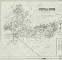 | Schaeffer, Frederick Ernst Jr. | Plate 1B: Geologic map of the Central and Southern Silver Island Mountains, Box Elder and Tooele Counties, Utah, and Elko County, Nevada | 1961-06 | thesis | |
| 118 |
 | Schaeffer, Jr. Frederick Ernst | Plate 1B: Geologic map of the Central and Southern Silver Island Mountains, Box Elder and Tooele Counties, Utah, and Elko County, Nevada (Google Earth map overlay KMZ file) | Thesis and dissertation georeferencing project | 1961-06 | thesis |
| 119 |
 | Schaeffer, Frederick Ernst Jr. | Plate 1C: Geologic cross sections of the Central and Southern Silver Island Mountains, Box Elder and Tooele Counties, Utah and Elko County, Nevada | 1961-06 | thesis | |
| 120 |
 | Johnson, Eric Henry | Plate 2 Topography, resistivity, and chargeability cross-sections along dipole-dipole line 1 on Fumarole Butte | Basalt -- Utah; Geothermal resources -- Utah | 1975-08 | thesis |
| 121 |
 | Baker, Walker Holcombe | Plate 2: Cross-section A-A' | 1959-06 | thesis | |
| 122 |
 | Rodriguez, Enrique Levy | Plate 2: Detailed geologic and vertical cross sections map of the Excelsior Orebody and New York Prospect Pit, Millard County, Utah | 1960-08 | thesis | |
| 123 |
 | Neff, Thomas Rodney | Plate 2: Sections along line A-A' and B-B' | 1962-11 | thesis | |
| 124 |
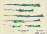 | Blakey, Ronald Clyde | Plate 2: Structural sections | 1970-08 | thesis | |
| 125 |
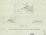 | Sadeghi, Ali Reza | Plate 2: Structure sections for geologic map of the Willard Peak area | 1972-12 | thesis | |
| 126 |
 | Hooper, Warren G. | Plate 3 Geologic map of portion of Northwestern Uinta Mountains, Utah (Google Earth map overlay KMZ file) | Geology -- Uinta Mountains (Utah and Wyo.); Thesis and dissertation georeferencing project | 1951 | thesis |
| 127 |
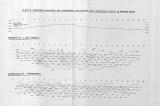 | Johnson, Eric Henry | Plate 3 Topography, resistivity, and chargeability cross-sections along dipole-dipole line 2 on Fumarole Butte | Basalt -- Utah; Geothermal resources -- Utah | 1975-08 | thesis |
| 128 |
 | Baker, Walker Holcombe | Plate 3: Cross-section B-B' | 1959-06 | thesis | |
| 129 |
 | Rodriguez, Enrique Levy | Plate 3: Detailed geologic and vertical cross section map of the Prince Albert Orebody, Mariposa and Queen Victoria Prospect Pits, Millard County, Utah | 1960-08 | thesis | |
| 130 |
 | Mount, Donald Lee | Plate 3: Geologic map and sections of Wanship-Park City region, Utah | 1952-06 | thesis | |
| 131 |
 | Mount, Donald Lee | Plate 3: Geologic map and sections of Wanship-Park City region, Utah (Google Earth map overlay KMZ file) | Geology -- Utah -- Summit County | 1952-06 | thesis |
| 132 |
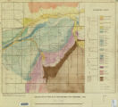 | Hooper, Warren G. | Plate 3: Geologic map of portion of Northwestern Uinta Mountains, Utah | 1951 | thesis | |
| 133 |
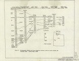 | Sadeghi, Ali Reza | Plate 3: Palinspastic middle and upper Cambrian columnar sections from western and northern Utah | 1972-12 | thesis | |
| 134 |
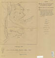 | Neff, Thomas Rodney | Plate 3: Structural map of the Little Willow Series, Wasatch Mountains, Utah | 1962-11 | thesis | |
| 135 |
 | Blakey, Ronald Clyde | Plate 3: Structural map of the Paria NW quadrangle, Kane County, Utah | 1970-08 | thesis | |
| 136 |
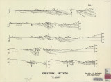 | Blakey, Ronald Clyde | Plate 3: Structural sections | 1970-08 | thesis | |
| 137 |
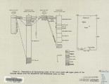 | Sadeghi, Ali Reza | Plate 4: Correlation of Precambrian rocks of the lower plate and upper plate of the Willard thrust with the Huntsville and Cottonwood areas | 1972-12 | thesis | |
| 138 |
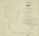 | Rodriguez, Enrique Levy | Plate 4: Detailed map showing diamond drill hole locations and vertical cross sections of the Sulphurdale Orebody, Beaver County, Utah | 1960-08 | thesis | |
| 139 |
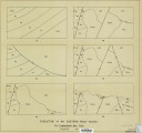 | Baker, Walker Holcombe | Plate 4: Evolution of the eastern fault block | 1959-06 | thesis | |
| 140 |
 | Neff, Thomas Rodney | Plate 4: Map variations of the Little Willow Series, Wasatch Mountains, Utah | 1962-11 | thesis | |
| 141 |
 | Blakey, Ronald Clyde | Plate 4: Topographic features of the Paria NW quadrangle, Kane County, Utah | 1970-08 | thesis | |
| 142 |
 | Stark, Norman Paul | Plate 5: Geologic map of the Upton region, Summit County, Utah (Google Earth map overlay KMZ file) | Geology -- Utah -- Upton area; Summit County; Coalville region; Thesis and dissertation georeferencing project | 1953-06 | thesis |
| 143 |
 | Johnson, Eric Henry | Plate1 Map of Fumarole Butte showing topography, geology, and locations of dipole-dipole profiles and Schlumberger soundings | Basalt -- Utah; Geothermal resources -- Utah | 1975-08 | thesis |
| 144 |
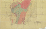 | Earll, Fred Nelson | Plate1-part1 Geologic map of the Central Mineral Range, Beaver County, Utah | Geology -- Utah -- Mineral Mountains; Geology -- Utah -- Beaver County | 1957-08 | thesis |
| 145 |
 | Temple, Dennis Charles | Plates 2-3 Geologic map of the Mount Ogden granite, Weber County, Utah and Geologic sections to accompany the Geologic map of the Mount Ogden granite, Weber County, Utah (Google Earth map overlay KMZ file) | Granite; Utah; Mount Ogden; Geology; Stratigraphic; Precambrian ; Rocks; Crystalline; Metamorphic; Thesis and dissertation georeferencing project | 1969-06 | thesis |
| 146 |
 | Huntsman, Chris | Princeton Graduate Housing | 2011 | thesis | |
| 147 |
 | Wright, Ned | Princeton graduate housing | 2011 | thesis | |
| 148 |
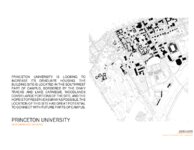 | Seppi, Jessica | Princeton University new graduate housing | 2011 | thesis | |
| 149 |
 | Johnson, Eric Henry | Resistivity and induced polarization survey of a basalt flow in a geothermal environment, Western Utah | Basalt -- Utah; Geothermal resources -- Utah | 1975-08 | thesis |
| 150 |
 | Dolan, Michael | Sandy fitness environment, Sandy City, Utah | Recreation centers; Designs; Plans | 2007 | thesis |
| 151 |
 | Winkler, Gary Ralphs | Sedimentology and geomorphic significance of the bishop conglomerate and the Browns Park Formation, Eastern Uinta Mountains, Utah, Colorado, And Wyoming (Thesis and maps) | Sediments (Geology); Uinta Mountains; Structural; Stratigraphic; Tertiary; Thesis and dissertation georeferencing project | 1970-06 | thesis |
| 152 |
 | Gross, Larry T. | Stratigraphic analysis of the Mesaverde Group, Uinta Basin, Utah | Geology; Stratigraphic; Cretaceous; Uinta Basin (Utah and Colo.) | 1961-05 | thesis |
| 153 |
 | Gross, Larry T. | Stratigraphic analysis of the Mesaverde Group, Uinta Basin, Utah (Google Earth map overlay KMZ file) | Geology; Stratigraphic; Cretaceous; Uinta Basin (Utah and Colo.); Thesis and dissertation georeferencing project | 1961-05 | map |
| 154 |
 | Gross, Larry T. | Stratigraphic analysis of the Mesaverde Group, Uinta Basin, Utah: Georeferenced map files | Geology; Stratigraphic; Cretaceous; Uinta Basin (Utah and Colo.) | 1961-05 | thesis |
| 155 |
 | Baetcke, Gustav Berndt | Stratigraphy of the Star Range and reconnaissance study of three selected mines-Maps | Geology: Stratigraphic-Paleozoic; Stratigraphic-Mesozoic; Utah-Star Range; Mines and mineral resources-Beaver County | 1969-06 | thesis |
| 156 |
 | Sadeghi, Ali Reza | Structural geology of the Willard Peak Area, North-Central Wasatch Mountains, Utah-Maps | Geology -- Structural -- Utah -- Willard Peak area | 1972-12 | thesis |
| 157 |
 | Sadeghi, Ali Reza | Structural geology of the Willard Peak Area, North-Central Wasatch Mountains, Utah: Georeferenced map files | Geology -- Structural -- Utah -- Willard Peak area | 1972-12 | thesis |
| 158 |
 | Groenewold, Bernard Cyrus | Subsurface geology of the Mesozoic formations overlying the Uncompahgre Uplift in Grand County, Utah | Geology; Utah; Grand County; Stratigraphic; Mesozoic | 1961-06 | thesis |
| 159 |
 | Groenewold, Bernard Cyrus | Subsurface geology of the Mesozoic formations overlying the Uncompahgre Uplift in Grand County, Utah (Google Earth map overlay KMZ file) | Geology; Utah; Grand County; Stratigraphic; Mesozoic; Thesis and dissertation georeferencing project | 1961-06 | map |
| 160 |
 | Groenewold, Bernard Cyrus | Subsurface geology of the Mesozoic formations overlying the Uncompahgre Uplift in Grand County, Utah: Georeferenced map files | Geology; Utah; Grand County; Stratigraphic; Mesozoic | 1961-06 | thesis |
| 161 |
 | Murany, Ernest E. | Subsurface stratigraphy of the Wasatch Formation of the Uinta Basin, Utah (Google Earth map overlay KMZ file) | Stratigraphic geology; Natural gas; Thesis and dissertation georeferencing project | 1963-05 | map |
| 162 |
 | Murany, Ernest E. | Subsurface stratigraphy of the Wasatch Formation of the Uinta Basin, Utah (Maps) | Stratigraphic geology; Natural gas | 1963-05 | map |
| 163 |
 | Murany, Ernest E. | Subsurface stratigraphy of the Wasatch Formation of the Uinta Basin, Utah: Georeferenced map files | Stratigraphic geology; Natural gas | 1963-05 | thesis |
| 164 |
 | Overtoom, Gregory James | Synvolcanic oligocene stress reorientation in Eastern Nevada: evidence from the Golden Gate range | Volcanism -- Nevada -- Lincoln County, Nye County; Faults (Geology) -- Nevada -- Lincoln County,Nye County | 1994-12 | thesis |
| 165 |
 | Slentz, Loren William | Tertiary Salt Lake group in the Great Salt Lake Basin | Geology; Stratigraphic; Tertiary; Utah; Great Salt Lake Basin | 1955-07 | thesis |
| 166 |
 | Slentz, Loren William | Tertiary Salt Lake group in the Great Salt Lake Basin (Google Earth map overlay KMZ file) | Geology; Stratigraphic; Tertiary; Utah; Great Salt Lake Basin; Thesis and dissertation georeferencing project | 1955-07 | map |
| 167 |
 | Slentz, Loren William | Tertiary Salt Lake group in the Great Salt Lake Basin: Georeferenced map files | Geology; Stratigraphic; Tertiary; Utah; Great Salt Lake Basin | 1955-07 | thesis |
| 168 |
 | Smith, Hugh Preston | The Thaynes formation of the Moenkopi group, North-Central Utah (Thesis and maps) | Geology; Utah; Thaynes Formation; Moenkopi group | 1969-06 | thesis |
| 169 |
 | Smith, Hugh Preston | The Thaynes formation of the Moenkopi group, North-Central Utah: Georeferenced map files | Geology; Utah; Thaynes Formation; Moenkopi group | 1969-06 | thesis |
1 - 200 of 169
