TO
Filters: Collection: "ir_etd" Type: "Image"
| Author | Title | Subject | Date | Publication Type | ||
|---|---|---|---|---|---|---|
| 1 |
 |
Parr, Clayton Joseph | A study of primary sedimentary structures around the Moab anticline, Grand County, Utah (Google Earth map overlay KMZ file) | Geology; Utah; Grand County | 1965-08 | map |
| 2 |
 |
Parr, Clayton Joseph | A study of primary sedimentary structures around the Moab anticline, Grand County, Utah (Thesis and maps) | Geology; Utah; Grand County | 1965-08 | thesis |
| 3 |
 |
Parr, Clayton Joseph | A study of primary sedimentary structures around the Moab anticline, Grand County, Utah: Georeferenced map files | Geology; Utah; Grand County | 1965-08 | thesis |
| 4 |
 |
Brooke, John Percival | Alteration and trace elements of volcanics in the San Francisco Mountains | Mineralogy; Utah; Beaver County; Geochemistry; Ore deposits; Thesis and dissertation georeferencing project | 1964-06 | thesis |
| 5 |
 |
Brooke, John Percival | Alteration and trace elements of volcanics in the San Francisco Mountains (Google Earth map overlay KMZ file) | Mineralogy; Utah; Beaver County; Geochemistry; Ore deposits; Thesis and dissertation georeferencing project | 1964-06 | map |
| 6 |
 |
Brooke, John Percival | Alteration and trace elements of volcanics in the San Francisco Mountains: Georeferenced map files | Thesis and dissertation georeferencing project | 1964-06 | thesis |
| 7 |
 |
Wood, William James | Areal geology of the Coalville vicinity, Summit County, Utah | Geology; Utah; Coalville region | 1953-06 | thesis |
| 8 |
 |
Wood, William James | Areal geology of the Coalville vicinity, Summit County, Utah (Google Earth map overlay KMZ file) | Geology; Utah; Coalville region; Thesis and dissertation georeferencing project | 1953-06 | map |
| 9 |
 |
Wood, William James | Areal geology of the Coalville vicinity, Summit County, Utah: Georeferenced map files | Geology; Utah; Coalville region | 1953-06 | thesis |
| 10 |
 |
Stark, Norman Paul | Areal geology of the Upton region, Summit County, Utah-Maps | Geology; Utah; upton area | 1953-06 | thesis |
| 11 |
 |
Stark, Norman Paul | Areal geology of the Upton Region, Summit County, Utah: Georeferenced map files | Geology -- Utah -- Upton area; Summit County; Coalville region | 1953-06 | thesis |
| 12 |
 |
O'Neill, Kelly | Bifurcate: Intersections and Photography | Fine arts; Photography | 2015-04 | honors thesis |
| 13 |
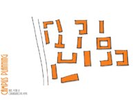 |
Metcalf, Matt | Campus planning: axes, vistas and organizational views | 2011 | thesis | |
| 14 |
 |
Mann, Daven Craig | Clastic laramide sediments of the Wasatch Hinterland, Northeastern Utah (Thesis and maps) | Sediments (Geology); Utah; Wasatch Hinterland | 1974 | thesis |
| 15 |
 |
Mann, Daven Craig | Clastic laramide sediments of the Wasatch Hinterland, Northeastern Utah: Georeferenced map files | Sediments (Geology); Utah; Wasatch Hinterland | 1974 | thesis |
| 16 |
 |
Rodriguez, Enrique Levy | Economic geology of the sulphur deposits at Sulphurdale, Utah-Maps | 1960-08 | thesis | |
| 17 |
 |
Rodriguez, Enrique Levy | Economic geology of the sulphur deposits at Sulphurdale, Utah: Georeferenced map files | Geology, Economic -- Utah -- Sulphurdale; Mines and mineral resources -- Utah -- Sulphurdale; Sulphur mines and mining -- Utah -- Sulphurdale | 1960-08 | thesis |
| 18 |
 |
Gates, Joseph S. | Figure 4: Longitudinal profile of Middle Canyon showing locations of the profiles across the canyon, the nickpoint, and the hypothetical profile before rejuvenation | Thesis and dissertation georeferencing project | 1960-08 | thesis |
| 19 |
 |
Carter, Eric Jeffery | Final graduate design studio | 2011 | thesis | |
| 20 |
 |
Arrington, Josh | Final Studio: Princeton University | 2011 | thesis | |
| 21 |
 |
Baker, Walker Holcombe | Geologic setting and origin of the Grouse Creek pluton, Box Elder County, Utah-Maps | Geology--Utah | 1959-06 | thesis |
| 22 |
 |
Baker, Walker Holcombe | Geologic setting and origin of the Grouse Creek pluton, Box Elder County, Utah: Georeferenced map files | Geology--Utah | 1959-06 | thesis |
| 23 |
 |
Doyuran, Vedat | Geology and ground-water resources of Ogden Valley, Utah | Geology -- Utah -- Ogden Valley; Groundwater -- Utah -- Ogden Valley; Thesis and dissertation georeferencing project | 1972-06 | thesis |
| 24 |
 |
Blue, Donald McCoy | Geology and ore deposits of the Lucin Mining District, Box Elder County, Utah and Elko County, Nevada: Georeferenced map files | 1960-08 | thesis | |
| 25 |
 |
Blue, Donald McCoy | Geology and ore deposits of the lucin mining district, Box Elder County, Utah, and Elko County, Nevada-Maps | 1960-08 | thesis | |
| 26 |
 |
Chapusa, Frank W. P. | Geology and structure of Stansbury Island (Thesis and maps) | Geology; Utah; Stansbury Island | 1969-06 | thesis |
| 27 |
 |
Chapusa, Frank W. P. | Geology and structure of Stansbury Island: Georeferenced map files | Geology; Utah; Stansbury Island | 1969-06 | thesis |
| 28 |
 |
Morris, Elliot Cobia | Geology of the Big Piney area, Summit County, Utah | Geology -- Utah -- Summit County | 1953-06 | thesis |
| 29 |
 |
Morris, Elliot Cobia | Geology of the Big Piney area, Summit County, Utah: Georeferenced map files | Geology -- Utah -- Summit County | 1953-06 | thesis |
| 30 |
 |
Maurer, Robert Eugene | Geology of the Cedar Mountains,Tooele County, Utah (Thesis and maps) | Geology; Utah; Tooele County; Geology; Utah; Cedar Mountains; Thesis and dissertation dereferencing project | 1970-06 | thesis |
| 31 |
 |
Schaeffer, Frederick Ernst Jr. | Geology of the Central and Southern silver Island Mountains Tooele County, Utah and Elko County, Nevada-Maps | Geology -- Utah -- Silver Island Mountains | 1961-06 | thesis |
| 32 |
 |
Schaeffer, Jr. Frederick Ernst | Geology of the Central and Southern Silver Island Mountains Tooele County, Utah and Elko County, Nevada: Georeferenced map files | 1961-06 | thesis | |
| 33 |
 |
Earll, Fred Nelson | Geology of the Central Mineral Range, Beaver County, Utah | Geology -- Utah -- Mineral Mountains; Beaver County | 1957-08 | thesis |
| 34 |
 |
Earll, Fred Nelson | Geology of the Central Mineral Range, Beaver County, Utah (Google Earth map overlay KMZ file) | Geology -- Utah -- Mineral Mountains; Beaver County; Thesis and dissertation georeferencing project | 1957-08 | map |
| 35 |
 |
Earll, Fred Nelson | Geology of the Central Mineral Range, Beaver County, Utah: Georeferenced map files | Geology -- Utah -- Mineral Mountains; Beaver County | 1957-08 | thesis |
| 36 |
 |
Zimmerman, James T. | Geology of the Cove Creek area Millard County and Beaver County, Utah | Geology; Utah; Cove Creek area; Thesis and dissertation georeferencing project | 1961-06 | thesis |
| 37 |
 |
Harrill, James Reece | Geology of the Davis Knolls and northern Big Davis Mountain area, Tooele County, Utah | Geology -- Utah -- Tooele County; Thesis and dissertation georeferencing project | 1962-08 | thesis |
| 38 |
 |
Harrill, James Reece | Geology of the Davis Knolls and northern Big Davis Mountain area, Tooele County, Utah (Google Earth map overlay KMZ file) | Geology -- Utah -- Tooele County; Thesis and dissertation georeferencing project | 1962-08 | map |
| 39 |
 |
Harrill, James Reece | Geology of the Davis Knolls and northern Big Davis Mountain area, Tooele County, Utah: Georeferenced map files | Geology -- Utah -- Tooele County | 1962-08 | thesis |
| 40 |
 |
Egbert, Robert L. | Geology of the East Canyon area, Morgan County, Utah | Geology -- Utah -- Morgan County; Thesis and dissertation georeferencing project | 1954 | thesis |
| 41 |
 |
O'Toole, Walter L. | Geology of the Keetley-Kamas volcanic area | Geology; Utah; Summit County; Wasatch County | 1951 | thesis |
| 42 |
 |
O'Toole, Walter L. | Geology of the Keetley-Kamas volcanic area (Google Earth map overlay KMZ file) | Geology; Utah; Summit County; Wasatch County; Thesis and dissertation georeferencing project | 1951 | map |
| 43 |
 |
O'Toole, Walter L. | Geology of the Keetley-Kamas volcanic area: Georeferenced map files | Geology; Utah; Summit County; Wasatch County | 1951 | thesis |
| 44 |
 |
Madsen, James Henry Jr. | Geology of the Lost Creek-Echo Canyon Area, Morgan and Summit Counties, Utah | Geology -- Utah -- Morgan County; Geology -- Utah -- Summit County; Thesis and dissertation georeferencing project | 1959-06 | thesis |
| 45 |
 |
Paddock, Robert Edwards | Geology of the Newfoundland Mountains, Box Elder County, Utah | Geology; Utah; Newfoundland Mountains; Box Elder County | 1956-12 | thesis |
| 46 |
 |
Paddock, Robert Edwards | Geology of the Newfoundland Mountains, Box Elder County, Utah: Georeferenced map files | Geology; Utah; Newfoundland Mountains; Box Elder County | 1956-12 | thesis |
| 47 |
 |
Doelling, Hellmut H. | Geology of the Northern Lakeside Mountains and the Grassy Mountains and vicinity, Tooele and Box Elder Counties, Utah | Geology -- Utah -- Tooele County; Geology -- Utah -- Box Elder County; Geology -- Utah -- Grassy Mountains -- Maps; Geology -- Utah -- Lakeside Mountains -- Maps | 1964-06 | thesis |
| 48 |
 |
Doelling, Hellmut H. | Geology of the Northern Lakeside Mountains and the Grassy Mountains and vicinity, Tooele and Box Elder Counties, Utah (Google Earth map overlay KMZ file) | Geology -- Utah -- Tooele County; Geology -- Utah -- Box Elder County; Geology -- Utah -- Grassy Mountains -- Maps; Geology -- Utah -- Lakeside Mountains -- Maps; Thesis and dissertation georeferencing project | 1964-06 | map |
| 49 |
 |
Doelling, Hellmut H. | Geology of the Northern Lakeside Mountains and the Grassy Mountains and vicinity, Tooele and Box Elder Counties, Utah: Georeferenced map files | Geology -- Utah -- Tooele County; Geology -- Utah -- Box Elder County; Geology -- Utah -- Grassy Mountains -- Maps; Geology -- Utah -- Lakeside Mountains -- Maps | 1964-06 | thesis |
| 50 |
 |
Anderson, Warren L. | Geology of the Northern Silver Island Mountains, Box Elder and Tooele Counties, Utah | Geology; Utah; Silver Island Mountains | 1957-06 | thesis |
| 51 |
 |
Anderson, Warren L. | Geology of the Northern Silver Island Mountains, Box Elder and Tooele Counties, Utah (Google Earth map overlay KMZ file) | Geology; Utah; Silver Island Mountains; Thesis and dissertation georeferencing project | 1957-06 | thesis |
| 52 |
 |
Anderson, Warren L. | Geology of the northern Silver Island Mountains, Box Elder and Tooele Counties, Utah: Georeferenced maps | Geology; Utah; Silver Island Mountains | 1957-06 | thesis |
| 53 |
 |
Blakey, Ronald Clyde | Geology of the Paria Northwest quadrangle Kane County, Utah (Google Earth map overlay KMZ file) | Geology -- Utah -- Kane County -- Paria Northwest quadrangle; Thesis and dissertation georeferencing project | 1970-08 | map |
| 54 |
 |
Blakey, Ronald Clyde | Geology of the Paria Northwest quadrangle Kane County, Utah-Maps | Geology -- Utah -- Kane County -- Paria Northwest quadrangle | 1970-08 | thesis |
| 55 |
 |
Blakey, Ronald Clyde | Geology of the Paria Northwest quadrangle, Kane County, Utah: Georeferenced map files | Geology -- Utah -- Kane County -- Paria Northwest quadrangle | 1970-08 | thesis |
| 56 |
 |
Staub, Ann Marie | Geology of the Picture Rock Hills quadrangle, Southwestern Keg Mountains, Juab County, Utah (Google Earth map overlay KMZ file) | Geology; Utah; Juab County | 1975 | map |
| 57 |
 |
Staub, Ann Marie | Geology of the Picture Rock Hills quadrangle, Southwestern Keg Mountains, Juab County, Utah (Thesis and maps) | Geology; Utah; Juab County | 1975 | thesis |
| 58 |
 |
Staub, Ann Marie | Geology of the Picture Rock Hills quadrangle, Southwestern Keg Mountains, Juab County, Utah: Georeferenced map files | Geology; Utah; Juab County | 1975 | thesis |
| 59 |
 |
Cohenour, Robert E. | Geology of the Sheeprock Mountains, Tooele and Juab Counties, Utah | Geology -- Utah -- Sheeprock Mountains; Geology -- Utah -- Tooele County; Geology -- Utah -- Juab County; Thesis and dissertation georeferencing project | 1957-08 | thesis |
| 60 |
 |
Cohenour, Robert E. | Geology of the Sheeprock Mountains, Tooele and Juab Counties, Utah: Georeferenced map files | Geology -- Utah -- Sheeprock Mountains; Geology -- Utah -- Tooele County; Geology -- Utah -- Juab County | 1957-08 | thesis |
| 61 |
 |
Root, Robert L. | Geology of the Smith and Morehouse-Hayden Fork area, Utah | Geology; Utah; Summit County; Thesis and dissertation georeferencing project | 1952 | thesis |
| 62 |
 |
Hooper, Warren G. | Geology of the Smith and Morehouse-South Fork Area, Utah: Georeferenced map files | Geology -- Uinta Mountains (Utah and Wyo.) | 1951 | thesis |
| 63 |
 |
Moussa, Mounir Tawfik | Geology of the Soldier Summit quadrangle, Utah (Thesis and maps) | Geology; Utah; Utah County; Carbon County; Wasatch County | 1965-06 | thesis |
| 64 |
 |
Moussa, Mounir Tawfik | Geology of the Soldier Summit quadrangle, Utah: Georeferenced map files | Geology; Utah; Utah County; Carbon County; Wasatch County | 1965-06 | thesis |
| 65 |
 |
Stifel, Peter Beekman | Geology of the Terrace and Hogup Mountains, Box Elder County, Utah | Geology -- Utah -- Box Elder County | 1964-06 | thesis |
| 66 |
 |
Stifel, Peter Beekman | Geology of the Terrace and Hogup Mountains, Box Elder County, Utah (Google Earth map overlay KMZ file) | Geology -- Utah -- Box Elder County | 1964-06 | map |
| 67 |
 |
Stifel, Peter Beekman | Geology of the Terrace and Hogup Mountains, Box Elder County, Utah (Maps) | Geology -- Utah -- Box Elder County | 1964-06 | map |
| 68 |
 |
Stifel, Peter Beekman | Geology of the Terrace and Hogup Mountains, Box Elder County, Utah: Georeferenced map files | Geology -- Utah -- Box Elder County | 1964-06 | thesis |
| 69 |
 |
Eriksson, Yves | Geology of the upper Ogden Canyon, Weber County, Utah | Geology -- Utah -- Weber County | 1960-06 | thesis |
| 70 |
 |
Eriksson, Yves | Geology of the upper Ogden Canyon, Weber County, Utah: Georeferenced map files | Geology -- Utah -- Weber County | 1960-06 | thesis |
| 71 |
 |
Mount, Donald Lee | Geology of the Wanship - Park City Region, Utah: Georeferenced map files | Geology -- Utah -- Summit County | 1952-06 | thesis |
| 72 |
 |
Gardner, Weston Clive | Geology of the West Tintic mining district and vicinity, Juab County, Utah | Geology -- Utah -- Juab County -- Tintic Mining District; Thesis and dissertation georeferencing project | 1954-06 | thesis |
| 73 |
 |
Nye, Matthew | Graduate student housing-Princeton | 2011 | thesis | |
| 74 |
 |
Stouffer, Stephen Gerald | Landslides in the Coal Hill area, Kane County, Utah (Google Earth map overlay KMZ file) | Landslides -- Utah -- Kane County; Geology -- Utah -- Kane County | 1964-06 | map |
| 75 |
 |
Stouffer, Stephen Gerald | Landslides in the Coal Hill area, Kane County, Utah (Thesis and maps) | Landslides -- Utah -- Kane County; Geology -- Utah -- Kane County | 1964-06 | thesis |
| 76 |
 |
Stouffer, Stephen Gerald | Landslides in the Coal Hill area, Kane County, Utah: Georeferenced map files | Landslides -- Utah -- Kane County; Geology -- Utah -- Kane County | 1964-06 | thesis |
| 77 |
 |
Morris, Elliot Cobia | Map 1 Geologic map and sections of Big Piney Area, Utah (Google Earth map overlay KMZ file) | Geology -- Utah -- Summit County | 1953-06 | thesis |
| 78 |
 |
Condie, Kent C. | Map 1 Geologic map of the Mineral Range, Utah (Google Earth map overlay KMZ file) | Petrology -- Utah -- Beaver County; Millard County; Geology -- Utah -- Beaver County; Millard County; Mineral Range (Utah); Thesis and dissertation georeferencing project | 1960-06 | thesis |
| 79 |
 |
Moussa, Mounir Tawfik | Map 1 Geologic map of the Soldier Summit Quadrangle, Utah (Google Earth map overlay KMZ file) | Geology; Utah; Utah County; Carbon County; Wasatch County | 1965-06 | thesis |
| 80 |
 |
Eriksson, Yves | Map 1 Geology of the upper Ogden Canyon, Weber County, Utah (Google Earth map overlay KMZ file) | Geology -- Utah -- Weber County; Thesis and dissertation georeferencing project | 1960-06 | thesis |
| 81 |
 |
Amin, Surendra R. | Map 1: Geologic map of Antelope intrusive and vicinity | 1950 | thesis | |
| 82 |
 |
Amin, Surendra R. | Map 1: Geologic map of Antelope intrusive and vicinity (Google Earth map overlay KMZ file) | Thesis and dissertation georeferencing project | 1950 | map |
| 83 |
 |
Paddock, Robert Edwards | Map1 Geologic map and sections of Newfoundland Mountains, Box Elder County, Utah (Google Earth map overlay KMZ file) | Geology; Utah; Newfoundland Mountains; Box Elder County; Thesis and dissertation georeferencing project | 1956-12 | thesis |
| 84 |
 |
Root, Robert L. | Map1 Geologic map and sections of Smith and Morehouse-Hayden Fork area, Utah (Google Earth map overlay KMZ file) | Geology; Utah; Summit County; Thesis and dissertation georeferencing project | 1952 | thesis |
| 85 |
 |
Thomson, Kenneth Clair | Mineral deposits of the Deep Creek Mountains, Tooele and Juab Counties, Utah (Google Earth map overlay KMZ file) | Mines and mineral resources -- Utah -- Deep Creek Mountains | 1970-08 | map |
| 86 |
 |
Thomson, Kenneth Clair | Mineral deposits of the Deep Creek Mountains, Tooele and Juab Counties, Utah (Thesis and maps) | Mines and mineral resources -- Utah -- Deep Creek Mountains | 1970-08 | thesis |
| 87 |
 |
Thomson, Kenneth Clair | Mineral deposits of the Deep Creek Mountains, Tooele and Juab Counties, Utah: Georeferenced map files | Mines and mineral resources -- Utah -- Deep Creek Mountains | 1970-08 | thesis |
| 88 |
 |
Temple, Dennis Charles | Mount Ogden granite (Thesis and maps) | Granite; Utah; Mount Ogden; Geology; Stratigraphic; Precambrian ; Rocks; Crystalline; Metamorphic | 1969-06 | thesis |
| 89 |
 |
Temple, Dennis Charles | Mount Ogden granite: Georeferenced map files | Granite; Utah; Mount Ogden; Geology; Stratigraphic; Precambrian ; Rocks; Crystalline; Metamorphic | 1969-06 | thesis |
| 90 |
 |
Wright, Heather | Not for sale: human trafficking awareness center, New York City highline | 2011 | thesis | |
| 91 |
 |
Soto, Melina | NYC highline hip hop center | 2011 | thesis | |
| 92 |
 |
Dalness, William Michael | Parunuweap formation in the vicinity of Zion National Park, Utah (Google Earth map overlay KMZ file) | Thesis and dissertation georeferencing project | 1969-06 | map |
| 93 |
 |
Dalness, William Michael | Parunuweap formation in the vicinity of Zion National Park, Utah-Maps | 1969-06 | thesis | |
| 94 |
 |
Dalness, William Michael | Parunuweap formation in the vicinity of Zion National Park, Utah: Georeferenced map files | 1969-06 | thesis | |
| 95 |
 |
Condie, Kent C. | Petrogeneis of the Mineral Range Pluton, Southwestern Utah | Petrology -- Utah -- Beaver County; Millard County; Geology -- Utah -- Beaver County; Millard County; Mineral Range (Utah) | 1960-06 | thesis |
| 96 |
 |
Condie, Kent C. | Petrogeneis of the Mineral Range Pluton, Southwestern Utah: Georeferenced map files | Petrology -- Utah -- Beaver County; Millard County; Geology -- Utah -- Beaver County; Millard County; Mineral Range (Utah) | 1960-06 | thesis |
| 97 |
 |
Neff, Thomas Rodney | Petrology and structure of the little willow series, Wasatch Mountains, Utah (Google Earth map overlay KMZ file) | Petrology -- Utah -- Wasatch Mountains; Thesis and dissertation georeferencing project | 1962-11 | map |
| 98 |
 |
Neff, Thomas Rodney | Petrology and structure of the Little Willow Series, Wasatch Mountains, Utah-Maps | Petrology -- Utah -- Wasatch Mountains | 1962-11 | thesis |
| 99 |
 |
Neff, Thomas Rodney | Petrology and structure of the little willow series, Wasatch Mountains, Utah: Georeferenced map files | Petrology -- Utah -- Wasatch Mountains | 1962-11 | thesis |
| 100 |
 |
Vlam, Heber Adolf Arien | Petrology of Lake Bonneville Gravels Salt Lake County, Utah | Petrology; Utah; Salt Lake County; Bonneville; Thesis and dissertation georeferencing project | 1963-05 | thesis |
