26 - 50 of 386
Number of results to display per page
TitleDateType
26 Figure 29. Granite Walls.
27 Figure 3. Pa-ru-nu weap Canon.
28 Figure 30. Mu'-av Canon, a side gorge.
29 Figure 31. Standing Rocks on the brink of Mu'-av Canon.
30 Figure 32. The Grand Canon, looking east from To-ro'-weap.
31 Figure 33. The Grand Canon, looking west from Toro'-weap.
32 Figure 34. Climbing the Grand Canon.
33 Figure 35. Our Indian Messenger.
34 Figure 36. Mary's Veil, the upper fall on Pine Creek, a small tributary or the Sevier. Figure 37. Filling's Cascade, the lower fall on Pine Creek.
35 Figure 38. Entrance to Pa-ru'-nu-weap.
36 Figure 39. Mu-koon'-tu-weap Canon.
37 Figure 4. The start from Green River Station.
38 Figure 40. Temples of Rock-Rover's Land.
39 Figure 41. U-nu'-pin Pi-ka'-vu or Elfin Water Pocket.
40 Figure 42, Wu-nav'-ai gathering seeds.
41 Figure 43. Indian Village.
42 Figure 44. An'-ti-naints, Pu-tu'-siv, and Wi'chuts.
43 Figure 45. The Human Pickle.
44 Figure 46. Indians gambling.
45 Figure 47. Cave Lake In Kanab Canon.
46 Figure 48. Canon in Escalanti Basin.
47 Figure 49. Tower at the mouth of Dirty Devil River.
48 Figure 5. Indian camp on Henry's Fork.
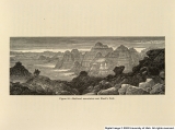
49 Figure 50. Bad-land mountains near Black's Fork.
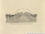
50 Figure 51. Generalized section through the Uinta Mountains from north to south.
26 - 50 of 386