|
|
Title | Date | Type |
| 1 |
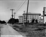 |
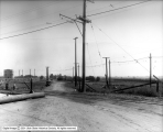
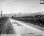
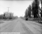
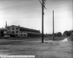
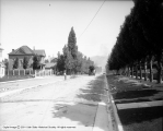
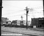
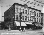
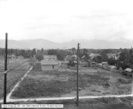
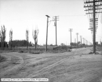
2100 South and State Street | 1917-09-28 | Image |
| 2 |
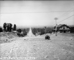 |
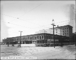
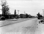
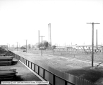
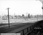
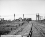
300 South, West From 1200 East | 1913-06-06 | Image |
| 3 |
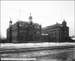 |
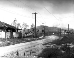
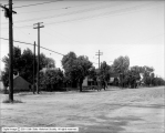
All Hallows College | 1908-12-10 | Image |
| 4 |
 |
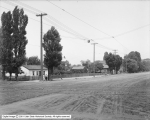
All Hallows College | 1904 | Image |
| 5 |
 |
Alta Club | 1905-12-04 | Image |
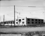
| 6 |
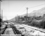 |
Andrew O'Dea, Tracks in front of Residence Looking Northwest | 1912-01-11 | Image |
| 7 |
 |
Andrew O'Dea, Tracks in front of Residence Looking Southeast | 1912-01-11 | Image |
| 8 |
 |
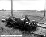
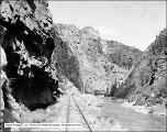
Auto Accident North of Beck's Hot Springs | 1914 | Image |
| 9 |
 |
Auto Accident North of Beck's Hot Springs | 1914 | Image |
| 10 |
 |
Auto Accident North of Beck's Hot Springs | 1914 | Image |
| 11 |
 |
Auto Accident North of Beck's Hot Springs | 1914 | Image |
| 12 |
 |
Auto Accident North of Beck's Hot Springs | 1914 | Image |
| 13 |
 |
Auto Accident Scene Between Warm Springs and Becks | 1917-09-01 | Image |
| 14 |
 |
Auto Accident Scene Between Warm Springs and Becks | 1917-09-01 | Image |
| 15 |
 |
Auto Race Course | 1908-08-05 | Image |
| 16 |
 |
Auto Race Course | 1908-08-05 | Image |
| 17 |
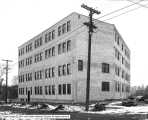 |
B. F. Redman, New Building | 1917-12-06 | Image |
| 18 |
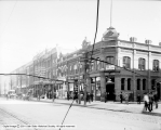
 |
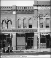
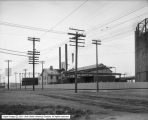
Barrett Manufacturing Company, County Road | 1916-03-28 | Image |
| 19 |
 |
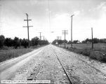
Barrett Manufacturing Company, County Road | 1916-03-28 | Image |
| 20 |
 |
Barrett Manufacturing Company, County Road | 1916-03-28 | Image |
| 21 |
 |
Becks Hot Springs from Tracks | 1919-05-13 | Image |
| 22 |
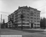
 |
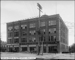
Belcher Building | 1910-07-21 | Image |
| 23 |
 |
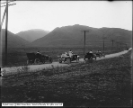
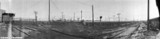
Big Cottonwood Canyon, Brighton Panorama #1 | 1910; 1906; 1907; 1908; 1909; 1911; 1912; 1913; 1914 | Image |
| 24 |
 |
Big Cottonwood Canyon, Brighton Panorama #2 | 1910; 1906; 1907; 1908; 1909; 1911; 1912; 1913; 1914 | Image |
| 25 |
 |
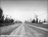
Big Cottonwood Canyon, Brighton Panorama #3 | 1910; 1906; 1907; 1908; 1909; 1911; 1912; 1913; 1914 | Image |
| 26 |
 |
Black Canyon of the Gunnison | 1908-07-17 | Image |
| 27 |
 |
Black Canyon of the Gunnison, Curicanti Needle and Railroad | 1908-07-17 | Image |
| 28 |
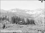
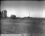
 |
Black Canyon of the Gunnison, Near Bridge 319A | 1908-07-17 | Image |
| 29 |
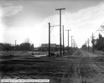
 |
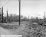
Car Tracks Near Jordan Bridge | 1914-08-04 | Image |
| 30 |
 |
Continental Oil Company | 1911-10-29 | Image |
| 31 |
 |
Continental Oil Company, Panorama #1 | 1911-10-29 | Image |
| 32 |
 |
Continental Oil Company, Panorama #2 | 1911-10-29 | Image |
| 33 |
 |
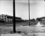
Corner of Richards and First South | 1909; 1905; 1906; 1907; 1908; 1910; 1911; 1912; 1913 | Image |
| 34 |
 |
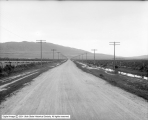
County Roads, Salt Lake County | 1914-05-08 | Image |
| 35 |
 |
County Roads, Salt Lake County | 1914-05-08 | Image |
| 36 |
 |
County Roads, Salt Lake County | 1914-05-08 | Image |
| 37 |
 |
County Roads, Salt Lake County | 1914-05-08 | Image |
| 38 |
 |
Crane Company Exterior of Building | 1911-05-19 | Image |
| 39 |
 |
Crane Company Exterior of Building | 1911-05-19 | Image |
| 40 |
 |
Crossing on Orem Line near Power Station | 1914-08-04 | Image |
| 41 |
 |
Danley and Johnson, State Street Looking North From Alhambra Place | 1910-10-13 | Image |
| 42 |
 |
Denver and Rio Grande Railroad Beck's Crossing, North Salt Lake | 1915-08 | Image |
| 43 |
 |
Denver and Rio Grande Railroad Depot | 1909-12-16 | Image |
| 44 |
 |
Denver and Rio Grande Railroad Tracks | 1917-08-10 | Image |
| 45 |
 |
Denver and Rio Grande Railroad Tracks | 1917-08-10 | Image |
| 46 |
 |
Denver and Rio Grande Railroad Tracks | 1917-08-10 | Image |
| 47 |
 |
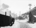
Denver and Rio Grande, Cudahy Crossing | 1931-12-12 | Image |
| 48 |
 |
Douglas Park | 1913-09-15 | Image |
| 49 |
 |
East First South From Commercial Street to State Street | 1909-09-23 | Image |
| 50 |
 |
Eclipse Building Front | 1905-12-23 | Image |
| 51 |
 |
Ed. A. Coston, Tracks in Front of Residence | 1912-01-08 | Image |
| 52 |
 |
Emery Holmes Building (Bransford Apartments) | 1904; 1900; 1901; 1902; 1903; 1905; 1906; 1907; 1908 | Image |
| 53 |
 |
F. W. Gardiner Company, Front | 1906-01-17 | Image |
| 54 |
 |
Fairbanks Morse | 1909-08-05 | Image |
| 55 |
 |
First South, Richards Street to Main Street | 1906-09-27 | Image |
| 56 |
 |
Galena Block | 1906-04-14 | Image |
| 57 |
 |
Gateway Pipe Line, Weber Canyon, P. J. Moran | 1908-11-16 | Image |
| 58 |
 |
Goddard Packing Company (Provo) | 1918-06-13 | Image |
| 59 |
 |
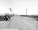
Good Roads Looking North From 1200 South | 1910-10-20 | Image |
| 60 |
 |
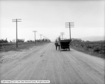
Good Roads on South Street | 1910-10-20 | Image |
| 61 |
 |
Head of Main Street | 1906-10-04 | Image |
| 62 |
 |
Head of Main Street | 1906-10-04 | Image |
| 63 |
 |
Head of Main Street | 1906-10-04 | Image |
| 64 |
 |
House at 623 First Avenue (Alex H. Tarbet) | 1912-06-13 | Image |
| 65 |
 |
International Harvester Company | 1915-03 | Image |
| 66 |
 |
J. W. Foote, Property | 1917-11-30 | Image |
| 67 |
 |
Judge Building, Exterior | 1908-07-02 | Image |
| 68 |
 |
Judge Railroad Exchange Building | 1907-12-03 | Image |
| 69 |
 |
Kimball and Richards | 1910-01-17 | Image |
| 70 |
 |
Kimball and Richards | 1910-01-17 | Image |
| 71 |
 |
Kimball and Richards | 1910-01-17 | Image |
| 72 |
 |
Knight Carriage and Auto Company | 1909-05-13 | Image |
| 73 |
 |
Knutsford and Manitou | 1909-11-27 | Image |
| 74 |
 |
Large Piece of Granite at Wasatch | 1914-02-05 | Image |
| 75 |
 |
Layton, Main Street | 1920-08-09 | Image |
| 76 |
 |
Lemp Bottling Works | 1909-04-22 | Image |
| 77 |
 |
Looking North on South State Street | 1910-10-20 | Image |
| 78 |
 |
Main Street Between 200-300 South | 1904 | Image |
| 79 |
 |
Main Street from South Temple | 1905-06-19 | Image |
| 80 |
 |
McCornick Block | 1908-12-27 | Image |
| 81 |
 |
McCornick Block | 1905-06-19 | Image |
| 82 |
 |
Morrison-Merrill Lumber Company Mill | 1912-02-12 | Image |
| 83 |
 |
Mountain States Telephone and Telegraph Truck with Poles | 1917-01-15 | Image |
| 84 |
 |
Mountain States Telephone and Telegraph Truck with Poles | 1917-01-15 | Image |
| 85 |
 |
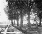
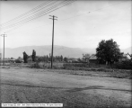
Mountains and Field | 1910; 1906; 1907; 1908; 1909; 1911; 1912; 1913; 1914 | Image |
| 86 |
 |
New Dooley Building | 1909-05-15 | Image |
| 87 |
 |
North from South Temple, Unknown Street | 1913-06-06 | Image |
| 88 |
 |
North Salt Lake County Road Looking North | 1915-03-25 | Image |
| 89 |
 |
North Salt Lake County Road looking South | 1915-03-25 | Image |
| 90 |
 |
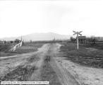
North State Road Accident Scene | 1918-06-05 | Image |
| 91 |
 |
Ohio, Texas, New York Buildings, Market Street | 1906-11-09 | Image |
| 92 |
 |
Old Hall Hotel | 1910-04-08 | Image |
| 93 |
 |
Orem Power Station | 1914-08-04 | Image |
| 94 |
 |
Orem Power Station | 1914-08-04 | Image |
| 95 |
 |
Orem Power Station | 1914-08-04 | Image |
| 96 |
 |
Parade | 1904 | Image |
| 97 |
 |
Provo Canyon, General View | 1910; 1906; 1907; 1908; 1909; 1911; 1912; 1913; 1914 | Image |
| 98 |
 |
Provo Canyon, General View and Railroad | 1910; 1906; 1907; 1908; 1909; 1911; 1912; 1913; 1914 | Image |
| 99 |
 |
Provo Canyon, General View Including Railroad | 1910; 1906; 1907; 1908; 1909; 1911; 1912; 1913; 1914 | Image |
| 100 |
 |
R. E. Hoffman Company | 1907-05 | Image |
| 101 |
 |
Railroad Crossing at 900 North and 400 West Looking East | 1919-01-03 | Image |
| 102 |
 |
Railroad Crossing at 900 North and 400 West Looking West | 1919-01-03 | Image |
| 103 |
 |
Railroad Exchange Site | 1907-03-12 | Image |
| 104 |
 |
Removing Poles on Main Street | 1909-11-28 | Image |
| 105 |
 |
Rio Grande Western Shops | 1905-06-28 | Image |
| 106 |
 |
S Street Looking North From South Temple | 1912-09-16 | Image |
| 107 |
 |
S. B. Young Cement Quarry | 1906-08-13 | Image |
| 108 |
 |
Salt Lake City View, South Section of Salt Lake from North | 1905-07-15 | Image |
| 109 |
 |
Salt Lake Route Near Tyng Warehouse | 1920-10-07 | Image |
| 110 |
 |
Salt Lake Route Near Tyng Warehouse | 1920-10-07 | Image |
| 111 |
 |
Salt Lake Route Near Tyng Warehouse | 1920-10-07 | Image |
| 112 |
 |
Salt Lake Route, Cushing Crossing | 1918-03-16 | Image |
| 113 |
 |
Salt Lake Route, Cushing Crossing | 1918-03-16 | Image |
| 114 |
 |
Salt Lake Route, Cushing Crossing | 1918-03-16 | Image |
| 115 |
 |
Salt Lake Route, Cushing Crossing, Midvale | 1918-03-16 | Image |
| 116 |
 |
Salt Lake Route, First Road Crossing North of Lehi, Panorama A | 1917-05-24 | Image |
| 117 |
 |
Salt Lake Route, First Road Crossing North of Lehi, Panorama B | 1917-05-24 | Image |
| 118 |
 |
Salt Lake Route, Hart Case, Panorama A | 1917-05-21 | Image |
| 119 |
 |
Salt Lake Route, Hart Case, Panorama B | 1917-05-21 | Image |
| 120 |
 |
Salt Lake Route, Hart Case, Panorama C | 1917-05-21 | Image |
| 121 |
 |
Salt Lake Route, Indiana and Poplar Grove | 1918-01-04 | Image |
| 122 |
 |
Salt Lake Route, Indiana and Poplar Grove | 1918-01-04 | Image |
| 123 |
 |
Salt Lake Route, Indiana and Poplar Grove | 1918-01-04 | Image |
| 124 |
 |
Salt Lake Route, Indiana Ave. Crossing | 1918-05-18 | Image |
| 125 |
 |
Salt Lake Route, Indiana Avenue Crossing | 1918-05-18 | Image |
| 126 |
 |
Salt Lake Route, Indiana Avenue Crossing | 1918-05-18 | Image |
| 127 |
 |
Salt Lake Route-Hart, Panorama A #2 | 1917-05-21 | Image |
| 128 |
 |
Salt Lake Route-Hart, Panorama B #2 | 1917-05-21 | Image |
| 129 |
 |
Salt Lake Route-Hart, Panorama C #2 | 1917-05-21 | Image |
| 130 |
 |
Salt Palace Looking South Showing Band Stand | 1912-05-22 | Image |
| 131 |
 |
Salt Palace, General View | 1912-05-22 | Image |
| 132 |
 |
Salt Palace, Showing Mill and Swing | 1912-05-22 | Image |
| 133 |
 |
Scene of Accident at St. Joseph | 1912-01-29 | Image |
| 134 |
 |
Scene of Accident at St. Joseph | 1912-01-29 | Image |
| 135 |
 |
Scene of Accident at St. Joseph | 1912-01-29 | Image |
| 136 |
 |
South Temple Showing Pavement, South Side of Temple Square | 1903-12-10 | Image |
| 137 |
 |
St. Nicholas Hotel, Exterior | 1905-09 | Image |
| 138 |
 |
State Street Looking South Between 2100 and 2700 South | 1916-11-25 | Image |
| 139 |
 |
Sugar House Business District, Panorama 1 | 1918-04-16 | Image |
| 140 |
 |
Sugar House Business District, Panorama 2 | 1918-04-16 | Image |
| 141 |
 |
Trees, Kimball and Richards | 1909-09-22 | Image |
| 142 |
 |
Universal Cleanser Manufacturing Company (UKO), Exterior of Plant | 1912-10-17 | Image |
| 143 |
 |
Utah Construction Company Views at Bingham | 1912-12-11 | Image |
| 144 |
 |
Utah Construction Company Views at Bingham | 1912-12-11 | Image |
| 145 |
 |
Utah Construction Company Views at Bingham | 1912-12-11 | Image |
| 146 |
 |
Utah Copper Company Mine | 1918-06-20 | Image |
| 147 |
 |
Utah Gas and Coke Company | 1914 | Image |
| 148 |
 |
Utah Gas and Coke Company, Looking East From Holder | 1914-10-05 | Image |
| 149 |
 |
Utah Gas and Coke Company, Looking North, Panorama A | 1914-08-28 | Image |
| 150 |
 |
Utah Gas and Coke Company, looking North, Panorama D | 1914-08-28 | Image |
| 151 |
 |
Utah Gas and Coke Company, Looking Northwest | 1914-09-26 | Image |
| 152 |
 |
Utah Gas and Coke Company, Looking West From 1000 West 100 South | 1914-09-28 | Image |
| 153 |
 |
Utah Gas and Coke Company, Looking West on Track Near Utah Light and Railway Plant | 1914-09-28 | Image |
| 154 |
 |
Utah Ice and Storage | 1905-11-24 | Image |
| 155 |
 |
Utah Light and Railway Company Tower | 1912-04-29 | Image |
| 156 |
 |
Utah Light and Railway Company Tower | 1912-04-29 | Image |
| 157 |
 |
Utah Light and Railway Company, Jordan Station | 1905-09-08 | Image |
| 158 |
 |
Utah Motor Car Company Building and International Trucks | 1918-03-12 | Image |
| 159 |
 |
Utah Power and Light Company Light Bracket and Pole Near 1300 South on State Street | 1916-03-14 | Image |
| 160 |
 |
View at 800 West 900 South | 1917-06-14 | Image |
| 161 |
 |
View at 800 West 900 South | 1917-06-14 | Image |
| 162 |
 |
View at 800 West 900 South | 1917-06-14 | Image |
| 163 |
 |
View at 800 West 900 South | 1917-06-14 | Image |
| 164 |
 |
View at 800 West 900 South | 1917-06-14 | Image |
| 165 |
 |
View East on 2100 South from State Street | 1918-01-26 | Image |
| 166 |
 |
View from 400 South and West Temple Looking East on 400 South | 1912-08-27 | Image |
| 167 |
 |
View North on State Street from 2100 South | 1918-01-26 | Image |
| 168 |
 |
View Northeast on 100 South from 600 West | 1918-06-29 | Image |
| 169 |
 |
View Northeast on South Temple from 600 West | 1918-06-29 | Image |
| 170 |
 |
View of 2nd (Second) Avenue | 1919-01-30 | Image |
| 171 |
 |
View of 2nd (Second) Avenue | 1919-01-30 | Image |
| 172 |
 |
View South on State Street from 2100 South | 1918-01-26 | Image |
| 173 |
 |
View Southwest on 500 West from South Temple | 1918-06-29 | Image |
| 174 |
 |
Walker Brothers Dry Goods Corner | 1906-04-14 | Image |
| 175 |
 |
Weber Canyon, Devil's Slide | 1910; 1906; 1907; 1908; 1909; 1911; 1912; 1913; 1914 | Image |
| 176 |
 |
Weber Canyon, Los Angeles Limited in Weber Canyon | 1910; 1906; 1907; 1908; 1909; 1911; 1912; 1913; 1914 | Image |
| 177 |
 |
Western Pacific Railroad Looking West from 700 West | 1909-11-23 | Image |
| 178 |
 |
Western Pacific Railroad, 700 West Looking Southeast | 1909-11-23 | Image |
| 179 |
 |
Western Pacific Railroad, Jeremy Street Crossing | 1909-11-27 | Image |
| 180 |
 |
Western Pacific Railroad, Looking East From West Side of Jeremy Street | 1909-11-27 | Image |
| 181 |
 |
Young Men's Christian Association (YMCA) Building | 1904-07-22 | Image |