|
|
Title | Date | Type |
| 1 |
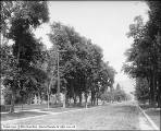 |
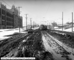
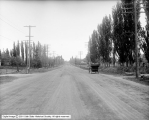
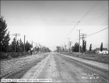
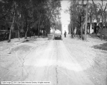
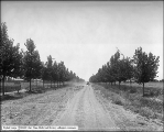
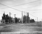
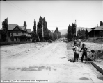
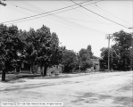
2nd (Second) Avenue Near H Street | 1909-07-19 | Image |
| 2 |
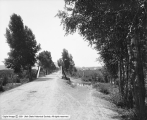 |
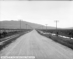
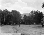
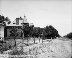
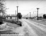
Approach to Evanston | 1912-08-11 | Image |
| 3 |
 |
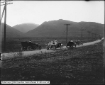
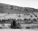
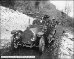
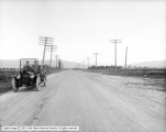
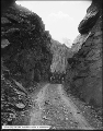
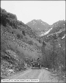
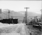
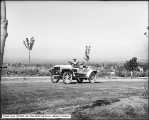
Auto Accident North of Beck's Hot Springs | 1914 | Image |
| 4 |
 |
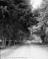
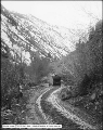
Auto in City Creek Canyon | 1916-09-10 | Image |
| 5 |
 |
Auto in City Creek Canyon | 1916-09-10 | Image |
| 6 |
 |
Auto Race | 1910; 1906; 1907; 1908; 1909; 1911; 1912; 1913; 1914 | Image |
| 7 |
 |
Auto Race Course | 1908-08-05 | Image |
| 8 |
 |
Auto Race Course | 1908-08-05 | Image |
| 9 |
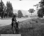 |
B. F. Goodrich Rubber Company, Road Sign Between Salt Lake City and Bonneville | 1915-09-15 | Image |
| 10 |
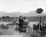 |
B. F. Goodrich Rubber Company, Road Sign Between Salt Lake City and Bonneville | 1915-09-15 | Image |
| 11 |
 |
B. F. Goodrich Rubber Company, Road Sign Between Salt Lake City and Bonneville | 1915-09-15 | Image |
| 12 |
 |
B. F. Goodrich Rubber Company, Road Sign Between Salt Lake City and Bonneville | 1915-09-15 | Image |
| 13 |
 |
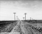
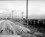
Bad Road, 1300 East and 900 South | 1916-03-25 | Image |
| 14 |
 |
Bad Road, 1300 East and 900 South | 1916-03-25 | Image |
| 15 |
 |
Bad Road, 1300 East and 900 South | 1916-03-25 | Image |
| 16 |
 |
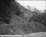
Big Cottonwood Canyon, In Snow Slide | 1910-04-10 | Image |
| 17 |
 |
Big Cottonwood Canyon, Mr. and Mrs. Dodd | 1910-04-10 | Image |
| 18 |
 |
Big Cottonwood Canyon, Road Above Brighton | 1907-07-22 | Image |
| 19 |
 |
Board of Health, Garbage Wagons, M Street | 1915-11-01 | Image |
| 20 |
 |
Botterill Auto Company, Hudson | 1914-04-24 | Image |
| 21 |
 |
Botterill Auto Company, Pierce | 1914-04-24 | Image |
| 22 |
 |
Capitol Grounds | 1911-03-23 | Image |
| 23 |
 |
Capitol Grounds | 1911-03-23 | Image |
| 24 |
 |
Capitol Grounds, Panorama #1 | 1911-09-12 | Image |
| 25 |
 |
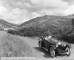
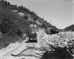
Car on Mountain Road | 1919-05-07 | Image |
| 26 |
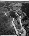
 |
Car Race | 1910; 1906; 1907; 1908; 1909; 1911; 1912; 1913; 1914 | Image |
| 27 |
 |
Car Race | 1910; 1906; 1907; 1908; 1909; 1911; 1912; 1913; 1914 | Image |
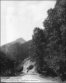
| 28 |
 |
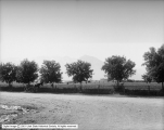
Christmas Tree Park | 1911-08 | Image |
| 29 |
 |
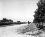
City Creek Road | 1912-09-16 | Image |
| 30 |
 |
City Creek Road | 1910; 1906; 1907; 1908; 1909; 1911; 1912; 1913; 1914 | Image |
| 31 |
 |
City Creek Road | 1910; 1906; 1907; 1908; 1909; 1911; 1912; 1913; 1914 | Image |
| 32 |
 |
City Creek Road From Top of Canyon | 1912-09-16 | Image |
| 33 |
 |
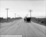
Country Road and Buggy | 1905-09-07 | Image |
| 34 |
 |
County Roads, Salt Lake County | 1914-05-08 | Image |
| 35 |
 |
County Roads, Salt Lake County | 1914-05-08 | Image |
| 36 |
 |
County Roads, Salt Lake County | 1914-05-08 | Image |
| 37 |
 |
County Roads, Salt Lake County | 1914-05-08 | Image |
| 38 |
 |
Danley and Johnson, State Street Looking North From Alhambra Place | 1910-10-13 | Image |
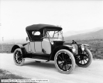
| 39 |
 |
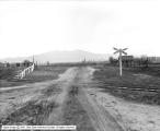
Denver and Rio Grande Western Railroad Company at Mabey Crossing (#17) | 1922-11-01 | Image |
| 40 |
 |
Dodd and Party in Canyon | 1910-04-10 | Image |
| 41 |
 |
Drive Along Bear Lake | 1912-08-09 | Image |
| 42 |
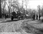 |
Duplex Truck and Trailer, 200 North Hill | 1917-05-04 | Image |
| 43 |
 |
Duplex Truck and Trailer, 200 North Hill | 1917-05-04 | Image |
| 44 |
 |
Duplex Truck and Trailer, 200 North Hill | 1917-05-04 | Image |
| 45 |
 |
Fillmore Commercial Club, General View of Office at Sulfur Beds | 1920-07-22 | Image |
| 46 |
 |
Golden Gate | 1908-08-19 | Image |
| 47 |
 |
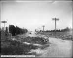
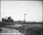
Good Roads Looking North From 1200 South | 1910-10-20 | Image |
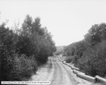
| 48 |
 |
Gramling Property, Logan Avenue | 1906-04-30 | Image |
| 49 |
 |
Hoffman Brothers, Looking North on 800 East | 1913-05-14 | Image |
| 50 |
 |
Hubbard Insurance Company | 1905-05-29 | Image |
| 51 |
 |
Hudson Automobile, City Creek | 1917-10-07 | Image |
| 52 |
 |
Hudson in City Creek Canyon | 1916-07-09 | Image |
| 53 |
 |
Hudson in City Creek Canyon | 1916-07-09 | Image |
| 54 |
 |
In Big Cottonwood Canyon | 1910-04-10 | Image |
| 55 |
 |
In Big Cottonwood Canyon | 1910-04-10 | Image |
| 56 |
 |
In Big Cottonwood Canyon | 1910-04-10 | Image |
| 57 |
 |
In Big Cottonwood Canyon | 1910-04-10 | Image |
| 58 |
 |
In Big Cottonwood Canyon at Bridge | 1910-04-10 | Image |
| 59 |
 |
In Big Cottonwood Canyon, Going up to Cut | 1910-04-10 | Image |
| 60 |
 |
In Big Cottonwood Canyon, In Cut | 1910-04-10 | Image |
| 61 |
 |
In Big Cottonwood Canyon, In Snow Slide | 1910-04-10 | Image |
| 62 |
 |
In Big Cottonwood Canyon, Mr. and Mrs. Shipler | 1910-04-10 | Image |
| 63 |
 |
Inland Crystal Salt Company | 1918-08-21 | Image |
| 64 |
 |
King Car on Road to Brighton | 1916-09-04 | Image |
| 65 |
 |
Land North of Wandamere, Angus McKellar | 1912-05-20 | Image |
| 66 |
 |
Looking North on South State Street | 1910-10-20 | Image |
| 67 |
 |
Oakley Panorama #2 | 1907-07 | Image |
| 68 |
 |
Oakley Panorama #3 | 1907-07 | Image |
| 69 |
 |
Oakley Road, Hubbard Investment Company, Looking South | 1908-07-16 | Image |
| 70 |
 |
Oakley, Hubbard Investment Company Looking North | 1908-07-16 | Image |
| 71 |
 |
Ogden Canyon, Roadway and Trees | 1910; 1906; 1907; 1908; 1909; 1911; 1912; 1913; 1914 | Image |
| 72 |
 |
Old Car | 1910; 1906; 1907; 1908; 1909; 1911; 1912; 1913; 1914 | Image |
| 73 |
 |
Oldsmobile at 11th (Eleventh) Avenue and B Street | 1919-05-14 | Image |
| 74 |
 |
Oldsmobile at Rock Bridge, City Creek | 1919-05-14 | Image |
| 75 |
 |
Oregon Short Line, Ashton Accident | 1914-04-13 | Image |
| 76 |
 |
Parley's Canyon, Approach to Mouth of Canyon and Mountains to South | 1910; 1906; 1907; 1908; 1909; 1911; 1912; 1913; 1914 | Image |
| 77 |
 |
Parley's Canyon, Upper Boulevard | 1910; 1906; 1907; 1908; 1909; 1911; 1912; 1913; 1914 | Image |
| 78 |
 |
Parley's Canyon, Upper Boulevard | 1910; 1906; 1907; 1908; 1909; 1911; 1912; 1913; 1914 | Image |
| 79 |
 |
Perrine's Northside Road, Looking Down From Rim Above | 1912-06-04 | Image |
| 80 |
 |
R. E. Hoffman Company | 1907-05 | Image |
| 81 |
 |
Railroad Crossing at 900 North and 400 West Looking East | 1919-01-03 | Image |
| 82 |
 |
Railroad Crossing at 900 North and 400 West Looking West | 1919-01-03 | Image |
| 83 |
 |
Road and Bear Lake at Fish Haven | 1912-08-09 | Image |
| 84 |
 |
Rustic Falls and Road | 1909-09 | Image |
| 85 |
 |
S Street Looking North From South Temple | 1912-09-16 | Image |
| 86 |
 |
Salt Lake Route, First Road Crossing North of Lehi, Panorama A | 1917-05-24 | Image |
| 87 |
 |
Salt Lake Route, First Road Crossing North of Lehi, Panorama B | 1917-05-24 | Image |
| 88 |
 |
Salt Lake Route, Indiana and Poplar Grove | 1918-01-04 | Image |
| 89 |
 |
Salt Lake Route, Indiana and Poplar Grove | 1918-01-04 | Image |
| 90 |
 |
Salt Lake Route, Indiana and Poplar Grove | 1918-01-04 | Image |
| 91 |
 |
Salt Lake Route, Indiana Ave. Crossing | 1918-05-18 | Image |
| 92 |
 |
Salt Lake Route, Indiana Avenue Crossing | 1918-05-18 | Image |
| 93 |
 |
Salt Lake Route, Indiana Avenue Crossing | 1918-05-18 | Image |
| 94 |
 |
Salt Lake Route, Spanish Fork Accident | 1914-11-30 | Image |
| 95 |
 |
Seeing Salt Lake City Company, City Creek Canyon | 1916-07-12 | Image |
| 96 |
 |
Seeing Salt Lake City, City Creek Canyon | 1916-07-12 | Image |
| 97 |
 |
Seeing Salt Lake City, Wasatch Drive | 1916-07-12 | Image |
| 98 |
 |
South Temple Showing Pavement, South Side of Temple Square | 1903-12-10 | Image |
| 99 |
 |
State Street and 400 South, South View | 1907-03-13 | Image |
| 100 |
 |
Union Pacific Railroad, Devils Gate, Weber Canyon | 1916-05-25 | Image |
| 101 |
 |
Union Pacific Railroad, Devils Gate, Weber Canyon | 1916-05-25 | Image |
| 102 |
 |
Union, Utah | 1911-03-23 | Image |
| 103 |
 |
Union, Utah | 1911-03-23 | Image |
| 104 |
 |
Unknown Street, North from South Temple | 1913-06-06 | Image |
| 105 |
 |
Utah Gas and Coke Company, North Side Euclid Avenue from 900 West | 1914-09-28 | Image |
| 106 |
 |
Utah Gas and Coke Company, South Side Euclid Avenue from 1000 West | 1914-09-28 | Image |
| 107 |
 |
Utah Light and Railway Company, Canal and Culvert looking North | 1913-04-28 | Image |
| 108 |
 |
Utah Light and Railway Company, Canal and Culvert Looking South | 1913-04-28 | Image |
| 109 |
 |
View at 800 West 900 South | 1917-06-14 | Image |
| 110 |
 |
View at Eastwood Park | 1912-06-04 | Image |
| 111 |
 |
View at Eastwood Park | 1912-06-04 | Image |
| 112 |
 |
View Northeast on 600 West from South Temple | 1918-06-29 | Image |
| 113 |
 |
View Northwest on 500 West from South Temple | 1918-06-29 | Image |
| 114 |
 |
View of Road | 1909-05-15 | Image |
| 115 |
 |
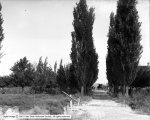
Walker Farm, Road to Farm | 1914-08-25 | Image |
| 116 |
 |
Wall and Railing on North Temple Viaduct | 1916-05-01 | Image |
| 117 |
 |
White Steamer | 1908-08-01 | Image |
| 118 |
 |
Yellowstone, Drive Along Madison River | 1915-09-05 | Image |