|
|
Title | Date | Type |
| 1 |
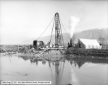 |
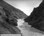
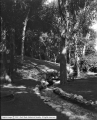
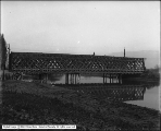
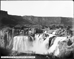
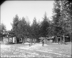
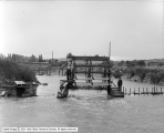
A. A. Clark and Company | 1912-02-13 | Image |
| 2 |
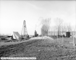 |
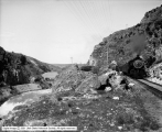
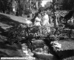
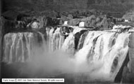
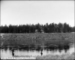
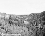
A. A. Clark and Company | 1912-02-13 | Image |
| 3 |
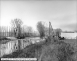 |
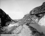
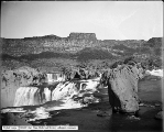
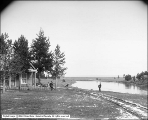
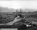
A. A. Clark and Company | 1912-02-13 | Image |
| 4 |
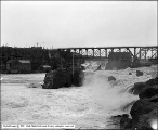 |
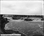
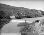
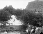
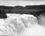
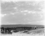
American Falls from East Side | 1911-05-16 | Image |
| 5 |
 |
American Falls from West Side (Foulks) | 1911-05-16 | Image |
| 6 |
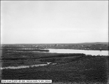 |
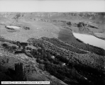
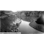
American Falls, Idaho, Pano A | 1911-05-16 | Image |
| 7 |
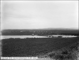 |
American Falls, Idaho, Pano B | 1911-05-16 | Image |
| 8 |
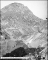 |
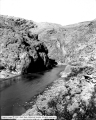
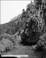
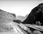
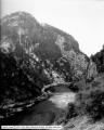
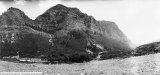
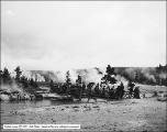
Bear River Canyon, General View | 1913-02-13 | Image |
| 9 |
 |
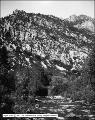
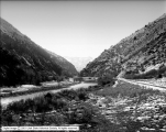
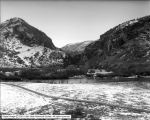
Bear River Canyon, General View in Canyon | 1913-02-13 | Image |
| 10 |
 |
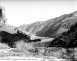
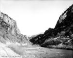
Bear River Canyon, Oregon Short Line | 1913-05-14 | Image |
| 11 |
 |
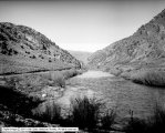
Bear River Canyon, Oregon Short Line | 1913-05-14 | Image |
| 12 |
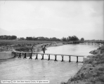
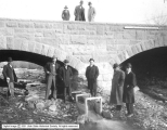
 |
Bear River Canyon, Oregon Short Line Train | 1913-05-14 | Image |
| 13 |
 |
Bear River Canyon, OSL Train | 1913-05-14 | Image |
| 14 |
 |
Bear River Canyon, Power Company Intake | 1913-05-14 | Image |
| 15 |
 |
Bear River Canyon, Upright above Falls | 1913-05-14 | Image |
| 16 |
 |
Bear River Duck Club | 1906-09-10 | Image |
| 17 |
 |
Bear River Duck Club | 1906-09-10 | Image |
| 18 |
 |
Bear River Duck Club | 1906-09-10 | Image |
| 19 |
 |
Bear River Duck Club | 1906-09-10 | Image |
| 20 |
 |
Bear River Duck Club Launch | 1906-09-11 | Image |
| 21 |
 |
Big Cottonwood Canyon, Big Cottonwood Creek at Knudsen's | 1912-05-10 | Image |
| 22 |
 |
Big Cottonwood Canyon, Big Cottonwood Creek Below Brighton | 1907-07-23 | Image |
| 23 |
 |
Big Cottonwood Canyon, Creek | 1915-06 | Image |
| 24 |
 |
Big Cottonwood Canyon, Creek Below Brighton | 1907-07-23 | Image |
| 25 |
 |
Big Cottonwood Canyon, Mr. and Mrs. Dodd | 1910-04-10 | Image |
| 26 |
 |
Black Canyon of Gunnison | 1908-07-17 | Image |
| 27 |
 |
Black Canyon of the Gunnison | 1908-07-17 | Image |
| 28 |
 |
Black Canyon of the Gunnison | 1908-07-17 | Image |
| 29 |
 |
Black Canyon of the Gunnison, Bridge 319A | 1908-07-17 | Image |
| 30 |
 |
Black Canyon of the Gunnison, Curicanti Needle | 1908-07-17 | Image |
| 31 |
 |
Black Canyon of the Gunnison, Curicanti Needle | 1908-07-17 | Image |
| 32 |
 |
Black Canyon of the Gunnison, Curicanti Needle | 1908-07-17 | Image |
| 33 |
 |
Black Canyon of the Gunnison, Curicanti Needle and Railroad | 1908-07-17 | Image |
| 34 |
 |
Black Canyon of the Gunnison, Near East End | 1908-07-17 | Image |
| 35 |
 |
Blue Lakes from Rim | 1912-06-04 | Image |
| 36 |
 |
Box Canyon, Virgin River Dam Site | 1913-06-14 | Image |
| 37 |
 |
Bridge at Murray | 1910-10-20 | Image |
| 38 |
 |
Bridge at Perrines | 1912-06-04 | Image |
| 39 |
 |
Bridge at Riverton | 1910-10-20 | Image |
| 40 |
 |
Bridge at Riverton | 1910-10-20 | Image |
| 41 |
 |
Bridge at Riverton | 1910-10-20 | Image |
| 42 |
 |
Bridge at Riverton | 1910-10-20 | Image |
| 43 |
 |
Bridge on South State Street | 1910-10-20 | Image |
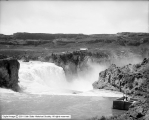
| 44 |
 |
Bridge on South State Street | 1910-10-20 | Image |
| 45 |
 |
Bridge on South State Street | 1910-10-20 | Image |
| 46 |
 |
Bridge over Bear River near Evanston, Wyoming | 1912-08-10 | Image |
| 47 |
 |
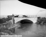
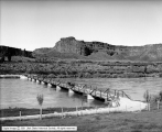
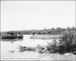
Bridge Over Jordan at Riverton | 1910-06-24 | Image |
| 48 |
 |
Bridge Over Jordan at Riverton | 1910-06-21 | Image |
| 49 |
 |
Canyon Crest Group | 1906-05-09 | Image |
| 50 |
 |
Canyon From Artist Point | 1909-09 | Image |
| 51 |
 |
Canyon From Inspiration Point | 1908-08-18 | Image |
| 52 |
 |
Chandler vs. Utah Copper Company, Creek at Side of Tailings Pond | 1907-04-27 | Image |
| 53 |
 |
Colorado Scenes, Royal Gorge, Hanging Bridge | 1910; 1906; 1907; 1908; 1909; 1911; 1912; 1913; 1914 | Image |
| 54 |
 |
Concrete Bridge at Yellowstone River | 1909-09 | Image |
| 55 |
 |
Devil's Corral | 1912-06-07 | Image |
| 56 |
 |
Devil's Corral | 1912-06-07 | Image |
| 57 |
 |
Dugway above Shoshone Falls from Rim | 1912-06-04 | Image |
| 58 |
 |
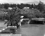
Falls | 1908; 1909 | Image |
| 59 |
 |
Firehole River - Upper Geyser Basin | 1908-08-15 | Image |
| 60 |
 |
Firehole River - Upper Geyser Basin | 1908-08-16 | Image |
| 61 |
 |
Firehole River Below Kepler Cascades | 1909-09 | Image |
| 62 |
 |
Fishing (Man) | 1912-05-25 | Image |
| 63 |
 |
Gibbon River - Below Gibbon Lunch Station | 1908-08-20 | Image |
| 64 |
 |
Group at Perrines | 1912-06-08 | Image |
| 65 |
 |
Group at Perrines #2 | 1912-06-08 | Image |
| 66 |
 |
Highland Improvement Company, Division Dam | 1913-07 | Image |
| 67 |
 |
Highland Improvement Company, Division Dam | 1913-07 | Image |
| 68 |
 |
In Big Cottonwood Canyon, Mr. and Mrs. Shipler | 1910-04-10 | Image |
| 69 |
 |
International Smelting and Refining Company, Testing Flow of Water (Moses Bruneau) | 1916-07-01 | Image |
| 70 |
 |
Jordan River | 1954-09-23 | Image |
| 71 |
 |
Jordan River | 1954-09-23 | Image |
| 72 |
 |
Jordan River | 1954-09-23 | Image |
| 73 |
 |
Jordan River | 1954-09-23 | Image |
| 74 |
 |
Jordan River | 1954-09-23 | Image |
| 75 |
 |
Jordan River | 1954-09-23 | Image |
| 76 |
 |
Jordan River | 1954-09-23 | Image |
| 77 |
 |
Jordan River | 1954-09-23 | Image |
| 78 |
 |
Jordan River | 1954-09-23 | Image |
| 79 |
 |
Jordan River | 1954-09-30 | Image |
| 80 |
 |
Jordan River | 1954-09-30 | Image |
| 81 |
 |
Jordan River | 1954-09-30 | Image |
| 82 |
 |
Jordan River | 1954-09-30 | Image |
| 83 |
 |
Jordan River | 1954-09-30 | Image |
| 84 |
 |
Jordan River | 1954-09-30 | Image |
| 85 |
 |
Jordan River - Western Pacific Bridge, Looking West | 1907-04-15 | Image |
| 86 |
 |
Jordan River Steel Bridge | 1909-05-15 | Image |
| 87 |
 |
Junction of Gibbon and Firehole Rivers | 1908-08 | Image |
| 88 |
 |
Kepler Cascades | 1909-09 | Image |
| 89 |
 |
Looking over Shoshone Falls From North Rim | 1912-06-04 | Image |
| 90 |
 |
Looking over Shoshone Falls From North Rim | 1912-06-04 | Image |
| 91 |
 |
Lower Blue Lakes and Perrines | 1912-06-04 | Image |
| 92 |
 |
National Park Trademark, Hayden Valley | 1909-09 | Image |
| 93 |
 |
Oakwood | 1916-08-18 | Image |
| 94 |
 |
Oakwood Grounds | 1916-08-18 | Image |
| 95 |
 |
Oakwood, Miss Blood and Mrs. Holmes | 1916-08-18 | Image |
| 96 |
 |
Ogden Canyon, Cliff in Ogden Canyon | 1910; 1906; 1907; 1908; 1909; 1911; 1912; 1913; 1914 | Image |
| 97 |
 |
Ogden Canyon, Stream and Mountains | 1910; 1906; 1907; 1908; 1909; 1911; 1912; 1913; 1914 | Image |
| 98 |
 |
Ogden Canyon, Stream and Side of Mountain | 1910; 1906; 1907; 1908; 1909; 1911; 1912; 1913; 1914 | Image |
| 99 |
 |
Ogden Canyon, Stream and Side of Mountain | 1910; 1906; 1907; 1908; 1909; 1911; 1912; 1913; 1914 | Image |
| 100 |
 |
Ogden Canyon, Stream and Side of Mountains | 1910; 1906; 1907; 1908; 1909; 1911; 1912; 1913; 1914 | Image |
| 101 |
 |
Old White Bridge | 1908-11-07 | Image |
| 102 |
 |
Old White Bridge, Side View | 1908-07-16 | Image |
| 103 |
 |
Oregon Short Line Railroad in Bear River Canyon | 1910; 1906; 1907; 1908; 1909; 1911; 1912; 1913; 1914 | Image |
| 104 |
 |
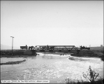
Oregon Short Line Railroad, Bear River Canyon | 1916-11-15 | Image |
| 105 |
 |
Oregon Short Line Railroad, Bear River Canyon | 1916-11-15 | Image |
| 106 |
 |
Oregon Short Line Railroad, Bear River Canyon | 1916-11-15 | Image |
| 107 |
 |
Oregon Short Line Railroad, Bear River Canyon | 1916-11-15 | Image |
| 108 |
 |
Oregon Short Line Railroad, Bear River Canyon | 1916-11-15 | Image |
| 109 |
 |
Oregon Short Line Railroad, Bear River Canyon | 1916-11-15 | Image |
| 110 |
 |
Oregon Short Line Railroad, Bear River Canyon | 1916-11-15 | Image |
| 111 |
 |
Oregon Short Line Railroad, Bear River Canyon Panorama 1 | 1916-11-15 | Image |
| 112 |
 |
Oregon Short Line Railroad, Bear River Canyon Panorama 2 | 1916-11-15 | Image |
| 113 |
 |
Oregon Short Line Railroad, Bear River Canyon, Panorama 1 | 1916-11-15 | Image |
| 114 |
 |
Oregon Short Line Railroad, Bear River Canyon, Panorama 2 | 1916-11-15 | Image |
| 115 |
 |
Perrine's Ranch from South Dugway | 1912-06-04 | Image |
| 116 |
 |
Perrine's Ranch, From Rim Toward Bridges | 1912-06-05 | Image |
| 117 |
 |
Perrine's Ranch, from top of El Capitan | 1912-06-05 | Image |
| 118 |
 |
Perrine's Ranch, Looking Down from Rim | 1912-06-05 | Image |
| 119 |
 |
Perrine's Ranch, Looking Toward Artificial Lake from Rim | 1912-06-05 | Image |
| 120 |
 |
Perrine's Ranch, looking up from Rim | 1912-06-05 | Image |
| 121 |
 |
Provo Canyon | 1910; 1906; 1907; 1908; 1909; 1911; 1912; 1913; 1914 | Image |
| 122 |
 |
Provo Canyon | 1910; 1906; 1907; 1908; 1909; 1911; 1912; 1913; 1914 | Image |
| 123 |
 |
Provo Canyon, General View | 1910; 1906; 1907; 1908; 1909; 1911; 1912; 1913; 1914 | Image |
| 124 |
 |
Provo Canyon, General View and Railroad | 1910; 1906; 1907; 1908; 1909; 1911; 1912; 1913; 1914 | Image |
| 125 |
 |
Provo Canyon, Stream Above Slick's, Woman and Bank | 1910; 1906; 1907; 1908; 1909; 1911; 1912; 1913; 1914 | Image |
| 126 |
 |
Rigs at Riverside, River in Background | 1911-08 | Image |
| 127 |
 |
Salt Lake City View, Jordan River | 1910; 1906; 1907; 1908; 1909; 1911; 1912; 1913; 1914 | Image |
| 128 |
 |
Scenery - Goose Necks, San Juan River | 1941-05 | Image |
| 129 |
 |
Sevier River - 2 Miles Above Leamington, Looking South | 1909-06-07 | Image |
| 130 |
 |
Sevier River - 2 Miles Above Leamington, Looking West | 1909-06-07 | Image |
| 131 |
 |
Sevier River at Leamington | 1909-06-07 | Image |
| 132 |
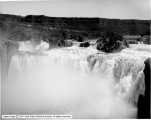 |
Shoshone Falls | 1912-06-04 | Image |
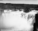
| 133 |
 |
Shoshone Falls | 1908; 1904; 1905; 1906; 1907; 1909; 1910; 1911; 1912 | Image |
| 134 |
 |
Shoshone Falls | 1908; 1904; 1905; 1906; 1907; 1909; 1910; 1911; 1912 | Image |
| 135 |
 |
Shoshone Falls | 1908; 1904; 1905; 1906; 1907; 1909; 1910; 1911; 1912 | Image |
| 136 |
 |
Shoshone Falls | 1912-06-04 | Image |
| 137 |
 |
Shoshone Falls and Rainbow | 1912-06-05 | Image |
| 138 |
 |
Shoshone Falls from above | 1908; 1904; 1905; 1906; 1907; 1909; 1910; 1911; 1912 | Image |
| 139 |
 |
Shoshone Falls from Bridge Site | 1912-06-04 | Image |
| 140 |
 |
Shoshone Falls from Bridge Site | 1912-06-04 | Image |
| 141 |
 |
Shoshone Falls from Bridge Site | 1912-06-04 | Image |
| 142 |
 |
Shoshone Falls From Road | 1912-06-04 | Image |
| 143 |
 |
Shoshone Falls, Below Falls with Rainbow | 1912-06-05 | Image |
| 144 |
 |
Shoshone Falls, Close View | 1912-06-04 | Image |
| 145 |
 |
Shoshone Falls, Close View | 1912-06-04 | Image |
| 146 |
 |
Shoshone Falls, Close View from North Side | 1912-06-05 | Image |
| 147 |
 |
Shoshone Falls, Looking Down Canyon over Falls | 1912-06-04 | Image |
| 148 |
 |
Shoshone Falls, Showing Intake | 1912-06-05 | Image |
| 149 |
 |
Shoshone Falls, Site of North End of Bridge | 1912-06-04 | Image |
| 150 |
 |
Snake River and Shoshone Falls From North Rim | 1912-06-07 | Image |
| 151 |
 |
Snake River and Twins from South Rim of Hughes | 1912-06-05 | Image |
| 152 |
 |
Snake River Looking Down from American Falls, Idaho | 1911-05-16 | Image |
| 153 |
 |
Snake River Looking Down from South Rim at Hughes | 1912-06-05 | Image |
| 154 |
 |
Snake River Looking Down from South Rim at Hughes | 1912-06-05 | Image |
| 155 |
 |
Sunset on Green River | 1909-07-17 | Image |
| 156 |
 |
Sunset Upper Geyser Basin | 1911-08 | Image |
| 157 |
 |
Tourists Crossing Firehole River | 1908-08 | Image |
| 158 |
 |
Train in Canyon | 1910; 1906; 1907; 1908; 1909; 1911; 1912; 1913; 1914 | Image |
| 159 |
 |
Union Pacific Railroad, Devils Gate, Weber Canyon | 1916-05-25 | Image |
| 160 |
 |
Union Pacific Railroad, Devils Gate, Weber Canyon | 1916-05-25 | Image |
| 161 |
 |
Union Pacific Slide in Weber Canyon | 1925; 1921; 1922; 1923; 1924; 1926; 1927; 1928; 1929 | Image |
| 162 |
 |
Utah Fish Screen, Group and Screen | 1914-07-31 | Image |
| 163 |
 |
Utaida Rod and Gun Club | 1909-11-09 | Image |
| 164 |
 |
Utaida Rod and Gun Club | 1909-11-09 | Image |
| 165 |
 |
Utaida Rod and Gun Club | 1909-11-09 | Image |
| 166 |
 |
Utaida Rod and Gun Club | 1909-11-09 | Image |
| 167 |
 |
Utaida Rod and Gun Club | 1909-11-09 | Image |
| 168 |
 |
Utaida Rod and Gun Club | 1909-11-09 | Image |
| 169 |
 |
Utaida Rod and Gun Club, Big Spring at Osborne's | 1909; 1905; 1906; 1907; 1908; 1910; 1911; 1912; 1913 | Image |
| 170 |
 |
Utaida Rod and Gun Club, Lower Falls | 1910; 1906; 1907; 1908; 1909; 1911; 1913; 1915; 1917 | Image |
| 171 |
 |
Utaida Rod and Gun Club, Snake River Falls | 1910-07-04 | Image |
| 172 |
 |
Utaida Rod and Gun Club, Upper Falls, North Fork Snake River | 1910; 1906; 1907; 1908; 1909; 1911; 1913; 1915; 1917 | Image |
| 173 |
 |
Virginia Cascades | 1908-08-19 | Image |
| 174 |
 |
Warm River Canyon, Looking Down | 1908-08-21 | Image |
| 175 |
 |
Warm River Canyon, Looking Up | 1908-08-21 | Image |
| 176 |
 |
Water Wheel, Jordan River | 1914-08-27 | Image |
| 177 |
 |
Water Wheel, Jordan River | 1914-08-27 | Image |
| 178 |
 |
Welsh Trout Farm, Flow from Well | 1917-12-22 | Image |
| 179 |
 |
Yellowstone Canyon From Inspiration Point | 1909-09 | Image |
| 180 |
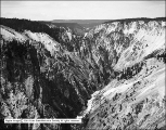 |
Yellowstone Canyon From Inspiration Point | 1908-08-18 | Image |
| 181 |
 |
Yellowstone Canyon, From Brink of Lower Falls | 1911-08 | Image |
| 182 |
 |
Yellowstone River Above Falls | 1909-09 | Image |
| 183 |
 |
Yellowstone River Concrete Bridge | 1909-09 | Image |
| 184 |
 |
Yellowstone River, Top of Upper Falls | 1909-09 | Image |
| 185 |
 |
Yellowstone, Drive Along Madison River | 1915-09-05 | Image |
| 186 |
 |
Yellowstone, Madison River from Bridge | 1915-09-05 | Image |
| 187 |
 |
Yellowstone, Tourists Crossing Firehole River | 1911-08 | Image |