|
|
Title | Date | Type |
| 1 |
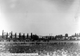 |
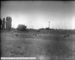
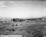
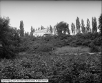
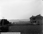
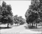
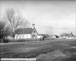
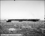
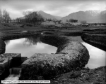
1000 South Between 1000 and 1100 East | 1905 | Image |
| 2 |
 |
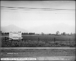
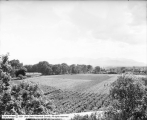
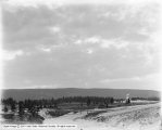
A. Richter | 1912-05-24 | Image |
| 3 |
 |
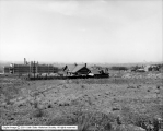
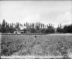
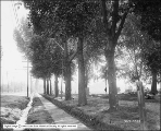
A. Richter | 1912-05-24 | Image |
| 4 |
 |
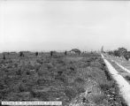
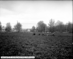
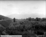
A. Richter | 1912-05-24 | Image |
| 5 |
 |
A. Richter | 1912-05-24 | Image |
| 6 |
 |
A. Richter | 1912-05-24 | Image |
| 7 |
 |
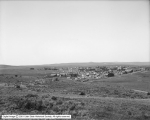
Aberdeen, Idaho (Foulks) | 1911-05-17 | Image |
| 8 |
 |
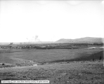
American Falls, Idaho, Pano A | 1911-05-16 | Image |
| 9 |
 |
American Falls, Idaho, Pano B | 1911-05-16 | Image |
| 10 |
 |
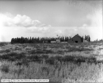
Bacchus, Utah View of Village | 1916-05-10 | Image |
| 11 |
 |
Bacchus, Utah View of Village No. 1 | 1916-05-10 | Image |
| 12 |
 |
Bamberger, Howatt Subdivision | 1914 | Image |
| 13 |
 |
Bamberger, Howatt Subdivision | 1914 | Image |
| 14 |
 |
Bamberger, Howatt Subdivision | 1914 | Image |
| 15 |
 |
Bingham and Garfield Railroad, Freeman Gulch | 1914-10-28 | Image |
| 16 |
 |
Bishop Canyon, Wells, Nevada | 1910-08-23 | Image |
| 17 |
 |
Bridge on South State Street | 1910-10-20 | Image |
| 18 |
 |
Bridge on South State Street | 1910-10-20 | Image |
| 19 |
 |
Cedar Creek Reservoir Site | 1912-06-06 | Image |
| 20 |
 |
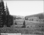
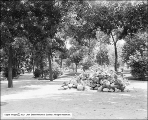
Christmas Tree Park | 1911-08 | Image |
| 21 |
 |
Colonel Holmes - Mountains From Oakwood Home | 1910; 1906; 1907; 1908; 1909; 1911; 1912; 1913; 1914 | Image |
| 22 |
 |
Consolidated Wagon Machine Company, Views at Cleverly Crossing | 1913-05-20 | Image |
| 23 |
 |
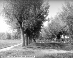
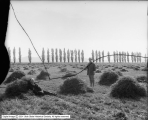
Country Road and Buggy | 1905-09-07 | Image |
| 24 |
 |
County Roads, Salt Lake County | 1914-05-08 | Image |
| 25 |
 |
Crescent Park | 1910-04-20 | Image |
| 26 |
 |
Crescent Park | 1910-04-20 | Image |
| 27 |
 |
Crossing on Orem Line near Power Station | 1914-08-04 | Image |
| 28 |
 |
Danley and Johnson, Alhambra Place | 1910-10-13 | Image |
| 29 |
 |
Denver and Rio Grande, Highline | 1920; 1916; 1917; 1918; 1919; 1921; 1922; 1923; 1924 | Image |
| 30 |
 |
Douglas Park | 1914-09-25 | Image |
| 31 |
 |
Douglas Park | 1914-09-25 | Image |
| 32 |
 |
Douglas Park | 1914-09-25 | Image |
| 33 |
 |
Douglas Park | 1914; 1910; 1911; 1912; 1913; 1915; 1916; 1917; 1918 | Image |
| 34 |
 |
Douglas Park | 1914; 1910; 1911; 1912; 1913; 1915; 1916; 1917; 1918 | Image |
| 35 |
 |
Douglas Park, East High | 1914; 1910; 1911; 1912; 1913; 1915; 1916; 1917; 1918 | Image |
| 36 |
 |
Douglas Park, Smoke over City | 1916-02-09 | Image |
| 37 |
 |
Douglas Park, View of City | 1916-05-06 | Image |
| 38 |
 |
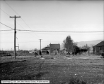
Ely, Grading Townsite | 1906-12 | Image |
| 39 |
 |
Evanston Panorama A | 1912-08-11 | Image |
| 40 |
 |
Evanston Panorama B | 1912-08-11 | Image |
| 41 |
 |
Farm | 1905-09-07 | Image |
| 42 |
 |
Farms at Littlefield, Arizona From Townsite | 1913-06-14 | Image |
| 43 |
 |
Garden at Ranch, Wells, Nevada | 1910-08-23 | Image |
| 44 |
 |
George E. Gunn Farm, Beans and Strawberries Towards Mountains | 1911-06-21 | Image |
| 45 |
 |
George E. Gunn Farm, Looking Southeast Toward House | 1911-06-21 | Image |
| 46 |
 |
George E. Gunn Farm, Looking West From Hill | 1911-06-21 | Image |
| 47 |
 |
George E. Gunn Farm, Strawberry Patch | 1911-06-21 | Image |
| 48 |
 |
George E. Gunn Farm, Strawberry Patch Toward House | 1911-06-21 | Image |
| 49 |
 |
George E. Gunn, Looking Southwest From Dr. Dull's | 1911-06-21 | Image |
| 50 |
 |
Gramling Property, Logan Avenue | 1906-04-30 | Image |
| 51 |
 |
Gramling Property, Panorama #1 | 1906-04-30 | Image |
| 52 |
 |
Gramling Property, Panorama #2 | 1906-04-30 | Image |
| 53 |
 |
Gramling Property, Panorama #3 | 1906-04-30 | Image |
| 54 |
 |
Gunn's Farm, Strawberries | 1912-08-22 | Image |
| 55 |
 |
Gus Buzanus' Property, International Smelting and Refining Company | 1917-08-21 | Image |
| 56 |
 |
Highland Park | 1910-04-18 | Image |
| 57 |
 |
Highland Park | 1910-04-18 | Image |
| 58 |
 |
Highland Park | 1910-04-18 | Image |
| 59 |
 |
Highland Park | 1910-04-18 | Image |
| 60 |
 |
Highland Park | 1910-04-18 | Image |
| 61 |
 |
Home and Dairy | 1909-11-30 | Image |
| 62 |
 |
Hot Pot, Midway | 1911-07-21 | Image |
| 63 |
 |
Hot Pots, Midway | 1911-07-21 | Image |
| 64 |
 |
Hot Pots, Midway | 1911-07-21 | Image |
| 65 |
 |
Hubbard Insurance Company, Southeast | 1905-05-29 | Image |
| 66 |
 |
In Big Cottonwood Canyon, Looking Down From Cut | 1910-04-10 | Image |
| 67 |
 |
International Smelting and Refining Company, Testing Flow of Water (Moses Bruneau) | 1916-07-01 | Image |
| 68 |
 |
Irrigation Project Near Milford | 1914; 1910; 1911; 1912; 1913; 1915; 1916; 1917; 1918 | Image |
| 69 |
 |
J. R. Allen and Brothers | 1910-07-27 | Image |
| 70 |
 |
J. R. Allen and Brothers | 1910-07-27 | Image |
| 71 |
 |
J. R. Allen and Brothers | 1910-07-25 | Image |
| 72 |
 |
J. R. Allen and Brothers | 1910-07-25 | Image |
| 73 |
 |
J. R. Allen and Brothers | 1910-07-25 | Image |
| 74 |
 |
J. W. Foote, Property | 1917-11-30 | Image |
| 75 |
 |
Judge Mining and Smelting, Robison Property Looking North | 1916-09-26 | Image |
| 76 |
 |
Kimball and Richards | 1910-01-17 | Image |
| 77 |
 |
Kimball and Richards | 1910-01-17 | Image |
| 78 |
 |
Kimball and Richards | 1910-01-17 | Image |
| 79 |
 |
Kimball and Richards | 1910-01-17 | Image |
| 80 |
 |
Land North of Wandamere, Angus McKellar | 1912-05-20 | Image |
| 81 |
 |
Land North of Wandamere, Angus McKellar | 1912-05-20 | Image |
| 82 |
 |
Land Northeast of Aberdeen, Idaho (Foulks) | 1911-05-17 | Image |
| 83 |
 |
Liberty Park, Center Drive (600 East) | 1907-06-19 | Image |
| 84 |
 |
Liberty Park, Lawn in Center of Park | 1910; 1906; 1907; 1908; 1909; 1911; 1912; 1913; 1914 | Image |
| 85 |
 |
Looking North From Lynn | 1909-06-07 | Image |
| 86 |
 |
Lots in Denver Place | 1909-06-24 | Image |
| 87 |
 |
Lots in Denver Place, Laird | 1909-06-24 | Image |
| 88 |
 |
Milford Lands | 1910-08 | Image |
| 89 |
 |
Milford Lands | 1910-08 | Image |
| 90 |
 |
Milford Lands | 1910-08 | Image |
| 91 |
 |
Mill Creek Farm, Field Looking West | 1911-06-21 | Image |
| 92 |
 |
Milner Corporation Iron Mine | 1925; 1921; 1922; 1923; 1924; 1926; 1927; 1928; 1929 | Image |
| 93 |
 |
Mosida Fruit Lands Company | 1910-04-29 | Image |
| 94 |
 |
Mosida Fruit Lands Company | 1910-04-29 | Image |
| 95 |
 |
Mountains from Capitol Grounds | 1912-02-01 | Image |
| 96 |
 |
Mountains From Roof Garden (Caithness Apartments) | 1909-07-09 | Image |
| 97 |
 |
Mrs. Campbell [Ranch] | 1916-06-07 | Image |
| 98 |
 |
Mrs. N. Gilmor, View of Land | 1912-05-06 | Image |
| 99 |
 |
Mrs. Sweet Residence | 1914-08-27 | Image |
| 100 |
 |
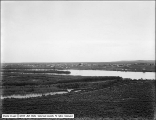
Neponset Land and Livestock Company, General View Looking South from Hill | 1912-08-10 | Image |
| 101 |
 |
Nevada Blossom Land Company | 1914-04-12 | Image |
| 102 |
 |
Nevada Blossom Land Company | 1914-04-12 | Image |
| 103 |
 |
Nevada Blossom Land Company | 1914-04-12 | Image |
| 104 |
 |
Nevada Blossom Land Company | 1914-04-12 | Image |
| 105 |
 |
Park Crescent | 1910-04-15 | Image |
| 106 |
 |
Park Crescent | 1910-04-15 | Image |
| 107 |
 |
Park Crescent | 1910-04-15 | Image |
| 108 |
 |
Park Crescent | 1910-04-15 | Image |
| 109 |
 |
People's Sugar Plant, Moroni, James Stewart and Company | 1917 | Image |
| 110 |
 |
People's Sugar Plant, Moroni, James Stewart and Company | 1917-03 | Image |
| 111 |
 |
Pinecrest Inn Under Construction | 1914 | Image |
| 112 |
 |
Pinecrest Inn Under Construction | 1914 | Image |
| 113 |
 |
Pioneer Plat, Bishop Woolley, View West From 2500 East and 1800 South | 1913-10 | Image |
| 114 |
 |
Pioneer Plat, Bishop Woolley, View West From 2600 East and 1700 South | 1913-10 | Image |
| 115 |
 |
Price Irrigated Land | 1910-05 | Image |
| 116 |
 |
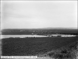
Ranch, Wells, Nevada | 1910-08-23 | Image |
| 117 |
 |
Ray Walker Country House | 1906-05-09 | Image |
| 118 |
 |
Ray Walker Residence, Cottonwood Canyon | 1912-06-10 | Image |
| 119 |
 |
Ray Walker Residence, Cottonwood Canyon | 1912-06-10 | Image |
| 120 |
 |
Ray Walker Residence, Cottonwood Canyon | 1912-06-10 | Image |
| 121 |
 |
Ray Walker Residence, Cottonwood Canyon | 1912-06-10 | Image |
| 122 |
 |
Ray Walker Residence, Cottonwood Canyon | 1912-06-10 | Image |
| 123 |
 |
Ray Walker Residence, Cottonwood Canyon | 1912-06-10 | Image |
| 124 |
 |
Ray Walker Residence, Cottonwood Canyon | 1912-06-10 | Image |
| 125 |
 |
Ray Walker Residence, Cottonwood Canyon | 1912-06-10 | Image |
| 126 |
 |
Reservoir Site, Bishop Creek, Wells, Nevada | 1910-08-23 | Image |
| 127 |
 |
Sage Brush Near Ranch, Wells, Nevada | 1910-08-23 | Image |
| 128 |
 |
Salt Lake City - 1700 South 900 East | 1930; 1926; 1927; 1928; 1929; 1931; 1932; 1933; 1934 | Image |
| 129 |
 |
Salt Lake City - 1700 South 900 East | 1930; 1926; 1927; 1928; 1929; 1931; 1932; 1933; 1934 | Image |
| 130 |
 |
Salt Lake City - From East Bench for Shriner's Hospital | 1950; 1946; 1947; 1948; 1949; 1951; 1952; 1953; 1954 | Image |
| 131 |
 |
Salt Lake City from Arsenal Hill | 1914-06-20 | Image |
| 132 |
 |
Salt Lake City Panoramic View | 1914-06-20 | Image |
| 133 |
 |
Salt Lake City View, 1600 South Row of Trees | 1910; 1906; 1907; 1908; 1909; 1911; 1912; 1913; 1914 | Image |
| 134 |
 |
Salt Lake City View, General View of City | 1905-07-15 | Image |
| 135 |
 |
Salt Lake City View, Part of Residential District, Mountains in Back | 1905-07-15 | Image |
| 136 |
 |
Salt Lake City View, Salt Lake Valley From Wasatch Drive Near Big Cottonwood | 1920-09-26 | Image |
| 137 |
 |
Salt Lake City View, South Section of Salt Lake from North | 1905-07-15 | Image |
| 138 |
 |
Salt Lake City View, Sunset from 1000 East and 300 South | 1912-05-26 | Image |
| 139 |
 |
Salt Lake City View, Sunset from 1000 East and 500 South | 1912-05-26 | Image |
| 140 |
 |
Salt Lake City View, Sunset from 1200 East and 300 South | 1912-05-27 | Image |
| 141 |
 |
Salt Lake City View, Sunset from East Bench | 1911-07 | Image |
| 142 |
 |
Salt Lake City, Looking West Across Valley | 1930; 1926; 1927; 1928; 1929; 1931; 1932; 1933; 1934 | Image |
| 143 |
 |
Salt Lake City, South Temple, Looking West | 1920; 1916; 1917; 1918; 1919; 1921; 1922; 1923; 1924 | Image |
| 144 |
 |
Salt Lake Route, Scene of Accident | 1914-09-25 | Image |
| 145 |
 |
Salt Lake Route, Scene of Accident | 1914-09-25 | Image |
| 146 |
 |
Salt Lake Route, Scene of Accident | 1914-09-25 | Image |
| 147 |
 |
Salt Lake Route, Scene of Accident | 1914-09-25 | Image |
| 148 |
 |
Salt Lake Temple Grounds | 1907-06-18 | Image |
| 149 |
 |
Salt Lake Tennis Club Grounds | 1914 | Image |
| 150 |
 |
Salt Palace Grounds | 1912-06-27 | Image |
| 151 |
 |
Saltair Aviation Field | 1911-03-31 | Image |
| 152 |
 |
Saltair Aviation Field | 1911-03-31 | Image |
| 153 |
 |
Saltair Aviation Field | 1911-03-31 | Image |
| 154 |
 |
Smelter Camp, Ely, Nevada | 1906-12 | Image |
| 155 |
 |
Sunrise From Lynn | 1909-06-07 | Image |
| 156 |
 |
Sunset Upper Geyser Basin | 1911-08 | Image |
| 157 |
 |
Tooele | 1910-04-13 | Image |
| 158 |
 |
Trees, Kimball and Richards | 1909-09-22 | Image |
| 159 |
 |
Union Heights | 1908-06-09 | Image |
| 160 |
 |
Union Pacific Railroad Near Uintah, Weber Canyon | 1916-05-25 | Image |
| 161 |
 |
Union Pacific Railroad Near Uintah, Weber Canyon | 1916-05-25 | Image |
| 162 |
 |
Union Pacific Railroad Train Near Uintah | 1916-05-25 | Image |
| 163 |
 |
Utah Copper Company, Bacchus Powder Works, Panorama A | 1914-05-28 | Image |
| 164 |
 |
Utah Copper Company, Bacchus Powder Works, Panorama B | 1914-05-28 | Image |
| 165 |
 |
Utah Copper Company, Land Below Mill Site | 1905-10-09 | Image |
| 166 |
 |
Utah Railroad Coal Train at Wattis | 1918-11-05 | Image |
| 167 |
 |
Utah Railroad Mallet #200 at Martin | 1918-11-05 | Image |
| 168 |
 |
Utah State Prison Garden | 1917-07-17 | Image |
| 169 |
 |
Utah State Prison Orchard | 1917-07-17 | Image |
| 170 |
 |
View at Eastwood Park | 1912-06-04 | Image |
| 171 |
 |
View at Eastwood Park | 1912-06-04 | Image |
| 172 |
 |
View at Eastwood Park | 1912-06-04 | Image |
| 173 |
 |
View at Eastwood Park | 1912-06-04 | Image |
| 174 |
 |
Wasatch Mountains From Spanish Fork | 1914-11-30 | Image |
| 175 |
 |
Wasatch Mountains, Mount Olympus | 1921-04-26 | Image |
| 176 |
 |
Wasatch Mountains, Mountains from State Prison | 1910; 1906; 1907; 1908; 1909; 1911; 1912; 1913; 1914 | Image |
| 177 |
 |
Welsh Trout Farm, Fish Runs on West Side | 1917-12-22 | Image |
| 178 |
 |
Welsh Trout Farm, Flow from Well | 1917-12-22 | Image |
| 179 |
 |
Welsh Trout Farm, Flow from Well | 1917-12-22 | Image |
| 180 |
 |
Welsh Trout Farm, Flow from Well | 1917-12-22 | Image |
| 181 |
 |
Welsh Trout Farm, Looking East | 1917-12-22 | Image |
| 182 |
 |
Welsh Trout Farm, New Fish Runs | 1917-12-22 | Image |
| 183 |
 |
Welsh Trout Farm, Panorama 1 | 1917-12-22 | Image |
| 184 |
 |
Welsh Trout Farm, Panorama 2 | 1917-12-22 | Image |
| 185 |
 |
Welsh Trout Farm, Southwest View | 1917-12-22 | Image |
| 186 |
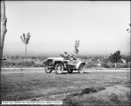 |
White Steamer | 1908-08-01 | Image |
| 187 |
 |
Wholesale District from Top of Newhouse Hotel | 1921-01-05 | Image |
| 188 |
 |
Woolf Ranch, Clover Valley, Nevada | 1910-08-24 | Image |