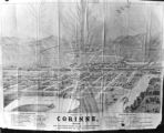
1 - 25 of 42
Number of results to display per page
TitleDateType
1Birdseye View of Salt Lake City P.1Image
2Cache Valley Relief Map P.1Image
3Camp Floyd Mining District P.1Image
4Capitol Building-Exhibits P.11920; 1921; 1922; 1923; 1924; 1925; 1926; 1927; 1928; 1929; 1930; 1931; 1932; 1933; 1934; 1935; 1936; 1937; 1938; 1939; 1940; 1941; 1942; 1943; 1944; 1945; 1946; 1947; 1948; 1949; 1950Image/StillImage
5Carbon County, Utah P.1Image
6Civic Center, Salt Lake City P.1Image
7Clarkston, Utah P.1Image
8Colorado Plateau--Map P.1Image
9Colorado River (Bishop Map) P.1Image
10Colorado River (Upper Basin) P.1Image
11Colorado River -- Excursions p.141935; 1936; 1937; 1938; 1939; 1940; 1941; 1942; 1943; 1944; 1945Image/StillImage
12Corinne, Utah P.1Image
13Cottonwood Mining District P.1Image
14Dry Canyon Ophir Mining District P.1Image
15Echo Canyon P.1Image
16Echo Canyon P.2Image
17Echo Canyon P.3Image
18Escalante Map P.1Image
19Escalante Route Map P.1Image
20Escalante, Utah--Map P.1Image
21Fort Douglas Utah Territory P.1Image
22Fur Traders' Route (Peter Skene Ogden) P.1Image
23Great Salt Lake City P.1Image
24Great Salt Lake--Trails of Charles Stoddard P.1Image
25The Green & Colorado Rivers P.1Image
1 - 25 of 42