|
|
Author | Title | Subject | Date | Publication Type |
| 526 |
 |
Wang, Zuoxing | Physicochemical aspects of smithsonite flotation | Crystal structure; Microflotation; SFG; Smithsonite; Zeta potential | 2014-08 | thesis |
| 527 |
 |
Murali, Arun | Plasma-assisted chemical vapor synthesis of transparent conducting oxides and their applications as transparent conducting films | Nanoscience; Nanotechnology; Materials science | 2018 | thesis |
| 528 |
 |
Smith, Hugh Preston | Plate 1 Fence diagram Moenkopi group (Google Earth map overlay KMZ file) | Geology; Utah; Thaynes Formation; Moenkopi group | 1969-06 | thesis |
| 529 |
|
Mann, Daven Craig | Plate 1 Generalized geologic map of the Laramide orogenic sediments of the Wasatch Hinterland (Google Earth map overlay KMZ file) | Sediments (Geology); Utah; Wasatch Hinterland | 1974 | thesis |
| 530 |
|
Chapusa, Frank W. P. | Plate 1 Geologic map of Stansbury Island, Tooele County, Utah (Google Earth map overlay KMZ file) | Geology; Utah; Stansbury Island | 1969-06 | thesis |
| 531 |
|
Cohenour, Robert E. | Plate 1 Geologic map of the Sheeprock Mountains area, Utah (Google Earth map overlay KMZ file) | Geology -- Utah -- Sheeprock Mountains; Geology -- Utah -- Tooele County; Geology -- Utah -- Juab County; Thesis and dissertation georeferencing project | 1957-08 | thesis |
| 532 |
 |
Rodriguez, Enrique Levy | Plate 1: Geologic map and vertical cross section of the Sulphurdale sulphur deposits, Beaver and Millard Counties, Utah | | 1960-08 | thesis |
| 533 |
|
Rodriguez, Enrique Levy | Plate 1: Geologic map and vertical cross section of the Sulphurdale sulphur deposits, Beaver and Millard Counties, Utah (Google Earth map overlay KMZ file) | Geology, Economic -- Utah -- Sulphurdale; Mines and mineral resources -- Utah -- Sulphurdale; Sulphur mines and mining -- Utah -- Sulphurdale; Thesis and dissertation georeferencing project | 1960-08 | thesis |
| 534 |
 |
Brox, George Stanley | Plate 1: Geologic map of Northern Bryce Canyon National Park | | 1961-06 | thesis |
| 535 |
 |
Neff, Thomas Rodney | Plate 1: Geologic map of the Little Willow Series, Wasatch Mountains, Utah | | 1962-11 | thesis |
| 536 |
 |
Boschetto, Harold Bradley | Plate 1: Geologic map of the Lothidok Range, Kenya | Geology; Kenya; Lothidok Range | 1988-08 | map |
| 537 |
 |
Blakey, Ronald Clyde | Plate 1: Geologic map of the Paria NW quadrangle, Kane County, Utah | | 1970-08 | thesis |
| 538 |
|
Baker, Walker Holcombe | Plate 1: Geologic map of the Southern Grouse Creek Mountains, Box Elder County, Utah (Google Earth map overlay KMZ file) | Geology--Utah; Thesis and dissertation georeferencing project | 1959-06 | thesis |
| 539 |
 |
Sadeghi, Ali Reza | Plate 1: Geologic map of the Willard Peak area, North-Central Wasatch Mountains, Utah | | 1972-12 | thesis |
| 540 |
|
Sadeghi, Ali Reza | Plate 1: Geologic map of the Willard Peak area, North-Central Wasatch Mountains, Utah (Google Earth map overlay KMZ file) | Geology -- Structural -- Utah -- Willard Peak area; Thesis and dissertation georeferencing project | 1972-12 | thesis |
| 541 |
|
Blue, Donald McCoy | Plate 1: Lucin mining district and vicinity, Northern Pilot Range, Box Elder County, Utah - Elko County, Nevada (Google Earth map overlay KMZ file) | Thesis and dissertation georeferencing project | 1960-08 | thesis |
| 542 |
 |
Schaeffer, Frederick Ernst Jr. | Plate 1B: Geologic map of the Central and Southern Silver Island Mountains, Box Elder and Tooele Counties, Utah, and Elko County, Nevada | | 1961-06 | thesis |
| 543 |
|
Schaeffer, Jr. Frederick Ernst | Plate 1B: Geologic map of the Central and Southern Silver Island Mountains, Box Elder and Tooele Counties, Utah, and Elko County, Nevada (Google Earth map overlay KMZ file) | Thesis and dissertation georeferencing project | 1961-06 | thesis |
| 544 |
 |
Schaeffer, Frederick Ernst Jr. | Plate 1C: Geologic cross sections of the Central and Southern Silver Island Mountains, Box Elder and Tooele Counties, Utah and Elko County, Nevada | | 1961-06 | thesis |
| 545 |
 |
Johnson, Eric Henry | Plate 2 Topography, resistivity, and chargeability cross-sections along dipole-dipole line 1 on Fumarole Butte | Basalt -- Utah; Geothermal resources -- Utah | 1975-08 | thesis |
| 546 |
 |
Baker, Walker Holcombe | Plate 2: Cross-section A-A' | | 1959-06 | thesis |
| 547 |
 |
Rodriguez, Enrique Levy | Plate 2: Detailed geologic and vertical cross sections map of the Excelsior Orebody and New York Prospect Pit, Millard County, Utah | | 1960-08 | thesis |
| 548 |
 |
Neff, Thomas Rodney | Plate 2: Sections along line A-A' and B-B' | | 1962-11 | thesis |
| 549 |
 |
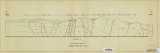
Blakey, Ronald Clyde | Plate 2: Structural sections | | 1970-08 | thesis |
| 550 |
 |
Sadeghi, Ali Reza | Plate 2: Structure sections for geologic map of the Willard Peak area | | 1972-12 | thesis |