TO
Filters: Publication Type: "thesis" School Or College: "College of Mines & Earth Sciences" Collection: ir_etd
| Author | Title | Subject | Date | Publication Type | ||
|---|---|---|---|---|---|---|
| 376 |
 |
Condie, Kent C. | Petrogeneis of the Mineral Range Pluton, Southwestern Utah: Georeferenced map files | Petrology -- Utah -- Beaver County; Millard County; Geology -- Utah -- Beaver County; Millard County; Mineral Range (Utah) | 1960-06 | thesis |
| 377 |
 |
Banks, Elizabeth Young | Petrographic characteristics and provenance of fluvial sandstone, sunnyside oil-impregnated sandstone deposit, Carbon County, Utah | Fluvial sandstone; Uinta Basin; Sunnyside oil-impregnated sandstone | 1981-12 | thesis |
| 378 |
 |
Ghassal, Bandar Ismail | Petroleum geochemistry and geology of the Midyan and Al Wajah basins, Northern Red Sea, Saudi Arabia | Petroleum--Saudi Arabia | 2010-01-28 | thesis |
| 379 |
 |
Martz, Alan Matthew | Petrology and Chemistry of tuffs from the Shungura Formation, Southwest Ethiopia | 1979 | thesis | |
| 380 |
 |
Neff, Thomas Rodney | Petrology and structure of the little willow series, Wasatch Mountains, Utah | Petrology -- Utah -- Wasatch Mountains; Thesis and dissertation georeferencing project | 1962-11 | thesis |
| 381 |
 |
Neff, Thomas Rodney | Petrology and structure of the Little Willow Series, Wasatch Mountains, Utah-Maps | Petrology -- Utah -- Wasatch Mountains | 1962-11 | thesis |
| 382 |
 |
Neff, Thomas Rodney | Petrology and structure of the little willow series, Wasatch Mountains, Utah: Georeferenced map files | Petrology -- Utah -- Wasatch Mountains | 1962-11 | thesis |
| 383 |
 |
Wiley, Dennis Roy | Petrology of bituminous sandstones in the Green River Formation, Southeastern Uinta Basin, Utah | Petrology; Utah; Green River Formation; Sandstone; Thesis and dissertation georeferencing project | 1967-06 | thesis |
| 384 |
 |
Vlam, Heber Adolf Arien | Petrology of Lake Bonneville Gravels Salt Lake County, Utah | Petrology; Utah; Salt Lake County; Bonneville; Thesis and dissertation georeferencing project | 1963-05 | thesis |
| 385 |
 |
Vlam, Heber Adolf Arien | Petrology of Lake Bonneville Gravels Salt Lake County, Utah: Georeferenced map files | Petrology; Utah; Salt Lake County; Bonneville; Lake | 1963-05 | thesis |
| 386 |
 |
Van Deventer, Bruce Robert | Petrology of the moenkopi formation (Early Triassic), Uinta Mountain Area, Northeastern Utah | Petrology; Utah; Moenkopi formation; Thesis and dissertation georeferencing project | 1974-06 | thesis |
| 387 |
 |
Gorenc, Marko Anton | Petrophysical and diagenetic characteristics of the permian white rim sandstone, southeast utah | Diagenesis; Hydrocarbons; Iron Oxide; Utah | 2015-08 | thesis |
| 388 |
 |
Hwang, Su Hyun | Phosphorus removal from manganese ore by plasma treatment | Ferro-manganese; Manganese ore; Phosphorus; Plasma | 2011-08 | thesis |
| 389 |
 |
Wang, Zuoxing | Physicochemical aspects of smithsonite flotation | Crystal structure; Microflotation; SFG; Smithsonite; Zeta potential | 2014-08 | thesis |
| 390 |
 |
Murali, Arun | Plasma-assisted chemical vapor synthesis of transparent conducting oxides and their applications as transparent conducting films | Nanoscience; Nanotechnology; Materials science | 2018 | thesis |
| 391 |
 |
Smith, Hugh Preston | Plate 1 Fence diagram Moenkopi group (Google Earth map overlay KMZ file) | Geology; Utah; Thaynes Formation; Moenkopi group | 1969-06 | thesis |
| 392 |
 |
Mann, Daven Craig | Plate 1 Generalized geologic map of the Laramide orogenic sediments of the Wasatch Hinterland (Google Earth map overlay KMZ file) | Sediments (Geology); Utah; Wasatch Hinterland | 1974 | thesis |
| 393 |
 |
Chapusa, Frank W. P. | Plate 1 Geologic map of Stansbury Island, Tooele County, Utah (Google Earth map overlay KMZ file) | Geology; Utah; Stansbury Island | 1969-06 | thesis |
| 394 |
 |
Cohenour, Robert E. | Plate 1 Geologic map of the Sheeprock Mountains area, Utah (Google Earth map overlay KMZ file) | Geology -- Utah -- Sheeprock Mountains; Geology -- Utah -- Tooele County; Geology -- Utah -- Juab County; Thesis and dissertation georeferencing project | 1957-08 | thesis |
| 395 |
 |
Rodriguez, Enrique Levy | Plate 1: Geologic map and vertical cross section of the Sulphurdale sulphur deposits, Beaver and Millard Counties, Utah | 1960-08 | thesis | |
| 396 |
 |
Rodriguez, Enrique Levy | Plate 1: Geologic map and vertical cross section of the Sulphurdale sulphur deposits, Beaver and Millard Counties, Utah (Google Earth map overlay KMZ file) | Geology, Economic -- Utah -- Sulphurdale; Mines and mineral resources -- Utah -- Sulphurdale; Sulphur mines and mining -- Utah -- Sulphurdale; Thesis and dissertation georeferencing project | 1960-08 | thesis |
| 397 |
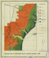 |
Brox, George Stanley | Plate 1: Geologic map of Northern Bryce Canyon National Park | 1961-06 | thesis | |
| 398 |
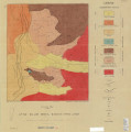 |
Neff, Thomas Rodney | Plate 1: Geologic map of the Little Willow Series, Wasatch Mountains, Utah | 1962-11 | thesis | |
| 399 |
 |
Blakey, Ronald Clyde | Plate 1: Geologic map of the Paria NW quadrangle, Kane County, Utah | 1970-08 | thesis | |
| 400 |
 |
Baker, Walker Holcombe | Plate 1: Geologic map of the Southern Grouse Creek Mountains, Box Elder County, Utah (Google Earth map overlay KMZ file) | Geology--Utah; Thesis and dissertation georeferencing project | 1959-06 | thesis |
