TO
1 - 25 of 7
| Author | Title | Subject | Date | Publication Type | ||
|---|---|---|---|---|---|---|
| 1 |
 |
Wood, William James | Areal geology of the Coalville vicinity, Summit County, Utah (Google Earth map overlay KMZ file) | Geology; Utah; Coalville region; Thesis and dissertation georeferencing project | 1953-06 | map |
| 2 |
|
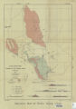
Earll, Fred Nelson | Geology of the Central Mineral Range, Beaver County, Utah (Google Earth map overlay KMZ file) | Geology -- Utah -- Mineral Mountains; Beaver County; Thesis and dissertation georeferencing project | 1957-08 | map |
| 3 |
|
O'Toole, Walter L. | Geology of the Keetley-Kamas volcanic area (Google Earth map overlay KMZ file) | Geology; Utah; Summit County; Wasatch County; Thesis and dissertation georeferencing project | 1951 | map |
| 4 |
|
Amin, Surendra R. | Map 1: Geologic map of Antelope intrusive and vicinity (Google Earth map overlay KMZ file) | Thesis and dissertation georeferencing project | 1950 | map |
| 5 |
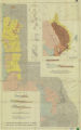 |
Plate17 Geologic map and sections of parts of the Magna, Lark, Fairfield, and Jordan Narrows quadrangles, Utah | Magna - Utah; Lark- Utah; Fairfield - Utah; Jordan Narrows - Utah; Geological map | 1955 | map | |
| 6 |
 |
Slentz, L. W. | Plate18 Geologic map of Rozel Hills, Utah | Geology - Rozel Hills. Utah; Geology map | 1955-06 | map |
| 7 |
|
Slentz, Loren William | Tertiary Salt Lake group in the Great Salt Lake Basin (Google Earth map overlay KMZ file) | Geology; Stratigraphic; Tertiary; Utah; Great Salt Lake Basin; Thesis and dissertation georeferencing project | 1955-07 | map |
1 - 25 of 7