Home
Browse
Ask Us
Chat
Harmful Language Statement
Log in
Advanced Search
Year
1873
1874
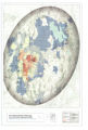
1875
1876
1877
1878
1879
1880
1881
1882
1883
1884
1885
1886
1887
1888
1889
1890
1891
1892
1893
1894
1895
1896
1897
1898
1899
1900
1901
1902
1903
1904
1905
1906
1907
1908
1909
1910
1911
1912
1913
1914
1915
1916
1917
1918
1919
1920
1921
1922
1923
1924
1925
1926
1927
1928
1929
1930
1931
1932
1933
1934
1935
1936
1937
1938
1939
1940
1941
1942
1943
1944
1945
1946
1947
1948
1949
1950
1951
1952
1953
1954
1955
1956
1957
1958
1959
1960
1961
1962
1963
1964
1965
1966
1967
1968
1969
1970
1971
1972
1973
1974
1975
1976
1977
1978
1979
1980
1981
1982
1983
1984
1985
1986
1987
1988
1989
1990
1991
1992
1993
1994
1995
1996
1997
1998
1999
2000
2001
2002
2003
2004
2005
2006
2007
2008
2009
TO
1873
1874
1875
1876
1877
1878
1879
1880
1881
1882
1883
1884
1885
1886
1887
1888
1889
1890
1891
1892
1893
1894
1895
1896
1897
1898
1899
1900
1901
1902
1903
1904
1905
1906
1907
1908
1909
1910
1911
1912
1913
1914
1915
1916
1917
1918
1919
1920
1921
1922
1923
1924
1925
1926
1927
1928
1929
1930
1931
1932
1933
1934
1935
1936
1937
1938
1939
1940
1941
1942
1943
1944
1945
1946
1947
1948
1949
1950
1951
1952
1953
1954
1955
1956
1957
1958
1959
1960
1961
1962
1963
1964
1965
1966
1967
1968
1969
1970
1971
1972
1973
1974
1975
1976
1977
1978
1979
1980
1981
1982
1983
1984
1985
1986
1987
1988
1989
1990
1991
1992
1993
1994
1995
1996
1997
1998
1999
2000
2001
2002
2003
2004
2005
2006
2007
2008
2009
Type
Image/StillImage
88
Text
8
Image/MovingImage
6
Sound
2
Format
image/jpeg
104
Collection
Multimedia Archives Photographs - Res...
44
UAIDA Main Collection
60
Filters:
Format:
"image/jpeg"
1
-
25
of
104
<
1
2
3
4
5
>
Gallery view
Number of results to display per page
10
25
50
100
200
Sort by Relevance
Sort by Title A-Z
Sort by Title Z-A
Sort by Date Ascending
Sort by Date Descending
Sort by Last Modified Ascending
Sort by Last Modified Descending
Title
Date
Type
Setname
1
2010 Boundary Validation Program_001
Image/StillImage
uaida_main
2
2010 Boundary Validation Program_002
Image/StillImage
uaida_main
3
2010 Boundary Validation Program_003
Image/StillImage
uaida_main
4
2010 Boundary Validation Program_004
Image/StillImage
uaida_main
5
2010 Boundary Validation Program_005
Image/StillImage
uaida_main
6
2010 Boundary Validation Program_006
Image/StillImage
uaida_main
7
A discussion of modernization and tradition
2009
Image/MovingImage
uaida_main
8
Appeal to the People for the Water - Goshute Tribal Chairman
Image/MovingImage
uaida_main
9
Appeal to the Youth - Goshute Tribal Chairman
Image/MovingImage
uaida_main
10
Areas Used by the Goshute People and Areas Potentially Impacted by Southern Nevada Water Authority
Image/StillImage
uaida_main
11
Boundary of Shoshone Indian Territory according to Swanton, 1952
1952
Image/StillImage
uaida_main
12
Boundary of Shoshone Indian Territory and Neighboring Tribes
1957
Image/StillImage
uaida_main
13
Boundary of Shoshone Indian Territory, Linguistic Boundaries of Shoshone and Bannock.
1941
Image/StillImage
uaida_main
14
Boundary of Shoshone Indian Territory, showing the locations of the Bannock
1957
Image/StillImage
uaida_main
15
Boundary of Shoshone Indian Territory, showing the locations of the Bannock from 1819 to 1951
1957
Image/StillImage
uaida_main
16
Boundary of Shoshone Indian Territory, showing the locations where the Bannock and Shoshone reported together 1819-1956
1957
Image/StillImage
uaida_main
17
Boundary of Shoshone Indian Territory; Doty Map of 1863 Indian Claims Commission
1957
Image/StillImage
uaida_main
18
Bureau of Indian Affairs
Image/StillImage
uaida_main
19
Coyote and Frog
2009
Image/MovingImage
uaida_main
20
Figure 01: Skull Valley, view from the northwest at, or near Timpie Junction. Jedediah Smith in 1827 climed {sic} the knob in the distance and obtained a glimpse of the Great Salt Lake
1939
Image/StillImage
uum_mapr
21
Figure 02: Knolls, Utah. View southwest. This locality is on the eastern edge of the Great Salt Lake Desert
1939
Image/StillImage
uum_mapr
22
Figure 03: The Bonneville Salt Flats on the Great Salt Lake Desert, Utah. Captain Cobb's world speed record car in the distance
1939
Image/StillImage
uum_mapr
23
Figure 04: Sage Brush in a favorable living locality just south of Skull Valley. This brush is as much as fourteen feet high, indicating a rich soil and a considerable amount of moisture
1939
Image/StillImage
uum_mapr
24
Figure 05: Deep Creek Valley from the Deep Creek Mountains. The Tippets Mountains appear twenty miles westward. The Gosiute village is the center of the picture
1939
Image/StillImage
uum_mapr
25
Figure 06: The Deep Creek Mountains
1939
Image/StillImage
uum_mapr
1
-
25
of
104
<
1
2
3
4
5
>