Home
Browse
Ask Us
Chat
Harmful Language Statement
Log in
Advanced Search
Year
1859
1860
1861
1862
1863
1864
1865
1866
1867
1868
1869
1870
1871
1872
1873
1874
1875
1876
1877
1878
1879
1880
1881
1882
1883
1884
1885
1886
1887
1888
1889
1890
1891
1892
1893
1894
1895
1896
1897
1898
1899
1900
1901
1902
1903
1904
1905
1906
1907
1908
1909
1910
1911
1912
1913
1914
1915
1916
1917
1918
1919
1920
1921
1922
1923
1924
1925
1926
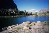
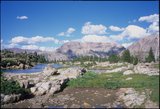
1927
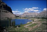
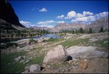
1928
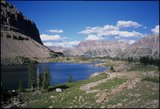
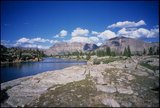
1929
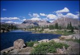
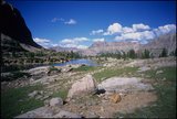
1930
1931
1932
1933
1934
1935
1936
1937
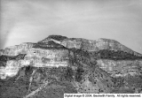
1938
1939
1940
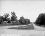
1941
1942
1943
1944
1945
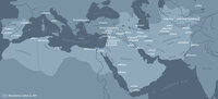
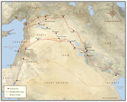
1946
1947
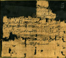
1948
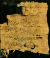
1949
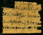
1950
1951
1952
1953
1954
1955
1956
1957
1958
1959
1960
1961
1962
1963
1964
1965
1966
1967
1968
1969
1970
1971
1972
1973
1974
1975
1976
1977
1978
1979
1980
1981
1982
1983
1984
1985
1986
1987
1988
1989
1990
1991
1992
1993
1994
1995
1996
1997
1998
1999
2000
2001
2002
2003
2004
2005
2006
2007
2008
2009
2010
2011
2012
2013
2014
2015
2016
2017
2018
2019
2020
2021
2022
TO
1859
1860
1861
1862
1863
1864
1865
1866
1867
1868
1869
1870
1871
1872
1873
1874
1875
1876
1877
1878
1879
1880
1881
1882
1883
1884
1885
1886
1887
1888
1889
1890
1891
1892
1893
1894
1895
1896
1897
1898
1899
1900
1901
1902
1903
1904
1905
1906
1907
1908
1909
1910
1911
1912
1913
1914
1915
1916
1917
1918
1919
1920
1921
1922
1923
1924
1925
1926
1927
1928
1929
1930
1931
1932
1933
1934
1935
1936
1937
1938
1939
1940
1941
1942
1943
1944
1945
1946
1947
1948
1949
1950
1951
1952
1953
1954
1955
1956
1957
1958
1959
1960
1961
1962
1963
1964
1965
1966
1967
1968
1969
1970
1971
1972
1973
1974
1975
1976
1977
1978
1979
1980
1981
1982
1983
1984
1985
1986
1987
1988
1989
1990
1991
1992
1993
1994
1995
1996
1997
1998
1999
2000
2001
2002
2003
2004
2005
2006
2007
2008
2009
2010
2011
2012
2013
2014
2015
2016
2017
2018
2019
2020
2021
2022
Type
Text
2,054
Image
170
Image/StillImage
34
Format
image/jpeg
2,299
Collection
Arabic Papyrus, Parchment, and Paper
2,054
Art and Art History
35
Beckwith Photograph Collection
4
CAP History
13
City Engineers
1
Classified Photographs
12
Discovery and Innovation at Universit...
1
Lennox and Catherine Tierney Photogra...
3
Marriott Library Posters
5
More Than A Flag: Utah State Flag Red...
7
Murray Museum
2
Park City Historical Society & Museum
1
Photo Archives
129
Quinney - Iraq Project
13
Regional History Center
4
Shipler Commercial Photographers
2
Thorne Photographs
3
Uintah County Regional History Center...
3
University Archival Photographs (P0305)
1
Westminster University Photographs
6
More
Filters:
Format:
"image/jpeg"
76
-
100
of
2,299
<
1
2
3
4
5
6
7
8
9
10
>
Gallery view
Number of results to display per page
10
25
50
100
200
Sort by Relevance
Sort by Title A-Z
Sort by Title Z-A
Sort by Date Ascending
Sort by Date Descending
Sort by Last Modified Ascending
Sort by Last Modified Descending
Title
Date
Type
Setname
76
McPheters Lake, Middle Basin [04]
2001-07-23
uum_map
77
McPheters Lake, Middle Basin [05]
2001-07-23
uum_map
78
McPheters Lake, Middle Basin [06]
2001-07-23
uum_map
79
McPheters Lake, Middle Basin [07]
2001-07-23
uum_map
80
McPheters Lake, Middle Basin [08]
2001-07-23
uum_map
81
McPheters Lake, Middle Basin [09]
2001-07-23
uum_map
82
McPheters Lake, Middle Basin [10]
2001-07-23
uum_map
83
McPheters Lake, Middle Basin [11]
2001-07-23
uum_map
84
McPheters Lake, Middle Basin [12]
2001-07-23
uum_map
85
McPheters Lake, Middle Basin [13]
2001-07-23
uum_map
86
McPheters Lake, Middle Basin [14]
2001-07-23
uum_map
87
Panorama [1]
1956-05-09
Image
dc_bpc
88
Panorama [2]
1946-05-09
Image
dc_bpc
89
Map: Abbasid caliphate
Image
uu_aah_art
90
Sixth East Street Looking South, Parking In Middle of Street
1912-09-16
Image
dha_scp
91
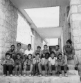
Karameh Elementary School, East Jordan, 1974-1975.
1974; 1975
Image
uum_map
92
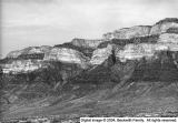
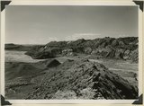
Looking south along Paria River from the mouth of Shurtz Gorge. Navajo sandstone in East Kaibab monocline is overlaid with decreasing dips by Upper Jurassic (banked against the Navajo), Dakota, and Tropic (foreground and left sky line). Erosion surface (middle distance) bevels upturned rocks. Kane County, UT, 1944
1944
Image
uum_map
93
Paramount Lubricants Company Service Station
1929-01-14
Image
dha_cp
94
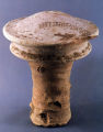
Architectural Peg Cover Ornament
Image
uu_aah_art
95
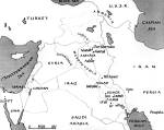
Map: Current Middle East Showing Ancient Mesopotamia
Image
uu_aah_art
96
Map: Location of Dura Europos in the Middle East
Image
uu_aah_art
97
Arabic Papyrus #0378
Text
uum_appp
98
Arabic Papyrus #0379
Text
uum_appp
99
Arabic Papyrus #0380
Text
uum_appp
100
Arabic Papyrus #0381
Text
uum_appp
76
-
100
of
2,299
<
1
2
3
4
5
6
7
8
9
10
>