Home
Browse
Ask Us
Chat
Harmful Language Statement
Log in
Advanced Search
Year
1853
1854
1855
1856
1857
1858
1859
1860
1861
1862
1863
1864
1865
1866
1867
1868
1869
1870
1871
1872
1873
1874
1875
1876
1877
1878
1879
1880
1881
1882
1883
1884
1885
1886
1887
1888
1889
1890
1891
1892
1893
1894
1895
1896
1897
1898
1899
1900
1901
1902
1903
1904
1905
1906
1907
1908
1909
1910
1911
1912
1913
1914
1915
1916
1917
1918
1919
1920
1921
1922
1923
1924
1925
1926
1927
1928
1929
1930
1931
1932
1933
1934
1935
1936
1937
1938
1939
1940
1941
1942
1943
1944
1945
1946
1947
1948
1949
1950
1951
1952
1953
1954
1955
1956
1957
1958
1959
1960
1961
1962
1963
1964
1965
1966
1967
1968
1969
1970
1971
1972
1973
1974
1975
1976
1977
1978
1979
1980
1981
1982
1983
1984
1985
1986
1987
1988
1989
1990
1991
1992
1993
1994
1995
1996
1997
1998
1999
2000
2001
2002
2003
2004
2005
2006
2007
2008
2009
2010
2011
2012
2013
2014
2015
2016
2017
2018
2019
2020
2021
2022
2023
2024
2025
TO
1853
1854
1855
1856
1857
1858
1859
1860
1861
1862
1863
1864
1865
1866
1867
1868
1869
1870
1871
1872
1873
1874
1875
1876
1877
1878
1879
1880
1881
1882
1883
1884
1885
1886
1887
1888
1889
1890
1891
1892
1893
1894
1895
1896
1897
1898
1899
1900
1901
1902
1903
1904
1905
1906
1907
1908
1909
1910
1911
1912
1913
1914
1915
1916
1917
1918
1919
1920
1921
1922
1923
1924
1925
1926
1927
1928
1929
1930
1931
1932
1933
1934
1935
1936
1937
1938
1939
1940
1941
1942
1943
1944
1945
1946
1947
1948
1949
1950
1951
1952
1953
1954
1955
1956
1957
1958
1959
1960
1961
1962
1963
1964
1965
1966
1967
1968
1969
1970
1971
1972
1973
1974
1975
1976
1977
1978
1979
1980
1981
1982
1983
1984
1985
1986
1987
1988
1989
1990
1991
1992
1993
1994
1995
1996
1997
1998
1999
2000
2001
2002
2003
2004
2005
2006
2007
2008
2009
2010
2011
2012
2013
2014
2015
2016
2017
2018
2019
2020
2021
2022
2023
2024
2025
Type
Image
6,477
Image/StillImage
2,925
Sound
3
Text
3
Format
image/jpeg
10,809
Collection
Anthropology Ethnographic Collections
42
Botany Vascular Plants
4
CAP History
17
College of Law Publications
383
Connell O'Donovan LGBT Utah History C...
21
Eccles Health Sciences Library History
1
Entomology Specimen Photos
196
Hotel Utah
12
Lennox and Catherine Tierney Photogra...
62
Manuscripts
3
Marriott Library Posters
2
More Than A Flag: Utah State Flag Red...
4
Murray Museum
15
NOVEL - William F. Hoyt Collection
7
Olympic Legacy
426
Peoples of Utah Revisited
12
Photo Archives
2,591
Regional History Center
96
Richard Kern's Far West Sketches: A V...
88
Right Whale Collection
3,306
Right Whale Contacts Collection
184
Right Whale Notes Collection
92
School of Medicine
5
Ski and Snow Sports Photo Archives
2,265
UAIDA Main Collection
2
UScholar Works
2
Uintah County Regional History Center...
2
University Archival Photographs (P0305)
1
Utah Artists Project
89
Utah River Running Photo Archives
35
We Remember, We Celebrate, We Believe...
2
Western Soundscape Spectrograms
838
Western Waters Audio-Video
3
Westminster University Photographs
1
More
Filters:
Format:
"image/jpeg"
701
-
725
of
10,809
<
24
25
26
27
28
29
30
31
32
33
>
Gallery view
Number of results to display per page
10
25
50
100
200
Sort by Relevance
Sort by Title A-Z
Sort by Title Z-A
Sort by Date Ascending
Sort by Date Descending
Sort by Last Modified Ascending
Sort by Last Modified Descending
Title
Date
Type
Setname
701
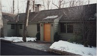
Aspen cabin, Camp David, January 2001
2001-01
Image
uum_map
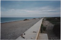
702
Beach wall
2001-03
Image
uum_map
703
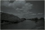
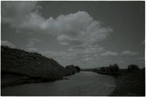
Bear River bottoms, Utah-Wyoming (negative) [1]
2001-06
Image/StillImage
uum_map
704
Bear River bottoms, Utah-Wyoming (negative) [2]
2001-06
Image/StillImage
uum_map
705
Bear River bottoms, Utah-Wyoming (negative) [3]
2001-06
Image/StillImage
uum_map
706
Bear River bottoms, Utah-Wyoming (negative) [4]
2001-06
Image/StillImage
uum_map
707
Bear River bottoms, Utah-Wyoming (negative) [5]
2001-06
Image/StillImage
uum_map
708
Bear River bottoms, Utah-Wyoming (negative) [6]
2001-06
Image/StillImage
uum_map
709
Bear River bottoms, Utah-Wyoming (negative) [7]
2001-06
Image/StillImage
uum_map
710
Bear River Bottoms, Wyoming; Christmas Meadows, Uintas [Contact prints]
2001-06
Image/StillImage
uum_map
711
Bear River in Cache Valley: Amalga Bottoms [Contact prints]
2001-11
Image/StillImage
uum_map
712
Bear River in Cache Valley: Cutler Reservoir, Benson dock, etc. [Contact prints]
2001-11
Image/StillImage
uum_map
713
Bear River in Idaho: Black Canyon, Oneida Narrows [Contact prints]
2001-10
Image/StillImage
uum_map
714
Bear River in Idaho: Dingle Bottoms [Contact prints]
2001-11
Image/StillImage
uum_map
715
Bear River in Idaho: Dingle Bottoms, Rainbow Canal [Contact prints]
2001-11
Image/StillImage
uum_map
716
Bear River in Idaho: Oneida Narrows reservoir and canyon [Contact prints]
2001-10
Image/StillImage
uum_map
717
Bear River in Idaho: Oneida Narrows, Black Canyon, Soda Point, travertine pools [Contact prints]
2001-10
Image/StillImage
uum_map
718
Bear River in Idaho: Soda Point, Black Canyon, Mound Valley [Contact prints]
2001-10
Image/StillImage
uum_map
719
Bear River in Idaho: Soda Point, Black Canyon, travertine pools, Oneida Narrows [Contact prints]
2001-10
Image/StillImage
uum_map
720
Bear River in Idaho: Stewart Dam [Contact prints]
2001-11
Image/StillImage
uum_map
721
Bear River in Idaho: Stewart Dam and Rainbow Canal [Contact prints]
2001-11
Image/StillImage
uum_map
722
Bear River near Evanston, Wyoming [Contact prints]
2001-09
Image/StillImage
uum_map
723
Bear River near Evanston, Wyoming; Wendy Burgener crawdad fishing [Contact prints]
2001-09
Image/StillImage
uum_map
724
Bear River north of Evanston, Wyoming (negative) [1]
2001-06
Image/StillImage
uum_map
725
Bear River north of Evanston, Wyoming (negative) [2]
2001-06
Image/StillImage
uum_map
701
-
725
of
10,809
<
24
25
26
27
28
29
30
31
32
33
>