Home
Browse
Ask Us
Chat
Harmful Language Statement
Log in
Advanced Search
Year
1853
1854
1855
1856
1857
1858
1859
1860
1861
1862
1863
1864
1865
1866
1867
1868
1869
1870
1871
1872
1873
1874
1875
1876
1877
1878
1879
1880
1881
1882
1883
1884
1885
1886
1887
1888
1889
1890
1891
1892
1893
1894
1895
1896
1897
1898
1899
1900
1901
1902
1903
1904
1905
1906
1907
1908
1909
1910
1911
1912
1913
1914
1915
1916
1917
1918
1919
1920
1921
1922
1923
1924
1925
1926
1927
1928
1929
1930
1931
1932
1933
1934
1935
1936
1937
1938
1939
1940
1941
1942
1943
1944
1945
1946
1947
1948
1949
1950
1951
1952
1953
1954
1955
1956
1957
1958
1959
1960
1961
1962
1963
1964
1965
1966
1967
1968
1969
1970
1971
1972
1973
1974
1975
1976
1977
1978
1979
1980
1981
1982
1983
1984
1985
1986
1987
1988
1989
1990
1991
1992
1993
1994
1995
1996
1997
1998
1999
2000
2001
2002
2003
2004
2005
2006
2007
2008
2009
2010
2011
2012
2013
2014
2015
2016
2017
2018
2019
2020
2021
2022
TO
1853
1854
1855
1856
1857
1858
1859
1860
1861
1862
1863
1864
1865
1866
1867
1868
1869
1870
1871
1872
1873
1874
1875
1876
1877
1878
1879
1880
1881
1882
1883
1884
1885
1886
1887
1888
1889
1890
1891
1892
1893
1894
1895
1896
1897
1898
1899
1900
1901
1902
1903
1904
1905
1906
1907
1908
1909
1910
1911
1912
1913
1914
1915
1916
1917
1918
1919
1920
1921
1922
1923
1924
1925
1926
1927
1928
1929
1930
1931
1932
1933
1934
1935
1936
1937
1938
1939
1940
1941
1942
1943
1944
1945
1946
1947
1948
1949
1950
1951
1952
1953
1954
1955
1956
1957
1958
1959
1960
1961
1962
1963
1964
1965
1966
1967
1968
1969
1970
1971
1972
1973
1974
1975
1976
1977
1978
1979
1980
1981
1982
1983
1984
1985
1986
1987
1988
1989
1990
1991
1992
1993
1994
1995
1996
1997
1998
1999
2000
2001
2002
2003
2004
2005
2006
2007
2008
2009
2010
2011
2012
2013
2014
2015
2016
2017
2018
2019
2020
2021
2022
Type
Image
1,687
Image/StillImage
597
Text
1
Format
image/jpeg
2,601
Collection
Al W. Morton Collection, 1930s-1950s
2
Art and Art History
3
Beckwith Photograph Collection
39
City Engineers
87
Civilian Conservation Corps
6
Classified Photographs
77
College of Architecture + Planning
3
Discovery and Innovation at Universit...
1
George M. Ottinger Photograph Collection
13
Great Basin Museum
4
Hidden Water - Salt Lake County Water...
25
Larson Studio Negative Collection
1
Markers and Monuments
2
Murray Museum
8
Peoples of Utah Revisited
3
Photo Archives
1,493
Project Art Heals Utah
1
Regional History Center
83
Richard Kern's Far West Sketches: A V...
18
Salt Lake Climbers Alliance
6
Salt Lake Tribune Negative Collection
312
Sanborn Fire Insurance Maps
5
Shipler Collection Negative Preservat...
1
Shipler Commercial Photographers
26
Ski and Snow Sports Archives
6
Thorne Photographs
101
Uintah County Regional History Center...
38
Utah COVID-19
2
Utah Religious Architecture Photographs
6
Utah River Running Photo Archives
44
Vernal Express Photographs
185
More
Filters:
Format:
"image/jpeg"
576
-
600
of
2,601
<
19
20
21
22
23
24
25
26
27
28
>
Gallery view
Number of results to display per page
10
25
50
100
200
Sort by Relevance
Sort by Title A-Z
Sort by Title Z-A
Sort by Date Ascending
Sort by Date Descending
Sort by Last Modified Ascending
Sort by Last Modified Descending
Title
Date
Type
Setname
576
Hyrum State Park, Cache County, Utah (negative) [18]
2002-05-09
uum_map
577
Hyrum State Park, Cache County, Utah (negative) [19]
2002-05-09
uum_map
578
Hyrum State Park, Cache County, Utah (negative) [20]
2002-05-09
uum_map
579
Hyrum State Park, Cache County, Utah (negative) [22]
2002-05-09
uum_map
580
Last Chance Reservoir (forebay) forming after rapids (negative)
2001-10
uum_map
581
Red Fleet Dam Construction
1979
Image/StillImage
ucl_rhc
582
Steinaker Feeder Canal
1960-12-01
Image/StillImage
ucl_vep
583
Steinaker Reservoir
Image
ucl_vep
584
Steinaker Reservoir P.2
Image
dha_cp
585
Views from dugway downstream from Cutler Reservoir [02]
2002-04-11
uum_map
586
Views from dugway downstream from Cutler Reservoir [03]
2002-04-11
uum_map
587
Views from dugway downstream from Cutler Reservoir [05]
2002-04-11
uum_map
588
Views from dugway downstream from Cutler Reservoir [11]
2002-04-11
uum_map
589
Views from dugway downstream from Cutler Reservoir [12]
2002-04-11
uum_map
590
Views from dugway downstream from Cutler Reservoir [13]
2002-04-11
uum_map
591
Woodruff spillway : Woodruff equalizing reservoir, showing first construction camp, 1926, and beginning of the new dam [and] Woodruff spillway at the height of 24 ft., which was the first level reached
1926
Image/StillImage
uum_map
592
Electric Lake, Emery County, Utah [021]
Image
uum_map
593
Electric Lake, Emery County, Utah [022]
Image
uum_map
594
Bear River downstream from Cutler Reservoir (negative) [08]
2002-04-11
uum_map
595
Bear River downstream from Cutler Reservoir (negative) [09]
2002-04-11
uum_map
596
Bear River in Idaho: Oneida Narrows reservoir and canyon [Contact prints]
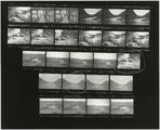
2001-10
uum_map
597
Boating--Rockport Reservoir P.1
Image
dha_cp
598
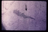
Engineering plan for a proposed reservoir in Salt Lake City. Note the anomalous contour spacing under the arrow. This indicates that the hillside has slid in the past. Construction of a reservoir here would inundate the toe of an ancient landslide and destroy the balance and stability of the weak landslide mass.
Image
uum_map
599
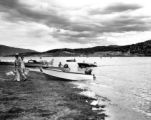
Gunnison Bend Reservoir Spillway [3]
Image
dc_bpc
600
Last Chance Reservoir (forebay) forming after rapids (negative)
2001-10
uum_map
576
-
600
of
2,601
<
19
20
21
22
23
24
25
26
27
28
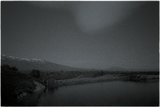
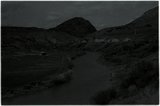
>