| Title | Date | Type | Setname | ||
|---|---|---|---|---|---|
| 26 |
 |
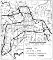
Map of Shoshone Indian Territory, and the Division of Shoshone Boundaries in Nevada | Image/StillImage | uaida_main | |
| 27 |
 |
Boundary of Shoshone Indian Territory, showing the locations where the Bannock and Shoshone reported together 1819-1956 | 1957 | Image/StillImage | uaida_main |
| 28 |
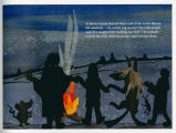 |
"Coyote" [Page 10] | 2005 | Image/StillImage | uaida_main |
| 29 |
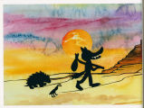 |
"Coyote" [Page 5] | 2005 | Image/StillImage | uaida_main |
| 30 |
 |
"Coyote" [Page19] | 2005 | Image/StillImage | uaida_main |
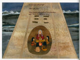
| 31 |
 |
'Coyote" [Page 16] | 2005 | Image/StillImage | uaida_main |
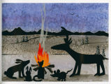
| 32 |
 |
Coyote [Page 1] | 2005 | Image/StillImage | uaida_main |
| 33 |
 |
Shoshone Language Materials: Gosiute Reservation | Sound | uaida_main | |
| 34 |
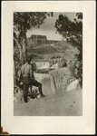 |
Shoshone Falls | 1920; 1921; 1922; 1923 | uum_map | |
| 35 |
 |
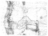
Map of the Homelands of Northern Shoshone, 1863 | Image/StillImage | uaida_main | |
| 36 |
 |
Map of the Shoshone Tribes | Image/StillImage | uaida_main | |
| 37 |
 |
Shoshone Falls | 1930; 1931; 1932; 1933; 1934; 1935; 1936 | uum_map | |
| 38 |
 |
Shoshone Falls | 1920-10 | uum_map | |
| 39 |
 |
Shoshone Falls | 1920-10 | uum_map | |
| 40 |
 |
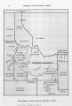
Boundary of Shoshone Indian Territory | 1957 | Image/StillImage | uaida_main |
| 41 |
 |
Shoshone Falls | 1920-10 | uum_map | |
| 42 |
|
Shoshone Language Materials: Historical Ethnography | Sound | uaida_main | |
| 43 |
 |
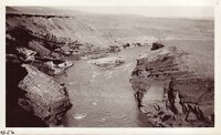
Shoshone River - Near Cody - Wyo | 1914-06 | Image/StillImage | uum_map |
| 44 |
 |
Shoshone River - Near Cody - Wyo | 1914-06 | Image/StillImage | uum_map |
| 45 |
 |
Boundary of Shoshone Indian Territory, Linguistic Boundaries of Shoshone and Bannock. | 1941 | Image/StillImage | uaida_main |
| 46 |
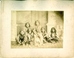 |
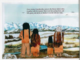
Shoshone Children | Image/StillImage | uaida_main | |
| 47 |
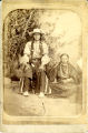 |
Unidentified Shoshone man and woman | Image/StillImage | uaida_main | |
| 48 |
 |
Shoshone Dam P.1 | Image | dha_cp | |
| 49 |
 |
Shoshone River - Near Cody - Wyo | 1907; 1908; 1909; 1910; 1911; 1912; 1913; 1914; 1915; 1916; 1917; 1918; 1919; 1920; 1921; 1922; 1923; 1924; 1925; 1926; 1927; 1928; 1929; 1930; 1931; 1932; 1933; 1934; 1935 | Image/StillImage | uum_map |
| 50 |
 |
Map of Shoshone, Goshute, Bannock, Wind River and Panamint Indian Tribal Groups | 1957 | Image/StillImage | uaida_main |