Home
Browse
Ask Us
Chat
Harmful Language Statement
Log in
Advanced Search
Year
1873
1874
1875
1876
1877
1878
1879
1880
1881
1882
1883
1884
1885
1886
1887
1888
1889
1890
1891
1892
1893
1894
1895
1896
1897
1898
1899
1900
1901
1902
1903
1904
1905
1906
1907
1908
1909
1910
1911
1912
1913
1914
1915
1916
1917
1918
1919
1920
1921
1922
1923
1924
1925
1926
1927
1928
1929
1930
1931
1932
1933
1934
1935
1936
1937
1938
1939
1940
1941
1942
1943
1944
1945
1946
1947
1948
1949
1950
1951
1952
1953
1954
1955
1956
1957
1958
1959
1960
1961
1962
1963
1964
1965
1966
1967
1968
1969
1970
1971
1972
1973
1974
1975
1976
1977
1978
1979
1980
1981
1982
1983
1984
1985
1986
1987
1988
1989
1990
1991
1992
1993
1994
1995
TO
1873
1874
1875
1876
1877
1878
1879
1880
1881
1882
1883
1884
1885
1886
1887
1888
1889
1890
1891
1892
1893
1894
1895
1896
1897
1898
1899
1900
1901
1902
1903
1904
1905
1906
1907
1908
1909
1910
1911
1912
1913
1914
1915
1916
1917
1918
1919
1920
1921
1922
1923
1924
1925
1926
1927
1928
1929
1930
1931
1932
1933
1934
1935
1936
1937
1938
1939
1940
1941
1942
1943
1944
1945
1946
1947
1948
1949
1950
1951
1952
1953
1954
1955
1956
1957
1958
1959
1960
1961
1962
1963
1964
1965
1966
1967
1968
1969
1970
1971
1972
1973
1974
1975
1976
1977
1978
1979
1980
1981
1982
1983
1984
1985
1986
1987
1988
1989
1990
1991
1992
1993
1994
1995
Type
Image/StillImage
62
Text
4
Image
3
Format
image/jpeg
69
Collection
Sanborn Fire Insurance Maps
3
UAIDA Main Collection
65
Uintah County Regional History Center...
1
Filters:
Format:
"image/jpeg"
26
-
50
of
69
<
1
2
3
>
Gallery view
Number of results to display per page
10
25
50
100
200
Sort by Relevance
Sort by Title A-Z
Sort by Title Z-A
Sort by Date Ascending
Sort by Date Descending
Sort by Last Modified Ascending
Sort by Last Modified Descending
Title
Date
Type
Setname
26
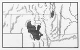
Map showing the boundary of the Shoshone Indian territory
1941
Image/StillImage
uaida_main
27
Boundary of Shoshone Indian Territory and Neighboring Tribes
1957
Image/StillImage
uaida_main
28
Map of Indian Reservations in the Western United States
Image/StillImage
uaida_main
29
Uintah Basin Replacement Project March 1995
1995-03-10
Image/StillImage
uaida_main
30
Map of Part of the West Boundary of the Uncompahgre Ute Indian Reservation as Surveyed by William B. Dougall
Image/StillImage
uaida_main
31
Map of East Central Utah, Uintah Ouray Reservation, Utah Valley
Image/StillImage
uaida_main
32
Uintah Indian Reservation and the Three Band Divisions 1903.
1903
Image/StillImage
uaida_main
33
Map of the South West Boundary of the Uintah Indian Reserve Utah Territory.
Image/StillImage
uaida_main
34
Boundary of Shoshone Indian Territory according to Swanton, 1952
1952
Image/StillImage
uaida_main
35
Map of Western Indian Territory Before 1850
Image/StillImage
uaida_main
36
Map of Northern Utah, Early Settlements
Image/StillImage
uaida_main
37
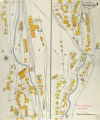
Bingham Canyon, 1907: Sheet 03
1907
Image
uum_sfim
38
Map of Reservations of the Western United States and the Religions that Worked on the Reservations 1870's
1873
Image/StillImage
uaida_main
39
Ute Indians: Before and after White Contact
1966
Text
uaida_main
40
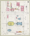
Salt Lake City, 1950: Sheet 056
1950
Image
uum_sfim
41
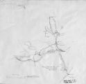
Sketch of Uintah Ouray Agencies.
Image/StillImage
uaida_main
42
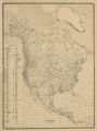
Map of Indian Tribes of North America
Image/StillImage
uaida_main
43
Map of North America and Original Inhabitants' Territory.
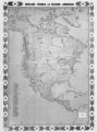
Image/StillImage
uaida_main
44
Map of the Uintah Basin and the Uintah Ouray Reservation
Image/StillImage
uaida_main
45
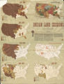
Map of Indian Land Cessions in the United States
Image/StillImage
uaida_main
46
Map of Stock Mining Claims in the Uintah Basin
Image/StillImage
uaida_main
47
Map of Uintah Reservation. Green River Area
Image/StillImage
uaida_main
48
Uintah Indian Reservation Boundaries Sheet Number 4
Image/StillImage
uaida_main
49
Uintah Indian Reservation Boundaries; Sheet Number 2
Image/StillImage
uaida_main
50
Uintah Indian Reservation Boundaries; Sheet Number 5
Image/StillImage
uaida_main
26
-
50
of
69
<
1
2
3
>