Home
Browse
Ask Us
Chat
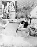
Harmful Language Statement
Log in
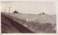
Advanced Search
Year
1880
1881
1882
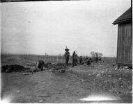
1883
1884
1885
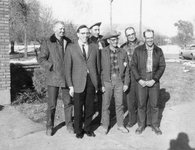
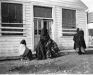
1886
1887
1888
1889
1890
1891
1892
1893
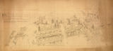
1894
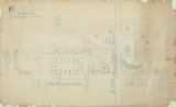
1895
1896
1897
1898
1899
1900
1901
1902
1903
1904
1905
1906
1907
1908
1909
1910
1911
1912
1913
1914
1915
1916
1917
1918
1919
1920
1921
1922
1923
1924
1925
1926
1927
1928
1929
1930
1931
1932
1933
1934
1935
1936
1937
1938
1939
1940
1941
1942
1943
1944
1945
1946
1947
1948
1949
1950
1951
1952
1953
1954
1955
1956
1957
1958
1959
1960
1961
1962
1963
1964
1965
1966
1967
1968
1969
1970
1971
1972
1973
1974
1975
1976
1977
1978
1979
1980
1981
1982
1983
1984
1985
1986
1987
1988
1989
1990
1991
1992
1993
1994
1995
1996
1997
1998
1999
2000
2001
2002
2003
2004
2005
2006
2007
2008
2009
2010
2011
2012
2013
2014
2015
2016
2017
2018
2019
TO
1880
1881
1882
1883
1884
1885
1886
1887
1888
1889
1890
1891
1892
1893
1894
1895
1896
1897
1898
1899
1900
1901
1902
1903
1904
1905
1906
1907
1908
1909
1910
1911
1912
1913
1914
1915
1916
1917
1918
1919
1920
1921
1922
1923
1924
1925
1926
1927
1928
1929
1930
1931
1932
1933
1934
1935
1936
1937
1938
1939
1940
1941
1942
1943
1944
1945
1946
1947
1948
1949
1950
1951
1952
1953
1954
1955
1956
1957
1958
1959
1960
1961
1962
1963
1964
1965
1966
1967
1968
1969
1970
1971
1972
1973
1974
1975
1976
1977
1978
1979
1980
1981
1982
1983
1984
1985
1986
1987
1988
1989
1990
1991
1992
1993
1994
1995
1996
1997
1998
1999
2000
2001
2002
2003
2004
2005
2006
2007
2008
2009
2010
2011
2012
2013
2014
2015
2016
2017
2018
2019
Type
Image/StillImage
127
Format
image/jpeg
127
Collection
Classified Photographs
7
George M. Ottinger Photograph Collection
5
KUED Topaz Residents Collection
4
Markers and Monuments
3
Photo Archives
30
Regional History Center
24
Shipler Collection Negative Preservat...
8
Taylor A. Woolley Papers
4
Thorne Photographs
20
UAIDA Main Collection
7
Uintah County Regional History Center...
1
Vernal Express Photographs
14
More
Filters:
Format:
"image/jpeg"
Type:
"Image/StillImage"
1
-
25
of
127
<
1
2
3
4
5
6
>
Gallery view
Number of results to display per page
10
25
50
100
200
Sort by Relevance
Sort by Title A-Z
Sort by Title Z-A
Sort by Date Ascending
Sort by Date Descending
Sort by Last Modified Ascending
Sort by Last Modified Descending
Title
Date
Type
Setname
1
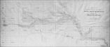
Map of Uintah Irrigation Project June 1926 Myton, Utah
Image/StillImage
uaida_main
2
Map of the Northern Part of the Former Uintah Indian Reservation Showing the Irrigation System
Image/StillImage
uaida_main
3
Mosby Irrigation Board
1965-02-25
Image/StillImage
ucl_vep
4
Burns Bench Irrigation System
1962-12-27
Image/StillImage
ucl_vep
5
Map of the Southern Part of the Former Uintah Indian Reservation Showing the Irrigation System of Indian Allotments
Image/StillImage
uaida_main
6
Geology field trip, Fall 1929: Imperial Valley - Irrigation Ditches on top of dykes
1929
Image/StillImage
uum_map
7
Map of Dry Gulch Irrigation District, Uintah Indian Reservation, Utah
Image/StillImage
uaida_main
8
Birth of Irrigation float in Pioneer Day parade
1931; 1932; 1933; 1934; 1935; 1936
Image/StillImage
dha_gmo
9
Irrigation float from Pioneer Day parade
1931; 1932; 1933; 1934; 1935; 1936
Image/StillImage
dha_gmo
10
C. F. Brown, Copy of Water Map
1920-03-29
Image/StillImage
dha_scnpp
11
Unidentified Ute People
1904; 1905; 1906; 1907; 1908; 1909; 1910; 1911; 1912
Image/StillImage
ucl_rhc
12
Ute Men
1904; 1905; 1906; 1907; 1908; 1909; 1910; 1911; 1912
Image/StillImage
ucl_rhc
13
Uinta Indian Reservation Utah Showing Irrigation Systems.
Image/StillImage
uaida_main
14
BIA Officers
Image/StillImage
ucl_vep
15
Map titled, "Northern Ute Lands, 1905"
Image/StillImage
uaida_main
16
Ashley Survey Positive Sanborn 1880
1880
Image/StillImage
ucl_maps
17
Jordan River p. 13
1925
Image/StillImage
dha_cp
18
Pioneer Day Parade irrigation float
1931; 1932; 1933; 1934; 1935; 1936
Image/StillImage
dha_gmo
19
Big Cottonwood Canyon p.10
1947
Image/StillImage
dha_cp
20
Wasatch view
1910; 1911; 1912; 1913; 1914; 1915; 1916; 1917; 1918; 1919; 1920; 1921; 1922; 1923; 1924; 1925; 1926; 1927; 1928; 1929; 1930; 1931; 1932; 1933; 1934; 1935; 1936; 1937; 1938; 1939; 1940
Image/StillImage
dha_gmo
21
Bamberger Electric Railroad Company, Scene of Hughes Accident
1935-08-14
Image/StillImage
dha_scnpp
22
Bitter Root Valley Irrigation Company, Village of Bitter Root, perspective: suggested plan of development, with consistent types of inexpensive practicable buildings adapted to the environment
1908
Image/StillImage
uum_tawp
23
Bitter Root Valley Irrigation Company, Village of Bitter Root, plan: suggested plan of development, with consistent types of inexpensive practicable buildings adapted to the environment
1908
Image/StillImage
uum_tawp
24
Dept. of Int. Indian Irrigation Service, Copy of Blue Print, Blackfoot River & Gray Lake Dev.
1921-06-18
Image/StillImage
dha_scnpp
25
Engineering Students
1942
Image/StillImage
dha_kued_trc
1
-
25
of
127
<
1
2
3
4
5
6
>